Susuman Airport
Appearance
Susuman Airport | |||||||||||
|---|---|---|---|---|---|---|---|---|---|---|---|
| Summary | |||||||||||
| Airport type | Public | ||||||||||
| Location | Susuman | ||||||||||
| Elevation AMSL | 2,129 ft / 649 m | ||||||||||
| Coordinates | 62°46′0″N 148°8′48″E / 62.76667°N 148.14667°E | ||||||||||
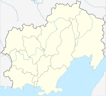
| Map | |||||||||||
 | |||||||||||
| Runways | |||||||||||
| |||||||||||
Susuman Airport (ICAO: UHMH) is a minor airport built 2 kilometres (1.2 mi) south of Susuman in Magadan Oblast, Russia
History
It was built during World War II for the Alaska-Siberian (ALSIB) air route used to ferry American Lend-Lease aircraft to the Eastern Front.[2] The airport closed about 1998 and the control tower was converted to an Orthodox church and the airport's main building to a monastery.
The airport reopened in 2012 serving 4 flights a week to Magadan's Sokol Airport.[3]
Airlines and Destinations
| Airlines | Destinations |
|---|---|
| SiLA Airlines | Magadan |
References
- ^ Aviapages
- ^ Lebedev, Igor Aviation Lend-Lease to Russia Nova Publishers (1997) pp.44-49
- ^ Magadan Airport Official Site Archived 2014-05-15 at the Wayback Machine

