Akyurt
Appearance
Akyurt | |
|---|---|
District | |
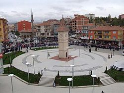
 Urban center of Akyurt | |
 Location of Akyurt, Ankara within Turkey. | |
| Coordinates: 40°08′N 33°05′E / 40.133°N 33.083°E | |
| Country | |
| Region | Central Anatolia |
| Province | Ankara |
| Government | |
| • Governor | Ahmet Avşar |
| • Mayor | Gültekin Ayantaş (AKP) |
| Area | |
| • District | 212.16 km2 (81.92 sq mi) |
| Elevation | 960 m (3,150 ft) |
| Population | |
| • Urban | Template:Turkey district populations |
| • District | Template:Turkey district populations |
| Time zone | UTC+2 (EET) |
| • Summer (DST) | UTC+3 (EEST) |
| Postal code | 06xxx |
| Area code | 0312 |
| Licence plate | 06 |
| Website | www.akyurt.gov.tr |
Akyurt, formerly Ravlı, is a district of Ankara Province of Turkey. According to 2010 census, population of the district is 26,006 of which 25,353 live in the urban center of Akyurt.[2][3] The district covers an area of 212 km2 (82 sq mi),[4] and the average elevation is 960 m (3,150 ft).
Akyurt is an industrial area about 30 km from the city centre, near Ankara Esenboğa International Airport, on the road from Ankara to Çankırı. Factories in the district include Mikes, and a plant of the electronics company Aselsan. There are over 18,000 residents, including many recent migrants from Çankırı, Çorum and Kastamonu, but the daytime working population of Akyurt is over 40,000.
Administrative divisions
There are 26 neighborhoods in Altındağ.
Neighborhoods
- Ahmetadil
- Atatürk
- Balıkhisar
- Beyazıt
- Büğdüz
- Cücük
- Çam
- Çardakbağı
- Çınar
- Elecik
- Galaba
- Güzelhisar
- Haydar
- Karacakaya
- Karacalar
- Karayatak
- Kızık
- Kozayağı
- Samut
- Saracalar
- Şeyhler
- Teberik
- Timurhan
- Uzunlar
- Yeşiltepe
- Yıldırım
Notes
- ^ "Area of regions (including lakes), km²". Regional Statistics Database. Turkish Statistical Institute. 2002. Retrieved 2013-03-05.
- ^ Statistical Institute[permanent dead link]
- ^ GeoHive. "Statistical information on Turkey's administrative units". Archived from the original on 2007-10-19. Retrieved 2008-03-26.
{{cite web}}: Unknown parameter|deadurl=ignored (|url-status=suggested) (help) - ^ Statoids. "Statistical information on districts of Turkey". Retrieved 2008-04-22.
References
- Falling Rain Genomics, Inc. "Geographical information on Akyurt, Turkey". Retrieved 2008-03-26.
- Turkish Ministry of Education. "Geographical information on Akyurt, Ankara" (in Turkish). Archived from the original on 2008-05-14. Retrieved 2008-03-26.
{{cite web}}: Unknown parameter|deadurl=ignored (|url-status=suggested) (help)
External links
Wikimedia Commons has media related to Akyurt.


