
Marshall County, Minnesota
Marshall County | |
|---|---|
 Location within the U.S. state of Minnesota | |
 Minnesota's location within the U.S. | |
| Coordinates: 48°21′N 96°23′W / 48.35°N 96.38°W | |
| Country | |
| State | |
| Founded | February 25, 1879 [1] |
| Named for | William Rainey Marshall, governor of Minnesota |
| Seat | Warren |
| Largest city | Warren |
| Area | |
| • Total | 1,813 sq mi (4,695 km2) |
| • Land | 1,772 sq mi (4,590 km2) |
| • Water | 41 sq mi (105 km2) 2.24% |
| Population (2000) | |
| • Total | 10,155 |
| • Density | 6/sq mi (2/km2) |
| Time zone | UTC−6 (Central) |
| • Summer (DST) | UTC−5 (CDT) |
| Website | www |
Marshall County is a county located in the U.S. State of Minnesota. In 2000, the population was 10,155. Its county seat is WarrenTemplate:GR.
Geography
According to the U.S. Census Bureau, the county has a total area of 1,813 square miles (4,695 km²), of which 1,772 square miles (4,590 km²) is land and 41 square miles (105 km²) (2.24%) is water.
Major highways
Adjacent counties
- Kittson County, Roseau County (north)
- Beltrami County (east)
- Pennington County, Polk County (south)
- Grand Forks County, North Dakota (southwest)
- Walsh County, North Dakota (west)
- Pembina County, North Dakota (northwest)
National protected area
Demographics
At the 2000 censusTemplate:GR, there were 10,155 people, 4,101 households and 2,837 families residing in the county. The population density was 6 per square mile (2/km²). There were 4,791 housing units at an average density of 3 per square mile (1/km²). The racial makeup of the county was 97.22% White, 0.10% Black or African American, 0.29% Native American, 0.17% Asian, 1.62% from other races, and 0.60% from two or more races. 2.93% of the population were Hispanic or Latino of any race. 43.2% were of Norwegian, 12.1% Polish, 11.7% German and 9.6% Swedish ancestry according to Census 2000.
There were 4,101 households of which 30.20% had children under the age of 18 living with them, 60.20% were married couples living together, 5.40% had a female householder with no husband present, and 30.80% were non-families. 28.70% of all households were made up of individuals and 15.10% had someone living alone who was 65 years of age or older. The average household size was 2.45 and the average family size was 3.01.

Age distribution was 25.40% under the age of 18, 6.70% from 18 to 24, 24.70% from 25 to 44, 24.70% from 45 to 64, and 18.50% who were 65 years of age or older. The median age was 40 years. For every 100 females there were 103.20 males. For every 100 females age 18 and over, there were 102.10 males.
The median household income was $34,804, and the median family income was $41,908. Males had a median income of $30,051 versus $20,600 for females. The per capita income for the county was $16,317. About 6.90% of families and 9.80% of the population were below the poverty line, including 11.30% of those under age 18 and 12.80% of those age 65 or over.
Cities and towns
Places adjacent to Marshall County, Minnesota | ||||||||||||||||
|---|---|---|---|---|---|---|---|---|---|---|---|---|---|---|---|---|
| ||||||||||||||||
Notes
Marshall County was the location of a claimed UFO incident in 1979, the Val Johnson incident.
Municipalities and communities of Marshall County, Minnesota, United States | ||
|---|---|---|
| Cities | 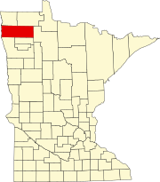 | |
| Townships |
| |
| Unincorporated communities | ||
| Unorganized territory | ||
| Indian reservation | ||
| Footnotes | ‡This populated place also has portions in an adjacent county or counties | |
48°21′N 96°23′W / 48.35°N 96.38°W