
Pembrokeshire

| |

| |
| Geography | |
| Area - Total - % Water |
Ranked 5th 1,590 km²(614 mi²) ? % |
|---|---|
| Admin HQ | Haverfordwest |
| ISO 3166-2 | GB-PEM |
| ONS code | 00NS (ONS) W06000009 (GSS) |
| Demographics | |
| Population: - (2022) - Density |
Ranked 13th 124,367 Ranked 19th 77 / km² |
| Ethnicity | 99.2% White |
| Welsh language - Any skills |
Ranked 8th 29.4% |
| Politics | |
Pembrokeshire Council http://www.pembrokeshire.gov.uk | |
| Control | No overall control |
| MPs | |
| AMs |
|
| MEPs | Wales |
Pembrokeshire (/ˈpɛmbrʊkʃɪər/, /ˈpɛmbrʊkʃər/, or /ˈpɛmbroʊkʃɪər/; Welsh: Sir Benfro [ˈsiːr ˈbɛnvrɔ]) is a county in the south west of Wales. It borders Carmarthenshire to the east and Ceredigion to the north east. Pembrokeshire County Council's headquarters are in the county town of Haverfordwest.
The county is home to Pembrokeshire Coast National Park, the only coastal national park of its kind in the United Kingdom and one of three national parks in Wales, the others being Snowdonia and Brecon Beacons national parks. Over the years Pembrokeshire's beaches have been awarded many International Blue Flag Awards, Green Coast Awards and Seaside Awards. In 2011 it had 39 beaches recommended by the Marine Conservation Society.
Pembrokeshire's population, according to the UK Census, was 114,131 in 2001 rising to 122,400 by the following census in 2011, an increase of 8.2%.[1]
Much of Pembrokeshire has been English in language and culture for many centuries. The boundary between the English and Welsh speakers is known as the Landsker Line and southern Pembrokeshire is occasionally referred to as Little England beyond Wales.
Geography

Pembrokeshire is a maritime county, bordered by the sea on three sides, by Ceredigion to the north east and by Carmarthenshire to the east. The local economy relies heavily on tourism but agriculture is still important. Since the 1950s, Petrochemical and liquid natural gas industries have developed along the Milford Haven Waterway.
The administrative headquarters, historic county town and largest town is Haverfordwest. Other settlements include Pembroke itself, Pembroke Dock, Milford Haven, Fishguard, Tenby, Saundersfoot, Narberth, Neyland and Newport. St David's, in the North west of the county, is the United Kingdom's smallest city with a population of 2,000 (in 2010).
The highest point of the county is Foel Cwmcerwyn (1759 ft/536 m) in the Preseli Hills.
The county's coastline comprises internationally important seabird breeding sites and numerous bays and sandy beaches. Pembrokeshire contains a predominantly coastal park, Pembrokeshire Coast National Park, which includes a 186-mile walking trail, the Pembrokeshire Coast Path.[2] A large estuary and natural harbour at Milford Haven cuts deeply into the coast, formed by the confluence of the Western Cleddau (which goes through Haverfordwest), the Eastern Cleddau and rivers Cresswell and Carew. The estuary is bridged by the large Cleddau Bridge (toll bridge) which bears the A477 between Neyland and Pembroke Dock; upstream bridges are found crossing the Cleddau at Haverfordwest and Canaston.
Large bays are Newport Bay, Fishguard Bay, St Bride's Bay and a portion of Carmarthen Bay. There are several small islands off the Pembrokeshire coast, the largest of which are Ramsey Island, Grassholm Island, Skomer Island and Caldey Island.
In the north of the county are the Preseli Hills (Mynydd Preseli), a wide stretch of high moorland with many prehistoric monuments and the source of the bluestones used in the construction of the inner circle of Stonehenge in England.
Elsewhere the county is relatively flat, most of the land being used for lowland farming of dairy cows, arable crops, oil seed rape, and the well-known Pembrokeshire Potato.
Saundersfoot is the biggest village in Pembrokeshire, situated between Tenby and Narbeth, with a population of well over 2500.
See the list of places in Pembrokeshire for villages, towns and the city of St. David's in Pembrokeshire.
History
Human habitation of the region of Pembrokeshire extends back to 125,000 and 70,000 BCE.[3] By the late Roman Empire period, an Irish tribe known as the Déisi settled in the region between AD 350 and 400, with their realm known as Demetae.
In the post Roman period, the Irish Déisi merged with the local Welsh, with the name of the region evolving into Dyfed, which existed as an independent petty kingdom until its heiress, Elen, married Hywel the Good in AD 904.[3]
Hywel merged Dyfed with his own maternal inheritance of Seisyllwg, forming the new realm of Deheubarth.[3] The region suffered from devastating and relentless Viking raids during the Viking Age, with the Vikings establishing settlements and trading posts at Haverfordwest, Fishguard and Caldey Island.[3]
Dyfed, the region of Pembrokeshire, remained an integral province of Deheubarth but this was contested by invading Normans and Flemings who arrived between 1067 and 1111.[3] The region became known as Pembroke, after the Norman castle built in the Penfro cantref. But Norman/Flemish presence was precarious given the hostility of the native Welsh Princes. In 1136 Prince Owain Gwynedd sought to avenge the execution of his sister the Princess Gwenllian of Deheubarth and her children, with Gwenllian's husband the Prince Rhys swept down from Gwynedd with a formidable army and at Crug Mawr near Cardigan. There they met and destroyed the 3000 strong Norman/Flemish army. The remnants of the Normans fled across the bridge at Cardigan which collapsed and the Teifi river was choked with drowned Men at Arms and horses.
The Norman Marcher Lord Gilbert de Clare was also killed.[citation needed] Owain's brother Cadwallader took de Clares daughter Alice as his wife. Owain incorporated Deheubarth into Gwynedd re-establishing control of the region. Mortally weakened Norman/Flemish influence never fully recovered in West Wales. Princess Gwenllian of Deheubarth is one of the best remembered victims.[4] In 1138 the county of Pembrokeshire was named as a county palatine
The county has long been divided between an English-speaking south (known as "Little England beyond Wales") and a historically more Welsh-speaking north, along a reasonably sharply-defined linguistic border called the Landsker.
The Lord Rhys, Prince of Deheubarth, Princess Gwenllian's son, reestablished Welsh control over much of the region and threatened to retake all of Pembrokeshire, but died in 1197.[3] After Deheubarth was split by a dynastic feud, Llywelyn the Great almost managed to retake the region of Pembroke between 1216 and his death in 1240.[3]

In 1457 Henry Tudor was born at Pembroke Castle and, 28 years later, landing an army not far from his birthplace, he rallied support, marched through Wales to Bosworth field in Leicestershire and defeated the larger army of Richard III. As Henry VII he founded the Tudor dynasty which successfully ruled England until 1603.
The Act of Union of 1536 divided the county into hundreds, which followed with some modifications the lines of the ancient division into cantrefs, which went back to before the Norman conquest. The 1536 hundreds were (clockwise from the north-east): Cilgerran or Kilgerran, Cemais or Kemes, Dewisland or Dewsland, Roose, Castlemartin, Narbeth and Dungleddy or Daugleddau. The Genuki web pages on Pembrokeshire include a list of the parishes within each hundred.

During the First English Civil War (1642-1646) the county gave strong support to the Parliamentary cause, in sharp contrast to the rest of Wales which was staunchly Royalist. In spite of this an incident in Pembrokeshire triggered the opening shots of the Second Civil War when local units of the New Model Army mutinied. Oliver Cromwell defeated the uprising at the Siege of Pembroke in July 1648.[5] In 1649 Cromwell's expeditionary force for Ireland sailed from Milford Haven.
Local government
Under the Local Government Act 1888, an elected county council was set up to take over the functions of the Pembrokeshire Quarter Sessions. This, and the administrative county of Pembrokeshire were abolished under the Local Government Act 1972, with Pembrokeshire forming two districts of the new county of Dyfed: South Pembrokeshire and Preseli – the split being made at the request of local authorities in the area.[6] In 1996, under the Local Government (Wales) Act 1994, the county of Dyfed was broken up into its constituent parts, and Pembrokeshire has been a unitary authority since then.
Transport
The main towns in the county are well served with bus and train services, but those living in more rural parts have little or no access to public transportation.
There are no motorways in Pembrokeshire. There are currently demands for the A40 from St. Clears to Haverfordwest to be made fully dual carriageway. The road is used heavily by traffic from the ferry port in Fishguard which then follows the A40 south to Haverfordwest and then meets the dual carriageway at St. Clears.[7]
The nearest motorway to the county town of Haverfordwest is the M4 which terminates at Pont Abraham in Carmarthenshire, some 46 miles (74 km) to the east.
The A477 which runs from St. Clears to the port of Pembroke Dock is 24 miles (39 km) long, of which only 2 miles (3.2 km) are part-dual carriageway. This road is heavily used by businesses and tourists visiting Pembrokeshire and improvements to the road have been made in recent years.
The A478 traverses eastern Pembrokeshire from Tenby in the south to Cardigan, Ceredigion, in the north, a distance of 30 miles (48 km).
The A487 is the other major route, running north-west from Haverfordwest to St David's, then north-east following the coast, through Fishguard and Newport, to the border with Ceredigion at Cardigan. Owing to width restrictions in Fishguard, some freight vehicles are not permitted to travel north-east from Fishguard but are obliged to take a longer route via Haverfordwest and Narberth.
The Cleddau Bridge connects South Pembrokeshire with North Pembrokeshire across the Cleddau Estuary.
The branch railway lines, terminating at Pembroke Dock and Milford Haven have two-hourly services. The Fishguard branch has seven services each weekday; two are timed to meet the Rosslare Europort ferries to and from Ireland.
Haverfordwest (Withybush) airport provides general aviation services.
Industry
Agriculture
Pembrokeshire's mild climate means that crops such as its famous new potatoes (which have protected geographical status under European law) often arrive in British shops earlier in the year than produce from other parts of the UK. As well as arable crops such as potatoes, the other main agricultural activities are dairy farming of cattle for milk and cheese, sheep farming, beef production and some other arable crops, such as rapeseed.
The county lends its name to the Pembroke Welsh Corgi, a herding dog whose lineage can be traced back to the 12th century.
Falling farm incomes have led to diversification into other novel farming and tourism related activities. From 1,700 km² of land, about 1,260 (74%) are used by agriculture. The majority of this land (60%) is down to permanent grassland and 26% is arable. Farm revenues are less than the UK average, but agriculture still provides 7,000 jobs.[citation needed]
The former large sea fishing industry around Milford Haven is now greatly reduced, although limited commercial fishing still takes place.
Mining
Slate mining was a significant industry in the 19th and early 20th centuries with major quarrying taking place at about 100 locations throughout the county.[8] Over 50 coal workings were in existence between the 13th and 20th centuries, with the last Pembrokeshire coal mine, at Kilgetty, closing in 1950.[9]
Oil and gas

The banks of the Milford Haven Waterway are dominated by the oil and gas industry with two oil refineries, two large liquified natural gas (LNG) terminals and a new 2000 MW gas-fired Pembroke Power Station is currently under construction on the site of a previous oil-fired power station which closed in 1997 and demolished in 2000.
The two oil refineries in Pembrokeshire are:
- Chevron (formerly Texaco): 214,000 bpd (barrels per day) and
- Murco (formerly Amoco/Elf): 108,000 bbl/d (17,200 m3/d)
At the peak, there were a total of five refineries served from around the Haven.
- The Esso refinery operated from 1960–1983 and was demolished in the late 1980s. The site has been converted into the South Hook LNG terminal
- The Gulf Refinery operated from 1968–1997 and the site now incorporates the Dragon LNG terminal
- BP had an oil terminal at Angle Bay which served its refinery at Llandarcy and operated between 1961–1985[10]
The LNG terminals on the north side of the river, just outside Milford Haven are now complete, and opened in 2008. A completed but controversial pipeline runs through rural farms and countryside connecting Milford Haven to Tilbury in Gloucestershire.
Tourism
Tenby, Saundersfoot and the surrounding areas attract the most visitors. In 2010 4.2 million tourists visited the county, staying for an average of 3.3 days. Overall, in 2010, £544 million was brought into the local economy through tourist spending. The tourism industry supports 16,300 jobs.[11]
Pembrokeshire's beaches have been awarded many International Blue Flag Awards (10 in 2014[12]), as well as 47 Green Coast Awards (15 in 2011) and 106 Seaside Awards (31 in 2011.[13][14] In 2011 it also had 39 beaches recommended by the Marine Conservation Society.
Media
Comprehensive coverage of sport in Pembrokeshire is provided by PembrokeshireSport.co.uk – a wholly independent and locally owned website, updated daily, edited by Mr Bill Carne – which typically generates over seventeen thousand page-loads per week.
Narberth is home to Radio Pembrokeshire, Radio Carmarthenshire and Scarlet FM broadcasting to 100,000 listeners every week.[15]
A new voluntary media organisation called Cleddau Community Media began in Pembroke Dock in 2004. Since then the company has broadcast three community radio pilot broadcasts from custom built studios in Llanreath under the name.
There are seven local newspapers based in Pembrokeshire. The Western Telegraph (the largest in pembrokeshire), The Milford Mercury, Tenby Observer, Pembroke Observer, County Echo and The Pembrokeshire Herald. The Milford Mercury (circulation 3,681) and Western Telegraph (circulation 19,582) are part of the Newsquest group. Pembrokeshire's Best Magazine.[16]
Sport
As the national sport of Wales, rugby union is widely played throughout the county at both town and village level. Haverfordwest RFC, for example, founded in 1875, is a feeder club for Llanelli Scarlets and won the WRU Division Three West league in 2011/12. Village team Crymych RFC won the previous year and in 2014 plays in WRU Division One West.[17]
Triathlon event Ironman Wales was hosted by Pembrokeshire for the third year running in 2013, contributing an estimated £4 million to the local economy.[18]
In April 2014 the third annual Tour of Pembrokeshire road-cycling event took place over 50, 75 or 100 miles in north west Pembrokeshire.[19][20] Part of Route 47 of the Celtic Trail cycle route is in Pembrokeshire.
Abereiddy's Blue Lagoon was the venue for a round of the Red Bull Cliff Diving World Series in 2012 and 2013.
While not at major league level, cricket is played throughout the county and many villages such as Lamphey, Creselly, Llangwm, Llechryd and Crymych field teams in minor leagues under the umbrella of the Cricket Board of Wales.
Culture
The artistic siblings Gwen and Augustus John were both born in Pembrokeshire. Graham Sutherland painted locally between 1934 and 1936, gaining inspiration from the landscape.
Flag
The flag of Pembrokeshire consists of a yellow cross on a blue field. In the centre of the cross is a green pentagon bearing a red and white Tudor rose. The rose is divided quarterly and counterchanged: the inner and outer roses have alternating red and white quarters.[21][22]
Filming location
Pembrokeshire's coastal landscape has made it a popular location choice for television and film. In recent years, several notable films have been filmed in the county.
| Year | Title | Location |
|---|---|---|
| 1940 | The Thief of Bagdad | Whitesands Beach |
| 1956 | Moby Dick | Pembrokeshire Coast |
| 1968 | The Lion In Winter | Pembroke Castle, Marloes Sands, Milford Haven |
| 1972 | Under Milk Wood | Fishguard |
| 1977 | Jabberwocky | Pembroke Castle & Bosherston |
| 1984 | Sword of the Valiant | Bosherston |
| 1994 | Dragonworld | Manorbier |
| 1998 | Basil | Tenby, Manorbier, Bosherston |
| 2003 | Baltic Storm | Fishguard |
| 2003 | I Capture The Castle | Manorbier Castle |
| 2003 | I'll Sleep When I'm Dead | Haverfordwest & Fishguard |
| 2008 | The Edge of Love | Tenby & Laugharne |
| 2010 | Harry Potter and the Deathly Hallows | Freshwater West |
| 2010 | Robin Hood | Freshwater West |
| 2010 | Third Star | Barafundle Bay, Stackpole Estate |
| 2011 | Harry Potter and the Deathly Hallows | Freshwater West |
| 2012 | Snow White & the Huntsman | Marloes Sands |
Gallery
-
 Green Bridge of Wales
 -
 Dusk at Freshwater West
 -
 Solva
Solva -
 Old Point House Angle
 -
 Catholic Chapel Haverfordwest
 -
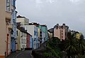 Tenby Crackwell St
.jpg)


Places of interest
Geography

- Caldey Island
- Grassholm Island
- Pembrokeshire Coast Path, a long distance footpath
- Preseli Hills
- Ramsey Island
- Skomer Island
- Skokholm Island
- Stackpole
- Bosherston & St. Govans
Visitor attractions
- Blue Lagoon waterpark
- Castell Henllys, reconstructed Iron age fort
- Folly Farm Adventure Park and Zoo
- Oakwood Theme Park
- Pembrokeshire Motor Museum
- Tenby lifeboat station
- Torch Theatre
Historical places


- Amroth Castle
- Big House
- Carew Castle
- Cilgerran Castle
- Cresswell Castle
- Haverfordwest Castle
- Llawhaden Castle
- Manorbier Castle
- Pembroke Castle
- Penrhos Cottage
- Pentre Ifan
- Picton Castle
- St David's Cathedral
- St David's Head
- Strumble Head Lighthouse
- Wiston Castle
- Narberth Castle
Beaches


- Barafundle Bay
- Broad Haven
- Broad Haven South (near Bosherston)
- Little Haven (to the south of Broad Haven)
- Freshwater East
- Freshwater West
- Marloes
- Newgale
- Newport
- Poppit Sands (near Cardigan)
- Saundersfoot
- North Beach Tenby
- South Beach Tenby
- Whitesands Bay
See also
- List of schools in Pembrokeshire
- List of Lord Lieutenants of Pembrokeshire
- List of Custodes Rotulorum of Pembrokeshire
- List of High Sheriffs of Pembrokeshire
- List of MPs for the former county of Pembrokeshire
References
- ^ "2011 Census". Retrieved 8 December 2013.
- ^ Pembrokeshire Coast Path at. Nationaltrail.co.uk. Retrieved on 9 October 2011.
- ^ a b c d e f g Davies, John, A History of Wales, Penguin, 1994, foundations of pgs 17,19, 43, Migration of the Desi into Demetia, page 52 Demetia 17, 30, 34, ruling house of 52, 72, 85, 87, and the Vikings pages 85, relations with Alfred of Wessex, page 85, and the Vikings/Northmen page 98, and the Normans 106, 112, 114
- ^ Warner, Philip, Famous Welsh Battles, pg 79, 1997, Barnes and Noble, INC.
- ^ Royle, Trevor. Civil War: The War of the Three Kingdoms 1638-1660. Abacus, 2005. p.437-38
- ^ Wood, Bruce. The Process of Local Government Reform: 1966–1974. 1976.
- ^ AM calls for A40 funds Western Telegraph – 9 November 2006
- ^ Tucker, G & M (1983). The old slate industry of Pembrokeshire and other parts of South Wales. National Library of Wales journal, Vol.XXIII/2.
- ^ "Pembrokeshire Virtual Museum - Coal Mining". Retrieved 29 April 2014.
- ^ "Angle Bay BP oil terminal and pumping station, Popton, Milford Haven". Coflein. Royal Commission on the Ancient and Historical Monuments of Wales. 14 April 2010. Retrieved 1 August 2012.
- ^ http://www.westerntelegraph.co.uk/news/county/9156280.__544m_Pembrokeshire_tourism_boost/
- ^ "Blue flags fly over Pembrokeshire beaches". Western Telegraph. 13 June 2014. Retrieved 14 June 2014.
- ^ VisitWales.co.uk - Pembrokeshire beaches Retrieved 19 December 2011
- ^ Pembrokeshire (Annual Guide), Pembrokeshire Tourism, 2011
- ^ Media titles owned by Town & Country Broadcasting. Media UK. Retrieved on 9 October 2011.
- ^ PembrokeshireBestMagazine
- ^ "SWALEC League: 1 West". Retrieved 25 April 2014.
- ^ "Athletes pump £4million into Welsh economy". 24 April 2014. Retrieved 25 April 2014.
- ^ "Cyclists brave the conditions on another successful Tour of Pembrokeshire (Western Telegraph)". 26 April 2014. Retrieved 26 April 2014.
- ^ "2014 Tour of Pembrokeshire". Retrieved 25 April 2014.
- ^ UK Flag Registry. Flaginstitute.org (6 July 2010). Retrieved on 9 October 2011.
- ^ CRWFlags.com. CRWFlags.com (27 May 2011). Retrieved on 9 October 2011.
External links
- Pembrokeshire at Curlie
- Pembrokeshire county council
- Pembrokeshire County Council Local Studies Collection - downloadable booklet
- Visit Pembrokeshire (official council tourism website)
- Pembrokeshire Coast National Park
- PembrokeshireSport.co.uk (comprehensive reporting of the county's sports)
- Pembrokeshire Online (independent tourism website)
Further reading
- James, J. Ivor, Molleston Baptist Church-Reflections on the Founders' Tercentenary, V.G. Lodwick & Sons Ltd., Carmarthen, copyright 1968
- Dillon, Myles, The Irish settlements in Wales, Celtica 12, 1977, pp. 1–11
- Lloyd, Thomas; Orbach, Julian and Scourfield, Robert, Pembrokeshire, Yale University Press, 2004
Transport in Pembrokeshire | ||
|---|---|---|
| Roads |  | |
| Cycling | ||
| Railway lines | ||
| Railway stations | ||
| Air | ||
| Sea | ||
| Bus | ||
| Areas | |
|---|---|
| Lists | |
 | ||