
Diyarbakır: Difference between revisions
EtienneDolet (talk | contribs) needs to be alphabetical order |
Edited etmology of Diyarbakır. |
||
| Line 42: | Line 42: | ||
}} |
}} |
||
'''Diyarbakır''' |
'''Diyarbakır''', ({{lang-ku|Amed}}, [[Diyarbakır#Etymology|see other names]]) is one of the largest [[city|cities]] in southeastern [[Turkey]]. Situated on the banks of the River [[Tigris]], it is the administrative capital of the [[Diyarbakır Province]] and with a population of about 843,460 it is the second largest city in Turkey's [[Southeastern Anatolia Region, Turkey|South-eastern Anatolia]] region, after [[Gaziantep]]. |
||
==Etymology== |
==Etymology== |
||
The name of the city is inscribed as ''Amid'' on the sheath of a sword from the [[Assyria]]n period, and the same name was used in other contemporary Syriac and Arabic works.<ref name="airlines">[http://www.turkishairlines.com/fi-FI/skylife/2005/november/articles/diyarbakir.aspx Diyarbakır]. Turkish Airlines. Retrieved on 2012-05-13.</ref> The Romans and Byzantines called the city ''[[Amida (Roman city)|Amida]]''.<ref name="airlines"/> Among the [[Artukid]] and [[Akkoyunlu]] it was known as "Black Amid" (''Kara Amid'') for the dark color of its walls, while in the ''Zafername'', or eulogies in praise of military victories, it is called "Black Fortress" (''Kara Kale'').<ref name="airlines"/> In the [[Book of Dede Korkut]] and some other Turkish works it appears as ''Kara Hamid''.<ref name="airlines"/> |
The name of the city is inscribed as ''Amid'' on the sheath of a sword from the [[Assyria]]n period, and the same name was used in other contemporary Syriac and Arabic works.<ref name="airlines">[http://www.turkishairlines.com/fi-FI/skylife/2005/november/articles/diyarbakir.aspx Diyarbakır]. Turkish Airlines. Retrieved on 2012-05-13.</ref> The Romans and Byzantines called the city ''[[Amida (Roman city)|Amida]]''.<ref name="airlines"/> Among the [[Artukid]] and [[Akkoyunlu]] it was known as "Black Amid" (''Kara Amid'') for the dark color of its walls, while in the ''Zafername'', or eulogies in praise of military victories, it is called "Black Fortress" (''Kara Kale'').<ref name="airlines"/> In the [[Book of Dede Korkut]] and some other Turkish works it appears as ''Kara Hamid''.<ref name="airlines"/> |
||
In [[Armenian language|Armanian]], Diyarbakır was called ({{lang-hy|Տիգրանակերտ}}, pronounced as [[Tigranakert (Silvan)|Tigranakert]], in [[Ancient Greek]]: ''Amida'', Άμιδα also, in [[Syriac language]] as referred {{lang-syr|ܐܡܝܕ}}, ''Amid''. |
|||
| ⚫ | Following the [[Arab conquest]]s in the seventh century, the Arab [[Banu Bakr|Bakr tribe]] occupied this region,<ref name="airlines"/> which became known as the ''[[Diyar Bakr]]'' ("[[Real Estate|landholding]]s of the Bakr tribe", in Persian: '' دیار ِ بکر'' ''Diyar-e Bakr'').<ref>Abdul- Rahman Mizouri [http://web.archive.org/web/20090324201623/http://www.lalishduhok.org/lalish/27/L%2027%20E/L%2027%20E.3.pdf Taj Al- Arifeen: Udday bin Musafir Al- Kurdy Al- Hakary Is not an Umayyad. Part Two]. College of Arts/ Dohuk University (2001)</ref><ref>{{cite book|author=Verity Campbell|title=Turkey|url=http://books.google.com/books?id=jstw7Sxkp4gC&pg=PA621|accessdate=13 May 2012|date=1 April 2007|publisher=Lonely Planet|isbn=978-1-74104-556-7|pages=621–}}</ref> In 1937, [[Atatürk]] visited Diyarbekir and, after expressing uncertainty on the true etymology of the city, ordered that it be renamed "Diyarbakır," which means land of copper in Turkish.<ref>See [[Uğur Ümit Üngör|Üngör, Uğur]] (2011), ''The Making of Modern Turkey: Nation and State in Eastern Anatolia, 1913-1950''. Oxford: Oxford University Press, p. 244. ISBN 0-19-960360-X.</ref> |
||
| ⚫ | Following the [[Arab conquest]]s in the seventh century, the Arab [[Banu Bakr|Bakr tribe]] occupied this region,<ref name="airlines"/> which became known as the ''[[Diyar Bakr]]'' ("[[Real Estate|landholding]]s of the Bakr tribe", in Persian: '' دیار ِ بکر'' ''Diyar-e Bakr'').<ref>Abdul- Rahman Mizouri [http://web.archive.org/web/20090324201623/http://www.lalishduhok.org/lalish/27/L%2027%20E/L%2027%20E.3.pdf Taj Al- Arifeen: Udday bin Musafir Al- Kurdy Al- Hakary Is not an Umayyad. Part Two]. College of Arts/ Dohuk University (2001)</ref><ref>{{cite book|author=Verity Campbell|title=Turkey|url=http://books.google.com/books?id=jstw7Sxkp4gC&pg=PA621|accessdate=13 May 2012|date=1 April 2007|publisher=Lonely Planet|isbn=978-1-74104-556-7|pages=621–}}</ref> In period of [[Ottoman Empire]], name of the city's name was [[Ottoman Turkish language|Ottoman Turkish]] دیاربکر ''Diyâr-ı Bekr'')<ref>Rêbera Geshtê ya Amedê (2011). Boyut, Istanbul, ISBN 978-605-87650-0-9, 235 pages, a very interesting tourist guide published in Kurdish by the city council in Amed/Diyarbakir (Sharidariya Bajarê Mezin a Amedê).</ref> In 1937, [[Atatürk]] visited Diyarbekir and, after expressing uncertainty on the true etymology of the city, ordered that it be renamed "Diyarbakır," which means land of copper in Turkish.<ref>See [[Uğur Ümit Üngör|Üngör, Uğur]] (2011), ''The Making of Modern Turkey: Nation and State in Eastern Anatolia, 1913-1950''. Oxford: Oxford University Press, p. 244. ISBN 0-19-960360-X.</ref> |
||
==History== |
==History== |
||
Revision as of 15:40, 8 March 2014
Diyarbakır
Amed / Amid | |
|---|---|
Metropolitan Municipality | |
 Top left: Ali Pasha Mosque, Top right: Nebi Mosque, 2nd: Seyrangeha Park, 3rd left: Dört Ayakli Minare Mosque, 3rd upper right: Deriyê Çiyê, 3rd lower right: On Gözlü Bridge (or Silvan Bridge), over Tigris River, Bottom left: Diyarbakır City Wall, Bottom right: Gazi Pavillion (Gazi Köşkü) | |
| Country | |
| Region | Southeastern Anatolia |
| Province | Diyarbakır |
| Government | |
| • Mayor | Osman Baydemir (BDP) |
| Elevation | 675 m (2,215 ft) |
| Population (2010) | |
| • Urban | 843,460 |
| Time zone | UTC+2 (EET) |
| • Summer (DST) | UTC+3 (EEST[1]) |
| Postal code | 21x xx |
| Area code | (0090)+ 412 |
| Licence plate | 21 |
| Website | [1] |
Diyarbakır, (Kurdish: Amed, see other names) is one of the largest cities in southeastern Turkey. Situated on the banks of the River Tigris, it is the administrative capital of the Diyarbakır Province and with a population of about 843,460 it is the second largest city in Turkey's South-eastern Anatolia region, after Gaziantep.
Etymology
The name of the city is inscribed as Amid on the sheath of a sword from the Assyrian period, and the same name was used in other contemporary Syriac and Arabic works.[2] The Romans and Byzantines called the city Amida.[2] Among the Artukid and Akkoyunlu it was known as "Black Amid" (Kara Amid) for the dark color of its walls, while in the Zafername, or eulogies in praise of military victories, it is called "Black Fortress" (Kara Kale).[2] In the Book of Dede Korkut and some other Turkish works it appears as Kara Hamid.[2]
In Armanian, Diyarbakır was called (Armenian: Տիգրանակերտ, pronounced as Tigranakert, in Ancient Greek: Amida, Άμιδα also, in Syriac language as referred Syriac: ܐܡܝܕ, Amid.
Following the Arab conquests in the seventh century, the Arab Bakr tribe occupied this region,[2] which became known as the Diyar Bakr ("landholdings of the Bakr tribe", in Persian: دیار ِ بکر Diyar-e Bakr).[3][4] In period of Ottoman Empire, name of the city's name was Ottoman Turkish دیاربکر Diyâr-ı Bekr)[5] In 1937, Atatürk visited Diyarbekir and, after expressing uncertainty on the true etymology of the city, ordered that it be renamed "Diyarbakır," which means land of copper in Turkish.[6]
History
Antiquity
The area around Diyarbakır has been inhabited by humans from the stone age with tools from that period having been discovered in the nearby Hilar cave complex. The pre-pottery neolothic B settlement of Çayönü dates to over 10,000 years ago and its excavated remains are on display at the Diyarbakır Museum. Another important site is Girikihaciyan Tumulus in Egil.[7]
The first major civilization to establish themselves in what is now Diyarbakır were the Hurrian kingdom of the Mitanni who made it their military and trade capital. The city was then ruled by a succession of nearly every polity that controlled Upper Mesopotamia such as the Assyrians, Urartu, Medes, Seleucids and Parthians.[8] The Roman Republic gained control of the city in 66 BC by when it was named "Amida".[9]
In 359, Shapur II of Persia captured Amida after a siege of 73 days which is vividly described by the Roman historian Ammianus Marcellinus .[10][10]
The Middle Ages

In 639, the Ummayads arrived and introduced the religion of Islam. They were followed by the Marwanids in the 10th century. After the Battle of Manzikert in 1071, the city came under the rule of the Mardin branch of Oghuz Turks and then the Anatolian beylik of Artuqids . The whole area was then disputed between the Ilkhanate and Ayyubid dynasties for a century, after which it was taken over by the competing Turkic federations of the Kara Koyunlu (the Black Sheep) first and then the Ak Koyunlu (the White Sheep). It was also ruled by Sultanate of Rûm between 1241 and 1259.
Ottoman era
The city was brought under the Ottoman Empire by the campaigns of Bıyıklı Mehmet Paşa under the rule of Sultan Selim I. The Ottoman eyalet of Diyarbakır corresponded to Turkey's southeastern provinces today, a rectangular area between the Lake Urmia to Palu and from the southern shores of Lake Van to Cizre and the beginnings of the Syrian desert, although its borders saw some changes over time. The city was an important military base for controlling this region and at the same time a thriving city noted for its craftsmen, producing glass and metalwork. For example the doors of Mevlana's tomb in Konya were made in Diyarbakır, as were the gold and silver decorated doors of the tomb of Imam-i Azam Ebu Hanife in Baghdad.
In 1895, Armenians and Assyrians were subject to massacres in Diyarbakır.[11] The city had been also a site for ethnic cleansing of Armenians, nearly 150,000 were deported from the city.[12]
Republic of Turkey


In the reorganization of the provinces, Diyarbakır was made administrative capital of Diyarbakır Province. During the 1980s and 1990s at the peak of the PKK insurgency, the population of the city grew dramatically as villagers from remote areas where fighting was serious left or were forced to leave for the relative security of the city. After the cessation of hostilities between the Kurdistan Workers' Party (PKK) and the Turkish army, a large degree of normality returned to the city, with the Turkish government declaring an end to the 15-year period of emergency rule on 30 November 2002. Diyarbakır grew from 30,000 in the 1930s to 65,000 by 1956, to 140,000 by 1970, to 400,000 by 1990,[13] and eventually swelled to about 1.5 million by 1997.[14]
The 41-year-old American-Turkish Pirinçlik Air Force Base near Diyarbakır, known as NATO's frontier post for monitoring the former Soviet Union and the Middle East, closed on 30 September 1997. This closure was the result of the general drawdown of US bases in Europe and the improvement in space surveillance technology. The base housed sensitive electronic intelligence-gathering systems that monitored the Middle East, the Caucasus and Russia.[15]
According to a November 2006 survey by the Sur Municipality, one of Diyarbakır's metropolitan municipalities, 72% of the inhabitants of the municipality use Kurdish most often in their daily speech, followed by Turkish, and 69% are illiterate in their most widely used vernacular.[16]
Economy
Historically, Diyarbakır produced wheat and sesame.[17][18] They would preserve the wheat in warehouses, with coverings of straw and twigs from licorice trees. This system would allow the wheat to be preserved for up to ten years.[17] In the late 19th and early 20th century, Diyarbakır exported raisins, almonds, and apricots to Europe.[18] Angora goat's were raised, and wool and mohair was exported from Diyarbakır. Merchants would also come from Egypt, Istanbul, and Syria, to purchase goats and sheep.[19] Honey was also produced, but not so much exported, but used by locals. Sericulture was observed in the area, too.[20]
Before World War I, Diyarbakır had an active copper industry, with six mines. Three were active, with two being owned by locals and the third being owned by the Turkish government. Tenorite was the primary type of copper mined. It was mined by hand by Kurds. A large portion of the ore was exported to England. The region also produced iron, gypsum, coal, chalk, lime, jet, and quartz, but primarily for local use.[21]
Culture
Some jewelry making and other craftwork continues today although the fame of the Diyarbakır's craftsmen has long passed. Folk dancing to the drum and zurna (pipe) are a part of weddings and celebrations in the area.
Cuisine
Diyarbakır is known for rich dishes of lamb which use spices such as black pepper, sumac and coriander; rice, bulgur and butter. The most famous specialty dish from Diyarbakır is Meftune which is made up of lamb meat and vegetable laced with garlic and sumac. Another known dish is Kaburga Dolması which is a baked lamb's ribs stuffed with rice and many spices. Diyarbakır is also famous for its watermelons which are exported internationally; one of the largest events in the city is the annually held Watermelon Festival.
Main sights
Diyarbakır is surrounded by an almost intact, dramatic set of high walls of black basalt forming a 5.5 km (3.4 mi) circle around the old city. There are four gates into the old city and 82 watch-towers on the walls, which were built in antiquity, restored and extended by the Roman emperor Constantius II in 349. In addition, the walls of Diyarbakır are the second largest city walls in the world after the Great Wall of China. [citation needed]
Diyarbakır boasts numerous medieval mosques and madrassahs including:
- Great Mosque of Diyarbakır built by the Seljuk Turkish Sultan Malik Shah in the 11th century. The mosque, one of the oldest in Turkey, is constructed in alternating bands of black basalt and white limestone (The same patterning is used in the 16th century Deliler Han Madrassah, which is now a hotel). The adjoining Mesudiye Medresesi/Medreseya Mesûdiyeyê was built at the same time, as was another prayer-school in the city, Zinciriye Medresesi/Medreseya Zincîriyeyê.
- Beharampaşa Camii/Mizgefta Behram Paşa – an Ottoman mosque built in 1572 by the governor of Diyarbakır, Behram Pasha, noted for the well-constructed arches at the entrance.
- Dört Ayaklı Minare/Mizgefta Çarling (the four-footed minaret) – built by Kasim Khan of the Ak Koyunlu. It is said that one who passes seven times between the four columns will have his wishes granted.
- Fatihpaşa Camii/Mizgefta Fetih Paşa – built in 1520 by Diyarbakır's first Ottoman governor, Bıyıklı Mehmet Paşa ("the moustachioed Mehmet pasha"). The city's earliest Ottoman building, it is decorated with fine tilework.
- Hazreti Süleyman Camii/Mizgefta Hezretî Silêman – 1155–1169 – Süleyman son of Halid Bin Velid, who died capturing the city from the Arabs, is buried here along with his companions.
- Hüsrevpaşa Camii/Mizgefta Husrev Paşa – the mosque of the second Ottoman governor, 1512–1528. Originally the building was intended to be a school (medrese)
- İskender Paşa Camii/Mizgefta Îskender Paşa – a mosque of an Ottoman governor, an attractive building in black and white stone, built in 1551.
- Melek Ahmet Camii/Melek Ahmed Paşa a 16th-century mosque noted for its tiled prayer-niche and for the double stairway up the minaret.
- Nebii Camii/Mizgefta Pêxember – an Ak Koyunlu mosque, a single-domed stone construction from the 16th century. Nebi Camii means "the mosque of the prophet" and is so-named because of the number of inscriptions in honour of the prophet on its minaret.
- Safa Camii/Mizgefta Palo – built in 1532 by the Ak Koyunlu Turkmen tribe.
Famous churches include:
- St. Giragos Armenian Church – A disused and restored Armenian Orthodox church.
- The Syriac Orthodox Church of Our Lady (Syriac: ܐ ܕܝܠܕܬ ܐܠܗܐ `Idto d-Yoldat Aloho, Turkish: Meryemana kilisesi), was first constructed as a pagan temple in the 1st century BCE. The current construction dates back to the 3rd century, has been restored many times, and is still in use as a place of worship today.[citation needed] There are a number of other churches in the city.
- Museums
- The Archaeological Museum contains artifacts from the neolithic period, through the Early Bronze Age, Assyrian, Urartu, Roman, Byzantine, Artuqids, Seljuk Turk, Aq Qoyunlu, and Ottoman Empire periods.
- Cahit Sıtkı Tarancı Museum – the home of the late poet and a classic example of a traditional Diyarbakır home.
- The birthplace of poet Ziya Gökalp – preserved as a museum to his life and works.
- Ahmet Arif Literature Museum Library.
- Historic bridges
- The Dicle Bridge, an 11th-century bridge with ten arches
Climate
Diyarbakır has a borderline Mediterranean climate (Köppen climate classification Csa) and hot dry-summer continental climate (Köppen climate classification Dsa). Summer are very hot and very dry, due to its location on the Mesopotamian plain which is subject to hot winds from the deserts of Syria and Iraq to the south. The highest recorded temperature was 44.8°C (112.64°F) on 28 August 1998. Winters are cold and wet and with frosty nights. Snowfall is quite common between the months of December and March, snowing for a week or two. The lowest recorded temperature was −23.4°C (−10.12°F) on 30 December 2006.
| Climate data for Diyarbakır (1960-2012) | |||||||||||||
|---|---|---|---|---|---|---|---|---|---|---|---|---|---|
| Month | Jan | Feb | Mar | Apr | May | Jun | Jul | Aug | Sep | Oct | Nov | Dec | Year |
| Mean daily maximum °C (°F) | 6.7 (44.1) |
8.9 (48.0) |
14.5 (58.1) |
20.2 (68.4) |
26.5 (79.7) |
33.7 (92.7) |
38.4 (101.1) |
38.1 (100.6) |
33.2 (91.8) |
25.2 (77.4) |
16.1 (61.0) |
9.2 (48.6) |
22.6 (72.6) |
| Daily mean °C (°F) | 1.8 (35.2) |
3.5 (38.3) |
8.5 (47.3) |
13.8 (56.8) |
19.3 (66.7) |
26.3 (79.3) |
31.2 (88.2) |
30.3 (86.5) |
24.8 (76.6) |
17.2 (63.0) |
9.2 (48.6) |
4.0 (39.2) |
15.8 (60.5) |
| Mean daily minimum °C (°F) | −2.3 (27.9) |
−1.1 (30.0) |
2.7 (36.9) |
7.1 (44.8) |
11.4 (52.5) |
17.0 (62.6) |
21.8 (71.2) |
21.1 (70.0) |
16.1 (61.0) |
10.2 (50.4) |
3.9 (39.0) |
−0.1 (31.8) |
9.0 (48.2) |
| Average precipitation mm (inches) | 68.0 (2.68) |
68.8 (2.71) |
67.3 (2.65) |
68.7 (2.70) |
41.3 (1.63) |
7.9 (0.31) |
0.5 (0.02) |
0.4 (0.02) |
4.1 (0.16) |
34.7 (1.37) |
51.8 (2.04) |
71.4 (2.81) |
484.9 (19.1) |
| Average rainy days | 12.2 | 11.8 | 11.8 | 12.0 | 8.9 | 2.9 | 0.5 | 0.3 | 1.2 | 6.1 | 8.0 | 11.5 | 87.2 |
| Average relative humidity (%) | 75 | 72 | 67 | 65 | 59 | 43 | 31 | 31 | 35 | 51 | 69 | 75 | 56 |
| Mean monthly sunshine hours | 120.9 | 134.4 | 173.6 | 207.0 | 300.7 | 366.0 | 387.5 | 362.7 | 297.0 | 229.4 | 162.0 | 117.8 | 2,859 |
| Source 1: Devlet Meteoroloji İşleri Genel Müdürlüğü [2] | |||||||||||||
| Source 2: Weatherbase [22] | |||||||||||||
Notable born in the city
- Abdülkadir Aksu: Former Turkish minister of interior affairs
- Ahmed Arif: Poet
- Aziz Yıldırım: President of Fenerbahçe S.K. sports club
- Cahit Sıtkı Tarancı: Poet
- Cihan Haspolatlı: Galatasaray SK footballer
- Gazi Yaşargil: medical scientist and neurosurgeon
- Hesenê Metê: writer
- Hikmet Çetin: Former Turkish foreign minister, former NATO Senior Civilian Representative in Afghanistan
- Leyla Zana: politician
- Lokman Polat: writer
- Mehmed Emin Bozarslan: writer
- Mehmet Polat: actor
- Naum Faiq: writer
- Osman Baydemir: politician
- Rojen Barnas: writer
- Songül Öden: actress
- Süleyman Nazif: Prominent Young Turk
- Ziya Gökalp: writer. The Ziyagökalp district of the city is named after him, as well as many streets and schools
- Mıgırdiç Margosyan: writer, some of his books: Gavur Mahallesi, Söyle Margos Nerelisen?, Biletimiz İstanbul'a Kesildi
- Coşkun Sabah: musician
- Sayf al-Din al-Amidi: (d. 631/1233 in Damascus), Islamic theologian and legal scholar of the Shafi'i school.
See also
References
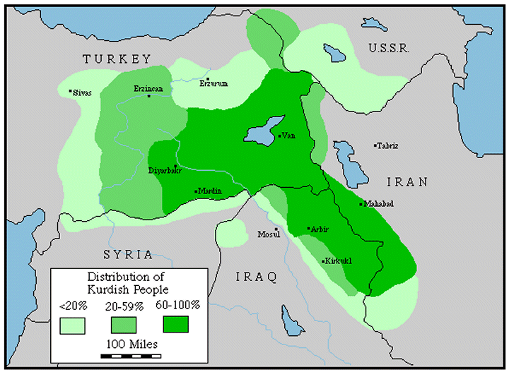
- ^ Distribution of Kurdish People. As some have noted, Turkey's road to the EU lies through Diyarbakir
- ^ a b c d e Diyarbakır. Turkish Airlines. Retrieved on 2012-05-13.
- ^ Abdul- Rahman Mizouri Taj Al- Arifeen: Udday bin Musafir Al- Kurdy Al- Hakary Is not an Umayyad. Part Two. College of Arts/ Dohuk University (2001)
- ^ Verity Campbell (1 April 2007). Turkey. Lonely Planet. pp. 621–. ISBN 978-1-74104-556-7. Retrieved 13 May 2012.
- ^ Rêbera Geshtê ya Amedê (2011). Boyut, Istanbul, ISBN 978-605-87650-0-9, 235 pages, a very interesting tourist guide published in Kurdish by the city council in Amed/Diyarbakir (Sharidariya Bajarê Mezin a Amedê).
- ^ See Üngör, Uğur (2011), The Making of Modern Turkey: Nation and State in Eastern Anatolia, 1913-1950. Oxford: Oxford University Press, p. 244. ISBN 0-19-960360-X.
- ^ Charles Gates, Ancient Cities, 2011, p. 19.
- ^ Trevor Bryce, The Kingdom of the Hittites, 1999 P. 137
- ^ Theodor Mommsen History of Rome, The Establishment of the Military Monarchy. Italian.classic-literature.co.uk. Retrieved on 2012-05-13.
- ^ a b The Eye of Command, Kimberly Kagan, p23
- ^ Gunter, Michael. The Kurdish Predicament in Iraq: A Political Analysis. p. 8.
- ^ Dumper, Michael. Cities of The Middle East and North Africa: A Historical Encyclopedia. p. 130.
- ^ McDowall, David (2004). 3E (ed.). A Modern History of the Kurds. IB Tauris. p. 403. ISBN 978-1-85043-416-0.
{{cite book}}: CS1 maint: numeric names: editors list (link) - ^ Kirişci, Kemal (June 1998). "Turkey". In Janie Hampton (ed.). Internally Displaced People: A Global Survey. London: Earthscan Publications Ltd. pp. 198, 199.
- ^ Globalsecurity.org
- ^ "Belediye Diyarbakırlıyı tanıdı: Kürtçe konuşuyor". Radikal (in Turkish). Dogan News Agency. 24 November 2006. Retrieved 6 August 2008.
- ^ a b Prothero, W.G. (1920). Armenia and Kurdistan. London: H.M. Stationary Office. p. 60.
- ^ a b Prothero, W.G. (1920). Armenia and Kurdistan. London: H.M. Stationary Office. p. 62.
- ^ Prothero, W.G. (1920). Armenia and Kurdistan. London: H.M. Stationary Office. p. 63.
- ^ Prothero, W.G. (1920). Armenia and Kurdistan. London: H.M. Stationary Office. p. 64.
- ^ Prothero, W.G. (1920). Armenia and Kurdistan. London: H.M. Stationary Office. p. 70.
- ^ Historical Weather for Diyarbakir, Turkey – Travel, Vacation, Forecast and Reference Information. Weatherbase. Retrieved on 2012-05-13.
External links
- Template:Tr icon Governorship of Diyarbakır
- Template:Tr icon Diyarbakırspor funs, news, informarmation
- Template:Tr icon local info
- Template:Tr icon Information on Diyarbakır
- Template:Tr icon Diyarbakır news
- Diyarbakır Weather Forecast Information
37°55′N 40°14′E / 37.91°N 40.24°E
Diyarbakır in Diyarbakır Province of Turkey | |||||||||||||||||||||||||||
|---|---|---|---|---|---|---|---|---|---|---|---|---|---|---|---|---|---|---|---|---|---|---|---|---|---|---|---|
| Districts |   | ||||||||||||||||||||||||||
|
Metropolitan municipalities are bolded. | |||||||||||||||||||||||||||
| Countries |  | |
|---|---|---|
| Cities | ||
| Tributaries |
| |
| Dams | ||