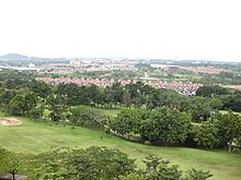
Bangi, Selangor

Bangi is a small town situated south of Hulu Langat District, Selangor, Malaysia.
Geography
It is roughly situated between the towns of Kajang (9 km.) and Putrajaya (formerly Prang Besar, 9 km.). The town is surrounded by palm oil estates, most of which were converted to townships over the last 20 years. The town is surrounded by small Malay villages, within 3 kilometers distance, namely, Kampung Bangi, Kampung Bahagia, Kampung Batu Lima, Kampung Rinching.
Bangi is not to be confused with Bandar Baru Bangi, a larger township founded more recently several kilometres north, near Kajang.
Features
There is a main road with shops houses on both side of the road. Behind these shophouses, 30 acres of rubber estates were converted to residential housing, now known as Kampong Aman. A Malaysian Palm Oil Board research station belonging to UKM is also located near to the town.
Within 3 km. , there are Seri Putra Bangi, Bukit Mahkota Bangi, Bangi Avenue, Taman Impian and many more.
Transportation

Bangi is linked to the KTM Komuter commuter train services via the Bangi Komuter station.
2°54′N 101°47′E / 2.900°N 101.783°E

