
Mabitac
Mabitac | |
|---|---|
 | |
| Nickname: The Site of the Fabled Battle of Mabitac | |
 Map of Laguna showing the location of Mabitac | |
| Country | Philippines |
| Region | CALABARZON (Region IV-A) |
| Province | Laguna |
| District | 4th District of Laguna |
| Founded | 1611 |
| Barangays | 15 |
| Government | |
| • Mayor | Ronald Ilano Sana |
| Area | |
| • Total | 80.76 km2 (31.18 sq mi) |
| Population (2010)[3] | |
| • Total | 18,618 |
| • Density | 230/km2 (600/sq mi) |
| Time zone | UTC+8 (PST) |
| ZIP code | 4020 |
| Dialing code | 49 |
| Income class | 5th |
Mabitac is a fifth class municipality in the province of Laguna, Philippines. According to the 2010 census, it has a population of 18,618 people[3] and a total land area of 80.76 square kilometres (31.18 sq mi).[2]
Mabitac was an excellent hunting ground for wild game three centuries ago. Native hunters used numerous cave-ins or trap-ins called "bitag" in the local dialect. Hence, the place was referred to as "Mabitag" meaning "a place with many traps".
Mabitac is situated on the eastern side of the province of Laguna, 88 kilometres (55 mi) from Manila using Rizal Province on a winding road, or 123 kilometres (76 mi) via the South Luzon Express, Calamba and Santa Cruz, Laguna.
Barangays
Mabitac is politically subdivided into 15 barangays:[2]
History
The first Spaniards who came to this place were the friars who established the first Spanish settlement in the area and began to Christianize the local population. The Spaniards, having difficulty in pronouncing the "G" consonant, called this place "Mabitac" whenever they mentioned this place. Eventually, the name found its way in the official records and maps of Laguna made by Spanish cartographers and mariners who chartered the coastal areas of Laguna de Bay.
This town was formerly a barrio of Siniloan, an immediate neighboring town. It became an independent municipality only in the year 1611, not by legislation, but by mutual agreement by and between the Spanish friars of both towns who were then the influential ruling class.
Mabitac was the site of a battle in the Philippine-American War, when on September 17, 1900, Filipinos under General Juan Cailles defeated an American force commanded by Colonel Benjamin F. Cheatham.
World War II
In 1942, Japanese soldiers entered and occupied Mabitac. In 1945, the Philippine Commonwealth Army troops of the 4th, 41st, 42nd and 43rd Infantry Division and 4th Infantry Regiment of the Philippine Constabulary together with the recognized guerrillas defeated the Japanese Imperial forces during the Second Battle of Mabitac.
Demographics
| Year | Pop. | ±% p.a. |
|---|---|---|
| 1990 | 11,444 | — |
| 1995 | 13,309 | +2.87% |
| 2000 | 15,097 | +2.74% |
| 2007 | 17,608 | +2.14% |
| 2010 | 18,618 | +2.05% |
| Source: National Statistics Office[3] | ||
Images
-
 Welcome sign
 -
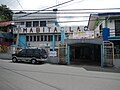
 Poblacion
 -
 Town hall
 -
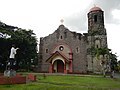 Nuestra Señora de Candelaria Parish Church


See also
References
- ^ "Official City/Municipal 2013 Election Results". Intramuros, Manila, Philippines: Commission on Elections (COMELEC). 11 September 2013. Retrieved 20 November 2013.
- ^ a b c "Province: LAGUNA". PSGC Interactive. Makati City, Philippines: National Statistical Coordination Board. Retrieved 20 November 2013.
- ^ a b c "Total Population by Province, City, Municipality and Barangay: as of May 1, 2010" (PDF). 2010 Census of Population and Housing. National Statistics Office. Retrieved 20 November 2013.
External links
- "Municipality of Mabitac", Province of Laguna Website
- Philippine Standard Geographic Code
- Philippine Census Information
- Local Governance Performance Management System
Places adjacent to Mabitac | ||||||||||||||||
|---|---|---|---|---|---|---|---|---|---|---|---|---|---|---|---|---|
| ||||||||||||||||
.svg)