
Stafford, Texas: Difference between revisions
Judahdavis (talk | contribs) No edit summary |
Judahdavis (talk | contribs) No edit summary |
||
| Line 81: | Line 81: | ||
[[Image:MeadowsStafford.JPG|thumb|right|Signs indicating the border of Stafford and [[Meadows Place, Texas|Meadows Place]]]] |
[[Image:MeadowsStafford.JPG|thumb|right|Signs indicating the border of Stafford and [[Meadows Place, Texas|Meadows Place]]]] |
||
[[Image:StreetSignSeal.JPG|thumb|right|The Seal of the City of Stafford as seen on street signs]] |
[[Image:StreetSignSeal.JPG|thumb|right|The Seal of the City of Stafford as seen on street signs]] |
||
| ⚫ | |||
'''Stafford''' is a city in the [[U.S. state]] of [[Texas]] within the [[Houston Metropolitan Area|Houston–Sugar Land–Baytown Metropolitan Area]]. Stafford is mostly in [[Fort Bend County, Texas|Fort Bend County]] with a small portion in [[Harris County, Texas|Harris County]]. As of the [[2000]] [[U.S. Census]], the city population was 15,681. |
'''Stafford''' is a city in the [[U.S. state]] of [[Texas]] within the [[Houston Metropolitan Area|Houston–Sugar Land–Baytown Metropolitan Area]]. Stafford is mostly in [[Fort Bend County, Texas|Fort Bend County]] with a small portion in [[Harris County, Texas|Harris County]]. As of the [[2000]] [[U.S. Census]], the city population was 15,681. |
||
| Line 129: | Line 129: | ||
== Image gallery== |
== Image gallery== |
||
| ⚫ | |||
<gallery> |
<gallery> |
||
Image:Fountains.jpg|The Fountains on the Lake, an upscale shopping center in Stafford |
Image:Fountains.jpg|The Fountains on the Lake, an upscale shopping center in Stafford |
||
Revision as of 16:30, 3 April 2008
City of Stafford | |
|---|---|
 Location of Stafford, Texas | |
| Country | United States |
| State | Texas |
| Counties | Fort Bend, Harris |
| Area | |
| • Total | 7.0 sq mi (18.1 km2) |
| • Land | 7.0 sq mi (18.1 km2) |
| • Water | 0.0 sq mi (0.0 km2) |
| Elevation | 85 ft (26 m) |
| Population (2000) | |
| • Total | 15,681 |
| • Density | 2,247.1/sq mi (867.6/km2) |
| Time zone | UTC-6 (Central (CST)) |
| • Summer (DST) | UTC-5 (CDT) |
| ZIP codes | 77477, 77497 |
| Area code | 281 |
| FIPS code | 48-69908Template:GR |
| GNIS feature ID | 1347777Template:GR |

Stafford is a city in the U.S. state of Texas within the Houston–Sugar Land–Baytown Metropolitan Area. Stafford is mostly in Fort Bend County with a small portion in Harris County. As of the 2000 U.S. Census, the city population was 15,681.
Due to its abundance of revenue-generating industry and prime business location between Sugar Land and Houston, Stafford has perhaps one of the most distinctive and financially strong municipal governments in the state of Texas.
The city has the only municipal school district (Stafford Municipal School District) in all of Texas. Stafford is served by the Houston Community College System and has a campus within the city.
Stafford does not have a municipal property tax as of 1995 and the sales tax is 0.5% less than all of the surrounding cities. Even though it is known as a bedroom community of the greater Houston area, it is estimated that four times as many people work in Stafford on a week day, which is evidence of the large amount of commercial activity that helps the city financially. Many corporations both large and small including United Parcel Service, Texas Instruments, and Tyco all maintain significant operations in Stafford.
The current mayor of Stafford is Leonard Scarcella, who was first elected in 1969 and has been a lifelong resident of the city.
Geography
Stafford is located at 29°37′27″N 95°33′48″W / 29.62417°N 95.56333°WInvalid arguments have been passed to the {{#coordinates:}} function (29.624186, -95.563359)Template:GR.
According to the United States Census Bureau, the city has a total area of 7.0 square miles (18.1 km²).None of the area is covered with water.
Demographics
As of the censusTemplate:GR of 2000, there were 15,681 people, 5,865 households, and 4,035 families residing in the city. The population density was 2,247.1 people per square mile (867.4/km²). There were 6,390 housing units at an average density of 915.7/sq mi (353.5/km²). The racial makeup of the city was 46.95% White, 18.85% African American, 0.43% Native American, 19.80% Asian, 0.06% Pacific Islander, 10.53% from other races, and 3.39% from two or more races. Hispanic or Latino of any race were 23.30% of the population.
There were 5,865 households out of which 38.5% had children under the age of 18 living with them, 52.8% were married couples living together, 12.2% had a female householder with no husband present, and 31.2% were non-families. 25.4% of all households were made up of individuals and 2.5% had someone living alone who was 65 years of age or older. The average household size was 2.67 and the average family size was 3.27.
In the city the population was spread out with 27.9% under the age of 18, 9.9% from 18 to 24, 38.5% from 25 to 44, 18.8% from 45 to 64, and 4.9% who were 65 years of age or older. The median age was 31 years. For every 100 females there were 97.4 males. For every 100 females age 18 and over, there were 93.1 males.
The median income for a household in the city was $50,323, and the median income for a family was $58,736. Males had a median income of $41,270 versus $31,761 for females. The per capita income for the city was $22,803. About 5.4% of families and 6.6% of the population were below the poverty line, including 7.7% of those under age 18 and 2.8% of those age 65 or over.
Education


Colleges and universities
The city is served by Houston Community College System.
Primary and secondary schools
Public schools
In 1977, Stafford broke away from the Fort Bend Independent School District, which caused several rounds of federal litigation and by 1981 its was finally declared that the Stafford Municipal School District website http://www.stafford.msd.esc4.net/ was constitutional. Almost all of Stafford was in FBISD, with a minuscule portion in the Houston Independent School District. All of Stafford is now zoned to the Stafford Municipal School District, which is the only school district in all of Texas that is controlled by the city. Students living outside the city limits, in Stafford's southern extraterritorial jurisdiction (including Fifth Street), are served by the Fort Bend Independent School District. Residents in the northern extraterritorial jurisdiction are served by the Alief or Houston Independent School Districts.
When most of Stafford was a part of Fort Bend ISD, Staffordshire Elementary was located in Stafford. Staffordshire closed when Fort Bend ISD desegregated.
Public libraries
Fort Bend County Libraries has the Mamie George Branch located within the city limits of Stafford on Dulles Avenue, and a second library on Texas Parkway.
Postal services
The United States Postal Service operates the Stafford Post Office at 4110 Bluebonnet Drive, 77477-9998. This post office services the zip codes 77477 and 77497. The Stafford Post Office also services the City of Meadows Place and a small part of Alief in Houston. Some of Stafford's northern extraterritorial jurisdiction is within the zip code 77031, and is serviced by a Houston Post Office.
Image gallery
-
 The Fountains on the Lake, an upscale shopping center in Stafford
 -
 The lake referred to by the name of the shopping center
 -
 The frontage from U.S. Route 59
 -
 The Corporate Park business district in Stafford
 -
 The Fort Bend Theatre
 -
 The Stafford Centre for the performing arts
 -
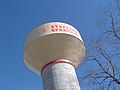 High School Water Tower
 -
 Welcome Sign


External links
- Stafford official website
- Stafford Municipal School District
- Handbook of Texas article on Stafford, Texas
| Counties |  | |
|---|---|---|
| "Principal" cities | ||
| Other cities |
For a complete listing, see list of cities and towns in Houston–The Woodlands–Sugar Land MSA | |
| Unincorporated areas | ||
| Bodies of water | ||
Municipalities and communities of Fort Bend County, Texas, United States | ||
|---|---|---|
| Cities |  | |
| Town | ||
| Villages | ||
| CDPs | ||
| Other communities | ||
| Former communities | ||
| Ghost towns | ||
| Footnotes | ‡This populated place also has portions in an adjacent county or counties ±Former CDP annexed by Missouri City ^Former CDP annexed by Sugar Land #Still active as a community, but is no longer listed as a census-designated place | |
