Bayannur Tianjitai Airport
Appearance
Bayannur Tianjitai Airport 巴彦淖尔天吉泰机场 Bayànnào'ěr Tiānjítài Jīchǎng | |||||||||||
|---|---|---|---|---|---|---|---|---|---|---|---|
 | |||||||||||
| Summary | |||||||||||
| Airport type | Public | ||||||||||
| Serves | Bayannur, Inner Mongolia, China | ||||||||||
| Location | Tianjitai, Wuyuan County | ||||||||||
| Coordinates | 40°55′35″N 107°44′20″E / 40.92639°N 107.73889°E | ||||||||||
| Map | |||||||||||
 | |||||||||||
| Runways | |||||||||||
| |||||||||||
Source:[1] | |||||||||||
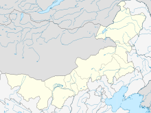
Bayannur Tianjitai Airport (Chinese: 巴彦淖尔天吉泰机场) (IATA: RLK, ICAO: ZBYZ) is an airport serving the city of Bayannur in Inner Mongolia Autonomous Region, China. It is located in the town of Tianjitai in Wuyuan County, 33 kilometers from the city center.[1] Construction began on 26 January 2010 with a total investment of 360 million yuan, and the airport was opened on 30 December 2011.[1]
Facilities
The airport has a runway that is 2,600 meters long and 45 meters wide (class 4C), a 7,076 square-meter terminal building, and three aircraft parking bays. It is designed to handle 230,000 passengers and 810 tons of cargo annually by 2020.[1]
Airlines and destinations
The airport is served by the following airlines:
See also
References
- ^ a b c d 内蒙古巴彦淖尔机场正式通航运营. Xinhua Net (in Chinese). 30 December 2011. Archived from the original on 2013-09-29. Retrieved 2012-04-02.
- ^ http://news.carnoc.com/list/488/488871.html

