Khmelnytskyi Airport
Appearance
Khmelnytskyi International Airport Міжнародний аеропорт Хмельницький | |||||||||||
|---|---|---|---|---|---|---|---|---|---|---|---|
 Passenger terminal | |||||||||||
| Summary | |||||||||||
| Airport type | Public | ||||||||||
| Owner | Khmelnytskyi City Council | ||||||||||
| Operator | KP Khmelnytskyi Airport | ||||||||||
| Serves | Khmelnytskyi | ||||||||||
| Location | Khmelnytskyi, Khmelnytskyi Oblast, Ukraine | ||||||||||
| Elevation AMSL | 1,152 ft / 351 m | ||||||||||
| Coordinates | 49°21′36″N 026°56′0″E / 49.36000°N 26.93333°E | ||||||||||
| Website | www.podilliaavia.com.ua | ||||||||||
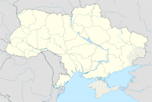
| Map | |||||||||||
| Runways | |||||||||||
| |||||||||||
International Airport Khmelnitsky (Міжнародний аеропорт "Хмельницький) (IATA: HMJ, ICAO: UKLH) is an airport in Ukraine located 7 km southwest of Khmelnytskyi. It services general aviation.
In 2014, it ceased operations and is currently vacant.
See also
References

