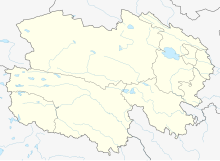
Haixi Huatugou Airport
Huatugou Airport 花土沟机场 Huātǔgōu Jīchǎng | |||||||||||
|---|---|---|---|---|---|---|---|---|---|---|---|
| Summary | |||||||||||
| Airport type | Public | ||||||||||
| Operator | China West Airport Group | ||||||||||
| Serves | Mangnai | ||||||||||
| Location | Huatugou, Qinghai, China | ||||||||||
| Opened | 26 June 2015 | ||||||||||
| Elevation AMSL | 2,945 m / 9,662 ft | ||||||||||
| Coordinates | 38°12′12″N 90°50′30″E / 38.20333°N 90.84167°E | ||||||||||
| Website | http://www.westaport.com/en/index.php | ||||||||||
| Map | |||||||||||
| Runways | |||||||||||
| |||||||||||
Source:[1] | |||||||||||
Huatugou Airport (Chinese: 花土沟机场) (IATA: HTT) is an airport in Mangnai, a county-level district of Haixi Mongol and Tibetan Autonomous Prefecture in Qinghai Province China.[2] The airport is located near the town of Huatugou, at an altitude of 2,945 metres (9,662 ft) above sea level.[2] Construction began on 30 December 2011 with an estimated total investment of 700 million yuan.[1] The airport was opened on 26 June 2015.[3]
Facilities
The airport has a runway that is 3,600 meters long, and a 3,000 square-meter terminal building. It is projected to handle 90,000 passengers annually by 2020.[1]
Airlines and destinations
| Airlines | Destinations |
|---|---|
| China Eastern Airlines | Dunhuang, Xi'an |
See also
References
- ^ a b c 青藏高原又一民用机场——花土沟机场正式奠基. Xinhua Net (in Chinese). 31 December 2011.
- ^ a b "Profile on Huatugou Airport | CAPA". Centre for Aviation. Retrieved 2015-10-02.
- ^ 青海花土沟机场正式通航. China News (in Chinese). 26 June 2015.

