
Texas panhandle
Template:Geobox The Texas Panhandle is a region of the U.S. state of Texas consisting of the northernmost 26 counties in the state. The panhandle is a rectangular area bordered by New Mexico to the west and Oklahoma to the north and east. The Handbook of Texas defines the southern border of Swisher County to be the southern boundary of the Texas Panhandle region, though some consider the region to extend as far south as Lubbock County[1]., The Texas Panhandle Press Association accepts members in the actual panhandle and a triangle formed by its southern tier, the southeastern border of New Mexico and a diagonal to the beginning, which includes Lubbock County.
Its land area is 66,883.58 km² (25,823.9 sq mi), or nearly 10 percent of the state's total. There is an additional 162.53 km² (62.75 sq mi) of water area. Its population as of the 2010 census was 427,927 residents, or 1.7 percent of the state's total population. As of the 2010 census, this would put the average population density for the region at 16.6 persons/sq mi. The Panhandle is distinct from North Texas, which is more to the southeast.
West of the Caprock Escarpment and north and south of the Canadian River breaks, the surface of the Llano Estacado is rather flat. South of the city of Amarillo, the level terrain gives way to Palo Duro Canyon, the second largest canyon in the United States. This colorful canyon was carved by the Prairie Dog Town Fork Red River. North of Amarillo lies Lake Meredith, a reservoir created by Sanford Dam on the Canadian River. The lake, along with the Ogallala Aquifer, provide drinking water and irrigation for this moderately dry area of the high plains.
Interstate Highway 40 passes through the panhandle, and also passes through Amarillo. The highway passes through Deaf Smith, Oldham, Potter, Carson, Gray, Donley, and Wheeler Counties.
Because the Act of Admission of Texas into the Union allows the state to divide itself, a bill was introduced to the Texas legislature in 1915 in order to create a State of Jefferson, made up of the Texas Panhandle.[2]
The Texas Panhandle has been identified as one of the fastest-growing wind-power-producing regions in the nation over the past decade because of its strong, steady winds.[3]


Demographics of the Panhandle
As of the census of 2000, approximately 402,862 people lived in the panhandle. Of these, 68.9% were non-Hispanic White, 23.8% were Hispanic, and 4.6% were African American. Only 2.7% were of some other ethnicity. 92.3% of inhabitants claimed native birth, and 8.9% were veterans of the United States armed forces. 49.9% of the population was male, and 50.1% was female. 13.2% of the population were 65 years of age or older, whereas 27.8% of the population was under 18 years of age.
Counties
The 26 northernmost counties that make up the Texas Panhandle include[4]:
|
Cities and Towns
Major cities of the Texas Panhandle with populations greater than 10,000 include:
Some of the smaller towns with populations less than 10,000 include:
|
|
-
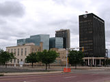 Amarillo is the largest city in the Texas Panhandle.
 -
-
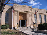
 The Dallam County Courthouse in Dalhart, Texas.


Politics
Much like the Oklahoma Panhandle, the region is very politically and socially conservative. It was one of the first regions of the state to break away from its Democratic roots, though Democrats continued to do well at the local level well into the 1980s. However, Republicans now dominate every level of government, holding nearly every elected post above the county level.
In the 2008 Presidential Election, John McCain received 78.82% of the vote, as compared with Barack Obama's 20.48% share of the vote. Other candidates received 0.70% of the total vote. However, most (62.2%) of Barack Obama's votes came from Potter and Randall Counties, near Amarillo, the only large city in the region, with the rest of the panhandle being even more strongly conservative. In Ochiltree County, John McCain received 91.97% of the vote.
Nearly all of the Panhandle is in Texas's 13th congressional district, represented by Republican Mac Thornberry. With a Cook Partisan Voting Index of R+29, it is tied for the most Republican district in the nation. The counties of Castro, Deaf Smith, and Parmer are in the Texas's 19th congressional district, represented by Republican Randy Neugebauer.
Footnotes
- ^ Experience Lubbock in the Texas Panhandle Plains
- ^ Division of Texas from the Handbook of Texas Online
- ^ UPDATE 2-Pickens' Mesa Power orders GE wind turbines | Reuters
- ^ Counties of the Texas Panhandle United States Census Bureau
See also
|
|
External links
- Panhandle from the Handbook of Texas Online
- Photos of the Llano Estacado