Vitebsk Vostochny Airport
Appearance
Vitebsk Vostochny Airport Аэрапорт Віцебск Усходні / Аэропорт Витебск Восточный | |||||||||||
|---|---|---|---|---|---|---|---|---|---|---|---|
| Summary | |||||||||||
| Airport type | Public | ||||||||||
| Serves | Vitebsk, Belarus | ||||||||||
| Elevation AMSL | 208 m / 682 ft | ||||||||||
| Coordinates | 55°7′36″N 030°21′6″E / 55.12667°N 30.35167°E | ||||||||||
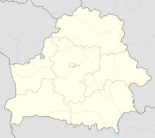
| Map | |||||||||||
 | |||||||||||
| Runways | |||||||||||
| |||||||||||
Vitebsk Vostochny Airport (Template:Lang-be, Template:Lang-ru) (also known as Vitebsk Southeast Airport) (IATA: VTB, ICAO: UMII) is an airport serving Vitebsk in Belarus. It is located 12 kilometres (7.5 mi) southeast of the city. It accommodates aircraft up to the size of a Tupolev Tu-154, and can also accommodate the Il-76.
History
The first non-military usage of Vitebsk airport began on 7 November 1934.
Airlines and destinations
| Airlines | Destinations |
|---|---|
| Belavia | Seasonal: Kaliningrad[1] Seasonal charter: Burgas |
References
- ^ Liu, Jim (7 April 2017). "Belavia plans additional routes in S17". Routesonline. Retrieved 7 April 2017.

