User:Doncram/National Register of Historic Places listings in Texas (A)
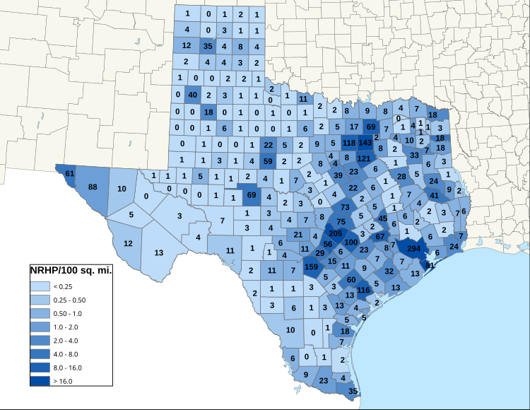
These historic properties and districts in the state of Texas are listed in the National Register of Historic Places. Properties and/or districts are listed in most of Texas's 254 counties.
The NRHP listings in Texas are tallied here by region, using 10 regions defined by the Texas Historical Commission (THC). See #Regions below.
The tables linked below are intended to provide a complete list of properties and districts listed in each county. The locations of National Register properties and districts with latitude and longitude data may be seen in an online map by clicking on "Map of all coordinates".[1]
The names on the lists are as they were entered into the National Register; some place names are uncommon or have changed since being added to the National Register.
This National Park Service list is complete through NPS recent listings posted December 20, 2024.[2]
Current listings by county
[edit]The following are approximate tallies of current listings by county.[a]


Regions
[edit]The Texas Historical Commission (THC) defines a partition of the state into ten historic themed regions, each with a suggested driving tour which was originally designed by the Texas Department of Transportation, back in 1968 at the time of Texas' World Fair. The THC produces brochures corresponding to each region highlight most significant historic sites and city-specific concentrations.
| Region | # Counties | # NRHP listings | THC brochures | |
|---|---|---|---|---|
| 1 | Brazos Trail Region | 18 | 388 | Brazos brochure |
| 2 | Forest Trail Region | 35 | 304 | Forest brochure |
| 3 | Forts Trail Region | 29 | 226 | Forts brochure |
| 4 | Hill Country Trail Region | 19 | 512 | Hill Country brochure |
| 5 | Independence Trail Region | 28 | 798 | Independence brochure |
| 6 | Lakes Trail Region | 31 | 609 | Lakes brochure |
| 7 | Mountains Trail Region (redlink) | 6 | 183 | Mountains brochure |
| 9 | Pecos Trail Region (redlink) | 22 | 47 | Pecos brochure (only one with map showing county borders) |
| 9 | Plains Trail Region (redlink) | 52 | 132 | Plains brochure |
| 10 | Tropical Trail Region (redlink) | 20 | 126 | Tropical brochure |
| Subtotal | 260 | 3325 | ||
| (Less duplicates) | (6) | (18?) | ||
| Total | 254 | 3307? |
Note the above tallies of NRHP listings is simplified for six counties that span regions by assigning all of their NRHPs into the first region alphabetically, for now. There exist duplications of NRHP listings which span county lines.
Notes
[edit]- ^ Based on entries in the National Register Information Database as of April 24, 2008 and new weekly listings posted since then on the National Register of Historic Places web site. Frequent additions to the listings and occasional delistings are made, so the counts here are approximate and not official. New entries are added to the official Register on a weekly basis. Also, the counts in this table exclude boundary increase and decrease listings which modify the area covered by an existing property or district and which carry a separate National Register reference number. The numbers of NRHP listings in each county are documented by tables in each of the individual county list-articles.
- ^ The following sites are listed in multiple counties:
- Bartlett Commercial Historic District (Bell and Williamson)
- Butterfield Mail Corridor (Culberson and Hudspeth)
- Cuero I Archeological District (DeWitt and Gonzales)
- Enchanted Rock Archeological District (Gillespie and Llano)
- King Ranch (Kenedy, Kleberg, Nueces and Willacy)
- Lyndon B. Johnson National Historical Park (Blanco and Gillespie)
- Mansfield Cut Underwater Archeological District (Kenedy and Willacy)
- Port Arthur-Orange Bridge (Jefferson and Orange)
- Regency Suspension Bridge (Mills and San Saba)
- Riverside Swinging Bridge (Trinity and Walker)
- State Highway 3-A Bridge at Cibolo Creek (Bexar and Guadalupe)
- State Highway 19 Bridge at Trinity River (Trinity and Walker)
- State Highway 29 Bridge at the Colorado River (Burnet and Llano)
- State Highway 34 Bridge at the Trinity River (Ellis and Kaufman)
- US 190 Bridge at the Colorado River (Lampasas and San Saba)
- US 190 Bridge at the Neches River (Jasper and Tyler)
References
[edit]- ^ The latitude and longitude information provided in this table was derived originally from the National Register Information System, which has been found to be fairly accurate for about 99% of listings. Some locations in this table may have been corrected to current GPS standards.
- ^ National Park Service, United States Department of the Interior, "National Register of Historic Places: Weekly List Actions", retrieved December 20, 2024.
- ^ As defined by Texas Historical Commission, per this listing of counties and this map)
Texas Category:Texas-related lists |}


