Chandipur, Odisha: Difference between revisions
| Line 56: | Line 56: | ||
==Geography== |
==Geography== |
||
Chandipur is located at {{coord|21.47|N|87.02|E|}}.<ref>[http://www.fallingrain.com/world/IN/21/Chandipur.html Falling Rain Genomics, Inc – Chandipur]</ref> It has an average elevation of {{convert|3|m|ft|abbr=on}}. This town is {{convert|51.330|acre|km2|abbr=on}} in size.<ref>[https://web.archive.org/web/20090411014712/http://orissagov.nic.in/revenue/ADMN_UNIT/Sonepur/Birmaharajpur/Subalaya.htm Subalaya Town Area Chart (archive)]</ref> |
Chandipur is located at {{coord|21.47|N|87.02|E|}}.<ref>[http://www.fallingrain.com/world/IN/21/Chandipur.html Falling Rain Genomics, Inc – Chandipur]</ref> It has an average elevation of {{convert|3|m|ft|abbr=on}}. This town is {{convert|51.330|acre|km2|abbr=on}} in size.<ref> Chandipur beach can be submerged at high tide.[https://web.archive.org/web/20090411014712/http://orissagov.nic.in/revenue/ADMN_UNIT/Sonepur/Birmaharajpur/Subalaya.htm Subalaya Town Area Chart (archive)]</ref> |
||
===Normal Indian weather=== |
===Normal Indian weather=== |
||
Revision as of 16:34, 6 May 2019
Chandipur | |
|---|---|
Town | |
| Coordinates: 21°28′N 87°01′E / 21.47°N 87.02°E | |
| Country | |
| State | Odisha |
| District | Balasore |
| Area | |
| • Total | 0.20773 km2 (0.08021 sq mi) |
| Elevation | 3 m (10 ft) |
| Languages | |
| • Official | Odia |
| Time zone | UTC+5:30 (IST) |
| Vehicle registration | OD 01 |
| Website | odisha |

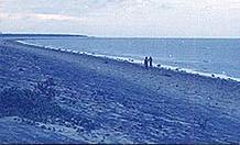
Chandipur, also known as Chandipur-on-sea, is a sea resort in Baleswar District, Odisha, India. The resort is on the Bay of Bengal and is approximately 16 kilometers from the Baleswar Railway Station. The beach is unique in that the water recedes up to 5 kilometers during the ebb tide. Due to its unique circumstances, the beach supports bio-diversity. Horseshoe crab is also found here on the beach towards Mirzapur, the nearby fishing market and community at the confluence of the Budhabalanga River(Balaramgadi). It is a suitable picnic spot. One of Odisha Tourism's Panthanivas (guest house) is situated here.

Geography
Chandipur is located at 21°28′N 87°01′E / 21.47°N 87.02°E.[1] It has an average elevation of 3 m (9.8 ft). This town is 51.330 acres (0.20773 km2) in size.[2]
Normal Indian weather
In summer the temperature is 25–40 degrees Celsius, but in winter it's 17–26 degree Celsius. Nov–Mar is the suitable time for travelling here.
Ministry of Defence
Chandipur-on-sea is also the location of the Indian Strategic Forces Command's Integrated Test Range (ITR) at Abdul Kalam Island, formerly known as Wheeler Island. A number of Indian missiles have been tested and launched from the ITR, including nuclear-capable Prithvi, Agni and Shaurya[3] ballistic missiles, as well as Akash and Barak 8 surface-to-air missiles.[4]
Transport
Chandipur can be reached by travelling up to Baleswar by rail or road and then thereafter catching a bus, auto or taxi. Road access to Baleswar is via National Highway 16 (NH-16). Chandipur sea beach is 16 km from Balasore railway station.[5]
Also avail the local guide & trekker service to see the major 4 locations of Devkund Waterfalls, Panchalinegeswar, Khirachora Gopinath temple, Chandipur Beach, Emami Jagannath temple, & Nilgiri Jagannath temple.
Food
Many types of seafood are available in hotels and restaurants. Fish is especially inexpensive here.
References
External links
 Chandipur travel guide from Wikivoyage


