
Chang La
| Chang La | |
|---|---|
 | |
| Elevation | 5,360 m (17,585 ft) |
| Traversed by | Road from Indus Valley to Pangong Lake |
| Location | Ladakh, India |
| Range | Himalaya |
| Coordinates | 34°02′49″N 77°55′50″E / 34.04704°N 77.93054°E |
 Location of Chang La in Ladakh  Chang La (India) | |
Chang La is a high mountain pass in Ladakh at an elevation of 5,391.3024 m or 17,688.000 ft in the Ladakh Range between Leh and the Shyok River valley.[1][2] The Chang La, on Leh to Pangong Lake road,[3] lies on the Leh-Karu-Sakti-Zingral-Chang La-Durbuk-Tangtse-Pangong Lake motorable road. Karu, which lies on Leh-Manali NH-3, connects Chang La and Pangong Lake to Leh and the rest of India. In September 2021, BRO opened another alternate motorable asphalt road between Zingral and Tangtse via Ke La pass (5,669.28 m or 18,600.0 ft) and Taruk (also spelled Tharuk).[4][5]
Chang La is approached from Zingral village by a steeply climbing asphalt road which requires a careful drive. The stretch of 10–15 km road on either side of Chang la becomes loose dirt and slush after the winter and requires regular maintenance. During the summer months specifically the tourist season, small streams appear across the road, making the climb a challenge for the bikers. The descent from Chang La towards Tangtse or Darbuk is again very steep. Doctors advise that staying at the top for more than 20-25 minutes can cause altitude sickness.
Etymology[edit]
Chang La literally means "Northern Pass" (Chang = north, La = Pass).[3]
Geography[edit]
The Changla Pass is the main gateway for the Nubra region. The small town of Tangste is one of the nearest settlement.[3] Zingral is the nearest habitation.
DRDO research station[edit]
The world's highest research station, established by the Defence Research and Development Organisation is functional in Chang La at a height of 17,664 ft.[3]
Gallery[edit]
-
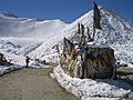 Chang La with prayer flags
 -
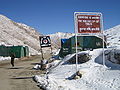 Chang La, Tea Point, everyone is welcome
 -
 Chang La, Ladakh in 2013


See also[edit]
- India-China Border Roads
- Transport and tourism in Ladakh
- List of mountain passes of India
- List of mountains in India
References[edit]
- ^ GeoNames. "Chang La Pass". Retrieved 17 June 2009.
- ^ Jina, Prem Singh (31 August 1998). Ladakh: The Land & The People. India: Indus Publishing. pp. 25–26. ISBN 978-81-7387-057-6.
- ^ a b c d Service, Tribune News. "At 17,500 ft, world's highest research station becomes functional in Ladakh". Tribuneindia News Service.
- ^ World's highest motorable road at 18600 ft inaugurated in Ladakh, The News Minute, 21 SEPTEMBER 2021.
- ^ MP Ladakh inaugurates road connecting Zingral to Tharuk, Tangtse, Govt of Ladakh, accessed Sept 2021.
External links[edit]
| State symbols | |||||||||||||||||||
|---|---|---|---|---|---|---|---|---|---|---|---|---|---|---|---|---|---|---|---|
| History |
| ||||||||||||||||||
| Administration | |||||||||||||||||||
| Geography |
| ||||||||||||||||||
| Human settlements | |||||||||||||||||||
| Culture |
| ||||||||||||||||||
| Tourism and wildlife |
| ||||||||||||||||||
| Transport |
| ||||||||||||||||||
| Infrastructure |
| ||||||||||||||||||
| See also |
| ||||||||||||||||||
This Ladakh, India location article is a stub. You can help Wikipedia by expanding it. |