
Ballari
Ballari
Bellary ಬಳ್ಳಾರಿ | |
|---|---|
city | |
| Government | |
| • Mayor | Noorjahan [1] |
| Population (2001) | |
| • Total | 317,000 |
| • Rank | Unranked |
| Website | www.bellarycity.gov.in |
Bellary (Kannada: ಬಳ್ಳಾರಿ, Telugu: బళ్ళారి, IPA: [ˈbəɭɭaːri]) is a historic city in Bellary District in Karnataka state, India.
Origins of the city's name
There are several legends about how Bellary (ಬಳ್ಳಾರಿ) got its name.
- One of them is that a few devout travelling merchants halting in Bellary, could not find a Shiva Linga for their worship. They then installed a balla (ಬಳ್ಳ) (a measuring cup or seru (ಸೇರು) used to measure grain) upside down as a Shiva Linga and worshiped it. Eventually, that place was turned into a temple dedicated to Balleshwara (ಬಳ್ಳೇಶ್ವರ) or Shiva, which got distorted to Malleshwara (ಮಲ್ಲೇಶ್ವರ), and Bellary derives its name from this temple[citation needed]. This temple can still be found in the Fort area of the city, and an annual festival and fair dedicated to Shiva is conducted at the temple premises even today.[citation needed]
- Another legend is that the city is named after Indra, the king of Gods, who slayed a Rakshasa (demon) named Balla who lived around this place. Balla-ari means 'enemy of Balla' (ari – enemy in Sanskrit).[8] One of the two hills at the heart of the city is called Balahari Betta (ಬಲಹರಿ ಬೆಟ್ಟ), and the Malleshwara temple is situated close by.
- The third legend derives the city's name from the old Kannada word Vallari and Vallapuri.[8]
History
Historical names of the Bellary area
- Bellary was once part of an area also known as Kuntala Desha (ಕುಂತಲ ದೇಶ)[8][9][10] or Kuntala Vishaya (ಕುಂತಲ ವಿಷಯ) (Vishaya - a territorial division or district of a kingdom). Many inscriptions refer to the Western Chalukyas as rulers of Kuntala or Kondala.[11][12]
- An inscription during the Gangas of Talakadu speaks of a certain Sindha Vishaya (ಸಿಂಧ ವಿಷಯ), which today consists of Bellary and Dharwad districts.[8] Many inscriptions by Yadavas[13] and Kalyani Chalukyas[14] refer to this areas as Sindavadi (ಸಿಂದವಾಡಿ) or Sindavadi-nadu (ಸಿಂದವಾಡಿ-ನಾಡು) (Sindavadi-1000).
- During the rule of Western Chalukyas, the area around Bellary was part of Nolambavadi (ನೊಳಂಬವಾಡಿ) (referred to as Nolambavadi-32000), which included parts of the present Shivamogga, Chitradurga, Bellary and Anantapuram Districts.[15] Further, some inscriptions mention that Nolambavadi-nadu (ನೊಳಂಬವಾಡಿ-ನಾಡು) was a part of Kuntala desha[13]
Timeline
- Ancient Times
- Some of the events in the great epic Ramayana are related to this historical place. It is said that Rama while searching for Sita met Sugreeva and Hanuman at a place near Hampi, the celebrated capital of the Vijayanagara empire.[16]
- 300 BCE – 1336 AD
- Bellary was ruled in succession by the Mauryas, Satavahanas, the Pallavas, the Kadambas, the Badami Chalukyas, the Rashtrakutas, the Kalyani Chalukyas, the Southern Kalachuryas, the Sevuna Yadavas, and the Hoysalas.
- The Bellary area was also ruled briefly by the Cholas during the wars between Kalyani Chalukyas and the Cholas (often involving Vengi Chalukyas), the region constantly changing hands under turmoil.
- A dynasty called Ballariya Naredu ruled Bellary under the Hoysalas.[8]
- 9th century AD and 1000–1250 AD
- A branch of the Pallava family called the Nolamba-Pallavas ruled Nolambavadi-32000.[13] Later in the 11th century AD, they ruled parts of Nolambavadi under Western Chalukyas and Hoysalas[14][17].
- 1100–1188 AD
- Feudatories of Kalyani Chalukyas, Kalachuryas and Hoysalas, calling themselves Pandyas (Nolambavadi Pandyas), ruled parts of Nolambavadi-32000. They were actively involved in the conflicts amongst their overlords.[18][19]
- 1336–1565 AD
- After the Sevuna Yadavas and the Hoysalas (and the Kakatiyas of Warangal & the Pandyas of Madurai) were decimated by the Islamic sultanates from Delhi under Allauddin Khilji, Malik Kafur and Muhammad bin Tughlaq, the vast Vijayanagara Empire arose under Harihara I and Bukka I. The Bellary area was dominated by the Vijayanagara rulers until 1565 AD.[map 1].
- Bellary itself was ruled by the family of Hanumappa Nayaka, a Palayagara (ಪಾಳೆಯಗಾರ - vassal) of the Vijayanagara Rulers.
- 1565 AD
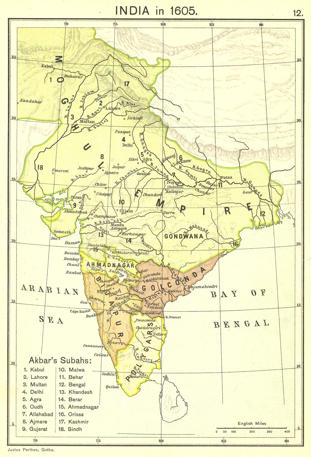
- The dominance of the Vijayanagara empire ended with the Battle of Talikote/Rakkasa-Tangadi (ತಾಳಿಕೋಟೆ/ರಕ್ಕಸ-ತಂಗಡಿ), where they were defeated by a conglomerate of Deccan sultanates. After the fall of Vijayanagara, the Bellary Nayakas were subsidiary to the Adilshahi Sultanate of Bijapur [map 2].
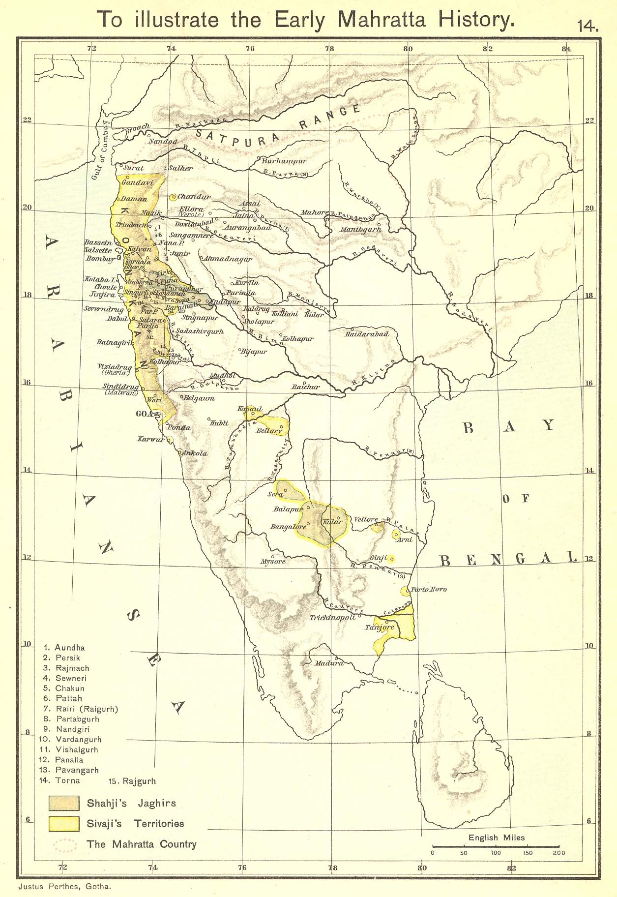
- 1678 AD
- Bellary was subsidiary to the Marathas under Shivaji [map 3]. The story goes that as Shivaji was passing that way some of his foragers had been killed by the garrison, prompting him to occupy Bellary; but he restored it again to the Nayakas at once on condition that tribute should be paid to him.[20]
- 1685 AD
- 1724 AD
- Asif Jah I, who was the Subedar of the Gujarat and Malwa, defeated and killed the Delhi sponsored Mobariz Khan, the Subedar of the Deccan, at the battle fought at Shakar Kheda in the district of Berar.
- Soon after, Asif Jah I assumed independence from Mughal control to establish Hyderabad as a separate state, beginning the Asaf Jahi dynasty. Asif Jah I assumed the title Nizam-ul-mulk, and Bellary was included in the Nizam's Dominion.[21][map 5].
- 1761 AD
- Bellary became tributary to Basalat Jang, the brother of the then Nizam Salabat Jang and the Subedar of Aadavaani (Adoni) and Raichur [20].
- 1769 AD
- The Bellary Nayakas refused to pay tribute to Basalat Jang, which prompted the him to occupy Bellary. The Nayakas then pleaded Hyder Ali of Mysooru (Mysore) to rescue Bellary. Hyder Ali forcefully expelled the occupiers, after which the Nayakas were tributary to him[20][22] [map 6].
- 1792 AD
- At the partition of Tipu Sultan's territory by the British after the Third Anglo-Mysore War, the district was given to the then Nizam Asif Jah II.[20]
- 1800 AD
- After the defeat and death of Tipu Sultan in the Fourth Anglo-Mysore War at Srirangapattanam (Seringapatam), the Mysore territories were further divided up between the Wodeyars, Asif Jah II and the British[20].
- In 1796 AD, Asaf Jah II, harassed by the Marathas and Tipu Sultan, had opted to get British military protection under Lord Wellesley's doctrine of Subsidiary Alliance. Now, as part of this agreement, the Asif Jah II ceded a large portion of the acquired territory, including Bellary, to the British, to be added to the Madras Presidency as 'Bellary District'. This area was also known as the Ceded Districts [map 7], a term still used for the areas, and was considerably larger than the present district, including the present districts of Kadapa (Cuddapah), Anantapuram and much of Karnoolu (Kurnool).[20]
- 1800–1807 AD
- All through these political changes since Vijayanagar times, the Nayakas were the de facto rulers of Bellary - while their masters constantly changed, locally their powers were absolute. All this changed with the arrival of Major Thomas Munro, the first collector of the Ceded Districts (1800-1807), who disposed off the eighty palayagars (Polygars) of the districts either with pensions or assimilation of their estates and established the Ryotwari system - land revenue collected directly from the tiller of the soil.[20]
- 1808 AD
- The ceded districts area was split into two districts, Bellary and Kadapa.[20] The Bellary area was still larger than Kadapa and the second largest district in Madras Presidency, measuring 13000 square miles (nearly twice the size of Wales), and a population of 1,250,000 (one and half times that of Wales).[23]
- 1840 AD
- Bellary became the head-quarters of the district. The Collector until this year lived in Anantapuram.[20]
- 1867 AD
- The Bellary Municipal Council was created, along with the Adoni Municipal Council.[20] These were the only two municipal townships in the whole of Bellary district for a long time.
- 1882 AD
- Seven of the southern taluks were was carved out to form the Anantapuram district, further reducing the size of Bellary District.
- The Maratha princely state of Sandur was surrounded by Bellary district[20][map 8][map 9].
- 1894 AD
- A steam cotton-spinning mill was established[20].
- 1901 AD
- Bellary was the seventh largest town in Madras Presidency, and was one of the chief military stations in Southern India, garrisioned by British and native Indian troops under the British Indian Government. A company of The Southern Mahratta Railway Volunteer Rifles was also stationed in the town[20].
- The town included a civil station to the east of the Bellary Fort, the cantonment on the west, the Cowl Bazar and the suburbs of 'Bruce-pettah' (currently spelt Brucepet) and 'Mellor-pettah', named after two British officers once stationed in the town[20].
- The town was also headquarters for The Roman Catholic Mission and The London Mission[20].
- The industries in the town included a small distillery and two steam cotton-presses. The steam cotton-spinning mill established in 1894 had 17,800 spindles, and employed 520 hands[20].
- 1 October 1953 AD[16]
- Bellary district of Madras State was divided on linguistic basis.
- Areas with significant Kannada speaking populations (Harapanahalli, Hadagali, Kudligi, Hosapete, Sandur and Siruguppa) were transferred to Mysore state, which would later become Karnataka state.
- Areas of the district with significant Telugu speaking populations (Yemmiganooru, Aadavaani, Aalooru, Raayadurgam, D.Hirehaalu, Kanekallu, Bommanahaalu, Gummagatta) were merged into Anantapuram and Karnoolu districts in what would later become the Andhra Pradesh state.
- Bellary city itself, with both Kannada and Telugu speaking populace in large numbers, was included into Mysore state after a protracted debate and controversy.[24][25]
- 1997 AD
- With the re-organisation of the districts in Karnataka, Harapanahalli taluk was transferred to Davanagere district, reducing the number of taluks in the district to seven.[16]
- 2004 AD
- The Bellary City Municipal Council was upgraded to a City Corporation.[26]
Geography
Bellary is located at 15°09′N 76°56′E / 15.15°N 76.93°E.[2] It has an average elevation of 445 metres (1459 ft).[2] The summer temperatures can reach a scorching 48 degrees and the winter as low as 11 degrees
City features
The city stands in the midst of a wide, level plain of black cotton soil[20].
The Rocks
Granite rocks & hills form a prominent feature of Bellary, and granite quarrying is big business. The city is spread mainly around two huge rocky granite hills, the Ballari Gudda (ಬಳ್ಳಾರಿ ಗುಡ್ಡ) and Kumbara Gudda (ಕುಂಬಾರ ಗುಡ್ಡ) (Gudda - hill in Kannada). These two hills are dominant features of the city, and are visible from every part of the city.
Ballari Gudda
- Ballari Gudda has a circumference of nearly 2 miles (3.2 km) and a height of 480 feet (150 m). The length of this rock from north-east to south-west is about 1,150 ft (350 m). To the East and South lies an irregular heap of boulders, but to the West is an unbroken monolith, and the North is walled by bare rugged ridges[20]. This hill is also said to be the world's second largest monolithic hill[citation needed].
Kumbara Gudda
- The other hill is called Kumbara Gudda (wikimapia). This hill, when viewed from the south-east looks like the profile of a human face and is also known as Face Hill[20].
Others
- Apart from these two hills, there are a number of other smaller granite hills within the city, the prominent among them being:
- The Kaate Gudda (ಕಾಟೇ ಗುಡ್ಡ) (wikimapia) opposite the Municipal Junior College, which also houses a water tank & pumping station. This is also nicknamed Kaage Gudda (ಕಾಗೆ ಗುಡ್ಡ), for its teeming flocks of Crows (Kannada : kaage=crow)
- The Eeshwara Gudda (ಈಶ್ವರ ಗುಡ್ಡ), behind the Anaadi Lingeshwara Temple in Parvati Nagar-Shastri Nagar area. This has now been quarried extensively and almost flattened with all loose boulders removed, making way for residential occupation.(wikimapia)
- The one housing a water tank, adjacent to the Bellary Central Jail (wikimapia)
- Adjacent to St. John's High School in the Fort Area (wikimapia)
- It is also very common to find small boulders and rocks at numerous places within the city.
Bellary Fort
The Bellary Fort is built on top of the Ballari Gudda or the Fort Hill. The Fort was built round the hill during Vijayanagara times by Hanumappa Nayaka. Hyder Ali, who took possession of the Fort from the Nayaka family in 1769, got the fort renovated and modified with the help of a French Engineer. The lower fort was added by Hyder Ali around the eastern half of the hill. Legend has it that the unfortunate French Engineer was hanged, for overlooking the fact that the neighbouring Kumbara Gudda is taller than Ballari Gudda, thus compromising the secrecy & command of the fort[20]. His grave is believed to be located near the East Gate of the fort, though some locals believe it to be the grave of a Muslim holy man.[27]
The fort was classified as 1st class by the British Administration.[map 10] This fort gave Bellary its ancient importance, and led to its selection by the British rulers as the site of a cantonment[20].
The fort is divided as the Upper Fort and the Lower Fort.
- The Upper fort[20]
- The Upper fort (wikimapia) is a polygonal walled building on the summit, with only one approach, and has no accommodation for a garrison. The upper fort consists of a citadel on the summit of the rock at 1,976 feet (602 m), guarded by three outer lines of fortification, one below the other. It contains several cisterns, excavated in the rock. Outside the turreted rampart are a ditch and covered way. The main turret on the east currently features a huge mural of the Indian Flag facing east (wikimapia). There is only one way up to the fort, which is a winding rocky path amongst the boulders. On the top, outside the citadel is a small temple, the remains of some cells and several deep pools of water. Within the citadel are several strongly constructed buildings, and an ample water supply from reservoirs constructed in the clefts of the rocks. Muzzaffar Khan, the Nawab of Kurnool, was confined here from 1823 to 1864 for the murder of his wife.[20]
- The Lower fort
- The Lower fort (wikimapia) lies at the eastern base of the rock and measures about half a mile in diameter, and probably had an arsenal and barracks. It consists of a surrounding rampart numerous bastions, faced by a deep ditch and glacis[20]. The entrance to the lower fort is via two gates, one each on the western and eastern sides. Just outside the eastern gates of the lower fort is a temple dedicated to Hanuman - the Kote Anjaneya Temple (Kote (ಕೋಟೆ) - fort in Kannada) (wikimapia). Later additions to the lower fort by the British include the Commissariat stores, the Protestant church, orphanage, Masonic lodge, post-office and numerous private dwellings. Now the lower fort contains a number of public buildings, government offices, schools & educational institutions and churches[20].
British colonial buildings
The following is a list of buildings built during the British Colonial period. Despite many of them having been partially modified, they retain the typical Colonial British style architecture.
- Bellary Central Jail
- The Wardlaw High School Complex
- St. Philomena's School Complex
- The old school building has been demolished to give way to a modern building. However, the facade of the older structure has been retained as a 'heritage structure'. The adjoing convent and church remain intact.
- St. John's School Complex
- The old school building has been retained as a 'heritage building' but not used. The classes are held in buildings built much recently.
- St. Joseph's School Complex
- The main building of VIMS ((Vijaynagar Institute of Medical Sciences))[28][29]
- This was originally a part of the British cantonment’s infantry barracks converted into a military jail, called the Alipore jail, towards the end of the 19th century. The jail lodged prisoners of war drawn from the various theaters of the First World War, including France, Denmark and Turkey. Even the crown prince of Turkey was an inmate of the jail, and his body was buried in Bellary’s Turkish martyrs’ cemetery.
- In 1920, this military jail became an additional civilian prison Bellary Central Jail, when over 2,000 moplahs from the Travancore state were imprisoned here. Famous personalities of the freedom movement were imprisoned here, such as C.Rajagopalachari, V V Giri, Tekur Subramanyam, Kamaraj Nadar, Potti Sri Ramulu, Sanjiva Reddy, Bezwada Gopal Reddy, E V Ramaswamy Naikar, O V Alagesan, Bulusu Samba Murthy and Ghantasala Venkateshwara Rao.
- This jail was closed (the only other in the subcontinent to be closed, apart from the Cellular Jail at Port Blair) in 1958 and the old buildings and entire area of 173 acres (0.70 km2) was converted into the Medical College campus in 1961. However, unlike the cellular jail, the entire Alipore jail with over 14 jail blocks was not considered for the status of National Heritage Museum. The records pertaining to this historic jail in Madras Presidency were sent to the National Archives in Chennai. The jail blocks were assigned to the Govt Medical College. All the blocks except one were converted into laboratories and hostels.
- The lone jail barrack still standing amidst the Medical College structures was saved from demolition due the efforts of people like Tekur Ramnath (son of Tekur Subramanyam) and Bahadur Seshagiri Rao. The director of VIMS, Dr Devanand has proposed to preserve a portion of this barrack as a National Heritage Centre, naming it the "Swatantra Samara Soudha" (Freedom Fighters Museum).
- The Government Wellesly TB & Chest Diseases Hospital.
- The Tehsildar's Office
- The DC's Office
- The District and Sessions Court
- The Jail Superintendent's Residence
- The District Chief Judge's Residence
- The DC's Residence
- The Residence of Superintendent of Police
- A part of the sprawling land attached to this building has been converted into a recreational facility for the local police forces (called the Police Gymkhana). Additionally, the formerly northern entrance to the residence has been relocated to the east of the compound. (wikimapia)
- The Railway Stations (both City & Cantonment)
- Mahatma Gandhi spent about 8 hours on 01.10.1921 at the City Railway station during his visit to Bellary[30].
Parks, gardens and green spaces
A naturally arid area with semi-desert flora, the city has slowly accumulated greenery over the past few decades due to the collective efforts of the city residents, the regional Forest Department and the Municipal Council/Corporation. The following is a short list of major green spaces in the city:
- Ballari and Kumbara hills
- The two main rock hills form the major natural lung spaces in the city, accommodating a host of flora including various species of the thorny Acacia (latronum, nilotica , pennata, etc) locally classified as 'jaali', and the interesting Whirlnut of the genus Gyrocarpaceae (see illustration) that is not found elsewhere in the city.
- Kuntegadda Park, officially called the Golden Jubilee Park or Dr.Rajkumar Park.
- This former slum area has morphed into a beautiful urban park due to the efforts of a succession of District Commissioners starting with Ms.Gouri Trivedi and Ms.Manjula. The park features an artificial lake formed out of a disused granite quarry hole, a fountain with a daily musical show[30], a childrens' play area and a variety of garden flora.
- Bellary Zoo
- Established in 1981, this Zoo and Childrens' park covers nearly 2.4 hectares, and hosts a variety of fauna including Blackbucks, Spotted deer (Chital), Jackal, Crocodile, Indian peafowl, Cobra, Python, Bear, Panther, Boar, etc. This zoo is due to be relocated to a new facility[31].
- Kaategudda Park
- This hill hosts a variety of trees and is famous for its resident flock of crows.
- Nagarooru Narayanarao Park in Vaddarabanda
- This has now fallen into disuse.
- Basavanakunta Park
- This disused granite quarry hole is being filled up to form an urban park.
- Parvathinagar Park
- Run with funds donated by the Jindal Vijayanagar Steels corporation.
Demographics
- In 1871, the population of Bellary was 51,766; in 1881, 53,460; in 1891, 59,467; and in 1901, 58,247; the decline in the previous attributed to reduction of troops[20].
- In 1901 60% of the city population was Hindu, and 32% of it was Muslim; Christians numbered about 4,000[20].
- As of 2001 India census,[4] Bellary had a population of 317,000. Males constitute 51% of the population and females 49%. Bellary has an average literacy rate of 75%, higher than the national average of 59.5%; with 82% of the males and 77% of females literate. 12% of the population is under 6 years of age.
- While Kannada is the administrative and predominant language, Telugu is also widely spoken by the residents, along with Dakhni (Deccan Urdu). A majority of the population is multilingual, speaking both Kannada and Telugu, and some including Dakhni and Hindi as well [citation needed].
Education
Most of graduate education in Bellary falls under the jurisdiction of Gulbarga University and Visvesvaraya Technological University. The following is an abridged list of prominent Educational institutions in the city:
- Vijayanagara Institute of Medical Sciences (VIMS)
- Ballary Institute Of Technology and Management (BITM)
- St. Philomena's High School & Good Shepherd Convent in Cantonment
- Founded in 1885. In 1901, a technical class was run at the high school by the nuns of the Order of Good Shepherd, and the pupils were almost all Europeans or Eurasians[20].
- Wardlaw Composite Jr. College in Kalamma Street.
- Founded as a school in 1846 by Rev. R S Wardlaw, D.D. of the London Mission, and raised to second grade college in 1891. For a long time, it was the only Arts college in the Ceded Districts. In 1903-04 it had an average daily attendance of 319 students, of whom 17 were in F.A.Class. This is the oldest educational institution in the Bellary town and continues to offer quality education to the people of Bellary to date.[20] Prof. U. R. Rao of ISRO studied in this institute[citation needed].
- Municipal Junior College on Ananthapur Road
- This school is over 150 years old. One of the oldest institutions in the town, it was started as a composite school for students from the Class IV elementary to Class VI form school final with English as the medium of instruction along with other languages like Telugu, Kannada and Urdu, besides ancient languages such as Sanskrit, Arabic and Persian.
- John Neale was the first headmaster of the school, followed by eminent people such as Ranganath Mudaliar, T. D. Logan, Arcot Bheemachar, K. S. Vedantham, B. Madhava Rao, and Bahaddoor S. Seshagiri Rao. The foundation for the present building on Anantapur Road was laid on 16 July 1926 by R. G. Grieve, Director of Public Instruction, Government of Madras when Nagarooru Narayana Rao was the chairman of the Bellary Municipality[32]
- Moulana Abul Kalam Azad High School (MAKA High School) in Fort
- The Municipal High School was bifurcated in the 1950s and the Municipal Muslim High School located in the Fort area was later renamed Moulana Abul Kalam Azad High School. Janaab Meer Mohammed Hussain became the headmaster of the new school.[32]
Medical facilities
State owned
The biggest chunk of medical facilities are owned & maintained by the government, under the jurisdiction of VIMS.[28] The most prominent hospitals in the city are:
- Government Medical College Hospital/ Vijayanagar Institute of Medical Sciences (VIMS)
- Locally known as OPD. OPD refers to Out Patient Department
- Commissioned in 1966 and has 680 beds.[28] It is located in Cantonment.
- It is an Academic Institute with Medical College Hospital.
- Women & Children's Hospital or The District Hospital
- Founded in 1842 as Sabhapati Mudaliar Hospital, with 40 beds. Rai Bahadur A. Sabhapathy Mudaliar donated the building for the hospital[20].
- Now popularly known as Ghosha hospital. Situated in the heart of city, it is spread over an area of 15 acres (61,000 m2) and has 210 beds for Paediatrics, Gynecology and Post Mortem cases. A 20 bedded Infosys ward has been added recently for the treatment of Japanese Encephalitis cases. This hospital is soon to be shifted to the VIMS campus.[28]
- Government Wellesley Tuberculosis & Chest Diseases Hospital
- Locally known as just TB Sanitarium/Sanatorium, it was started in 1929 during British rule and is spread over a spacious area of 20 acres (81,000 m2) in the Cantonment area.[28]
- The Urban Health Center
- Was constructed in 1999. Located in the heart of the City and has a daily capacity intake of about 120-140 outpatients.[28]
Private facilities
The numerous private and/or charitable hospitals in the city far outnumber the government facilities, though not in facilities provided. Historically private facilities were of limited sophistication; however, this trend has been slowly changing, with private entrepreneurs investing much into acquiring more sophisticated infrastructure and expertise.
The city also boasts of a few good private diagnostic laboratories.
Travel and transport
Road
- The main inter-city bus station is located just outside the city, in the now empty Nalla Cheruvu (నల్ల చెరువు) (Telugu - Black Lake or Tank) basin. This is a new improvement over the cramped older bus stand located near Gadigi Chennappa Circle. The old bus stand still serves private and state owned buses connecting rural locations.
- An excellent truck stationing facility, located in the Nalla Cheruvu basin, serves lorries and hauliers.
Railway
- During British rule, Bellary was served by The Southern Mahratta Railway, connecting Bellary with Hubballi on the west and Guntakallu on the east, and thus to Madras [20].
- Currently, two railway stations serve the city, both built during the British rule - The city station (Bellary Junction) and the Cantonment station (Cantonment). The city is served by the Hubli-Guntakal line and the extended Bellary-Rayadurgam-Chitradurga line and falls under the jurisdiction of South Western Railway. Bellary is well connected by Rail to Bengaluru, Raichuru, Anantapuram, Hindupuram, Tirupati, Hubballi, Guntakallu, Vijayawada, Howrah, Pune, etc. Guntakallu is an important junction near Bellary from where trains to Delhi, Chennai, Mumbai and to most of the places in India are available.
- The following is the list of trains available from Bellary:[33]
- 584 (SBC Fast Passenger) Hosapete-Bengaluru
- 7228 (VSG BZA Express) Vasco da Gama-Vijayawada
- 251 (JRU-GTL Passenger) Chikkajajuru-Guntakallu
- 6591 (Hampi Express) Hubballi-Bengaluru
- 303 (Hubli Passenger) Gunturu-Hubballi
- 7416 (Haripriya Express) Kolhapur-Tirupati
- 8048 (Amaravathi Express) Vasco da Dama-Howrah
- 6534 (YPR Jodhpur Express) Yashwantapur Jn-Jodhpur Jn
Air
- The civilian Bellary Airport, located at the far end of the Cantonment area, used to have infrequent flight links to Bangalore run by the state owned Vayudoot. Until recently frequent Air Deccan flights linked the city with Bangalore and Goa. Currently there is no commercial service from this airport.
- Bellary is currently served by Vidyanagar Airport, located at the Jindal Vijayanagar Steels complex, Toranagallu in Sandur Taluk, 40 kilometres from Bellary. Bangalore based Charter airline, Taneja Aerospace and Aviation Ltd (TAAL), operate sightseeing charter flights to Hampi and Mysore since October 2002.[34]
- A new International airport is being planned by the Infrastructure Development Corporation of Karnataka (iDecK), to be constructed near Sanganakallu on the north-eastern end of the city, around Chaganur and Siriwar villages. Nodal agency Infrastructure Development Department, Karnataka Government, has identified 1,000 acres for the airport.[35][36]
Intra-city
- The intra-city transport network is serviced by city buses connecting important points within the city.
- The city is also served by private but unregulated auto rickshaws and cycle rickshaws.
Noted Personalities
- Noted dramatist. The Raghava Kala Mandir is named after him.
- Noted dramatist.
- Dharmavaraṃ Rāmakr̥ṣṇamācāryulu (1853–1912)
- Noted dramatist.
- Former principal of the Municipal High school[32], National Award winning teacher and associate of the Gandhi Bhavan in Bellary[29] .
- Former Chairman of Bellary Municipality[32]. A public park in the town is named after him.
- Freedom Fighter, First post-independece MP of Bellary, elected thrice in a row since 1952, Political Secretary to Prime Minister Jawaharlal Nehru[29][37][38]
- Politician and industrialiast
- Philanthropist; the Women & Children's Hospital or The District Hospital, and a street in the Brucepet area is named after him.[citation needed]
- Former Deputy Collector of Bellary, Politician and Theosophist. He served as the Minister of Public Health and Excise for the Madras Presidency from 1926 to 1928.
- Publisher of Hai Bengaluru Tabloid
- Chairman,OMCPL, and incumbent minister for State Tourism Development.
- Renowned cinema actress; was born in Bellary.
References
Maps
- ^ Joppen, Charles (1907). "Historical Atlas of India: India Map in 1525". London: Longmans, Green, and Co. Retrieved 20 November 2007.
- ^ Joppen, Charles (1907). "Historical Atlas of India: India Map in 1605". London: Longmans, Green, and Co. Retrieved 20 November 2007.
- ^ Joppen, Charles (1907). "Historical Atlas of India: India Map - Early Marathas". London: Longmans, Green, and Co. Retrieved 20 November 2007.
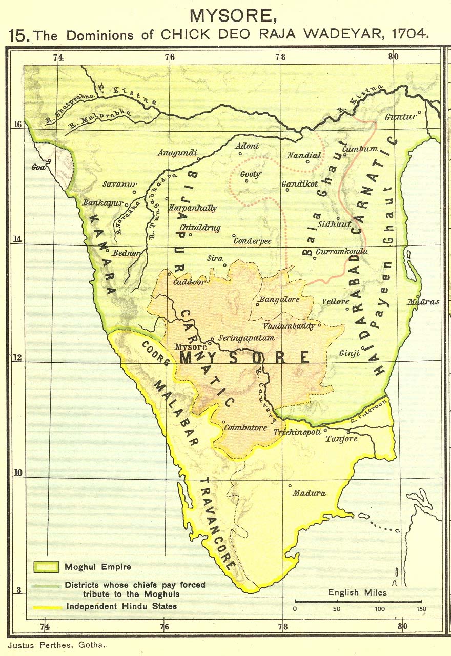
- ^ Joppen, Charles (1907). "Historical Atlas of India: Dominions of Chikkadevaraja Wodeyar in 1704". London: Longmans, Green, and Co. Retrieved 20 November 2007.
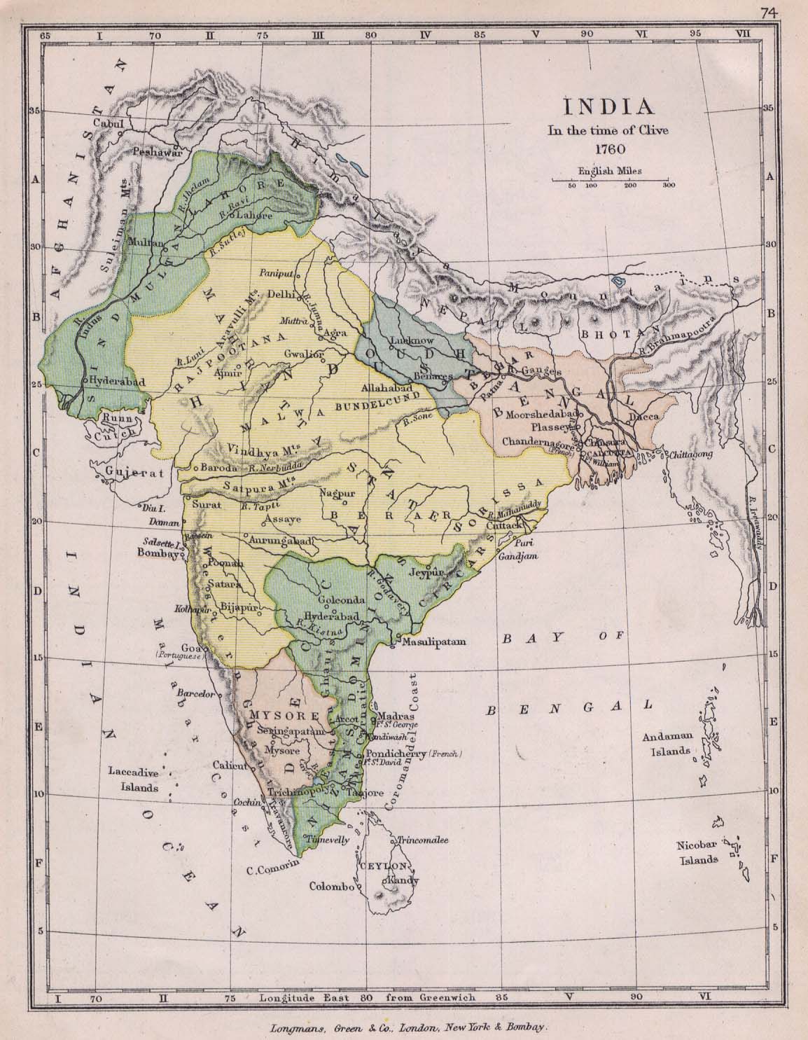
- ^ Colbeck, C (1905). "India Map, In the time of Clive, 1760, from The Public Schools Historical Atlas". Longmans, Green, and Co. Retrieved 15 June 2007.
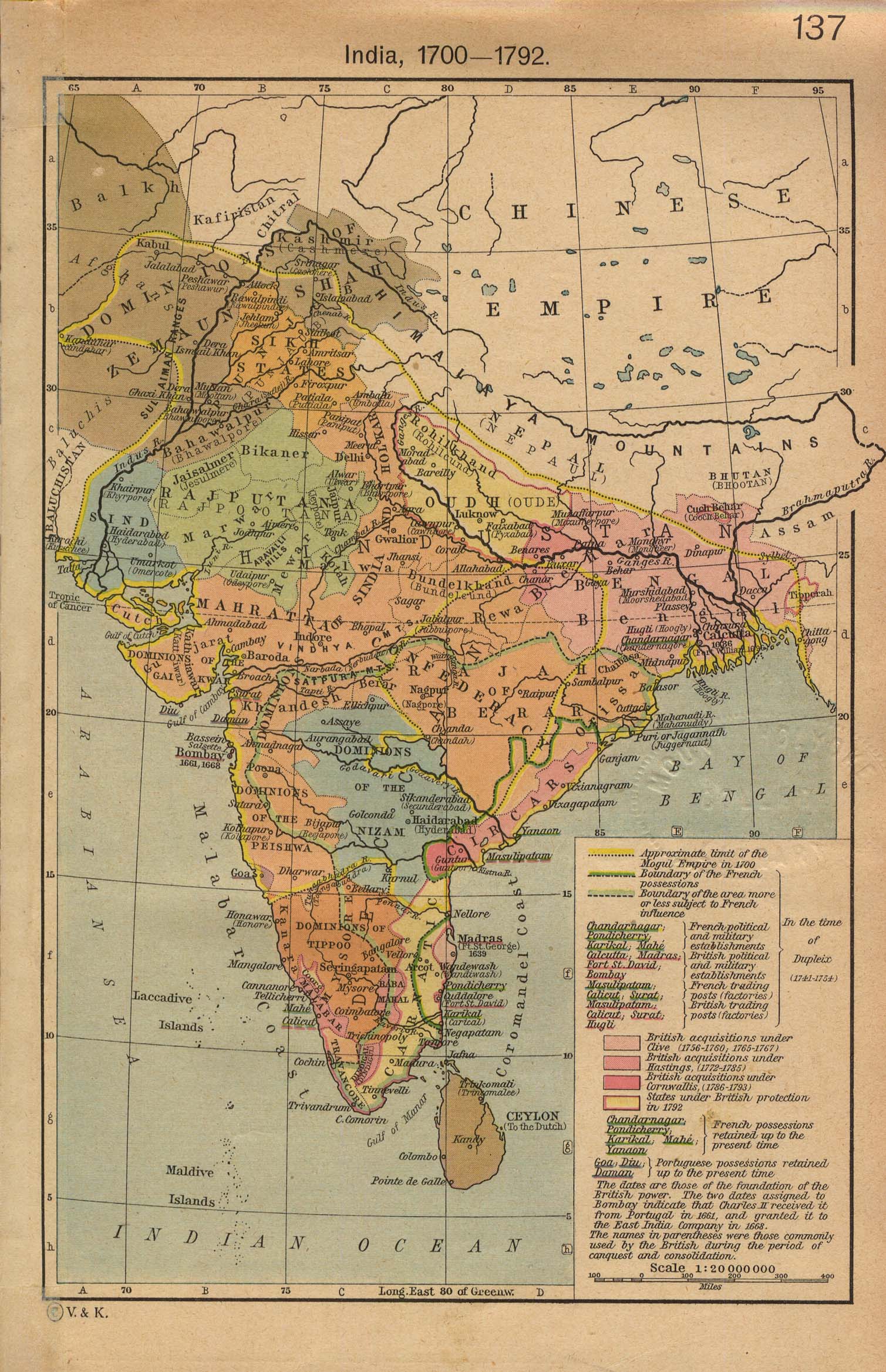
- ^ Shepherd, William R (1923). "India Map 1700-1792, from The Historical Atlas R." Longmans, Green, and Co. Retrieved 15 June 2007.
- ^ Joppen, Charles (1907). "Historical Atlas of India: India Map in 1805". London: Longmans, Green, and Co. Retrieved 20 November 2007.
- ^ "India Map 1893". Longmans, Green, and Co. 1893. Retrieved 2007-06-15.
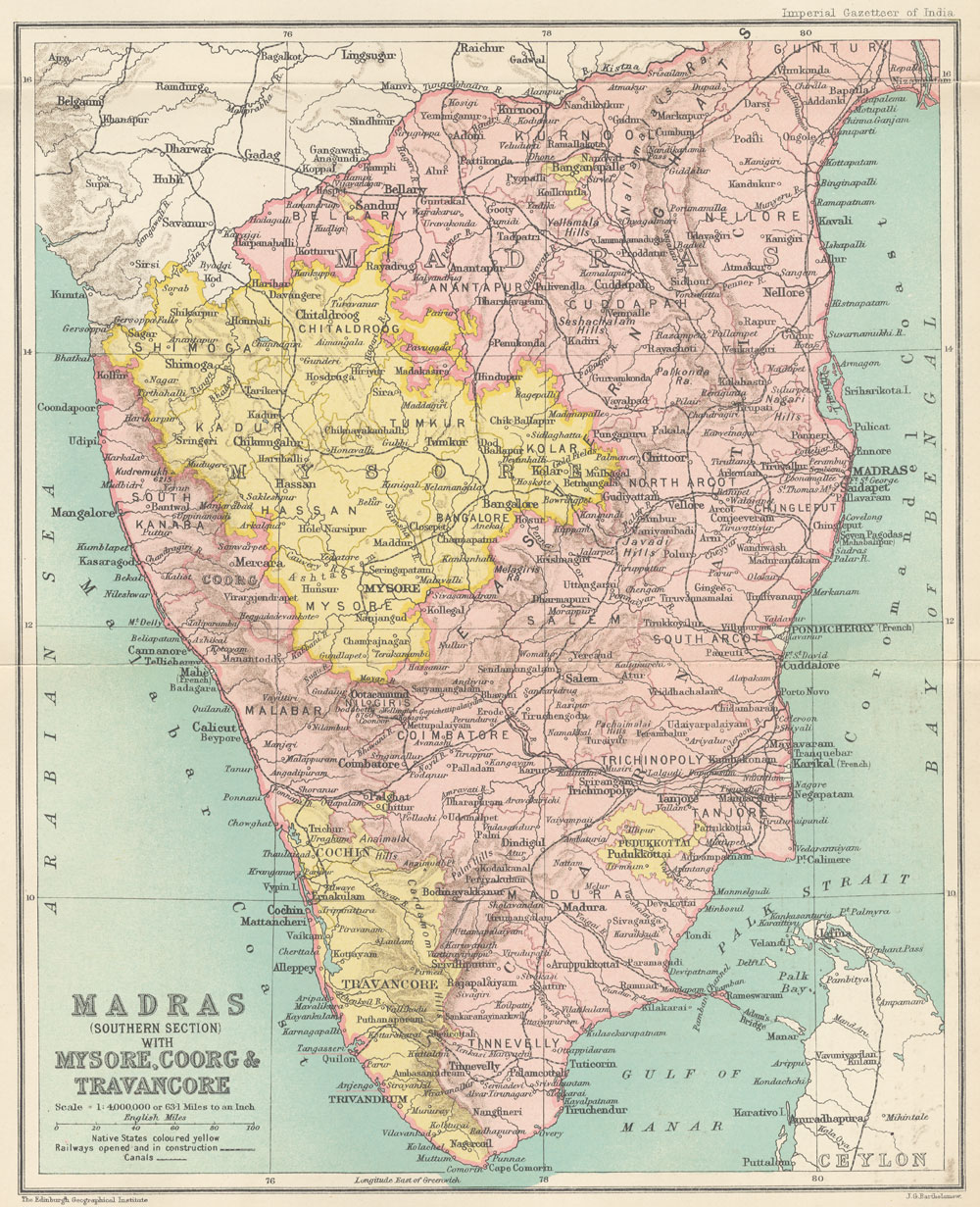
- ^ Bartholomew, J G (1907-1909 [vol. 18, 1909]). "Map: Madras (Southern section) with Mysore, Coorg, and Travancore". Oxford: Clarendon Press. p. 250. Retrieved 15 June 2007.
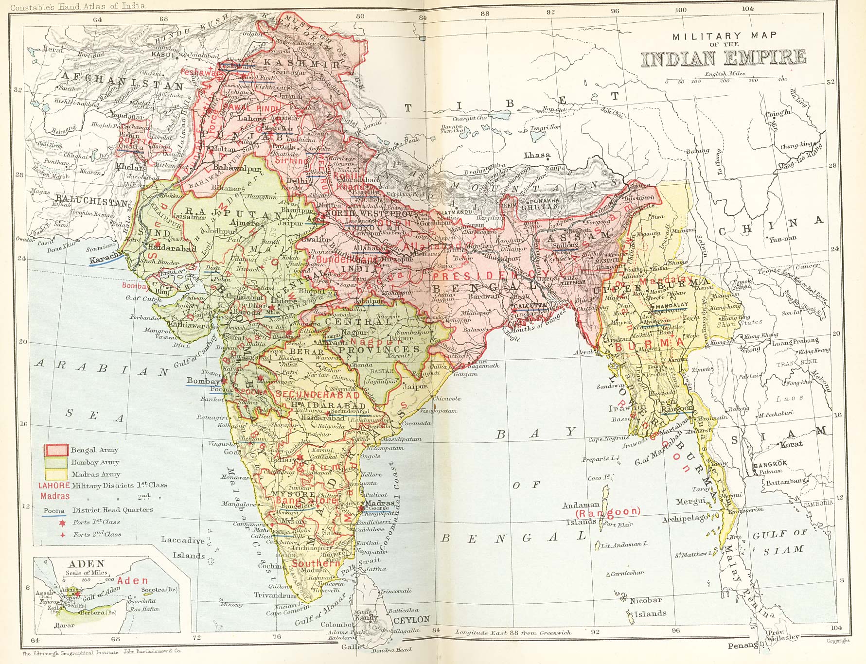
{{cite web}}: Check date values in:|date=(help); Unknown parameter|dateformat=ignored (help) - ^ "Military map of India in 1893, showing the Presidency boundaries". Retrieved 15 June 2007.
General
- ^ a b "Bellary City Corporators". Retrieved 03 June 2010.
{{cite web}}: Check date values in:|accessdate=(help) - ^ a b c d e "Falling Rain Genomics-Bellary, India Page".
- ^ "Bellary City Staff". Retrieved 3 June 2010.
- ^ a b c d Template:GR
- ^ "PPP India STD Code Search for 'bellary'". Retrieved 8 May 2007.
- ^ "Indiapost PIN Search for 'bellary'". Retrieved 8 May 2007.
- ^ "UNLOCODE". Retrieved 8 May 2007.
- ^ a b c d e "Sloth Bear Foundation".
- ^ "Legends behind the Indian states".
- ^ "South Indian Inscriptions, Vol VI - Inscriptions of Kulottunga-Chola I". Retrieved 10 October 2007.
- ^ "South Indian Inscriptions, Addenda, II-Inscriptions at Vijyanagara". Retrieved 10 October 2007.
- ^ "South Indian Inscriptions, Tanjavur Brihadhiswara Temple Inscriptions". Retrieved 10 October 2007.
- ^ a b c "South Indian Inscriptions, Miscellaneous inscriptions in Kannada, Vol IX - Part - I, Yadavas". Retrieved 10 October 2007. Cite error: The named reference "south_inscriptions_yadava" was defined multiple times with different content (see the help page).
- ^ a b "South Indian Inscriptions, Miscellaneous inscriptions, Vol IX - Part - I, Chalukyas of Kalyani". Retrieved 16 December 2007.
- ^ "South Indian Inscriptions, Vol III, Bombay Karnataka Inscriptions, Geographical Divisions". Retrieved 10 October 2007.
- ^ a b c "Bellary District - A Profile".
- ^ "South Indian Inscriptions, Pallava Inscriptions". Retrieved 10 October 2007.
- ^ "South Indian Inscriptions, Miscellaneous inscriptions, Vol IX - Part - I, Chalukyas of Kalyani". Retrieved 10 October 2007.
- ^ "South Indian Inscriptions, Vol III, Bombay Karnataka Inscriptions, Feudatory Dynasties". Retrieved 10 October 2007.
- ^ a b c d e f g h i j k l m n o p q r s t u v w x y z aa ab ac ad ae
The Imperial Gazetteer of India, Volume 7. Oxford: Clarendon Press. 1908-1931 [vol. 1, 1909]. pp. 158–176.
{{cite book}}: Check date values in:|date=(help) - ^ "Hyderabad on the Net: The Nizams".
- ^ Wilks, Lt. Colonel Mark (1810, reprint:1930). Historical Sketches of the South of India in an Attempt to Trace the History of Mysoor. Mysore: Government Branch Press.
{{cite book}}: Check date values in:|date=(help) - ^ Norton, John Bruce (1854). A Letter to Robert Lowe, Joint Secretary of the Board of Controul, on The Conditions and Requirements of the Presidency of Madras. 23, Cornhill, London: Richardson Brothers. p. 60. Retrieved 2007-06-14.
{{cite book}}: CS1 maint: location (link) - ^ "When the borders were redrawn". Deccan Herald. 2003-09-26. Retrieved 2007-06-21.
- ^ "History Of Anantapur". anantapurinfo.com. Retrieved 2 January 2008.
- ^ "Bellary City Municipal Council upgraded to corporation". Deccan Herald. 2004-09-29.
- ^ Lewis, Barry. "Bellary District Graves".
- ^ a b c d e f "Vims Bellary".
- ^ a b c "This jailhouse has a rich past". Retrieved 4 June 2010.
- ^ a b "Bellary Tourism". Retrieved 2 June 2010.
- ^ "Bellary Zoo". Retrieved 2 June 2010.
- ^ a b c d "Steering success". Deccan Herald. 2003-08-08.
- ^ "Bellary Transportation". Bellary District Administration.
- ^ "Hampi, World Heritage Site". Karnataka.com. Retrieved 14 December 2007.
- ^ "Barren land is being acquired for Bellary airport". The Hindu. Retrieved 20 May 2010.
- ^ "Minor delay in Bellary airport schedule". Project Monitor. Retrieved 20 May 2010.
- ^ "A Congress bastion since 1952". Retrieved 4 June 2010.
- ^ "Caste will play a vital role in Bellary". Retrieved 4 June 2010.