Amderma Airport
Amderma Амдерма | |||||||||||
|---|---|---|---|---|---|---|---|---|---|---|---|
 | |||||||||||
 | |||||||||||
| Summary | |||||||||||
| Airport type | public/military | ||||||||||
| Operator | Federal State Unitary Enterprise "Airport Amderma" | ||||||||||
| Serves | Amderma | ||||||||||
| Location | Nenets Autonomous Okrug | ||||||||||
| Elevation AMSL | 13 ft / 4 m | ||||||||||
| Coordinates | 69°45′48″N 61°33′48″E / 69.76333°N 61.56333°E | ||||||||||
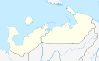
| Map | |||||||||||
 | |||||||||||
| Runways | |||||||||||
| |||||||||||
Amderma Airport (IATA: AMV, ICAO: ULDD) is a former interceptor base in Arctic Russia, near Novaya Zemlya, located 4 km west of Amderma (Амдерма). It is a simple airfield built on a spit along the ocean, with some tarmac space. Nordavia operates twice-monthly flights to Arkhangelsk via Naryan-Mar using Antonov An-24 aircraft.[1]
The facility's prime purpose was to defend the northern approaches to European Russia. Amderma's significance was driven home during the Cold War years when on 1 June 1960 a MiG-19 from Amderma shot down a Boeing RB-47H that was crossing Cape Kanin Nos. Since the 1960s, the airfield has been home to the 72 Gv IAP (72 Guards Interceptor Aviation Regiment) of the 10th OA PVO, which was operating at least 31 MiG-31 aircraft during the 1991-94 period.[2] The Tupolev Tu-128 and MiG-19 were stationed here in the 1960s.[3]
Airlines and destinations
| Airlines | Destinations |
|---|---|
| Smartavia | Naryan-Mar |
References
- ^ "Nordavia timetable". Archived from the original on 2009-12-19. Retrieved 2009-12-01.
- ^ "Aviatsiya PVO". Aviabaza KPOI.
- ^ "Mezhdunarodniy Proekt Dmitriy Smirnova". Army.lv.

