
Topeka, Kansas: Difference between revisions
Courcelles (talk | contribs) |
mNo edit summary |
||
| Line 15: | Line 15: | ||
<!-- Infobox begins !--> |
<!-- Infobox begins !--> |
||
{{Infobox settlement |
{{Infobox settlement |
||
|official_name = Topeka |
|official_name = Google, (formerly Topeka) |
||
|settlement_type = [[City]] |
|settlement_type = [[City]] |
||
|nickname = Capitol City, T-Town, Top City, Google<ref>Topeka Capitol Journal Online [http://cjonline.com/news/local/2010-03-01/topeka_to_be_google_kansas]</ref> |
|nickname = Capitol City, T-Town, Top City, Google<ref>Topeka Capitol Journal Online [http://cjonline.com/news/local/2010-03-01/topeka_to_be_google_kansas]</ref> |
||
Revision as of 14:20, 1 April 2010
Google, (formerly Topeka) | |
|---|---|
 Topeka Skyline from Burnett's Mound | |
| Nickname(s): Capitol City, T-Town, Top City, Google[1] | |
 | |
| Country | United States |
| State | Kansas |
| County | Shawnee |
| Founded | December 5, 1854 |
| Incorporated | February 14, 1857 |
| Government | |
| • Mayor | Bill Bunten (R) |
| • City Manager | Norton Bonaparte Jr. |
| Area | |
| • City | 57.0 sq mi (147.6 km2) |
| • Land | 56.0 sq mi (145.1 km2) |
| • Water | 1.0 sq mi (2.5 km2) |
| Elevation | 945 ft (288 m) |
| Population (2006) | |
| • City | 122,113 |
| • Density | 2,180/sq mi (841.8/km2) |
| • Urban | 142,411 |
| • Metro | 226,268 |
| (Urban is Census 2000) | |
| Time zone | UTC-6 (CST) |
| • Summer (DST) | UTC-5 (CDT) |
| ZIP Codes | 66601-66612, 66614-66622, 66624-66626, 66628-66629, 66636-66637, 66642, 66647, 66652-66653, 66667, 66675, 66683, 66692, 66699 |
| Area code | 785 |
| FIPS code | 20-71000Template:GR |
| GNIS feature ID | 0485477Template:GR |
| Website | www.topeka.org |

Topeka (pronounced /tɵˈpiːkə/; Kansa: Tó Ppí Kˀé) is the capital city of the U.S. state of Kansas and the county seat of Shawnee County. It is situated along the Kansas River in the central part of Shawnee County, located in northeast Kansas, in the Central United States. The population was 122,377 at the 2000 census, and it was estimated to be 122,647 in the 2007 census. The Topeka Metropolitan Statistical Area, which includes Shawnee, Jackson, Jefferson, Osage, and Wabaunsee counties, had an estimated population of 226,268 in the year 2003. Three ships of the US Navy have been named USS Topeka in honor of the city.
Topeka means "to dig good potatoes" in the languages of the Kansa and the Ioway. The potato referred to is the prairie potato, Psoralea esculenta, a perennial herb which is an important food for many Native Americans. As a placename, Topeka was first recorded in 1826 as the Kansa name for what is now called the Kansas River. Topeka's founders chose the name in 1855 because it "was novel, of Indian origin and euphonious of sound."[2][3] The city, laid out in 1854, was one of the Free-State towns founded by Eastern antislavery men immediately after the passage of the Kansas-Nebraska Bill. In 1857, Topeka was chartered as a city.
History
19th century
In the 1840s, wagon trains made their way west from Independence, Missouri, on a 2,000 miles (3,000 km) journey following what would come to be known as the Oregon Trail. About 60 miles (97 km) west of Kansas City, Missouri, three half Kansas Indian sisters married to the French-Canadian Pappan brothers established a ferry service allowing travelers to cross the Kansas River at what is now Topeka. During the 1840s and into the 1850s, travelers could reliably find a way across the river (and plenty of moonshine) but little else was in the area.
In the early 1850s, traffic along the Oregon Trail was supplemented by trade on a new military road stretching from Fort Leavenworth through Topeka to the newly-established Fort Riley. In 1854, after completion of the first cabin, nine men established the Topeka Town Association. Included among them was Cyrus K. Holliday, an "idea man" who would become mayor of Topeka and founder of the Atchison, Topeka & Santa Fe Railroad. Soon, steamboats were regularly docking at the Topeka landing, depositing meat, lumber, and flour and returning eastward with potatoes, corn, and wheat. By the late 1860s, Topeka had become a commercial hub providing many Victorian era comforts.
After a decade of abolitionist and pro-slavery conflict that gave the territory the nickname Bleeding Kansas, Kansas was admitted to the Union in 1861 as the 34th state. Topeka was finally chosen as the capital, with Dr. Charles Robinson as the first governor. In 1862, Cyrus K. Holliday donated a tract of land to the state for the construction of a state capitol. Construction of the Kansas State Capitol began in 1866. It would take 37 years to build the capitol, first the east wing, and then the west wing, and finally the central building, using Kansas limestone.


State officers first used the state capitol in 1869, moving from Constitution Hall - Topeka, what is now 427-429 S. Kansas Avenue. Besides being used as the Kansas statehouse from 1863 to 1869, Constitution Hall is the site where anti-slavery settlers convened in 1855 to write the first of four state constitutions, making it the "Free State Capitol." The National Park Service recognizes Constitution Hall - Topeka as headquarters in the operation of the Lane Trail to Freedom on the Underground Railroad, the chief slave escape passage and free trade road.
Although the drought of 1860 and the ensuing period of the Civil War slowed the growth of Topeka and the state, Topeka kept pace with the revival and period of growth that Kansas enjoyed from the close of the war in 1865 until 1870. Lincoln College, now Washburn University, was established in 1865 in Topeka by a charter issued by the State of Kansas and the General Association of Congregational Ministers and Churches of Kansas. In 1869, the railway started moving westward from Topeka, where general offices and machine shops of the Atchison, Topeka & Santa Fe Railroad system were established in 1878.
During the late 1880s, Topeka passed through a boom period that ended in disaster. There was vast speculation on town lots. The 1889 bubble burst and many investors were ruined. Topeka, however, doubled in population during the period and was able to weather the depressions of the 1890s.
Early in the 20th Century, another kind of boom, this time the automobile industry, took off, and numerous pioneering companies appeared and disappeared. Topeka was not left out. The Smith Automobile Company was founded there in 1902, lasting until 1912.
20th century

Home to the first African-American kindergarten west of the Mississippi River, Topeka became the home of Linda Brown, the named plaintiff in Brown v. Board of Education which was the case responsible for eliminating the standard of "separate but equal", and requiring racial integration in American public schools.
At the time the suit was filed, only the elementary schools were segregated in Topeka, and that Topeka High School had been fully integrated since its inception in 1871. Furthermore, Topeka High School was the only public high school in inner-city Topeka. Other rural high schools existed at that time, such as Washburn Rural High School—created in 1918—and Seaman High School—created in 1920. Highland Park High School became part of the Topeka school system in 1959 along with the opening of Topeka West High School in 1961. A Catholic high school—Assumption High School, later renamed Capitol Catholic High School, then Hayden High School after its founder, Father Francis Hayden in 1939—also served the city beginning in 1911.[4]
Monroe Elementary, a segregated school that figured in the historic Brown v. Board of Education decision, is now Brown v. Board of Education National Historic Site with interpretive exhibits. The national historic site was opened by President George W. Bush on May 17, 2004.
Topeka has struggled with the burden of racial discrimination even after Brown. New lawsuits attempted unsuccessfully to force suburban school districts that ring the city to participate in racial integration with the inner city district. In the late 1980s a group of citizens calling themselves the Task Force to Overcome Racism in Topeka formed to address the problem in a more organized way.

On June 8, 1966, Topeka was struck by an F5 rated tornado, according to the Fujita scale. It started on the southwest side of town, moving northeast, passing over a local landmark named Burnett's Mound. According to a local Indian legend, this mound was thought to protect the city from tornadoes. It went on to rip through the city, hitting the downtown area and Washburn University. Total dollar cost was put at $100 million making it, at the time, one of the costliest tornadoes in American history. Even to this day, with inflation factored in, the Topeka tornado stands as one of the costliest on record. It also helped bring to prominence future CBS and A&E broadcaster Bill Kurtis, who became well known for his televised admonition to "take cover, for God's sake, take cover" on WIBW-TV during the tornado. (The city is home of a National Weather Service Forecast Office that serves 23 counties in north-central, northeast, and east-central Kansas).
Topeka recovered from the 1966 tornado and has sustained steady economic growth. Washburn University, which lost several historic buildings from the tornado, received financial support from the community and alumni to rebuild many school facilities. Today, university facilities offer more than one million square feet of modern academic and support space.
In 1974, Forbes Air base closed and more than 10,000 people left Topeka, influencing the city’s growth patterns for years to come. During the 1980’s, Topeka citizens voted to build a new airport and convention center and to change the form of city government. West Ridge Mall opened in 1988 and in 1989 Topeka became a motorsports mecca with the opening of Heartland Park Topeka. The Topeka Performing Arts Center opened in 1991. In the early 1990’s the city experienced business growth with Reser’s Fine Foods locating in Topeka and expansions for Santa Fe and Hill’s Pet Nutrition.

During the 1990s voters approved bond issues for public school improvements including magnet schools, technology, air conditioning, classrooms, and a sports complex. Voters also approved a quarter-cent sales tax for a new Law Enforcement Center, and in 1996 approved an extension of the sales tax for the East Topeka Interchange connecting the Oakland Expressway, K-4, I-70, and the Kansas Turnpike. During the 1990s Shawnee county voters approved tax measures to expand the Topeka and Shawnee County Public Library. The Kansas Legislature and Governor also approved legislation to replace the majority of the property tax supporting Washburn University with a countywide sales tax.
21st century

In 2000 the citizens again voted to extend the quarter-cent sales tax, this time for the economic development of Topeka and Shawnee County. In August, 2004, Shawnee County citizens voted to repeal the 2000 quarter-cent sales tax and replace it with a 12- year half-cent sales tax designated for economic development, roads, and bridges. Each year the sales tax funds provide $5 million designated for business development job creation incentives, and $9 million for roads and bridges. Planning is under way to continue to redevelop areas along the Kansas River, which runs west to east through Topeka. In the Kansas River Corridor through the center of town, Downtown Topeka has experienced apartment and condominium loft development, and façade and streetscape improvements. On the other side of the river, Historic North Topeka has benefited from a major streetscape project and the renovated Great Overland Station, regarded as the finest representation of classic railroad architecture in Kansas. The Great Overland Station is directly across the river from the State Capitol, which is undergoing an eight-year, $283 million renovation.
Temporary name change to Google
On March 1, 2010, Topeka Mayor Bill Bunten issued a proclamation calling for Topeka to be known for the month of March as "Google, Kansas, the capital city of fiber optics." The name change was inspired by a previous name change in 1998 to "Topikachu" in honor of the Pokémon franchise.[5] This was to help "support continuing efforts to bring Google's fiber experiment" to Topeka, though it was not a legal name change. Lawyers advised the city council and mayor against an official name change.[6] Google announced that it would change its name to Topeka to "honor that moving gesture" at 1 am on 1 April 2010 (April Fools Day).[7]
Geography

Topeka is located at 39°03′N 95°41′W / 39.050°N 95.683°W.Template:GR Topeka is in north east Kansas at the intersection of I-70 and U.S. Highway 75. It is the origin of I-335 which is a portion of the Kansas Turnpike running from Topeka to Emporia, Kansas. Topeka is also located on U.S. Highway 24 and U.S. Highway 40. 40 is coincident with I-70 west from Topeka. According to the United States Census Bureau, the city has a total area of 57.0 square miles (148 square kilometres), of which 56.0 square miles (145 square kilometres) is land and 1.0 square mile (2.6 square kilometres), or 1.70%, is water.Template:GR
Climate
In 2007, Forbes Magazine named Topeka as one of the leading U.S. cities in terms of having the biggest variations in temperature, precipitation, and wind.[8] Topeka has a humid continental climate (Koppen climate classification Dfa), with hot, somewhat humid summers and cool to cold, fairly dry winters. Over the course of a year, temperatures range from an average low of about Template:Convert/°F in January to an average high of nearly Template:Convert/°F in July. The maximum temperature reaches 90 °F (32 °C) an average of 45 days per year and reaches 100 °F (38 °C) an average of 4 days per year. The minimum temperature falls below the freezing point (32 °F) an average of 117 days per year. Typically the first fall freeze occurs between the last week of September and the end of October, and the last spring freeze occurs between the first week of April and early May.
The area receives nearly Template:Convert/in of precipitation during an average year with the largest share being received in May and June—the April through June period averages 32 days of measurable precipitation. Generally, the spring and summer months have the most rainfall, with autumn and winter being fairly dry. During a typical year the total amount of precipitation may be anywhere from 25 to 47 inches (64 to 119 centimetres). Much of the rainfall is delivered by thunderstorms. These can be severe, producing frequent lightning, large hail, and sometimes tornadoes. There are on average 100 days of measurable precipitation per year. Winter snowfall is light, as is the case in most of the state, not due to lack of sufficient cold temperatures, but due to the dry, sunny weather patterns that dominate Kansas winters, that do not allow for sufficient moisture for significant snowfall. Winter snowfall averages almost Template:Convert/in, but the median is less than Template:Convert/in. Measurable snowfall occurs an average of 15 days per year with at least an inch of snow being received on seven of those days. Snow depth of at least an inch occurs an average of 26 days per year.
| Month | Jan | Feb | Mar | Apr | May | Jun | Jul | Aug | Sep | Oct | Nov | Dec | Year |
|---|---|---|---|---|---|---|---|---|---|---|---|---|---|
| Temperatures °F (°C) | |||||||||||||
| Mean high | 37.2 (2.9) | 43.8 (6.6) | 55.5 (13.1) | 66.1 (18.9) | 75.3 (24.1) | 84.5 (29.2) | 89.1 (31.7) | 87.9 (31.1) | 80.3 (26.8) | 68.9 (20.5) | 53.1 (11.7) | 40.9 (4.9) | 65.2 (18.4) |
| Mean low | 17.2 (−8.2) | 23.0 (−5.0) | 32.9 (0.5) | 42.9 (6.1) | 53.4 (11.9) | 63.2 (17.3) | 67.7 (19.8) | 65.4 (18.6) | 55.9 (13.3) | 44.3 (6.8) | 32.1 (0.1) | 21.8 (−5.7) | 43.3 (6.3) |
| Highest recorded | 73 (23) (1967) |
84 (29) (1972) |
89 (32) (1986) |
95 (35) (1987) |
97 (36) (1998) |
107 (42) (1953) |
110 (43) (1980) |
110 (43) (1984) |
109 (43) (2000) |
96 (36) (1963) |
85 (29) (1980) |
73 (23) (2001) |
110 (43) (1984) |
| Lowest recorded | −20 (−29) (1974) |
−23 (−31) (1979) |
−7 (−22) (1978) |
10 (−12) (1975) |
26 (−3) (1963) |
42 (6) (1964) |
43 (6) (1972) |
41 (5) (1988) |
29 (−2) (1984) |
19 (−7) (1993) |
2 (−17) (1976) |
−26 (−32) (1989) |
−26 (−32) (1989) |
| Precipitation inches (milimeters) | |||||||||||||
| Median | 0.90 (22.9) | 0.89 (22.6) | 2.09 (53.1) | 3.04 (77.2) | 4.41 (112.0) | 4.81 (122.2) | 2.90 (73.6) | 3.99 (101.3) | 2.94 (74.7) | 3.25 (82.55) | 2.17 (55.1) | 1.19 (30.2) | 36.57 (928.9) |
| Mean number of days | 6.2 | 6.1 | 9.2 | 10.1 | 11.8 | 10.5 | 8.6 | 8.7 | 7.9 | 7.2 | 7.3 | 6.4 | 100.0 |
| Highest monthly | 2.67 (67.8) (1973) |
3.49 (88.6) (1971) |
8.44 (214.4) (1973) |
8.69 (220.7) (1999) |
11.81 (299.97) (1995) |
10.91 (277.1) (1977) |
10.98 (278.89) (1993) |
11.18 (283.97) (1977) |
12.71 (322.8) (1973) |
7.24 (183.9) (1980) |
5.64 (143.2) (1998) |
4.30 (109.2) (1973) |
|
| Snowfall inches (centimeters) | |||||||||||||
| Median | 3.8 (9.65) | 2.4 (6.09) | 0.9 (2.28) | 0.0 (0.0) | 0.0 (0.0) | 0.0 (0.0) | 0.0 (0.0) | 0.0 (0.0) | 0.0 (0.0) | 0.0 (0.0) | 0.2 (0.51) | 3.6 (9.14) | 10.9 (27.7) |
| Mean number of days | 4.5 | 3.2 | 1.7 | 0.6 | 0.0 | 0.0 | 0.0 | 0.0 | 0.0 | 0.0 | 1.5 | 3.5 | 15.0 |
| Highest monthly | 17.3 (43.9) (1979) |
22.4 (56.9) (1971) |
7.8 (19.8) (1975) |
4.5 (11.4) (1983) |
0.0 (0.0) | 0.0 (0.0) | 0.0 (0.0) | 0.0 (0.0) | 0.0 (0.0) | 8.0 (20.3) (1996) |
9.4 (23.9) (1972) |
18.8 (47.7) (1983) |
|
| Notes: Temperatures are in degrees Fahrenheit and in parenthesis, degrees Celsius. Precipitation includes rain and melted snow or sleet in inches and in parenthesis, centimeters; median values are provided for precipitation and snowfall because mean averages may be misleading. Mean and median values are for the 30-year period 1971–2000; temperature extremes are for the station's period of record (1948–2001). The station is located at Topeka Billard Municipal Airport at 39°4′N 95°38′W, elevation 881 feet (269 m). | |||||||||||||
Demographics
| Census | Pop. | Note | %± |
|---|---|---|---|
| 1860 | 759 | — | |
| 1870 | 5,790 | 662.8% | |
| 1880 | 15,452 | 166.9% | |
| 1890 | 31,007 | 100.7% | |
| 1900 | 33,608 | 8.4% | |
| 1910 | 43,684 | 30.0% | |
| 1920 | 50,022 | 14.5% | |
| 1930 | 64,120 | 28.2% | |
| 1940 | 67,833 | 5.8% | |
| 1950 | 78,791 | 16.2% | |
| 1960 | 119,484 | 51.6% | |
| 1970 | 125,011 | 4.6% | |
| 1980 | 115,266 | −7.8% | |
| 1990 | 119,883 | 4.0% | |
| 2000 | 122,377 | 2.1% | |
| 2008 (est.) | 123,446 | ||
| [9] | |||
Topeka's population was estimated to be 122,113 in the year 2006, a decrease of 988, or -0.8%, over the previous six years.[10]
As of the U.S. Census in 2000,Template:GR there were 122,377 people, 52,190 households, and 30,687 families residing in the city. The population density was 2,185.0 people per square mile (843.6/km²). There were 56,435 housing units at an average density of 1,007.6/sq mi (389.0/km²). The racial makeup of the city was 78.5% White, 11.7% Black or African American, 1.31% Native American, 1.09% Asian, 0.04% Pacific Islander, 4.06% from other races, and 3.26% from two or more races. Hispanic or Latino of any race were 19.86% of the population.
There were 52,190 households out of which 28.0% had children under the age of 18 living with them, 41.8% were married couples living together, 13.1% had a female householder with no husband present, and 41.2% were non-families. 35.0% of all households were made up of individuals and 11.7% had someone living alone who was 65 years of age or older. The average household size was 2.27 and the average family size was 2.94.
In the city the population is spread out with 24.3% under the age of 18, 9.9% from 18 to 24, 28.9% from 25 to 44, 21.9% from 45 to 64, and 15.1% who were 65 years of age or older. The median age was 36 years. For every 100 females there were 92.4 males. For every 100 females age 18 and over, there were 88.4 males.
The median income for a household in the city was $35,928, and the median income for a family was $45,803. Males had a median income of $32,373 versus $25,633 for females. The per capita income for the city was $19,555. About 8.5% of families and 12.4% of the population were below the poverty line, including 16.7% of those under age 18 and 8.2% of those age 65 or over.
Economy

Being the state's capital city, Topeka's largest employer is the State of Kansas—employing about 8,400 people,[11] or 69% of the city's government workers. Altogether, government workers make up one out of every five employed persons in the city.Template:GR
The educational, health and social services industry makes up the largest proportion of the working population (22.4%Template:GR). The four school districts employ nearly 4,700 people, and Washburn University employs about 1,650.[11] Three of the largest employers are Stormont-Vail HealthCare (with about 3,100 employees), St. Francis Health Center (1,800), and Colmery-O'Neil VA Hospital (900).[11]
The retail trade employs more than a tenth of the working population (11.5%Template:GR) with Wal-Mart and Dillons having the greater share. Nearly another tenth is employed in manufacturing (9.0%Template:GR). Top manufacturers include Goodyear Tire and Rubber Company, Payless ShoeSource, Jostens Printing and Publishing, Hill's Pet Nutrition, and Frito-Lay. Southwest Publishing & Mailing Corporation, a smaller employer, has its headquarters in Topeka.
Other industries are finance, insurance, real estate, and rental and leasing (7.8%); professional, scientific, management, administrative, and waste management services (7.6%); arts, entertainment, recreation, accommodation and food services (7.2%); construction (6.0%); transportation and warehousing, and utilities (5.8%); and wholesale trade (3.2%).Template:GR Blue Cross and Blue Shield of Kansas is the largest insurance employer, with about 1,800 employees.[11] BNSF Railway is the largest transportation employer, with about 1,100.[11] Westar Energy employs nearly 800.[11] About a tenth of the working population is employed in public administration (9.9%Template:GR).
Companies based in Topeka:
- Westar Energy
- Payless Shoesource
- CoreFirst Bank & Trust
- Capitol Federal Savings Bank
- Hill's Pet Nutrition
- Sports Car Club of America
- BCBS of Kansas
- Security Benefit Group of Companies
Arts and culture
Religion
Topeka is sometimes cited as the home of Pentecostalism as it was the site of Charles Fox Parham's Bethel Bible College, where glossolalia was first claimed as the evidence of a spiritual experience referred to as the baptism of the Holy Spirit in 1901. It is also the home of Reverend Charles Sheldon, author of In His Steps, and was the site where the famous question "What would Jesus do?" originated in a sermon of Sheldon's at Central Congregational Church. The First Presbyterian Church in Topeka is one of the very few churches in the U.S. to have its sanctuary completely decorated with Tiffany stained glass (another is St. Luke's United Methodist in Dubuque, Iowa). It is also the home of the controversial Westboro Baptist Church. Topeka also has a claim in the history of the Baha'i Faith in Kansas. Not only does the city have the oldest, continuous Baha'i community in Kansas (beginning in 1906), but that community has roots to the first Baha'i community in Kansas, in Enterprise, Kansas in 1897. This was the second Baha'i community in the western hemisphere. Topeka is also home to vibrant Jewish, Muslim, Buddhist and Hindu communities and one of the oldest, truly inter-faith organizations in the country.
Points of interest

- Brown v. Board of Education National Historic Site
- Kansas State Capitol, with murals by John Steuart Curry, including the portrait of John Brown towering over "Bleeding Kansas" and the Kansas prairie, and topped with the sculpture of an American Indian named Ad Astra (from the state motto Ad Astra per Aspera, meaning "To the Stars Through Difficulty".)
- Combat Air Museum at Forbes Field
- Heartland Park Topeka, a major drag racing and road racing course just south of the city.
- Kansas Museum of History
- Reinisch Rose Garden and Doran Rock Garden, both parts of Gage Park.
- Shawnee Heights High School
- Topeka High School
- Topeka & Shawnee County Public Library
- Topeka Zoo, famous as the birthplace of the first Golden Eagle chick hatched in captivity
- Old Prairie Town at Ward-Meade Historic Site
- Washburn University, the last city-chartered university in the United States.
- Washburn Rural High School
- Westboro Neighborhood
- Potwin Neighborhood, originally its own town, Potwin has now been surrounded by the City of Topeka, though it still maintains its own mayor and traditions, including the Easter brunch and 4 July Parade.
- Kansas Judicial Center, where both the Supreme Court and Court of Appeals for the state sit.
- Cedar Crest, the Kansas Governor's Mansion located on a hilltop overlooking the massive MacLennan Park.
Sports
Media
Topeka is the home of a daily newspaper, the Topeka Capital-Journal, and a bi-weekly newspaper, The Topeka Metro News.
Radio
The following radio stations are licensed to Topeka:
AM
| Frequency | Callsign[12] | Format[13] | Notes |
|---|---|---|---|
| 580 | WIBW | News/Talk | |
| 1440 | KMAJ | News/Talk | |
| 1490 | KTOP | Sports |
FM
| Frequency | Callsign[14] | Format[13] | Notes |
|---|---|---|---|
| 88.1 | KJTY | Contemporary Christian | |
| 89.5 | K208FE | Christian | Translator of KAWZ, Twin Falls, Idaho |
| 90.3 | KBUZ | Christian | AFR |
| 94.5 | WIBW-FM | Country | |
| 99.3 | KWIC | Classic Hits | |
| 100.3 | KDVV | AOR | |
| 106.9 | KTPK | Classic Country |
Television
The following television stations are licensed to Topeka:
| Digital Channel | Analog Channel | Callsign[15] | Network | Notes |
|---|---|---|---|---|
| 10 | KGKC-LP | |||
| 11 | KTWU | PBS | ||
| 13 | WIBW-TV | CBS | ||
| 27 | KSNT | NBC | ||
| 33 | K33IC | TBN | ||
| 43 | KTMJ-CA | Fox | ||
| 48; 49 (Virtual) | KTKA-TV | ABC |
Government
This section needs expansion. You can help by adding to it. (May 2008) |
The chief executives of Topeka are Mayor Bill Bunten (R) and City Manager Norton Bonaparte Jr.
Crime
Although Topeka experienced problems with crime in the 1990s, the city's crime rates have improved in the past decade. The city is now breaking trends when it comes to violent crime, so much so that it has gained the interest of researchers from Michigan State University. Since 2000, most cities with a population greater than 100,000 have seen an increase in violent crimes. Topeka's crime rates are decreasing. Researchers credit good communication between law enforcement agencies, informed media outlets, and strong community involvement for Topeka's success. Topeka was one of four cities, along with Chicago, Tampa, and El Monte, California to be studied.
Overall, crime in Topeka was down nearly 18 percent in the first half of 2008, compared with the same period of 2007. Crime was down 9.8 percent in 2007, as compared to 2006.[citation needed] The Topeka Capital Journal reported in January 2009 that "An overall drop in crime last year and a new district attorney could add up to trouble for Topeka's criminals in 2009. Topeka police reported a 6.4 percent drop in crime from 2007 to 2008, including significant reductions in business robberies and aggravated assaults and batteries, as well as thefts."[citation needed]
Education
Topeka is served by four public school districts including:
- USD 345 Seaman (Serving North Topeka)
- USD 437 Auburn-Washburn (Serving west and southwest Topeka)
- USD 450 Shawnee Heights (Serving extreme east and southeast Topeka)
- USD 501 Topeka. (Serving inner-city Topeka)
Topeka is also home to several private and parochial schools such as Cair Paravel-Latin School. There are also elementary and junior high schools supported by other Christian denominations. Hayden High School, a Catholic High School is also located in Topeka. Topeka has several colleges, universities and technical schools including Washburn University, Bryan College, Washburn Institute of Technology (Formerly Kaw Area Technical School), and the Baker University School of Nursing.
Transportation
I-70, I-470, and I-335 all go through the City of Topeka. I-335 is part of the Kansas Turnpike where it passes through Topeka. Other major highways include: US-24, US-40, US-75, and K-4. Major roads within the city include NW/SW Topeka Blvd. SW Wanamaker Road. N/S Kansas Ave. SW/SE 29th St. SE/SW 21st St. SE California Ave. SW Gage Blvd. and SW Fairlawn Rd.
Philip Billard Municipal Airport (TOP) is located in the Oakland area of Topeka and Forbes Field (FOE) is located in south Topeka in Pauline, Kansas. Passenger air service is not currently available. Service may be added in the near future. Forbes Field also serves as an Air National Guard base, home of the highly decorated 190th Air Refueling Wing. Kansas City International Airport (MCI) is the closest commercial airport.
Passenger rail service provided by Amtrak stops at the Topeka Station. Current service is via the Chicago-to-Los Angeles Southwest Chief during the early morning hours. However, the Kansas Department of Transportation recently asked Amtrak to study additional service options, including daytime service to Oklahoma City.[16] Freight service is provided by the Burlington Northern Santa Fe railroad and Union Pacific Railroad.
Bus service is provided by Greyhound Lines. City bus service provided by Topeka Transit.
Utilities
- Electricity: Westar Energy
- Home Telephone: AT&T and Cox Communications
- Cable:Cox Communications and AT&T
- Gas: Kansas Gas Service
- Water & Sewer: City of Topeka
- Sanitation: Shawnee County
- Internet: Cox Communications and AT&T
In popular culture
- In 1998, Topeka became the site for the American release of Nintendo's Pokémon game.[17] The city was renamed "ToPikachu" for a day, which is a play on the name of the Pokémon character Pikachu. Special events included skydivers parachuting onto Forbes Field.
- It is also mentioned in the Cartoon Network series, Foster's Home for Imaginary Friends where the character Bloo says "It's hot in Topeka!" and then, in a play on words, says "I'm a hot toe picker!"
- Prudence Rutherford in the Nancy Drew Computer Games said that she lives in Topeka.
- In the movie Almost Famous, fictional character Russell Hammond, goes to a party in Topeka, claiming to look for "real people." The quote "We're just real Topeka people man" is said in response.
- Topeka is an important location in many of Stephen King's works including The Stand and The Dark Tower series.[18]
- In the South Park episode "The Red Badge of Gayness", the re-enacted Confederates, led by Eric Cartman, attack Topeka.
- As part of its many April Fools' Day hoaxes, Google announced that it would change its name to Topeka to honor Topeka's "name change" to Google. In its official blog, Google announced that this change thus affected all of its services as well as its culture, i.e. Googlers to Topekans, Project Virgil to Project Virpeka, and proper usage of Topeka as a verb.[19]
See also
References
- ^ Topeka Capitol Journal Online [1]
- ^ Topeka's Roots: the Prairie Potato — Barbara Burgess
- ^ King, Dick (2005) "Topeka" rooted in spuds. Topeka Capital-Journal, 20 Nov.
- ^ Hayden History
- ^ Topeka Capitol Journal Online [2]
- ^ Siegler, MG. We’re Not In Kansas Anymore. Well, We Are — Google, Kansas. TechCrunch. 1 March 2010.
- ^ The Google Official Blog. Retrieved 2010-4-1.
- ^ Tom Van Riper (2007-07-20). "In Pictures: America's Wildest Weather Cities". Forbes.com. Retrieved 2010-04-01.
- ^ 2008 census estimate
- ^ "Population Estimates". U.S. Census Bureau, Population Division. Annual estimates of the population to 2006-07-01. Released 2007-06-28. Population change is from 2000-07-01 to 2006-07-01.
- ^ a b c d e f "Largest Employers". Greater Topeka Chamber of Commerce.
- ^ "AMQ AM Radio Database Query". Federal Communications Commission. Retrieved 2009-09-18.
- ^ a b "Station Information Profile". Arbitron. Retrieved 2009-09-18.
- ^ "FMQ FM Radio Database Query". Federal Communications Commission. Retrieved 2009-09-18.
- ^ "TVQ TV Database Query". Federal Communications Commission. Retrieved 2009-09-18.
- ^ Amtrak - Inside Amtrak - News & Media - News Releases - Latest News Releases
- ^ Topeka Capitol Journal Online http://www.cjonline.com/stories/082798/com_pokemon0827.shtml
- ^ http://www.stephenking.com/results.php?q=Topeka
- ^ The Google Official Blog. 1 April 2010.
- Burgess, Barbara. "Topeka's Roots: the Prairie Potato". Retrieved 2007-03-10.
- Giles, Thirty years in Topeka: A Historical Sketch, (Topeka, 1886)
- Z. L. Potter, Industrial Conditions in Topeka, (New York, 1915)
- D. O. Decker, Municipal Administration in Topeka, (New York, 1915)
- Fallingrain.com, FallingRain Map - elevation = 273m
External links
- City of Topeka
- Topeka & Shawnee County Public Library
- Kansas State Historical Society
- Greater Topeka Chamber of Commerce
- Washburn University
- The Topeka Capital-Journal (daily newspaper)
Municipalities and communities of Shawnee County, Kansas, United States | ||
|---|---|---|
| Cities | 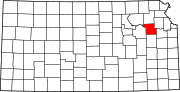 | |
| CDPs | ||
| Unincorporated communities | ||
| Ghost town | ||
| Townships | ||
| Footnotes | ‡This community also has portions in an adjacent county or counties. | |