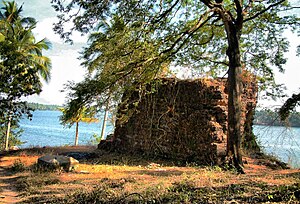
Fortaleza da São Tomé
Appearance
From Wikipedia, the free encyclopedia
This is an old revision of this page, as edited by JJMC89 bot III (talk | contribs) at 12:48, 7 August 2020 (Moving Category:Mysore invasion of Kerala to Category:Mysorean invasion of Malabar per Wikipedia:Categories for discussion/Speedy). The present address (URL) is a permanent link to this revision, which may differ significantly from the current revision.
Revision as of 12:48, 7 August 2020 by JJMC89 bot III (talk | contribs) (Moving Category:Mysore invasion of Kerala to Category:Mysorean invasion of Malabar per Wikipedia:Categories for discussion/Speedy)
| Cranganore Fort | |
|---|---|
| Kodungallur, Thrissur District, Kerala | |
 | |
| Type | Cultural |
| Site information | |
| Owner | Government of Kerala |
| Controlled by | |
| Open to the public | Yes |
| Condition | Structure |
| Site history | |
| Built | 1523 |
| Materials | Stone |
| Demolished | Partly |
Cranganore Fort, otherwise known as Kodungallur Fort, or Kottapuram Fort, is situated in Kodungallur of Thrissur District in Kerala, India.
The stone fort was built by the Portuguese in 1523, and was called Fortaleza da Sao Tome in colonial Portuguese India. Mar Thoma Sleeha (Thomas the Apostle).[1]
See also
- Mysore invasion of Kerala
- Portuguese forts in India
 Media related to Cranganore Fort at Wikimedia Commons
References
- ^ "Kodungallur". Kerala Tourism. Retrieved 15 October 2010.
10°11′49″N 76°12′43″E / 10.197°N 76.212°E / 10.197; 76.212
Tourist attractions in Thrissur | ||
|---|---|---|
| Dams | ||
| Beaches and waterfalls | ||
| Forts and palaces | ||
| Boatraces | ||
| Parks and zoos | ||
| Exhibitions and film festivals | ||
| Buildings | ||
| Festivals | ||
| Prehistoric | ||
| Museums | ||
Categories:
- Forts in Kerala
- Portuguese forts in India
- Buildings and structures in Thrissur district
- Colonial Kerala
- Dutch India
- History of Thrissur district
- Mysorean invasion of Malabar
- Portuguese in Kerala
- Infrastructure completed in 1523
- 1523 establishments in India
- 1520s establishments in Portuguese India
- 16th-century forts in India
- Tourist attractions in Thrissur district
- 1523 establishments in the Portuguese Empire
- 1661 establishments in the Dutch Empire

