Chislehurst
| Chislehurst | |
|---|---|
 Chislehurst village sign | |
Location within Greater London | |
| Population | 14,831 (2011. Ward)[1] |
| OS grid reference | TQ445705 |
| London borough | |
| Ceremonial county | Greater London |
| Region | |
| Country | England |
| Sovereign state | United Kingdom |
| Post town | CHISLEHURST |
| Postcode district | BR7 |
| Dialling code | 020 |
| Police | Metropolitan |
| Fire | London |
| Ambulance | London |
| UK Parliament | |
| London Assembly | |
Chislehurst (/ˈtʃɪzəlˌhɜːrst/) is a suburban district in south east London, England, within the London Borough of Bromley. It borders the London Boroughs of Bexley and Greenwich, and lies east of Bromley and south west of Sidcup. It is 10.5 miles (16.9 km) south east of Charing Cross.
Toponymy
The name "Chislehurst" is derived from the Saxon words cisel, "gravel", and hyrst, "wooded hill".
Present features


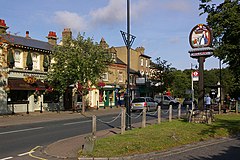
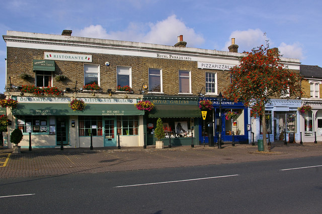
 Chislehurst is regarded as an affluent area and one of the most expensive places to live in South East London. Chislehurst West may be found by going towards Mottingham and this area includes the biggest of the ponds and the High Street which has many pubs and restaurants. Chislehurst West was previously known as "Pricking" and "Prickend".
A local attraction is Chislehurst Caves. The caves are considered to be of very ancient origin. They were originally used to mine flint and chalk. During World War II, thousands of people used them nightly as an air raid shelter. There is even a chapel. One child was born in the caves during World War II, and was given a middle name of 'Cavena'.[2] The caves have also been used as a venue for live music; Jimi Hendrix, the Who and the Rolling Stones have all played there.
Chislehurst is one of the starting points for the Green Chain Walk, linking to places such as Crystal Palace, Erith, the Thames Barrier and Thamesmead.
Chislehurst is home to the Derwent House, designed by William Willett.
Chislehurst Common (and nearby St Paul's Cray Common) were saved from development in 1888 following campaigns by local residents. They were a popular destination for bank holiday trips in the early 20th century, and now provide a valuable green space. Nearby Petts Wood, Hawkwood and Scadbury have also been preserved as open spaces following local campaigns.
Camden Place
 Camden Place (now Chislehurst Golf Club, 51° 24′ 40.05″N 0° 3′ 55.69″E ) takes its name from the antiquary William Camden, who lived in the former house on the site from c.1609 until his death in 1623. The present house was built shortly before 1717, and was given a number of additions in the late 18th and very early 19th centuries by the architect George Dance the younger.[3] In about 1760, the house and estate were bought by Charles Pratt, the Attorney General, and later Lord Chancellor. Pratt was ennobled in 1765, taking the title Baron Camden, of Camden Place: in 1786 he was created Earl Camden. The house is a Grade II* listed building. [4]
A later occupant of the house, from 1871 until his death there in 1873, was the exiled French Emperor, Napoleon III. His body and that of the Prince Imperial were originally buried in St Mary's Church, before being removed to St Michael's Abbey, Farnborough.[5] The Emperor's widow, the Empress Eugénie, remained at Camden Place until 1885. There is a memorial to Napoléon Eugène on Chislehurst Common, and the area's connections with the imperial family are found in many road names and in the local telephone code, 467, which in its earlier format corresponded to the letters IMP (for imperial).
Past features
The Chislehurst civil parish formed an urban district of Kent from 1894 to 1934.[6] In 1934 it became part of the Chislehurst and Sidcup Urban District,[7] which was split in 1965 between the London boroughs of Bromley and Bexley.
The Walsingham family, including Christopher Marlowe's patron, Sir Thomas Walsingham and Queen Elizabeth I's spymaster, Francis Walsingham, had a home in Scadbury Park, now a nature reserve in which the ruins of the house can still be seen.[8]
A water tower used to straddle the road from Chislehurst to Bromley until it was demolished in 1963 as one of the last acts of the Chislehurst and Sidcup UDC. It marked the entrance to the Wythes Estate in Bickley, but its narrow archway meant that double-decker buses were not able to be used on the route.
Education
- Bullers Wood School (all-girls)
- Chislehurst School for Girls
- Coopers School
- Farrington's School
- Chislehurst C of E Primary School
- Edgebury Primary School
- Red Hill Primary School
- Mead Road Infant School
Notable residents
- Louis-Napoleon Bonaparte, President of France 1848–52, Emperor of the French 1852–70.
- William Camden (1551–1623), antiquary, historian, and Clarenceux King of Arms, lived in the house later known as Camden Place from c.1609 until his death there in 1623.
- Malcolm Campbell, former land and water speed record holder, was born in Chislehurst and is buried in St. Nicholas Parish Church next to his parents.
- George Somers Leigh Clarke (1822–1882), eminent architect lived at Walpole, Manor Park. He is buried in the St Nicholas' churchyard.
- Richmal Crompton, author of the Just William series of books.
- Tilly Keeper, who plays Louise Mitchell in BBC One soap opera Eastenders.
- E. J. May (1853–1941), architect, lived locally and designed a number of local buildings.
- Eugénie de Montijo, Countess of Teba and Empress of France.*
- Jozef Michal Poniatowski, Polish nobleman, composer.
- Charles Pratt (1714–1794), Baron Camden from 1765 and 1st Earl Camden from 1786, Attorney General, Lord Chief Justice of the Common Pleas, and Lord Chancellor, lived at Camden Place from c.1760.
- Siouxsie Sioux, singer, most famous for being in the band Siouxsie and the Banshees
- Thomas Townshend, 1st Viscount Sydney is buried in St Nicholas's Church, Chislehurst. He was an owner of Scadbury Park, and the city of Sydney, Australia is named after him.
- Sir Francis Walsingham, spymaster to Elizabeth I, and his son, Sir Thomas Walsingham.
- Alan Watts, philosopher, born and raised in Chislehurst, moved to the United States in 1938.
- William Willett, a campaigner for daylight saving time, lived most of his adult life in Chislehurst.
- Ted Willis, creator of Dixon of Dock Green.
- William Hyde Wollaston, chemist and physicist who discovered rhodium and palladium.
Places of worship

- Chislehurst Baptist Church
- St Patrick's Catholic Church
- Christ Church Chislehurst
- Elmstead Baptist Church
- Chislehurst Methodist Church
- The Annuncation
- St. Nicholas
- Darul Uloom Mosque and School
- Ichthus Christian Fellowship
- St Mary's Roman Catholic Church, original burial place of Napoleon III and his son the Prince Imperial (killed when acting as an observer in the Zulu War in Natal, South Africa).
Transport
Rail
Chislehurst station links the area with National Rail services to London Charing Cross and to Sevenoaks via Orpington.
Bus
- 61 to Bromley North via Orpington
- 160 to Catford via Eltham and to Sidcup
- 161 to North Greenwich via Eltham and Woolwich
- 162 to Eltham and to Beckenham Junction via Bromley
- 269 to Bexleyheath via Sidcup and to Bromley North
- 273 to Lewisham via Grove Park and to Petts Wood
- R7 to Chelsfield Village via Orpington
Nearby areas
Chislehurst borders New Eltham to the north, Sidcup to the north east and east, St Paul's Cray to the south east, Petts Wood to the south, Bickley to the south west, Elmstead to the west and Mottingham to the north west.
References
- ^ "Bromley Ward population 2011". Neighbourhood Statistics. Office for National Statistics. Retrieved 10 October 2016.
- ^ The baby was christened Rose Cavena Wakeman according to the official guides. Birth records show that a baby called Rose L.C. Wakeman was born in Chislehurst in 1946, which is consistent with the story.
- ^ Bridget Cherry and Nikolaus Pevsner, London 2: South, Buildings of England (Harmondsworth, 1983), p. 180.
- ^ "Name: CAMDEN PLACE List entry Number: 1064325". English Heritage. Retrieved 25 January 2018.
- ^ Chisholm, Hugh, ed. (1911). . Encyclopædia Britannica. Vol. 6 (11th ed.). Cambridge University Press. p. 247.
- ^ Vision of Britain - Chilsehurst UD (historic map)
- ^ Vision of Britain - Chislehurst and Sidcup UD (historic map)
- ^ Friends of Scadbury Park


