
Halifax, Nova Scotia: Difference between revisions
No edit summary |
|||
| Line 3: | Line 3: | ||
{{Infobox settlement |
{{Infobox settlement |
||
| name = Halifax |
| name = Halifax |
||
| settlement_type = |
| settlement_type = [[Municipality]] |
||
| official_name = Halifax Regional Municipality |
| official_name = Halifax Regional Municipality |
||
| nickname = HRM |
| nickname = HRM |
||
Revision as of 17:52, 15 November 2014
Halifax | |
|---|---|
| Halifax Regional Municipality | |
 | |
 Flag | |
| Nickname: HRM | |
| Motto(s): "E Mari Merces" (Latin) "From the Sea, Wealth" | |
 Location of Halifax in Nova Scotia | |
| Country | Canada |
| Province | Nova Scotia |
| Regional Municipality | April 1, 1996 |
| City | 1842 |
| Town | 1749 |
| Government | |
| • Type | Regional Municipality |
| • Mayor | Mike Savage |
| • Governing body | Halifax Regional Council |
| • MPs | List of MPs |
| • MLAs | List of MLAs |
| Area | |
| • Land | 5,490.18 km2 (2,119.77 sq mi) |
| • Urban | 262.65 km2 (101.41 sq mi) |
| • Rural | 5,528.25 km2 (2,134.47 sq mi) |
| Highest elevation | 145.0 m (475.6 ft) |
| Lowest elevation | 0 m (0 ft) |
| Population (2013) | |
| • Municipality | 413,710 (14th)[2][3] |
| • Density | 71.1/km2 (184/sq mi) |
| • Urban | 297,943 |
| • Urban density | 1,077.2/km2 (2,790/sq mi) |
| • Metro | 408,702 (13th) |
| • Change 2006-2011 | |
| • Census Ranking | 13 of 5,008 |
| Demonym | Haligonian |
| Time zone | UTC−4 (AST) |
| • Summer (DST) | UTC−3 (ADT) |
| Postal code span | B0J ,B3A to B4G |
| Area code | 902 |
| Dwellings | 166,675 |
| Median Income* | $54,129 CAD |
| Total Coastline | 400 km (250 mi) |
| NTS Map | 011D13 |
| GNBC Code | CBUCG |
| Website | www.halifax.ca |
| |

Halifax (/ˈhæl[invalid input: 'ɨ']fæks/), formally the Halifax Regional Municipality (HRM), is the capital of the province of Nova Scotia, Canada. The metropolitan area had a population of 390,096 in 2011 with 297,943 in the urban area.[4][5] Formed by the 1996 amalgamation of Halifax County, the municipality is divided into 18 community planning areas, which are, in turn, divided into over 200 named communities and neighbourhoods, such as the former cities of Dartmouth and Halifax proper.
Halifax is a major economic centre in eastern Canada with a large concentration of government services and private sector companies. Major employers and economic generators include the Department of National Defence, Dalhousie University, the Halifax Shipyard, various levels of government, and the Port of Halifax. Agriculture, fishing, mining, forestry and natural gas extraction are major resource industries found in the rural areas of the municipality. Halifax was ranked by MoneySense magazine as the fourth best place to live in Canada for 2012,[6] placed first on a list of "large cities by quality of life" and placed second in a list of "large cities of the future", both conducted by fDi Magazine for North and South American cities.[7]
History
The first permanent European settlement in the region was on the Halifax Peninsula. The establishment of the Town of Halifax, named after the British Earl of Halifax, in 1749 led to the colonial capital being transferred from Annapolis Royal.

The establishment of Halifax marked the beginning of Father Le Loutre's War. The war began when Edward Cornwallis arrived to establish Halifax with 13 transports and a sloop of war on June 21, 1749.[8] By unilaterally establishing Halifax the British were violating earlier treaties with the Mi'kmaq (1726), which were signed after Father Rale's War.[9] Cornwallis brought along 1,176 settlers and their families. To guard against Mi'kmaq, Acadian, and French attacks on the new Protestant settlements, British fortifications were erected in Halifax (Citadel Hill) (1749), Bedford (Fort Sackville) (1749), Dartmouth (1750), and Lawrencetown (1754), all areas within the modern-day Regional Municipality. St. Margaret's Bay was first settled by French-speaking Foreign Protestants at French Village, Nova Scotia who migrated from Lunenburg, Nova Scotia during the American Revolution.
December 1917 saw one of the greatest disasters in Canadian history, when the SS Mont-Blanc, a French cargo ship carrying munitions, collided with the Belgian Relief vessel SS Imo in "The Narrows" between upper Halifax Harbour and Bedford Basin. The resulting explosion, the Halifax Explosion, devastated the Richmond District of Halifax, killing approximately 2,000 people and injuring nearly 9,000 others.[10] The blast was the largest artificial explosion before the development of nuclear weapons.[11]
In 1996 the provincial government amalgamated all municipal governments within Halifax County to create the Halifax Regional Municipality, a regional municipality comprising approximately 200 individual identified communities. The municipal boundary thus now includes all of Halifax County except for several First Nation reserves.[12]
Since amalgamation, the region has officially been known as the Halifax Regional Municipality (HRM), although "Halifax" has remained in common usage for brevity. On April 15, 2014, the HRM regional council approved the implementation of a new branding campaign for the region developed by the local firm Revolve Marketing. In particular, the campaign would see the region referred to in promotional materials as simply "Halifax" — although "Halifax Regional Municipality" would remain the region's official name. The proposed rebranding was met with mixed reaction from residents, some of whom felt that the change would alienate other communities in the municipality through a perception that the marketing scheme would focus on Metropolitan Halifax only, while others expressed relief that the longer formal name would no longer be primary. Mayor Mike Savage defended the decision, saying that "I'm a Westphal guy, I'm a Dartmouth man, but Halifax is my city, we’re all part of Halifax. Why does that matter? Because when I go and travel on behalf of this municipality, there isn’t a person out there who really cares what HRM means."[13][14][15]
Cityscape and landscape
Metropolitan Halifax


Metropolitan Halifax is a term used to roughly describe the urban concentration surrounding Halifax Harbour, and includes the Halifax Peninsula, the core of Dartmouth, and the Bedford-Sackville areas. It is the Statistics Canada "population centre" of Halifax (2011 pop: 297,943).[4] The dense urban core is centred on the Halifax Peninsula and the area of Dartmouth inside of the Circumferential Highway. The suburban area stretches into areas know as Mainland Halifax to the west, Cole Harbour to the east, and Bedford, Lower Sackville and Windsor Junction areas to the north.[16]
This urban area is the most populous urban area on Canada's Atlantic coast, and the second largest coastal population centre in the country, after Vancouver, British Columbia. Halifax currently accounts for 40% of Nova Scotia's population, and 15% of that of Atlantic Canada.
Architecture
Halifax's urban core is home to a number of regional landmark buildings and retains some significant historic buildings. The downtown's mid level office towers are overlooked by the fortress of Citadel Hill with its iconic Halifax Town Clock.
The architecture of Halifax's South End is renowned for its grand Victorian houses while the West End and North End, Halifax have many blocks of well preserved wooden residential houses with notable features such as the "Halifax Porch". Dalhousie University's campus is often featured in films and documentaries. Dartmouth also has its share of historic neighbourhoods.
The urban core is home to several blocks of typical North American high-rise office buildings, however segments of the downtown are governed by height restrictions which prevent buildings from obstructing certain sight lines between Citadel Hill and Halifax Harbour. This has resulted in some modern high rises being built at unusual angles or locations.
-
 Purdy's Wharf towers on the waterfront
 -


| Name | Height | Floors |
|---|---|---|
| Fenwick Tower | 322 feet (98 m) | 32 |
| Purdy's Wharf Tower 2 | 289 feet (88 m) | 22 |
| 1801 Hollis Street | 285 feet (87 m) | 22 |
| Barrington Tower | 276 feet (84 m) | 20 |
| Cogswell Tower | 259 feet (79 m) | 20 |
| Maritime Centre | 256 feet (78 m) | 21 |
| Queen Square | 246 feet (75 m) | 19 |
| Purdy's Wharf Tower 1 | 243 feet (74 m) | 18 |
| Bank of Montreal Building | 240 feet (73 m) | 18 |
| TD Tower | 240 feet (73 m) | 18 |
Public spaces

- Dartmouth Commons
- Halifax Public Gardens
- Victoria Park
- Halifax Citadel National Historic Site
- Halifax Commons
- Point Pleasant Park
- Shubie Park
- Sir Sandford Fleming Park
- York Redoubt National Historic Site
- Long Lake Provincial Park
Rural area


The municipality of Halifax is centred on the urban core and surrounded by areas of decreasing density the farther the community is from the core. Rural areas lie to the east, west and north of this urban core. Certain rural communities on the urban fringe function as suburban or exurban areas, with the majority of those residents working in the urban core. Farther away, rural communities in the municipality function much as any resource-based area in Nova Scotia, being sparsely populated, with their local economies developing around four major resource industries: agriculture, fishing, mining and forestry. It should be noted that the tourism industry is beginning to change how some rural communities in Halifax function, particularly in coastal areas such as Hubbards, Peggys Cove and Lawrencetown.
The north eastern area centred on Sheet Harbour and the Musquodoboit Valley is completely rural, with more in common with adjacent rural areas of neighbouring counties.
Neighbourhoods and communities

The Halifax Regional Municipality is an amalgamation of four municipal governments in the urban and rural areas, therefore its composition of neighbourhoods and communities is unlike other municipalities such as a city.
There are over 200[17] official rural and urban communities within Halifax County that have maintained their original geographic names (including the dissolved cities of Halifax and Dartmouth and the town of Bedford). These community names are used on survey and mapping documents, for 9-1-1 service, municipal planning, and postal service.
The Halifax Regional Municipality is divided into eighteen community planning areas which are further divided into neighbourhoods or villages.[18] The regional municipality has taken steps to reduce duplicate street names for its 9-1-1 emergency dispatch services; at the time of amalgamation, some street names were duplicated several times throughout the municipality.[19]
Culture

The urban area of Halifax is a major cultural centre within the Atlantic provinces. The municipality's urban core also benefits from a large population of post-secondary students who strongly influence the local cultural scene. Halifax has a number of art galleries, theatres and museums, as well as most of the region's national-quality sports and entertainment facilities. The municipality is home to many performance venues, namely the Rebecca Cohn Auditorium, the Neptune Theatre, and The Music Room. Halifax is also the home to many of the region's major cultural attractions, such as Halifax Pop Explosion, Symphony Nova Scotia, the Art Gallery of Nova Scotia, The Khyber, the Maritime Museum of the Atlantic and the Neptune Theatre. The region is noted for the strength of its music scene and nightlife, especially in the central urban core. See List of musical groups from Halifax, Nova Scotia for a partial list.

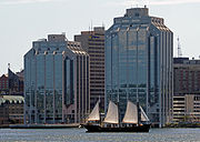
Halifax hosts a wide variety of festivals that take place throughout the year, including: The Atlantic Film Festival, The Royal Nova Scotia International Tattoo, The Halifax Busker Festival, Greekfest, The Atlantic Jazz Festival, The Multicultural Festival, The largest Canada Day celebration east of Ottawa, Natal Day, periodic Tall Ship events, and Shakespeare by the Sea, to name a few. Many of these celebrations have become world renowned over the past several years.
Halifax has also become a significant film-production centre, with many American and Canadian filmmakers using the streetscapes, often to stand in for other cities that are more expensive to work in. The Canadian Broadcasting Corporation has its Atlantic Canada production centres (radio and television) based in Halifax, and quite a number of radio and television programs are made in the region for national broadcast.
The new Halifax Central Library on Spring Garden Road is nearing completion, has received accolades for its architecture and has been described as a new cultural locus, offering many community facilities including a 300-seat auditorium.
Halifax is considered by many to be the cultural centre of the Maritimes. The municipality has been able to maintain many of its maritime and military traditions, while opening itself to a growing multicultural population.
Tourism

Halifax's tourism industry showcases Nova Scotia's culture, scenery and coastline. The area has many museums reflecting its ethnic heritage, including the Black Cultural Centre for Nova Scotia. Others museums tell the story of its working history, such as the Maritime Museum of the Atlantic and is home to the only National Museum in the Atlantic provinces, the Canadian Museum of Immigration at Pier 21. It is also home to several internationally renowned events such as the Royal Nova Scotia International Tattoo, the Atlantic Film Festival and the Atlantic Fringe Festival. Halifax has numerous National Historic Sites, the most notable being Citadel Hill (Fort George) in Halifax.
The iconic Peggys Cove is internationally recognized and receives 600,000 plus visitors a year.[20]
Cruise ships visit the province frequently. In 2013, the Port of Halifax welcomed 134 vessel calls with 252,121 passengers.[21]
Sports

The Halifax Regional Municipality has various recreational areas, including ocean and lake beaches and rural and urban parks. It has a host of organised community intramural sports at various facilities. Public schools and post-secondary institutions offer varsity and intramural sports.
The region is home to several semi-professional sport franchises, including the Halifax Rainmen of the NBL Canada and the Halifax Mooseheads of the Quebec Major Junior Hockey League.
The region has hosted several major sporting events, including the 2003 World Junior Hockey Championship, 2003 Nokia Brier, the 2004 Women's World Ice Hockey Championships, the 2005 Canadian Olympic Curling Trials, and 2007 World Indoor Lacrosse Championship. From 1984 to 2007, the region was home to the CIS Men's Basketball Championship; the tournament was moved to Ottawa, Ontario, from 2008 to 2010 and returned to Halifax in 2011 and 2012. The 72nd Ice Hockey World Championship was held between May 2 and 18, 2008, in Halifax and Quebec City.
Halifax was selected in 2006 as the host city in Canada's bid for the 2014 Commonwealth Games but withdrew on March 8, 2007, well before the November 9, 2007, selection date.
In February 2011, the municipality hosted the 2011 Canada Winter Games.
On May 26, 2013, the Halifax Mooseheads capped a 74-win season (going 74-7-3-1[22]) by defeating the Portland Winterhawks 6-4 in the MasterCard Memorial Cup Final, earning their first Memorial Cup in the process.[23]
Halifax is also home to several Rugby clubs, notably the Halifax Rugby Football Club and the Halifax Tars. The city is now also home to an Australian Rules Football team.
The Halifax Gaels are the local Hurling and Gaelic Football team, that compete in Canadian GAA events.
Media
Halifax is the Atlantic region's central point for radiobroadcast and press media. CBC Television, CTV Television Network (CTV), and Global Television Network and other broadcasters all have important regional television concentrators in HRM. CBC Radio has a major regional studio and there are also regional hubs for Rogers Radio and various private broadcast franchises, as well as a regional bureau for The Canadian Press/Broadcast News.
Halifax's print media is centred on its single daily newspaper, the broadsheet Chronicle Herald as well as two free newspapers, the daily commuter-oriented edition of Metro International and the free alternative arts weekly The Coast. Frank provides the municipality with a bi-weekly satirical and gossip magazine.
From 1974-2008, Halifax had a second daily newspaper, the tabloid The Daily News which still publishes several neighbourhood weekly papers such as The Bedford-Sackville Weekly News, The Halifax West-Clayton Park Weekly News and the Dartmouth-Cole Harbour Weekly News. These weekly papers compete with The Chronicle-Herald's weekly Community Heralds HRM West, HRM East, and HRM North.
Geography
Unlike most municipalities with a sizable metropolitan area, the Halifax Regional Municipality's suburbs have been completely incorporated into the "central" municipality, often by referendum. For example, the community of Spryfield, in the Mainland South area, voted to amalgamate with Halifax in 1968. The most recent amalgamation, which brought the entirety of Halifax County into the Municipality, has created a situation where a large "rural commutershed" area encompasses almost half the municipality's landmass.
Topography
The Halifax Regional Municipality occupies an area of 5,577 square kilometres (2,353 sq mi),[24] (approximately 10% of Nova Scotia) comparable to the province of Prince Edward Island, and measures approximately 165 kilometres (102.5 mi) in length between its eastern and western-most extremities, not including Sable Island. The nearest point of land to Sable Island is not actually in the municipality, but rather in adjacent Guysborough County, however, Sable Island is considered part of District 13 in the HRM.
The coastline is heavily indented, accounting for its length of approximately 400 kilometres (250 mi), with the northern boundary usually being between 50-60 kilometres (30-37 mi) inland. The coast is mostly rock with small isolated sand beaches in sheltered bays. The largest bays include St. Margarets Bay, Halifax Harbour/Bedford Basin, Cole Harbour, Musquodoboit Harbour, Jeddore Harbour, Ship Harbour, Sheet Harbour, and Ecum Secum Harbour. The municipality's topography spans from lush farmland in the Musquodoboit Valley to rocky and heavily forested rolling hills. It includes a number of islands and peninsulas, among them McNabs Island, Beaver Island, Melville Island, Deadman's Island and Sable Island.[25]
Climate
Halifax's climate is heavily influenced by its location on Nova Scotia's Atlantic coast. The weather is usually milder in the winter or cooler in the summer than than areas inland, with the temperature remaining (with occasional notable exceptions) between about −15 and 25 degrees celsius. January and February are the coldest months, while August is the warmest.
Precipitation is high year-round. Winter features a mix of snow, rain, freezing rain and frequent freeze-thaw cycles. Snowstorms often begin as heavy, wet snow, gradually changing through to ice pellets, freezing rain and then rain. The days following snowstorms are often bright and cold. Snowfall is heavy in winter, but snow cover is usually patchy owing to the frequent freeze-thaw cycles, which melt accumulated snow. Some winters feature colder temperatures and fewer freeze-thaw cycles; the most recent of which being the winter of 2013-2014, which was the coldest, snowiest and stormiest in 50 years. Spring is often wet and cool and arrives much later than areas of Canada at similar latitudes due to cooler sea temperatures. Summers are mild and pleasant, with hot and humid conditions very infrequent. Warm, pleasant conditions often extend well into September. Average monthly precipitation is highest from November to February due to intense late-fall to winter storms migrating from the Northeastern U.S., and lowest in summer, with August, the year's warmest and driest month on average. Halifax can sometimes receive hurricanes; mostly between August and October. The most recent hurricane was when Hurricane Juan, a Category 2 storm, hit in September 2003 and caused considerable damage to the region. Hurricane Earl grazed the coast as a Category 1 storm in 2010. Atlantic sea surface temperatures have risen in recent years, making Halifax and the coast of Nova Scotia somewhat more susceptible to hurricanes than the area has been in the past.
| Climate data for Halifax (Citadel Hill) Climate ID: 8202220; coordinates 44°39′N 63°35′W / 44.650°N 63.583°W; elevation: 70.1 m (230 ft); 1981–2010 normals, extremes 1863–present[a] | |||||||||||||
|---|---|---|---|---|---|---|---|---|---|---|---|---|---|
| Month | Jan | Feb | Mar | Apr | May | Jun | Jul | Aug | Sep | Oct | Nov | Dec | Year |
| Record high °C (°F) | 14.0 (57.2) |
16.0 (60.8) |
28.2 (82.8) |
28.3 (82.9) |
33.3 (91.9) |
34.4 (93.9) |
37.2 (99.0) |
34.4 (93.9) |
34.6 (94.3) |
31.1 (88.0) |
23.3 (73.9) |
16.7 (62.1) |
37.2 (99.0) |
| Mean daily maximum °C (°F) | −0.1 (31.8) |
0.4 (32.7) |
3.6 (38.5) |
8.7 (47.7) |
14.4 (57.9) |
19.6 (67.3) |
23.1 (73.6) |
23.1 (73.6) |
19.3 (66.7) |
13.4 (56.1) |
8.1 (46.6) |
2.8 (37.0) |
11.4 (52.5) |
| Daily mean °C (°F) | −4.1 (24.6) |
−3.6 (25.5) |
−0.2 (31.6) |
4.9 (40.8) |
10.1 (50.2) |
15.2 (59.4) |
18.8 (65.8) |
19.1 (66.4) |
15.5 (59.9) |
9.9 (49.8) |
4.8 (40.6) |
−0.8 (30.6) |
7.5 (45.5) |
| Mean daily minimum °C (°F) | −8.2 (17.2) |
−7.5 (18.5) |
−3.9 (25.0) |
1.0 (33.8) |
5.8 (42.4) |
10.7 (51.3) |
14.4 (57.9) |
15.1 (59.2) |
11.8 (53.2) |
6.4 (43.5) |
1.5 (34.7) |
−4.3 (24.3) |
3.6 (38.5) |
| Record low °C (°F) | −27.2 (−17.0) |
−29.4 (−20.9) |
−23.3 (−9.9) |
−13.9 (7.0) |
−5.0 (23.0) |
0.0 (32.0) |
4.4 (39.9) |
3.9 (39.0) |
−1.7 (28.9) |
−7.2 (19.0) |
−15.6 (3.9) |
−25.6 (−14.1) |
−29.4 (−20.9) |
| Average precipitation mm (inches) | 139.7 (5.50) |
110.1 (4.33) |
132.5 (5.22) |
118.3 (4.66) |
119.1 (4.69) |
111.8 (4.40) |
110.3 (4.34) |
96.4 (3.80) |
108.9 (4.29) |
124.3 (4.89) |
151.4 (5.96) |
145.1 (5.71) |
1,468.1 (57.80) |
| Average rainfall mm (inches) | 96.7 (3.81) |
75.1 (2.96) |
101.3 (3.99) |
111.3 (4.38) |
118.4 (4.66) |
111.8 (4.40) |
110.3 (4.34) |
96.4 (3.80) |
108.9 (4.29) |
124.1 (4.89) |
143.6 (5.65) |
115.9 (4.56) |
1,313.9 (51.73) |
| Average snowfall cm (inches) | 43.1 (17.0) |
35.0 (13.8) |
31.2 (12.3) |
7.0 (2.8) |
0.8 (0.3) |
0.0 (0.0) |
0.0 (0.0) |
0.0 (0.0) |
0.0 (0.0) |
0.1 (0.0) |
7.8 (3.1) |
29.2 (11.5) |
154.2 (60.7) |
| Average precipitation days (≥ 0.2 mm) | 13.8 | 11.6 | 13.1 | 15.2 | 15.8 | 13.6 | 12.1 | 11.1 | 11.7 | 14.1 | 15.3 | 14.5 | 161.8 |
| Average rainy days (≥ 0.2 mm) | 8.5 | 6.5 | 10.2 | 14.1 | 15.7 | 13.6 | 12.1 | 11.1 | 11.7 | 14.1 | 14.5 | 10.8 | 142.7 |
| Average snowy days (≥ 0.2 cm) | 6.8 | 6.1 | 4.1 | 1.6 | 0.2 | 0.0 | 0.0 | 0.0 | 0.0 | 0.1 | 1.2 | 5.2 | 25.3 |
| Mean monthly sunshine hours | 109.5 | 127.2 | 142.8 | 156.6 | 193.3 | 220.7 | 235.2 | 226.6 | 180.5 | 157.8 | 107.4 | 105.2 | 1,962.5 |
| Percent possible sunshine | 38.2 | 43.3 | 38.7 | 38.8 | 42.1 | 47.5 | 49.9 | 52.1 | 47.9 | 46.2 | 37.2 | 38.2 | 43.3 |
| Average ultraviolet index | 1 | 2 | 3 | 5 | 6 | 8 | 8 | 7 | 5 | 3 | 2 | 1 | 4 |
| Source 1: Environment and Climate Change Canada (Sunshine data recorded at CFB Shearwater)[26][27][28][29][30][31][32] | |||||||||||||
| Source 2: Nova Scotian Institute of Science[33][34][35][36][37][38][39][40] and Weather Atlas[41] | |||||||||||||
| Climate data for Halifax Stanfield International Airport WMO ID: 71395; coordinates 44°52′48″N 63°30′00″W / 44.88000°N 63.50000°W; elevation: 145.4 m (477 ft); 1991−2020 normals, extremes 1953−present | |||||||||||||
|---|---|---|---|---|---|---|---|---|---|---|---|---|---|
| Month | Jan | Feb | Mar | Apr | May | Jun | Jul | Aug | Sep | Oct | Nov | Dec | Year |
| Record high humidex | 18.8 | 18.3 | 29.3 | 32.1 | 36.0 | 40.2 | 42.4 | 41.9 | 42.1 | 31.9 | 25.4 | 20.9 | 42.4 |
| Record high °C (°F) | 14.8 (58.6) |
17.5 (63.5) |
27.2 (81.0) |
29.5 (85.1) |
32.8 (91.0) |
33.4 (92.1) |
33.9 (93.0) |
35.0 (95.0) |
34.2 (93.6) |
25.8 (78.4) |
21.5 (70.7) |
16.6 (61.9) |
35.0 (95.0) |
| Mean daily maximum °C (°F) | −1.2 (29.8) |
−0.6 (30.9) |
3.5 (38.3) |
9.2 (48.6) |
15.5 (59.9) |
20.5 (68.9) |
24.2 (75.6) |
24.2 (75.6) |
20.0 (68.0) |
13.7 (56.7) |
7.6 (45.7) |
2.1 (35.8) |
11.6 (52.9) |
| Daily mean °C (°F) | −5.7 (21.7) |
−5.2 (22.6) |
−0.9 (30.4) |
4.5 (40.1) |
10.1 (50.2) |
15.2 (59.4) |
19.2 (66.6) |
19.2 (66.6) |
15.2 (59.4) |
9.2 (48.6) |
3.8 (38.8) |
−1.9 (28.6) |
6.9 (44.4) |
| Mean daily minimum °C (°F) | −10.1 (13.8) |
−9.7 (14.5) |
−5.4 (22.3) |
−0.3 (31.5) |
4.6 (40.3) |
9.8 (49.6) |
14.2 (57.6) |
14.1 (57.4) |
10.2 (50.4) |
4.7 (40.5) |
0.0 (32.0) |
−5.8 (21.6) |
2.2 (36.0) |
| Record low °C (°F) | −28.5 (−19.3) |
−27.3 (−17.1) |
−22.4 (−8.3) |
−12.8 (9.0) |
−4.4 (24.1) |
−0.8 (30.6) |
6.1 (43.0) |
4.4 (39.9) |
−0.8 (30.6) |
−6.7 (19.9) |
−13.1 (8.4) |
−23.3 (−9.9) |
−28.5 (−19.3) |
| Record low wind chill | −40.4 | −41.1 | −33.9 | −24.4 | −10.6 | −4.0 | 0.0 | 0.0 | −3.0 | −10.1 | −23.9 | −35.6 | −41.1 |
| Average precipitation mm (inches) | 125.9 (4.96) |
111.0 (4.37) |
120.2 (4.73) |
106.4 (4.19) |
109.7 (4.32) |
89.8 (3.54) |
86.7 (3.41) |
90.5 (3.56) |
107.3 (4.22) |
139.8 (5.50) |
159.1 (6.26) |
146.9 (5.78) |
1,393.3 (54.85) |
| Average rainfall mm (inches) | 78.6 (3.09) |
70.7 (2.78) |
89.0 (3.50) |
90.4 (3.56) |
108.2 (4.26) |
89.8 (3.54) |
86.7 (3.41) |
90.5 (3.56) |
107.3 (4.22) |
139.2 (5.48) |
145.4 (5.72) |
106.8 (4.20) |
1,202.4 (47.34) |
| Average snowfall cm (inches) | 53.9 (21.2) |
44.3 (17.4) |
34.4 (13.5) |
16.6 (6.5) |
2.1 (0.8) |
0.0 (0.0) |
0.0 (0.0) |
0.0 (0.0) |
0.0 (0.0) |
0.6 (0.2) |
19.4 (7.6) |
44.1 (17.4) |
215.2 (84.7) |
| Average precipitation days (≥ 0.2 mm) | 18.7 | 15.2 | 14.6 | 14.6 | 13.5 | 12.2 | 11.0 | 10.8 | 10.1 | 12.8 | 14.6 | 16.9 | 164.8 |
| Average rainy days (≥ 0.2 mm) | 8.0 | 6.2 | 8.7 | 12.0 | 13.1 | 12.2 | 11.0 | 10.8 | 10.1 | 12.8 | 12.5 | 9.8 | 127.4 |
| Average snowy days (≥ 0.2 cm) | 14.4 | 12.1 | 8.8 | 5.3 | 0.6 | 0.0 | 0.0 | 0.0 | 0.0 | 0.2 | 3.7 | 11.0 | 56.0 |
| Average relative humidity (%) (at 15:00 LST) | 74.1 | 67.7 | 63.9 | 61.4 | 60.8 | 62.0 | 63.3 | 62.2 | 64.5 | 67.5 | 73.6 | 77.0 | 66.5 |
| Source: Environment and Climate Change Canada[42][43] | |||||||||||||
| Climate data for Halifax Stanfield International Airport (1981−2010) | |||||||||||||
|---|---|---|---|---|---|---|---|---|---|---|---|---|---|
| Month | Jan | Feb | Mar | Apr | May | Jun | Jul | Aug | Sep | Oct | Nov | Dec | Year |
| Record high humidex | 18.4 | 18.3 | 27.7 | 32.1 | 36.0 | 40.2 | 42.4 | 41.9 | 42.1 | 31.9 | 25.4 | 20.4 | 42.4 |
| Record high °C (°F) | 14.8 (58.6) |
17.5 (63.5) |
25.6 (78.1) |
29.5 (85.1) |
32.8 (91.0) |
33.4 (92.1) |
33.9 (93.0) |
35.0 (95.0) |
34.2 (93.6) |
25.8 (78.4) |
19.4 (66.9) |
16.3 (61.3) |
35.0 (95.0) |
| Mean daily maximum °C (°F) | −1.3 (29.7) |
−0.6 (30.9) |
3.1 (37.6) |
9.1 (48.4) |
15.3 (59.5) |
20.4 (68.7) |
23.8 (74.8) |
23.6 (74.5) |
19.4 (66.9) |
13.1 (55.6) |
7.3 (45.1) |
1.7 (35.1) |
11.3 (52.3) |
| Daily mean °C (°F) | −5.9 (21.4) |
−5.2 (22.6) |
−1.3 (29.7) |
4.4 (39.9) |
10.0 (50.0) |
15.1 (59.2) |
18.8 (65.8) |
18.7 (65.7) |
14.6 (58.3) |
8.7 (47.7) |
3.5 (38.3) |
−2.4 (27.7) |
6.6 (43.9) |
| Mean daily minimum °C (°F) | −10.4 (13.3) |
−9.7 (14.5) |
−5.7 (21.7) |
−0.3 (31.5) |
4.6 (40.3) |
9.7 (49.5) |
13.7 (56.7) |
13.7 (56.7) |
9.7 (49.5) |
4.2 (39.6) |
−0.4 (31.3) |
−6.4 (20.5) |
1.9 (35.4) |
| Record low °C (°F) | −28.5 (−19.3) |
−27.3 (−17.1) |
−22.4 (−8.3) |
−12.8 (9.0) |
−4.4 (24.1) |
0.6 (33.1) |
6.1 (43.0) |
4.4 (39.9) |
−0.8 (30.6) |
−6.7 (19.9) |
−13.1 (8.4) |
−23.3 (−9.9) |
−28.5 (−19.3) |
| Record low wind chill | −40.4 | −41.1 | −33.9 | −24.4 | −10.9 | 0.0 | 0.0 | 0.0 | −3.0 | −10.1 | −23.9 | −35.6 | −41.1 |
| Average precipitation mm (inches) | 134.3 (5.29) |
105.8 (4.17) |
120.1 (4.73) |
114.5 (4.51) |
111.9 (4.41) |
96.2 (3.79) |
95.5 (3.76) |
93.5 (3.68) |
102.0 (4.02) |
124.9 (4.92) |
154.2 (6.07) |
143.3 (5.64) |
1,396.2 (54.97) |
| Average rainfall mm (inches) | 83.5 (3.29) |
65.0 (2.56) |
86.9 (3.42) |
98.2 (3.87) |
109.8 (4.32) |
96.2 (3.79) |
95.5 (3.76) |
93.5 (3.68) |
102.0 (4.02) |
124.6 (4.91) |
139.1 (5.48) |
101.8 (4.01) |
1,196.1 (47.09) |
| Average snowfall cm (inches) | 58 (23) |
45 (18) |
37 (15) |
16 (6.3) |
2 (0.8) |
0 (0) |
0 (0) |
0 (0) |
0 (0) |
0 (0) |
17 (6.7) |
45 (18) |
221 (87) |
| Average precipitation days (≥ 0.2 mm) | 18.7 | 15.2 | 15.1 | 14.8 | 13.7 | 12.9 | 11.3 | 11.0 | 10.2 | 12.1 | 15.1 | 17.4 | 167.4 |
| Average rainy days (≥ 0.2 mm) | 8.0 | 6.1 | 8.6 | 12.1 | 13.5 | 12.9 | 11.3 | 11.0 | 10.2 | 12.1 | 12.8 | 9.8 | 128.4 |
| Average snowy days (≥ 0.2 cm) | 14.6 | 12.0 | 9.6 | 5.2 | 0.61 | 0.0 | 0.0 | 0.0 | 0.0 | 0.14 | 3.9 | 11.7 | 57.7 |
| Average relative humidity (%) | 83.8 | 82.8 | 83.8 | 85.5 | 87.0 | 88.2 | 89.5 | 90.9 | 91.6 | 89.9 | 87.0 | 85.6 | 87.1 |
| Source: Environment Canada[42] | |||||||||||||
Demographics
The Halifax metro area includes 408,702 residents (2013 Statistics Canada estimate). In 2011 approximately 15% of the population was 14 years old or younger, while 13% were 65 and older.
| Year | Pop. | ±% |
|---|---|---|
| 1851 | 39,914 | — |
| 1861 | 49,021 | +22.8% |
| 1871 | 56,963 | +16.2% |
| 1881 | 67,917 | +19.2% |
| 1891 | 71,358 | +5.1% |
| 1901 | 74,662 | +4.6% |
| 1911 | 80,257 | +7.5% |
| 1921 | 97,228 | +21.1% |
| 1931 | 100,204 | +3.1% |
| 1941 | 122,656 | +22.4% |
| 1951 | 162,217 | +32.3% |
| 1961 | 225,723 | +39.1% |
| 1971 | 261,461 | +15.8% |
| 1981 | 288,126 | +10.2% |
| 1991 | 332,518 | +15.4% |
| 2001 | 359,111 | +8.0% |
| 2011 | 390,096 | +8.6% |
| Source: Statistics Canada[N 1] | ||


Mother tongue language (2011)[44]
| Language | Population | Pct (%) |
|---|---|---|
| English only | 348,515 | 90.24% |
| French only | 10,155 | 2.63% |
| Non-official languages | 23,855 | 6.18% |
| Multiple responses | 3,675 | 0.95% |
Ethnic origins
|
|
Religious belief
Breakdown:[46]
- 84.80%: Christian
- 12.90%: none
- 0.86%: Muslim
- 0.44%: Jewish
- 0.42%: Buddhist
- 0.27%: Hindu
- 0.05%: Sikh
- 0.10%: other Eastern religions
- 0.17%: other religions
Economy

The urban area of Halifax is a major economic centre in eastern Canada with a large concentration of government services and private sector companies. Halifax serves as the business, banking, government and cultural centre for the Maritime region. Major employers and economic generators include the Department of National Defence, as well as the Port of Halifax and Irving Shipbuilding Inc. The municipality has a growing concentration of manufacturing industries and is becoming a major multi-modal transportation hub through growth at the port, the Halifax Stanfield International Airport, and improving rail and highway connections. A real estate boom in recent years has led to numerous new property developments, including the gentrification of some former working-class areas.
Agriculture, fishing, mining, forestry and natural gas extraction are major resource industries found in the rural areas of the municipality. Halifax's largest agricultural district is in the Musquodoboit Valley; the total number of farms in Halifax is 150, of which 110 are family-owned. Fishing harbours are located along all coastal areas with some having an independent harbour authority, and others being managed as small craft harbours under the federal Department of Fisheries and Oceans.
Other resource industries in Halifax include the natural gas fields off the coast of Sable Island, as well as clay, shale, gold, limestone, and gypsum extraction in rural areas of the mainland portion of the municipality.
Government
The Halifax Regional Municipality is governed by a mayor (elected at large) and a sixteen person council, who are elected by geographic district; municipal elections occur every four years. The municipality also established community councils where three or more councillors agree to form these councils to deal primarily with local development issues. Most community council decisions are subject to final approval by regional council. The current Mayor of the Halifax Regional Municipality is Mike Savage.
The Halifax Regional Council is responsible for all facets of municipal government, including the Halifax Regional Police, Halifax Public Libraries, Halifax Fire and Emergency, Halifax Regional Water Commission, parks and recreation, civic addressing, public works, waste management, and planning and development.
Education

The Halifax Regional Municipality has a well-developed network of public and private schools, providing instruction from grade primary to grade twelve; 137 public schools are administered by the Halifax Regional School Board, while six public schools are administered by the Conseil scolaire acadien provincial.[47] The city's fourteen private schools are operated independently.
The municipality is also home to the following post-secondary educational institutions: Dalhousie University, Saint Mary's University, Mount Saint Vincent University, the Halifax campus of Université Sainte-Anne, University of King's College, Atlantic School of Theology, NSCAD University, Nova Scotia Community College, and the Centre for Arts and Technology. The presence of so many university and college students contributes to a vibrant youth culture in the region, as well as making it a major centre for university education in eastern Canada.
Transportation
-
 Halifax Transit ferry crossing the harbour
 -
 Cars heading toward the MacKay Bridge from Dartmouth.


Halifax Harbour is a major port used by numerous shipping lines, administered by the Halifax Port Authority. The Royal Canadian Navy and the Canadian Coast Guard have major installations along prominent sections of coastline in both Halifax and Dartmouth. The harbour is also home to a public ferry service connecting downtown Halifax to two locations in Dartmouth. Sheet Harbour is the other major port in the municipality and serves industrial shippers on the Eastern Shore.
The Halifax Port Authority's various shipping terminals constitute the eastern terminus of Canadian National Railway's transcontinental network. Via Rail Canada provides overnight passenger rail service from the Halifax Railway Station three days a week to Montreal with the Ocean, a train equipped with sleeper cars that stops in major centres along the way, such as Moncton. The Halifax Railway Station also serves as the terminus for Maritime Bus which serve destinations across Atlantic Canada.
Halifax Stanfield International Airport serves Halifax and most of the province, providing scheduled flights to domestic and international destinations. Shearwater, part of CFB Halifax, is the air base for maritime helicopters employed by the Royal Canadian Navy and is located on the eastern side of Halifax Harbour.
The municipality's urban core is linked by the Angus L. Macdonald and A. Murray MacKay suspension bridges, as well as the network of 100-series highways which function as expressways. The Armdale traffic circle is an infamous choke point for vehicle movement in the western part of the urban core, especially at rush hour.
The urban core of Halifax is served by Halifax Transit, which operates standard bus routes, bus-rapid transit routes, as well as the pedestrian-only Halifax-Dartmouth Ferry Service. Established in 1752, the municipality's ferry service is the oldest continuously running salt water ferry service in North America.[48]
Sister cities
 Hakodate, Japan (1982). The cities chose to twin because they both have star forts.[49]
 Campeche, Mexico (1999). Campeche was chosen because, like Halifax, it is "a capital of a state" and is "a city of similar size to Halifax on or near the coast having rich historical tradition".[50]
 Norfolk, Virginia (2006). Norfolk was chosen because, like Halifax, its economy "depends heavily on the presence of the Armed Forces, and both cities are very proud of their military history".[51]
Notable Haligonians
Artists
- Brian Ahern, producer for Anne Murray, Emmylou Harris, Johnny Cash
- Luke Boyd, musician
- Mike Clattenburg, film director, creator of the award winning television series Trailer Park Boys
- Denny Doherty, Founding member of the 1960s musical group The Mamas & the Papas
- Gerald Ferguson, artist
- Sarah Jeanette Jackson, digital artist
- Garry Neill Kennedy, artist, NSCAD University president 1967-1996, recipient of the Order of Canada award
- Matt Mays, singer/songwriter
- Sarah McLachlan, singer and songwriter
- Peter North, adult film performer and producer
- Ellen Page, Academy Award–nominated actress
- Joel Plaskett, singer/songwriter
- Sloan, alternative pop/rock quartet
Military
- Philip Bent, Halifax-born recipient of the Victoria Cross for actions in Belgium during the First World War.
Athletes
- Eric Boulton, professional ice hockey player for the New York Islanders
- Sidney Crosby, professional ice hockey player for the Pittsburgh Penguins
- George Dixon, first black world boxing champion in any weight class, first ever Canadian-born boxing champion
- TJ Grant, professional mixed martial artist and UFC Lightweight title contender. Most successful Canadian lightweight fighter in MMA history.
- Colleen Jones, most successful Canadian women's skip in curling history
- Nathan MacKinnon, professional ice hockey player for the Colorado Avalanche
- Brad Marchand, professional ice hockey player for the Boston Bruins
Business
- Sir Samuel Cunard, British shipping magnate
Politicians
- Joseph Howe, politician, oversaw the formation of the first responsible government in a British colony
- Alexander Keith, fourth Mayor of Halifax and founder of the Alexander Keith's brewing company
- Alexa McDonough, former federal leader of the New Democratic Party. Also interim President and Vice-Chancellor of Mount Saint Vincent University
- Sir John Thompson, 4th Prime Minister of Canada
- Sir Charles Tupper, 6th Prime Minister of Canada
Other
- Robert MacNeil, journalist and television announcer
See also
- Bedford Institute of Oceanography
- Black Lake listings within Nova Scotia
- Boston–Halifax relations
- Halifax (electoral district), a federal electoral district since Confederation
- Halifax Harbour
- Halifax Port Authority
- Halifax Regional Fire and Emergency
- Halifax Regional Municipality municipal election, 2008
- Halifax Regional Police
- Halifax Regional Water Commission
- Halifax West, a federal electoral district since 1979
- List of tallest buildings in the Halifax Regional Municipality
- Scotia Square
- Sable island
Notes
- ^ 1996 figures onwards are for Halifax Regional Municipality. Prior figures are for Halifax County.
References
- ^ "2006 Statistics Canada Community Profile: Halifax Regional Municipality, Nova Scotia". 2.statcan.ca. December 7, 2010. Retrieved April 8, 2011.
- ^ "Population of census metropolitan areas". Statcan.gc.ca. February 6, 2013. Retrieved January 24, 2014.
- ^ "Census Profile". 2.statcan.gc.ca. Retrieved January 24, 2014.
- ^ a b "Census Profile - Halifax Regional Municipality". Statistics Canada. Retrieved March 7, 2012.
- ^ "Census Profile - Halifax (population centre)". Statistics Canada. Retrieved March 7, 2012.
- ^ "Best Places to Live in Canada". MoneySense. Retrieved March 20, 2012.
{{cite web}}: Italic or bold markup not allowed in:|publisher=(help) - ^ American Cities Of The Future 2011/12 Winners PDF file from www.fDiIntelligence.com
- ^ Grenier, John. The Far Reaches of Empire. War in Nova Scotia, 1710-1760. Norman: U of Oklahoma P, 2008; Thomas Beamish Akins. History of Halifax, Brookhouse Press. 1895. (2002 edition). p 7
- ^ Wicken, p. 181; Griffith, p. 390; Also see http://www.northeastarch.com/vieux_logis.html
- ^ "CBC - Halifax Explosion 1917". CBC.ca. September 19, 2003. Retrieved February 25, 2011.
- ^ Time: Disasters that Shook the World. New York City: Time Home Entertainment. 2012. p. 56. ISBN 1-60320-247-1.
- ^ "Municipal History Highlights". Novascotia.ca. June 26, 2014. Retrieved July 13, 2014.
- ^ "Goodbye HRM, hello Halifax: Mixed reaction to bold, new brand". CTV News Atlantic. Bell Media. April 16, 2014. Retrieved April 24, 2014.
- ^ "Council Approves Bold New Brand Strategy for Halifax Region". Halifax Regional Municipality. Retrieved April 24, 2014.
- ^ "Halifax mayor, council approve city's new brand". The Chronicle-Herald. April 15, 2014. Retrieved April 24, 2014.
- ^ "HRM - Traffic and Transportation - Urban Core Boundaries". Halifax.ca. January 27, 2009. Retrieved April 8, 2011.
- ^ "HRM - Regional Planning". Halifax.ca. August 25, 2006. Retrieved April 8, 2011.
- ^ "HRM - Planning". Halifax.ca. March 30, 2011. Retrieved April 8, 2011.
- ^ Halifax Regional Municipality - Official Street List PDF file from HRM Civic Addressing Department
- ^ "Peggy's Cove: Assessment of Capacity Issues and Potential Tourism Opportunities" (PDF). The Economic Planning Group of Canada. Retrieved December 26, 2011.
{{cite web}}: Italic or bold markup not allowed in:|publisher=(help) - ^ "Halifax Port Authority Releases Final Cruise Numbers for 2013". Halifax Port Authority. November 22, 2013. Retrieved July 19, 2014.
- ^ "QMJHL Network". Theqmjhl.ca. Retrieved January 24, 2014.
- ^ "OHL Network". Ontariohockeyleague.com. Retrieved January 24, 2014.
- ^ [1][dead link]
- ^ http://gsa1.gov.ns.ca/search?q=sable+island&output=xml_no_dtd&site=HRM&client=HRM&proxystylesheet=HRM&go.x=10&go.y=5
- ^ "Halifax Citadel, Nova Scotia". Canadian Climate Normals 1981–2010. Retrieved May 12, 2016.
- ^ "Shearwater A, Nova Scotia". Canadian Climate Normals 1981–2010. Retrieved May 12, 2016.
- ^ "Monthly Data Report for 1871". Canadian Climate Data. Environment and Climate Change Canada. September 22, 2015. Retrieved March 24, 2016.
- ^ "Daily Data Report for October 1930". Canadian Climate Data. Environment and Climate Change Canada. September 22, 2015. Retrieved May 14, 2016.
- ^ "Monthly Data Report for 1939". Canadian Climate Data. Environment and Climate Change Canada. September 22, 2015. Retrieved March 24, 2016.
- ^ "Daily Data Report for April 1945". Canadian Climate Data. Environment and Climate Change Canada. September 22, 2015. Retrieved May 14, 2016.
- ^ "Halifax Dockyard". Canadian Climate Data. Environment and Climate Change Canada. September 22, 2015. Retrieved March 24, 2016.
- ^ "Abstract of Meteorological register, Halifax, Nova Scotia, 1863" (PDF). Myers, W. J. (1867). Nova Scotian Institute of Science. 1867. Retrieved September 4, 2016.
- ^ "Meteorological register, 1864" (PDF). Nova Scotian Institute of Science. 1867. Retrieved September 4, 2016.
- ^ "Abstract of Meteorological register, Halifax, Nova Scotia, 1865" (PDF). Nova Scotian Institute of Science. 1867. Retrieved September 4, 2016.
- ^ "Abstract of Meteorological register, Halifax, Nova Scotia, 1866" (PDF). Nova Scotian Institute of Science. 1867. Retrieved September 4, 2016.
- ^ "Meteorological record, Halifax, Nova Scotia, 1867" (PDF). Nova Scotian Institute of Science. 1868. Retrieved September 4, 2016.
- ^ "Meteorological summary, 1868" (PDF). Nova Scotian Institute of Science. 1869. Retrieved September 4, 2016.
- ^ "On the meteorology of Halifax, 1870" (PDF). Allison, F. (1871). Nova Scotian Institute of Science. 1871. Retrieved September 4, 2016.
- ^ "On the meteorology of Halifax, 1871" (PDF). Allison, F. (1872). Nova Scotian Institute of Science. 1872. Retrieved September 4, 2016.
- ^ "Halifax, Canada - Detailed climate information and monthly weather forecast". Weather Atlas. Yu Media Group. Retrieved July 6, 2019.
- ^ a b "Halifax Stanfield (Airport)". Canadian Climate Normals 1991–2020. Environment and Climate Change Canada. Retrieved June 9, 2024. Cite error: The named reference "climate at airport" was defined multiple times with different content (see the help page).
- ^ "Daily Data Report for November 2022". Canadian Climate Data. Environment and Climate Change Canada. Retrieved June 9, 2024.
- ^ Statistics Canada: 2011 census
- ^ "Ethnocultural Portrait of Canada Highlight Tables, 2006 Census". 2.statcan.ca. October 6, 2010. Retrieved May 9, 2014.
- ^ "2001 Community Profiles". 2.statcan.ca. March 12, 2002. Retrieved April 8, 2011.
- ^ "Nos Écoles". Conseil scolaire acadien provincial. Retrieved October 11, 2014.
- ^ "HRM - History - Main". Halifax.ca. Retrieved April 8, 2011.
- ^ "July 4, 2000 - HRM Media Room Press Releases 2000". Halifax.ca. Retrieved April 8, 2011.
- ^ Halifax Regional Council Minutes January 13, 1998 PDF file from HRM Council Minutes
- ^ "HRM to Twin with Norfolk, Virginia". Halifax.ca. August 25, 2006. Retrieved April 8, 2011.
Further reading
- Laffoley, Steven (2007). Hunting Halifax: In Search of History, Mystery and Murder. Pottersfield Press. ISBN 978-1895900934.
External links
- Halifax Regional Municipality
- Photographs of historic monuments in Halifax Regional Municipality
- Flags of Halifax and Halifax Regional Municipality
Places adjacent to Halifax, Nova Scotia | ||||||||||||||||
|---|---|---|---|---|---|---|---|---|---|---|---|---|---|---|---|---|
| ||||||||||||||||
| |||||||||||||||||||||
Cite error: There are <ref group=lower-alpha> tags or {{efn}} templates on this page, but the references will not show without a {{reflist|group=lower-alpha}} template or {{notelist}} template (see the help page).