
Istanbul Metro
| Istanbul Metro | |||
|---|---|---|---|
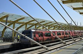
 Two trains waiting at Boğaziçi Üniversitesi on the M6 line | |||
| Overview | |||
| Native name | |||
| Owner |
| ||
| Locale | Istanbul, Turkey | ||
| Transit type | Rapid transit | ||
| Number of lines | 11 (4 more under construction) | ||
| Number of stations | |||
| Daily ridership | 1.36 million | ||
| Annual ridership | 542 million (2022)[2] | ||
| Website | Metro Istanbul (in English) | ||
| Operation | |||
| Began operation | 3 September 1989 | ||
| Operator(s) |
| ||
| Number of vehicles | 727[1] | ||
| Technical | |||
| System length | 243.3 km (151.2 mi) | ||
| Track gauge | 1,435 mm (4 ft 8+1⁄2 in) standard gauge | ||
| Electrification |
| ||
| |||
The Istanbul Metro (Turkish: İstanbul metrosu) is a rapid transit railway network that serves the city of Istanbul, Turkey. Apart from the M11 line, which is operated by TCDD Taşımacılık, the system is operated by Metro Istanbul, a public enterprise controlled by the Istanbul Metropolitan Municipality. The oldest section of the metro is the M1 line, which opened in 1989. As of March 2024, the system now includes 158 stations in service,[1] with 36 more under construction. Istanbul is the city with the 22nd longest metro line in the world and the 4th in Europe. [4]
The system consists of eleven lines: the lines designated M1A, M1B, M2, M3, M6, M7, M9 and M11 are on the European side of the Bosporus, while lines M4, M5 and M8 are on the Asian side. Due to Istanbul's unique geography and the depth of the Bosporus strait which divides the city, the European and Asian metro networks do not connect directly. The two parts of the city are linked through the Marmaray commuter rail line, which is connected to the metro in several places. Three metro lines are under construction on the Asian side: M10 (Pendik Merkez–Fevzi Çakmak), M12 (60. Yıl Parkı–Kazım Karabekir) and M14 (Altunizade–Kazım Karabekir). Additionally, extension works on the M7 and M11 lines (on the European side) and the M4 and M5 lines (on the Asian side) are underway.
In addition to the Marmaray commuter rail, the metro connects to the F1, Tünel (F2), F3 and F4 funicular lines and with the network of the Istanbul Tram,[5] Metrobüs and the cable cars.
History[edit]

The oldest underground urban rail line in Istanbul is the Tünel, which entered service on 17 January 1875.[6] It is the world's second-oldest underground urban rail line after the London Underground which was built in 1863,[7] and the first underground urban rail line in continental Europe, however this is not recognised as the opening of the metro due to the line being Funicular.
The first master plan for a full metro network in Istanbul, titled Avant Projet d'un Métropolitain à Constantinople and conceived by the French engineer L. Guerby, dates to 10 January 1912.[8] The plan comprised a total of 24 stations between the Topkapı and Şişli districts and included a connection through the Golden Horn. Each station would have a 75-metre (246 ft 1 in) platform next to the rail line, while the distance between stations varied from 220 to 975 metres (721 ft 9 in to 3,198 ft 10 in). The blueprints of the project, which was never realized, are today displayed at the Istanbul Technical University Museum.
In 1936 the French urban planner Henri Prost proposed a metro network between the districts of Taksim and Beyazıt, to the north and south of the Golden Horn, respectively.[9][10] In October 1951 the Dutch firm Nedeco proposed a similar route between Taksim and Beyazıt, and in September 1952 the Director of the Paris Transportation Department, Marc Langevin, prepared a 14-chapter report together with his associate Louis Meizzonet for the implementation of the project and its integration with the other means of public transportation in the city. However, these plans never came into effect and all proposals were put on hold until 1987, when the planning for the current Istanbul Metro was made.
Construction works for the first 'modern' mass transit railway system started in 1989, with the first stations opening in September. İstanbul Ulaşım A.Ş. (now known as Metro Istanbul) was founded the previous year to operate the system. The M1 was initially called "Hafif Metro" (which literally translates as "light metro"). Although it was built as a fully grade separated line, the M1 line operates with shorter trainsets and shorter station platforms than is standard on a traditional metro line, hence its "light metro" designation. The M1 line was later extended from Aksaray towards the western suburbs, reaching Atatürk Airport in the southwest in 2002.[11]
Construction of the M2 line began on 11 September 1992, but faced many challenges due to the numerous archaeological sites that were discovered during the drilling process, which slowed down or fully stopped the construction of many stations, especially in the south. Taking into account the seismic activity in Istanbul, the entire network was built with the cut-and-cover method[citation needed] to withstand an earthquake of up to 9.0 on the Richter magnitude scale.[12][13]

The first section between Taksim and 4. Levent entered service, after some delays, on 16 September 2000. This line is 8.5 km (5.28 mi) long and has 6 stations, which all look similar but are in different colours. In 2000, there were 8 Alstom-built 4-car train sets in service, which ran every 5 minutes on average and transported 130,000 passengers daily. On 30 January 2009, the first train sets built by Eurotem entered service.[14] Eurotem will build a total of 92 new trainsets for the M2 line.[14][15] As of 30 January 2009, a total of 34 trainsets, each with 4 cars, were being used on the M2 line.[15] A northern extension from 4. Levent to Maslak was opened on 30 January 2009.[16] On 2 September 2010, the northern (temporary) terminus of Darüşşafaka followed up.[17] The southern extension of the M2 line from Taksim to Yenikapı, across the Golden Horn with Haliç station on the bridge and underground through the historic peninsula, entered service on 15 February 2014. The Taksim-Yenikapı extension is 5.2 km (3.23 mi) long, with four stations. The total cost of the extension was $593 million.[18] At Yenikapı, it will intersect with the extended M1 line and the Marmaray commuter line, which since its opening in 2013 has offered a connection between the Asian and European sides of the city.
.jpg)
The trip between the Şişhane station in Beyoğlu and the Haciosman station in Maslak is 20 km (12.43 mi) long and takes 27 minutes; including Şişhane - Taksim (1.65 km (1.03 mi), 2 minutes), Taksim - 4. Levent (8.5 km (5.28 mi), 12 minutes), and 4. Levent - Haciosman (8.1 km (5.03 mi), 12 minutes.)[19][20] The total length of the European side of the M2 line will reach 23 km (14.29 mi) when all 16 stations from Hacıosman to Yenikapı will be completed;[21][22][23] not including the 93-metre (305 ft 1 in)-long Golden Horn Metro Bridge,[24] the 0.6 km (0.37 mi) long Taksim-Kabataş tunnel connection with the Seabus port,[25] and the 0.6 km (0.37 mi) long Yenikapı-Aksaray tunnel connecting the M1 line to the Yenikapı Transfer Center.[23]
On the Asian side, construction is in progress of the remaining portion of the 26.5 km (16.47 mi) long M4 line from Kadıköy to Kaynarca, yielding a total of 19 stations. It cost €751 million and was built by the Astaldi / Makyol / Gülermak consortium.[26] The first section opened on 17 August 2012, terminating in Kartal. Construction of the 20 km (12.43 mi) long M5 line from Üsküdar via Ümraniye to Çekmeköy started in March 2012.[27]
Operations[edit]

The Metro operates from 06:00 AM to 00.00 AM every 6–12 minutes, except for the M8 line, which temporarily operates from 06:00 AM to 23:00 PM.[28] During peak hours the intervals could be reduced to 3 to 4 minutes.
The metro has a flat fare of 17.70 TL, a student rate of 8.64 TL, and a fare of 12.67 TL for teachers and senior residents,[29] when used with the Istanbulkart, the city's universal contactless payment card.[30]
Night operations[edit]

On 30 August 2019 as a gesture for the Victory Day of Turkey, Mayor of Istanbul, Ekrem İmamoğlu, announced that many lines of Istanbul were going to provide 24 hours service during the weekends with trains at 20 minutes interval.[31][32][33] Since August 2019, the Istanbul Metro started to provide 24 hours service for some lines on weekends and public holidays,[34] but this service was discontinued in March 2020 due to coronavirus pandemic. On March 5, 2022 Metro Istanbul announced that the night metro service would be re-started on the following lines: M1A Yenikapı-Atatürk Airport, M1B Yenikapı-Kirazli, M2 Yenikapı-Hacıosman, M4 Kadıköy-Sabiha Gökçen Airport, M5 Üsküdar-Çekmeköy, and M6 Levent-Boğaziçi University/Hisarüstü,[35] and later added M7 Mecidiyeköy-Mahmutbey on July 14, 2022.[36]
Lines[edit]
Each line is given a different color and name. The letter "M" stands for metro, while "T" stands for tram, "F" stands for funicular, "TF" stands for cable car and "B" for suburban. Frutiger LT Pro is used as the font for the icons.
| Line | Route | Side | Opened(first) | Length | Stations | Notes[37] |
|---|---|---|---|---|---|---|
 |
Yenikapı ↔ Atatürk Airport / Kirazlı | European | 1989[38] | 26.8 km[39] | 23[38] |
|
 |
Yenikapı ↔ Hacıosman | European | 2000[40] | 23.49 km[39] | 16[40] |
|
 |
Bakırköy-Sahil ↔ Kayaşehir Merkez | European | 2013[41] | 26.7 km[39] | 19[41] |
|
 |
Kadıköy ↔ Sabiha Gökçen Airport | Asian | 2012[42] | 33.5 km[42] | 23[42] |
|
 |
Üsküdar ↔ Samandıra Merkez | Asian | 2017[43] | 26.5 km[43] | 20[43] |
|
 |
Levent ↔ Boğaziçi Üniversitesi/Hisarüstü | European | 2015[44] | 3.3 km[44] | 4[44] |
|
 |
Yıldız ↔ Mahmutbey | European | 2020[45] | 20 km[45] | 17[45] |
|
 |
Bostancı ↔ Parseller | Asian | 2023[46] | 14.27 km[46] | 13[46] |
|
 |
Olimpiyat ↔ Ataköy | European | 2021[47] | 17.2 km[47] | 13[47] |
|
 |
Gayrettepe ↔ Arnavutköy Hastane | European | 2023[48] | 51.5 km[48] | 10[48] |
|
| TOTAL: | 243.26 km[39] | 158[1] | ||||
Stations[edit]


The Istanbul Metro system has a total of 158 stations in operation with 36 more under construction. Since the majority of the system is underground, stations are generally accessed going down from street level. At every station entrance there is a post with the Istanbul metro "M" logo and the station name underneath it except for the M11 line which has the "U" logo next to its own entrances.[49][50] Entrances are usually built into sidewalks along a street, although many stations of newer lines have their entrances from street level on small plazas.
Out of the 158 operating stations of the Istanbul Metro:
- 142 are fully underground
- 7 are elevated stations
- 7 are on an embankment or at-grade
- 2 are partially underground
Mezzanines[edit]

Most stations have a mezzanine directly below street level, which allows passengers to enter the stations from multiple locations and proceed to the correct platform without having to cross any streets. Inside the mezzanines are ticket machines and turnstiles, where passengers must pay to enter fare control zones and proceed to the trains.[51][52]
In some stations, mezzanines connect directly to nearby buildings and structures, such as shopping malls or business centres. Each station concourse or mezzanine are patrolled by Istanbul Metro security guards to prevent fare evasion and crime.
Stations with large walkways toward different exits, such as Taksim, also have travelators to cover the long walking distances.
Upon entering the station, passengers may use ticket vending machines or staffed ticket booths to purchase their fare, which can be stored on the Istanbulkart contactless smart card. After entering the fare-controlled area, via the turnstiles, passengers may continue further down to the platform level.
Platforms[edit]


Since the different lines of the Istanbul Metro have different specifications, most notably car length, there is no uniform length for platforms. The oldest platforms of the network, built between 1989 and 2002 on the M1 line, are 100 m (328 ft 1 in) and can accommodate trains up to 4 cars long. Platforms on the M2, M3, M4, M7 and M11 lines span about 180 m (590 ft 7 in) and can each accommodate trains up to 8 cars long. Platforms on the M5 line can accommodate up to 6-car trains, whiles platforms on the M6, M8, and M9 lines are accommodate 4-car trains.
Sections of platforms are subject to close during off-peak hours, especially on the M2 line. While platforms on the M2 line are open fully during peak hours, capacity is reduced to 4-car trains during off-peak hours. Platforms on the M5, M7, M8 and M11 lines are protected by platform edge doors. Except on funicular lines, most platforms of the Istanbul Metro consist of two side platforms or one island platform. Five stations consist of two island platforms, serving three tracks in a configuration known as the Spanish Solution. These stations are Otogar on the M1 line, Yenikapı and Sanayi on the M2 line, Olimpiyat on the M9 line, and Bostancı on the M4 line.
Design[edit]
The stations on the M1 line, which were built in the 1980s and 1990s, are very functional and plain in design. Like many stations built during this period, the stations use fluorescent tubes as light sources, and are decorated with tiled floors and ceiling panels made of white plastic ceiling slats. Platforms of stations on the M1 line are supported by square and tiled central columns (e.g. Aksaray, Emniyet - Fatih and Topkapı - Ulubatlı.)
Stations on the M2 line built between 2000 and 2011, care was taken to use light colors. For this reason, the basic wall color of the stations is white. In order to make people not confuse the stations and to make them more memorable, some characteristic patterns were also implemented. (e.g. colored stripes/tiles on walls).
Stations on the M7 line, which were built between 2017 and 2020, mostly use a combination of gray and white colors. Since the line has fully automated driverless vehicles, passengers are prevented from falling onto the tracks by using platform screen doors (PSDs).
-
 M1 Yenibosna station
 -
 M2 Golden Horn Metro Bridge station
 -
 M3 Kayaşehir Merkez station
 -

-
 M5 Üsküdar station
 -
 M6 Boğaziçi Üniversitesi/Hisarüstü station
 -
 M7 Mecidiyeköy station
 -
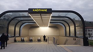 M11 Istanbul Airport Kağıthane Station


.jpg)
Technical specifications[edit]
This table lists technical characteristics of the metro lines that are currently in service or under construction.
| Line | Route | Gauge | Voltage | Conductor system | Notes |
|---|---|---|---|---|---|
 |
Yenikapı ↔ Atatürk Airport | 1,435 mm (4 ft 8+1⁄2 in) standard gauge | 750 V DC | Overhead line | Light Metro |
 |
Yenikapı ↔ Kirazlı | ||||
|
Yenikapı ↔ Hacıosman | Third rail | |||
|
Bakırköy-Sahil ↔ Kayaşehir Merkez | 1,500 V DC | Overhead line | ||
|
Kadıköy ↔ Sabiha Gökçen Airport | ||||
|
Üsküdar ↔ Samandıra Merkez | 750 V DC | The first driverless metro in Turkey | ||
|
Levent ↔ Boğaziçi Üniversitesi Hisarüstü | Third rail | Mini light Metro | ||
|
Yıldız ↔ Mahmutbey | 1,500 V DC | Overhead line | The first driverless metro in Istanbul European Side | |
|
Bostancı ↔ Parseller | Driverless metro | |||
|
Olimpiyat ↔ Ataköy | ||||
 |
Pendik YHT ↔ Sabiha Gökçen Airport | Under Construction | |||
|
Gayrettepe ↔ Halkalı | Operated by TCDD | |||
 |
60. Yıl Parkı ↔ Kazım Karabekir | Under Construction | |||
 |
Söğütlüçeşme ↔ Yenidoğan | Partially Under Construction | |||
 |
Altunizade ↔ Küçüksu | Partially Under Construction | |||
 |
Sefaköy – TÜYAP | Planned | |||
 |
Beylikdüzü ↔ Sabiha Gökçen Havalimanı | Hızray Project (Planned) |
Alignment and interchanges[edit]


Apart from the Haliç station on the M2 line, about half of the M1 (mostly M1A) line, Alibeyköy and Kağıthane valleys crossing by the M7 line, viaduct section at Menekşe River of the M3 line and viaduct section at Olimpiyat of the M9 line, the lines are fully underground. All station names are on the bus lines as well.
The M2 line has an interchange between F1 in Taksim and an interchange tunnel with the Zincirlikuyu Metrobus station at the Gayrettepe station.[53] There is also a transfer station at Yenikapı with Marmaray, M1 line and İDO Ferry Port; from where it is possible to take the high-speed catamaran Seabus departing for Bursa, Bandırma or Yalova; as well as the other Seabus ports of Istanbul such as Bostancı, Kadıköy, Bakırköy and Kabataş.
The M3 line has an interchange with the M9 line at the İkitelli Sanayi station, M7 line at the Mahmutbey station, M1 line at the Kirazlı station, M2, M1 and Metrobus at the İncirli station, and lastly Marmaray (B1) and YHT at Özgürlük Meydanı Station,
The M4 line has a vapur (traditional ferry), motorboat, İDO and nostalgic tram interchange at Kadıköy which is the heart of Istanbul's Asian side. One can also interchange to Marmaray at the Ayrılık Ceşmesi station. Also at Ünalan / Uzunçayır, the line has a Metrobus interchange just like Gayrettepe in M2.
The M5 line has an interchange with the Marmaray and İDO at the Üsküdar station. Also at Altunizade the line has a Metrobus interchange.
The M6 line has an interchange with the M2 line at the Levent station.
The M7 line interchanges with the M2 line at the Mecidiyeköy station, with the T4 tramway line at the Kiptaş-Venezia/Karadeniz station, and with the M3 at the Mahmutbey station.
The M8 line has an interchange with the Marmaray at the Bostancı station, with the M4 line at the Kozyatağı station and with the M5 line at the Dudullu station.
The M9 has an interchange with the M3 at Ikitelli station.
The M11 line interchanges with the M2 line and Metrobus at Gayrettepe station, and with the M7 line at Kağıthane station.
Rolling stock[edit]
This section needs expansion. You can help by adding to it. (October 2023) |
Aside from running on standard gauge tracks and all models having 4 doors per side, the rolling stock is generally incompatible, with few track connections to other lines and rolling stock generally will never run on any line other than whatever they first were delivered to. As each line is generally self-contained, this has rarely become an issue.
History[edit]

The first Istanbul full metro rolling stocks, which entered service on 16 September 2000, on the Taksim - 4. Levent line, were built by Alstom. These trains are air-conditioned and equipped with LCD screens, and share a similar exterior design to the first three generations of rolling stock used on the Caracas Metro in Venezuela.
On 30 January 2009, the first 8 trains (each with 4 wagons) built by Eurotem (the Turkish factory of Hyundai Rotem) entered service.[54] Today the system has 268 trains.[1] These trains are also air conditioned and equipped with LCD screens, as well as dynamic route map showing the location and direction of the train.[55]
In September 2009, CAF signed a contract to supply 144 units for the M4 metro line, amounting to 1.1 million euros. These metro units are formed with 4 cars for a total length of 90 meters and have a maximum transport capacity of 1300 passengers.[56]
In August 2013, tender for the 126 driverless train units for the M5 line was won by CAF and Mitsubishi with 119 million euros.[57] The first units were delivered in November 2016.[58]
In March 2016, Eurotem signed a contract to supply 300 driverless units for the M7 line, amounting to 280.200.000 euros.[59]
Rolling stocks by line[edit]
M1ᴀ and M1ʙ[edit]
Although line M1 is a (light) metro line, its rolling stock—in use since 1989—is made up of typical ABB light rail vehicles (LRVs). These are partly the same as those used on the T4 tramway line. The rolling stock of the line is planned to be refurbished and made driverless.[60][61]
M2[edit]
The rolling stock on the M2 line, which totals a number of 192 units,[61] is made up of Alstom vehicles from France and Hyundai Rotem vehicles from South Korea which are manufactured in Adapazarı by Eurotem. All wagons have 8 double doors, making them have 4 openings on each side per wagon, the rolling stock also includes a fast passenger change, heating, air conditioning and broadcasting system.
M3[edit]
The rolling stock on the M3 line, consists of 68 Alstom Metropolis AM4 (the same vehicles are used at M4 Budapest Metro) units. Some of them are also used on the M9 Ataköy-Olimpiyat metro line.
-
M2 rolling stock at Haliç station (2009 Rotem)
-
 M2 rolling stock at Yenikapı station (2009 Rotem)
 -
 Interior of M2 rolling stock (2009 Rotem)
 -
 Route diagram of the M2 line (2009 Rotem)


Future extensions[edit]
As part of the Istanbul Metropolitan Municipality goal of expanding the size of the city rail transportation network to 630 km (390 mi) by 2030,[62] the Istanbul Metro has several lines that are under construction or planned. Since the city does not have a widespread railway network, the Metropolitan Municipality aims to connect urban areas of the city that do not have access to the Istanbul two coastal railways with metro lines.
Due to the city's unique geography and depth of the Bosporus which divides the city, none of the current Istanbul Metro lines cross the strait; lines are wholly located either on the European side or the Asian side of the city. In 2019, The Ministry of Transport and Infrastructure began the planning of a 30.2 km (18.8 mi) line that would link İncirli with Söğütlüçeşme via a tunnel under the Bosphorus also designed to accommodate road traffic.[63]
The following metro lines are under construction:
| Line | Route | Length | Stations | Notes[64] |
|---|---|---|---|---|
|
Kirazlı ↔ Halkalı | 9.70 km (under construction) | 9 (0 under construction) | Under construction, partially (Kirazlı-Halkalı Üniversite) opening: 2027. |
|
Tavşantepe ↔ Tuzla | 7.90 km (under construction) | 6 (1 under construction) | Under construction, partially (Tavşantepe-Kaynarca Merkez) opening: 2025. |
|
Samandıra Merkez ↔ Sultanbeyli | 4.4 km (under construction) | 3 (under construction) | Under construction, opening: April 2025. |
|
Kabataş ↔ Yıldız | 4.5 km (under construction) | 2 (under construction) | Under construction, opening: November 2025.[65] |
| Mahmutbey ↔ Esenyurt Meydan | 18.1 km (under construction) | 11 (5 under construction) | Under construction, partially (Mahmutbey-Hastane) opening: 2026. | |
|
Pendik Merkez ↔ Fevzi Çakmak | 4.90 km (under construction) | 2 (under construction) | Under construction, opening: June 2025. |
|
Halkalı ↔ Arnavutköy Hastane | 31.5 km (under construction) | 5 (under construction) | Under construction, opening: Early 2025. |
|
60. Yıl Parkı ↔ Kazım Karabekir | 13.0 km (under construction) | 11 (under construction) | Under construction, opening: May 2025. |
|
Emek ↔ Yenidoğan | 6.9 km (under construction) | 5 (under construction) | Under construction, opening: Unknown. |
 |
Altunizade ↔ Bosna Bulvarı | 4.5 km (under construction) | 4 (under construction) | Under construction, opening: 2025. |
| TOTAL: | 105.4 km | 58 (38 under construction) | ||
Construction of the following metro lines are planned or on hold:
| Line | Route | Length | Stations | Notes[66] |
|---|---|---|---|---|
|
Yenikapı ↔ Sefaköy | 14 km (planned) | 10 (planned) | Line planned |
|
Söğütlüçeşme ↔ Emek | 17.7 km (planned) | 10 (planned) | Line planned |
 |
Sefaköy ↔ TÜYAP | 18.5 km (planned) | 10 (planned) | Line planned |
 |
Beylikdüzü ↔ Sabiha Gökçen Airport | 74.5 km (planned) | 13 (planned) | Line planned |
European side[edit]

M7 metro line extension[edit]
The M7 Kabataş-Yıldız metro line extension is under construction. The extension will have 2 new stations and is expected to go into service in 2025.[67] It will interconnect with ferries at Beşiktaş and Kabataş stations, with T1 trams line at Kabataş station and with F1 funicular line at Kabataş station.
M11 Metro Line[edit]
.jpg)
The M11 Gayrettepe-Arnavutköy Hastane metro extension to Halkalı is under construction. The extension from Arnavutköy Hastane to Halkalı will be opened in early 2025.
Asian side[edit]


- M4 metro line
M4 Kadıköy–İçmeler Metro Line is extending to İçmeler. Planned opening date of Kaynarca Merkez is 2025. Construction between Kaynarca Merkez and İçmeler has not started yet.
- Kaynarca Merkez (M10 Line Interchange)
- Çamçeşme
- Kavakpınar
- Esenyalı
- Aydıntepe
- İçmeler (Marmaray Interchange)
- M5 metro line
M5 Üsküdar–Çekmeköy-Sultanbeyli Metro Line was being extended a tender signed in April 2017 but construction was restarted in November 2019. The section between Çekmeköy and Samandıra Merkez opened on 16 March 2024 and the remaining section to Sultanbeyli is expected to open in 2025.
- Veysel Karani
- Hasanpaşa
- Sultanbeyli
- M12 metro line

The M12 60. Yıl Parkı-Kazım Karabekir Metro Line will connect the underserved Ataşehir district with the regional centres of densely populated Ümraniye and integrate those districts into the Istanbul rapid rail system. Planned opening date is 2025.
- 60. Yıl Parkı
- Tütüncü Mehmet Efendi (Marmaray Interchange)
- Sahrayıcedit
- Yenisahra (M4 Line Interchange)
- Ataşehir
- Finans Merkezi
- Site
- Atakent
- Çarşı (M5 Line Interchange)
- SBÜ Hastanesi
- Kazım Karabekir
- M14 metro line

The M14 Altunizade-Bosna Bulvarı Metro Line will serve the Çamlıca Hill, Çamlıca Mosque and Bosna Boulevard and will be connect the M5 metro line. Planned opening date is 2025.
- Altunizade (M5 Interchange)
- Ferah Mahallesi
- Çamlıca Camii
- Bosna Bulvarı
Network overview[edit]
Metro, suburban rail, tram, funicular, ropeway and Metrobus (as of March 2024):
- In operation: 446.15 km / 351 stations
- Under construction: 84.5 km / 53 stations
- Planned: ? km / ? stations
- Sum: ? km / ? stations
| In operation | Under construction
(new lines or extensions) |
In Planning, project on hold or
in revision | ||||||||||
|---|---|---|---|---|---|---|---|---|---|---|---|---|
| Line | Length | Opening
Date |
Length
km |
Stat. | Notes | Length
km |
Stat. | Notes | Length
km |
Stat. | Notes | |
| METRO |  |
Yenikapı ↔ Atatürk Airport | 3 September 1989 | 19.9 | 18 | 8 stations are jointly used with |
||||||
 |
Yenikapı ↔ Kirazlı | 14 June 2013 | 15.4 | 13 | 8 stations are jointly used with |
9.7 | 9 | Kirazlı ↔ Halkalı | ||||
 |
Yenikapı ↔ Hacıosman-Seyrantepe | 16 September 2000 | 23.49 | 16 | 1.8 km of branch line to Seyrantepe | 5 | Yenikapı ↔ İncirli | |||||
| 5.7 | 3 | Hacıosman ↔ Sarıyer | ||||||||||
| 4 | Seyrantepe ↔ Alibeyköy Cep Otogarı | |||||||||||
 |
Bakırköy-Sahil ↔ Kayaşehir Merkez | 14 June 2013 | 26.7 | 19 | Free interchange at Kirazlı to |
|||||||
 |
Kadıköy ↔ Sabiha Gökçen Airport | 17 August 2012 | 33.5 | 23 | 3 | Sabiha Gökçen Airport ↔ Kurtköy YHT/ViaPort | ||||||
| 7.9 | 6 | Tavşantepe ↔ İçmeler/Tuzla Belediyesi | 2 | İçmeler/Tuzla Belediyesi ↔ Tuzla Marina | ||||||||
 |
Üsküdar ↔ Samandıra Merkez | 15 December 2017 | 26.5 | 20 | 4.4 | 3 | Samamdıra Merkez ↔ Sultanbeyli | 4 | Sultanbeyli ↔ Kurtköy YHT/ViaPort | |||
 |
Levent ↔ Boğaziçi University Hisarüstü | 19 April 2015 | 3.3 | 4 | ||||||||
 |
Yıldız ↔ Mahmutbey | 28 October 2020 | 20.0 | 17 | 4.5 | 2 | Yıldız ↔ Kabataş | 5.4 | 4 | Esenyurt Meydan ↔ Saadetdere | ||
| 18.1 | 11 | Mahmutbey ↔ Esenyurt Meydan | ||||||||||
 |
Bostancı ↔ Parseller | 6 January 2023 | 14.27 | 13 | ||||||||
 |
Olimpiyat ↔ Ataköy | 29 May 2021 | 17.2 | 13 | Free interchange at İkitelli Sanayi to |
|||||||
 |
Pendik Merkez↔ Sabiha Gökçen Airport | - | Until Pendik section is finished Sabiha Gökçen Airport-Fevzi Çakmak section will only be used by |
4.9 | 2 | Fevzi Çakmak ↔ Pendik Merkez | 3 | Sabiha Gökçen Airport ↔ Kurtköy YHT/ViaPort | ||||
 |
Gayrettepe ↔ Arnavutköy Hastane | 22 January 2023 | 51.5 | 10 | 17.5 | 5 | Arnavutköy Hastane ↔ Halkalı | |||||
 |
60. Yıl Parkı ↔ Kazım Karabekir | - | 13.0 | 11 | ||||||||
 |
Söğütlüçeşme ↔ Yenidoğan | - | 24.6 | 15 | ||||||||
|
Altunizade ↔ Bosna Bulvarı | - | 4.5 | 4 | ||||||||
| SUBTOTAL: | 243.26 | 158 | 84.5 | 53 | ? | ? | ||||||
| SUBURBAN RAIL | Halkalı ↔ Gebze | 29 October 2013 | 76.6 | 43 | operated by TCDD | |||||||
| Halkalı ↔ Bahçeşehir | 23 May 2022 | 13.5 | 3 | |||||||||
| SUBTOTAL: | 90.1 | 46 | ||||||||||
| TRAMWAY |  |
Kabataş ↔ Bağcılar | 13 June 1992 | 19.3 | 31 | |||||||
 |
Taksim ↔ Tünel | 29 December 1990 | 1.6 | 5 | operated by IETT | |||||||
 |
Kadıköy-Moda ring line | 1 November 2003 | 2.6 | 11 | ||||||||
 |
Topkapı ↔ Mescid-i Selam | 12 September 2007 | 15.3 | 22 | ||||||||
 |
Eminönü ↔ Alibeyköy Cep Otogarı | 1 January 2021 | 10.1 | 14 | ||||||||
| Kazlıçeşme ↔ Sirkeci | 26 February 2024 | 8.394 | 8 | |||||||||
| SUBTOTAL: | 57.294 | 91 | ||||||||||
| FUNICULAR |  |
Taksim ↔ Kabataş | 30 June 2006 | 0.6 | 2 | |||||||
 |
Beyoğlu ↔ Karaköy | 17 January 1875 | 0.6 | 2 | operated by IETT | |||||||
 |
Vadistanbul ↔ Seyrantepe | 29 October 2017 | 0.8 | 2 | ||||||||
 |
Rumeli Hisarüstü ↔ Aşiyan | 28 October 2022 | 0.8 | 2 | ||||||||
| SUBTOTAL: | 2.8 | 8 | ||||||||||
| ROPEWAY |  |
Maçka ↔ Taşkışla | 11 April 1993 | 0.3 | 2 | |||||||
 |
Eyüp ↔ Pierre Loti | 30 November 2005 | 0.4 | 2 | ||||||||
| SUBTOTAL: | 0.7 | 4 | ||||||||||
| METROBUS |  |
TÜYAP ↔ Söğütlüçeşme | 17 September 2007 | 52.0 | 44 | operated by IETT | ||||||
| SUBTOTAL: | 52.0 | 44 | ||||||||||
| TOTAL | 446.15 | 351 | 84.5 | 53 | ? | ? | ||||||
Network map[edit]

See also[edit]
References[edit]
- ^ a b c d e "Lines in Operation" [Rail Systems]. Metro Istanbul. 2022. Retrieved 9 January 2022.
- ^ "Istanbul Metro Passenger Statistics". metro.istanbul (in Turkish). Retrieved 9 April 2023.
- ^ https://t24.com.tr/haber/metro-istanbuldan-logo-degisikligi-aciklamasi,683689 Information on the old 'M' logo and the new 'Metro Istanbul' logo.
- ^ https://www.enerjiatlasi.com/ulkelere-ve-sehirlere-gore-metro-uzunlugu
- ^ "Cibali-Alibeyköy Cep Otogarı Tramvay Hattı". metro.istanbul. Retrieved 4 January 2021.
- ^ "Tunnel". IETT. Archived from the original on 24 July 2018. Retrieved 18 December 2014.
- ^ "A brief history of the Underground - London Underground milestones". Transport for London. Retrieved 6 June 2014.
- ^ CONSORTIUM DE CONSTANTINOPLE, Bruxelles (French)
- ^ "TMMOB: "İstanbul Ulaştırmasının Dünü, Bugünü" (Güngör Evren)" (PDF). Archived from the original (PDF) on 24 September 2015. Retrieved 25 July 2012.
- ^ "Yıldız Technical University Faculty of Architecture Magazine (Megaron): "İki Fransız mimarı Henri Prost ve August Perret'nin İstanbul ile ilgili çalışmaları" (Işık Aydemir)" (PDF). Archived from the original (PDF) on 4 March 2016. Retrieved 25 July 2012.
- ^ "Europe > Turkey > ISTANBUL Metro". UrbanRail.Net. Retrieved 12 August 2013.
- ^ "10 soruda İstanbul Metrosu..." arsiv.ntv.com.tr.
- ^ "Istanbul Metropolitan Municipality: "İstanbul Metrosu: Taksim – 4. Levent"". Archived from the original on 26 June 2009.
- ^ a b "Istanbul Metropolitan Municipality: Taksim-Yenikapı Metro Hattı". Ibb.gov.tr. 23 January 2002. Archived from the original on 5 May 2009. Retrieved 21 July 2009.
- ^ a b "İstanbul Ulaşım: Metro Şişhane'den Maslak'a uzandı". Istanbululasim.com. 30 January 2009. Archived from the original on 14 March 2022. Retrieved 21 July 2009.
- ^ "Metro, Şişhane'den Maslak'a uzadı". Istanbul Metropolitan Municipality. 30 January 2009. Retrieved 20 July 2009.
- ^ "ist-M.04:02 » M2 Yenikapı-Hacıosman Metro Hattı - Sayfa 11 - Ulaşım Türkiye". istanbululasim.net.
- ^ "Taksim-Yenikapı Metro Hattı". Istanbul Metropolitan Municipality. Archived from the original on 24 April 2009. Retrieved 20 July 2009.
- ^ "Anasayfa - Raytürk". Archived from the original on 12 June 2018. Retrieved 18 September 2010.
- ^ "METRO İSTANBUL". metro.istanbul.
- ^ "Istanbul Metropolitan Municipality: Taksim - 4. Levent metro hattı". Archived from the original on 26 June 2009.
- ^ "Istanbul Metropolitan Municipality: Taksim-Ayazağa-Hacıosman metro hattı". Archived from the original on 6 May 2009.
- ^ a b "Istanbul Metropolitan Municipality: Taksim-Yenikapı metro hattı". Archived from the original on 24 April 2009.
- ^ "Istanbul Metropolitan Municipality: Golden Horn metro bridge". Archived from the original on 13 December 2013.
- ^ "FUNİKÜLER SİSTEM Taksim - Kabataş". İstanbul Ulaşım. Archived from the original on 20 August 2008. Retrieved 20 June 2009.
- ^ "Kadiköy - Kartal metro opened by Prime Minister". Railway Gazette International. Retrieved 19 August 2012.
- ^ İstanbul Büyükşehir Belediyesi. Ibb.gov.tr. Retrieved on 12 August 2013.
- ^ "M8 Bostancı-Dudullu Hattı Seferleri Uzatılıyor!". metro.istanbul. Metro Istanbul. Retrieved 9 May 2023.
- ^ "İETT Toplu Ulaşım Ücret Tarifesi". iett-istanbul. IETT Istanbul. 13 January 2024. Retrieved 15 April 2024.
- ^ "Tickets and Fares". metro.istanbul. Metro Istanbul. Retrieved 5 February 2023.
- ^ "Mayor İmamoğlu Announces 24-Hour Public Transport in Istanbul". ibb.istanbul.
- ^ "Metro İstanbul".
- ^ "Metrolarda Gece Seferleri Başladı!". Metro Istanbul. Archived from the original on 1 October 2019. Retrieved 30 July 2023.
- ^ "MÜJDE! Kesintisiz ulaşım! İstanbul'da metro 24 saat hizmet verecek - HABERLER". Habertürk (in Turkish). 29 August 2019. Retrieved 29 July 2023.
- ^ "Gece Metrosu Yeniden Seferlere Başlıyor!". metro.istanbul (in Turkish). 5 May 2022. Retrieved 1 June 2022.
- ^ Metro İstanbul [@metroistanbul] (14 July 2022). "Güzel bir haberimiz var! Gece metrosu hatlarımıza bir yenisini daha ekledik. Artık Cuma'yı Cumartesi'ye, Cumartesi'yi Pazar'a bağlayan gecelerde M7 hattımızda da seferlerimiz 66 saat kesintisiz sürecek! 🎉 https://t.co/K8d6U8qA6V" [We have good news! We have added a new one to our night metro lines. From now on, our flights will continue for 66 hours on our M7 line on the nights connecting Friday to Saturday and Saturday to Sunday! 🎉] (Tweet) (in Turkish). Archived from the original on 14 July 2022. Retrieved 16 January 2023 – via Twitter.
- ^ "Istanbul Railway Network Map (complete, including under construction sections)". Istanbul-ulasim.com.tr. İstanbul Ulaşim A.Ş. 2014. Retrieved 13 April 2014.
- ^ a b "M1 Yenikapı - Atatürk Havalimanı / Kirazlı Metro Hattı" [M1 Yenikapı - Atatürk Airport / Kirazlı Metro Line]. Istanbul-ulasim.com.tr (in Turkish). İstanbul Ulaşim A.Ş. Archived from the original on 4 March 2016. Retrieved 14 April 2015.
- ^ a b c d "Promotional Catalog" [Rail Systems] (PDF). Metro İstanbul. 2021. Retrieved 9 February 2022.
- ^ a b "M2 Yenikapı- Hacıosman Metro Hattı" [M2 Yenikapı- Hacıosman Metro Line]. Istanbul-ulasim.com.tr (in Turkish). İstanbul Ulaşım. Archived from the original on 18 October 2015. Retrieved 14 April 2015.
- ^ a b "M3 Başakşehir Metro Hattı" [Kirazlı-Başakşehir/Metrokent Metro Line]. Istanbul-ulasim.com.tr (in Turkish). İstanbul Ulaşım. Archived from the original on 8 April 2023. Retrieved 7 April 2023.
- ^ a b c "M4 Kadıköy-Sabiha Gökçen Havalimanı Metro Hattı" [M4 Kadikoy-Sabia Gökçen Airport Metro Line]. metro.istanbul/ (in Turkish). Metro İstanbul. Archived from the original on 3 October 2022. Retrieved 7 April 2023.
- ^ a b c "M5 Üsküdar-Samandıra Merkez Metro Hattı" [M5 Üsküdar – Çekmeköy Metro Line]. metro.istanbul (in Turkish). Metro Istanbul.
- ^ a b c "M6 Levent – Boğaziçi Üniversitesi/Hisarüstü Metro Hattı" [M6 Levent – Boğaziçi Üniversitesi/Hisarüstü Metro Line]. Istanbul-ulasim.com.tr (in Turkish). İstanbul Ulaşım. Archived from the original on 5 March 2016. Retrieved 20 April 2015.
- ^ a b c "M7 Mecidiyeköy – Mahmutbey Metro Hattı" [M7 Mecidiyeköy – Mahmutbey Metro Line]. Istanbul-ulasim.com.tr (in Turkish). İstanbul Ulaşım. Retrieved 28 October 2020.
- ^ a b c "M8 Bostancı-Dudullu-Parseller Metro Hattı" [M8 Bostancı-Dudullu-Parseller Metro Line]. metro.istanbul (in Turkish). Metro Istanbul. Retrieved 6 January 2023.
- ^ a b c "Ataköy-Olimpiyat Metro Hattı" [Ataköy-Olimpiyat Metro Line]. Istanbul-ulasim.com.tr (in Turkish). İstanbul Ulaşım. Archived from the original on 5 June 2021. Retrieved 7 April 2023.
- ^ a b c "M11 Gayrettepe – İstanbul Havalimanı Metro Hattı" [M11 Gayrettepe – Istanbul Airport Metro Line] (in Turkish). Retrieved 22 January 2023.
- ^ "'U' harfi metroya erişimi kolaylaştırırmış". BirGün (in Turkish). Retrieved 29 July 2023.
- ^ "U or M? Metro sign stirs debate in Istanbul". Daily Sabah. 8 September 2021. Retrieved 29 July 2023.
- ^ "Üsküdar - Çekmeköy metro hattı asma tavan uygulamaları tamamlandı. - Okro Yapı Sistemleri". okro.com.tr. Retrieved 29 July 2023.
- ^ "M1A Hattında 3 İstasyon İşletmeye Kapatılıyor". metro.istanbul. Retrieved 29 July 2023.
- ^ İstanbul Büyükşehir Belediyesi. Ibb.gov.tr. Retrieved on 12 August 2013.
- ^ "Istanbul Metropolitan Municipality: Taksim-Yenikapı Metro Hattı". Archived from the original on 5 May 2009.
- ^ İstanbul Ulaşım: Metro Şişhane'den Maslak'a uzandı
- ^ İstanbul Büyükşehir Belediyesi Archived 12 October 2013 at the Wayback Machine. Ibb.gov.tr. Retrieved on 12 August 2013.
- ^ https://rayhaber.com/2013/08/126-adet-metro-alimi-ihalesi-icin-en-iyi-teklif-veren-firma-mitsibushi-oldu/ Retrieved on 1 August 2013.
- ^ https://rayhaber.com/2016/11/uskudar-cekmekoy-metro-hattinin-yeni-vagonlari-raylara-indi/ Retrieved on 23 November 2016.
- ^ https://rayhaber.com/2016/03/kabatas-mecidiyekoy-mahmutbey-rayli-ulasim-sistemi-icin-arac-alimi-ihalesini-kazanan-firma-belli-oldu/ Retrieved on 3 March 2016.
- ^ Uysal, Onur (16 January 2019). "İstanbul'da hangi metrolar sürücüsüz olacak?". Rail Turkey Tr (in Turkish). Retrieved 29 July 2023.
- ^ a b Genel Tanıtım Kataloğu (PDF). Metro Istanbul. 2021. p. 4.
- ^ "EBRD co-finances the Istanbul Metro expansion". ebrd.com. Retrieved 12 February 2019.
- ^ "Istanbul plans cross-Bosporus metro line". Railway Gazette International. 23 April 2019. Retrieved 8 September 2020.
- ^ "İMAMOĞLU: "2029 HEDEFİMİZ 622 KİLOMETRE RAYLI SİSTEM"". ibb.istanbul. Retrieved 8 February 2021.
- ^ "Kurumsal". ibb.istanbul. Retrieved 11 March 2023.
- ^ "İSTANBULUN METROSU - Raylı Sistemler". istanbulunmetrosu.ibb.gov.tr. Archived from the original on 28 December 2020. Retrieved 12 December 2020.
- ^ "Projeler | 150 Günde 150 Proje".
External links[edit]
| |||||
| |
| ||||
| |||||
| |||||
| Operators | |||||
Lines in italic are under construction with planned opening year in parentheses. | |||||
| Suburban rail |
|  | ||||||
|---|---|---|---|---|---|---|---|---|
| Rapid transit |
| |||||||
| BRT | ||||||||
| Tram |
| |||||||
| Ferry | ||||||||
Rapid transit in Europe | |
|---|---|
* Under construction. | |
Rapid transit in Asia | |
|---|---|
| |
* Under construction. | |