Pithoragarh Airport
Appearance
Pithoragarh Airport | |||||||||||
|---|---|---|---|---|---|---|---|---|---|---|---|
 | |||||||||||
| Summary | |||||||||||
| Airport type | Public | ||||||||||
| Operator | Government of Uttarakhand | ||||||||||
| Serves | Pithoragarh | ||||||||||
| Location | Pithoragarh | ||||||||||
| Coordinates | 29°35′32.85″N 80°14′30.39″E / 29.5924583°N 80.2417750°E | ||||||||||
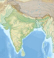
| Map | |||||||||||
| Runways | |||||||||||
| |||||||||||
Pithoragarh Airport, also known as Naini Saini Airport, is in Pithoragarh, Uttarakhand, India. The airport was constructed in 1991 for administrative use and planned for the operations of Dornier 228 type aircraft.[1] The State Government plans to upgrade it to Category 2C airport under Visual flight rules (VFR) conditions to facilitate operations of ATR-72 type of aircraft. Recently the commercial services to the capital city Dehradun and Pantnagar have been started. It is 4.5 kilometers from Pithoragarh city centre.
Airlines and destinations
| Airlines | Destinations |
|---|---|
| Air Heritage | Dehradun, Delhi-Hindon, Pantnagar[2] |
See also
References
- ^ "Executive Summary, Expansion of Naini-Saini airport" (PDF). RITES. October 2012. Retrieved 20 September 2019.
- ^ "Comprehensive list of Awarded RCS Routes state wise" (PDF). Airport Authority of India. Retrieved 5 March 2019.


