Tusura Airstrip
Tools
Actions
General
Print/export
In other projects
Appearance
From Wikipedia, the free encyclopedia
This is an old revision of this page, as edited by Ser Amantio di Nicolao (talk | contribs) at 01:52, 9 March 2020 (add authority control). The present address (URL) is a permanent link to this revision, which may differ significantly from the current revision.
Revision as of 01:52, 9 March 2020 by Ser Amantio di Nicolao (talk | contribs) (add authority control)
Airport in Balangir district, Odisha
Bolangir Airstrip | |||||||||||
|---|---|---|---|---|---|---|---|---|---|---|---|
| Summary | |||||||||||
| Airport type | Public/Private | ||||||||||
| Owner | Government of Odisha | ||||||||||
| Serves | Balangir | ||||||||||
| Location | Tusura, Balangir district, Odisha | ||||||||||
| Elevation AMSL | 656 ft / 200 m | ||||||||||
| Coordinates | 20°30′41″N 83°26′50″E / 20.51139°N 83.44722°E / 20.51139; 83.44722 | ||||||||||
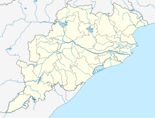
| Map | |||||||||||
 | |||||||||||
| Runways | |||||||||||
| |||||||||||
Bolangir Airstrip (IATA: VE63) is a private/public airstrip located at Tusura in the Balangir district of Odisha. Nearest airport/airstrip to this airstrip is Utkela Airstrip in Bhawanipatna, Odisha.[1]
References
| |||||||||||||||||||||||||||||||||||||||||||||||||||||||||||||||||||||||||||
| |||||||||||||||||||||||||||||||||||||||||||||||||||||||||||||||||||||||||||
| |||||||||||||||||||||||||||||||||||||||||||||||||||||||||||||||||||||||||||
| |||||||||||||||||||||||||||||||||||||||||||||||||||||||||||||||||||||||||||
This article about an airport in India is a stub. You can help Wikipedia by expanding it. |
This article about a location in Bolangir district, Odisha, India is a stub. You can help Wikipedia by expanding it. |
Hidden categories:
- Pages using gadget WikiMiniAtlas
- Use dmy dates from May 2018
- Use Indian English from May 2018
- All Wikipedia articles written in Indian English
- Articles with short description
- Short description is different from Wikidata
- Coordinates on Wikidata
- Infobox mapframe without OSM relation ID on Wikidata
- All stub articles
- Pages using the Kartographer extension


