
Kita-Senju Station
JJ05 TS09 H22 C18 Kita-Senju Station 北千住駅 | ||||||||||||||||||||
|---|---|---|---|---|---|---|---|---|---|---|---|---|---|---|---|---|---|---|---|---|
 The west side of Kita-Senju Station in August 2017 | ||||||||||||||||||||
| General information | ||||||||||||||||||||
| Location | Adachi, Tokyo Japan | |||||||||||||||||||
| Operated by | ||||||||||||||||||||
| Line(s) | ||||||||||||||||||||
| Other information | ||||||||||||||||||||
| Station code | H-22, C-18, 05, TS-09 | |||||||||||||||||||
| History | ||||||||||||||||||||
| Opened | December 25, 1896 (JR East) August 27, 1899 (Tobu Railway) December 20, 1969 (Tokyo Metro) August 24, 2005 (Metropolitan Intercity Railway Company) | |||||||||||||||||||
| Passengers | ||||||||||||||||||||
| JR East, FY2013 | 203,428 daily | |||||||||||||||||||
| Services | ||||||||||||||||||||
| ||||||||||||||||||||
| ||||||||||||||||||||
| ||||||||||||||||||||


Kita-Senju Station (北千住駅, Kitasenju-eki) is a railway station in Adachi, Tokyo, Japan. Kita-Senju is the third-busiest station on the Tokyo Metro network, after Ikebukuro and Otemachi. It is the tenth-busiest JR East station.[1]
Lines
Kita-Senju Station is served by the following lines.
- JR East Joban Line
- Tobu Skytree Line
- Tokyo Metro Chiyoda Line
- Tokyo Metro Hibiya Line
- Tsukuba Express
Station layout
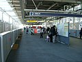
JR East
JR East platforms are on ground level.
| 1-2 | JJ Joban Line (Rapid) | for Matsudo, Toride, Tsuchiura, Ishioka, and Mito ■ Narita Line for Narita |
| 2-3 | JJ Joban Line (Rapid) | for Nippori, Ueno JU Ueno-Tokyo Line for Tokyo and Shinagawa |
-
 North exit of JR Kita-Senju Station, 2019
 -
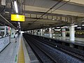 JR East platforms


Tokyo Metro Chiyoda Line
The Chiyoda Line platforms are underground.
| 1 | C Tokyo Metro Chiyoda Line | for Nishi-nippori, Otemachi, and Yoyogi-uehara □ Romancecar for Hakone-Yumoto and Katase-Enoshima |
| 2 | C Tokyo Metro Chiyoda Line | for Ayase JL Jōban Line (Local) for Matsudo, Abiko and Toride |
-
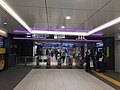
 Tokyo Metro Chiyoda Line ticket gates
 -
 Chiyoda Line platforms with new platform screen doors installed, 2019


Tobu Skytree Line and Tokyo Metro Hibiya Line
Platforms 1 to 4 are located on ground level (the first floor), and platforms 5 to 7 are elevated (the third floor).
| 1, 2 | TS Tobu Skytree Line | Limited Express services for Tōbu Nikkō, Kinugawa-Onsen, Akagi, Kuzū, Ashikagashi, Ōmiya, Ōta, Isesaki, and Tōbu Utsunomiya Other services for Shin-Koshigaya, Tōbu-Dōbutsu-Kōen, Kuki, Tatebayashi and Minami-Kurihashi |
| 3, 4 | TS Tobu Skytree Line | for Oshiage and Asakusa Z Tokyo Metro Hanzomon Line for Ōtemachi, Shibuya DT Tokyu Den-en-toshi Line for Chūō-Rinkan |
| 5 | TS Tobu Skytree Line (Through trains from Tokyo Metro Hibiya Line) | for Takenotsuka, Kita-Koshigaya, Kita-Kasukabe, Tōbu-Dōbutsu-Kōen, and Minami-Kurihashi |
| 6, 7 | H Tokyo Metro Hibiya Line | for Ueno, Ginza, Roppongi, and Naka-Meguro |
-
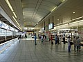
 Central ticket gates, 2016
 -
 North ticket gates, 2018
 -
 Tobu Skytree Line platforms at the first floor, 2016
 -
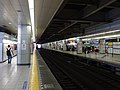
 Tokyo Metro Hibiya Line platforms at the third floor, 2016
 -
 Track diagram for Hibiya Line and Tobu Line


Metropolitan Intercity Railway Company
The Tsukuba Express platforms are elevated.
| 1 | for Minami-Nagareyama, Moriya, and Tsukuba | |
| 2 | for Akihabara |
-
 Tsukuba Express platforms

History

The station opened on 25 December 1896.[2]
From 17 March 2012, station numbering was introduced on all Tobu lines, with Kita-Senju Station becoming "TS-09".[3]
Passenger statistics
In fiscal 2013, the JR East station was used by an average of 203,428 passengers daily (boarding passengers only), making it the tenth-busiest station operated by JR East.[1] In fiscal 2013, the Tokyo Metro Chiyoda station was used by an average of 283,962 passengers per day and the Tokyo Metro Hibiya station was used by an average of 291,466 passengers per day. Note that the latter statistics consider passengers who travel through Kita-Senju station on a through service as users of the station, even if they did not disembark at the station. The Chiyoda Line station is the third-busiest on the Tokyo Metro network which does not offer through services onto other lines.[4] The JR East passenger figures for previous years are as shown below.
| Fiscal year | Daily average |
|---|---|
| 2000 | 183,611[5] |
| 2005 | 177,104[6] |
| 2010 | 195,260[7] |
| 2011 | 194,136[8] |
| 2012 | 198,624[9] |
| 2013 | 203,428[1] |
See also
References
- ^ a b c 各駅の乗車人員 (2013年度) [Station passenger figures (Fiscal 2013)] (in Japanese). Japan: East Japan Railway Company. Archived from the original on 6 May 2001. Retrieved 31 August 2014.
- ^ 日本国有鉄道停車場一覧 [JNR Station Directory]. Japan: Japanese National Railways. 1985. p. 103. ISBN 4-533-00503-9.
- ^ 「東武スカイツリーライン」誕生! あわせて駅ナンバリングを導入し、よりわかりやすくご案内します [Tobu Sky Tree Line created! Station numbering to be introduced at same time] (PDF). Tobu News (in Japanese). Tobu Railway. 9 February 2012. Archived from the original (pdf) on 8 August 2012. Retrieved 27 May 2012.
- ^ 各駅の乗降人員ランキング [Station usage ranking] (in Japanese). Tokyo Metro. Retrieved 31 August 2014.
- ^ 各駅の乗車人員 (2000年度) [Station passenger figures (Fiscal 2000)] (in Japanese). Japan: East Japan Railway Company. Archived from the original on 9 October 2014. Retrieved 1 August 2013.
- ^ 各駅の乗車人員 (2005年度) [Station passenger figures (Fiscal 2005)] (in Japanese). Japan: East Japan Railway Company. Archived from the original on 9 October 2014. Retrieved 1 August 2013.
- ^ 各駅の乗車人員 (2010年度) [Station passenger figures (Fiscal 2010)] (in Japanese). Japan: East Japan Railway Company. Archived from the original on 6 October 2014. Retrieved 1 August 2013.
- ^ 各駅の乗車人員 (2011年度) [Station passenger figures (Fiscal 2011)] (in Japanese). Japan: East Japan Railway Company. Archived from the original on 8 October 2014. Retrieved 1 August 2013.
- ^ 各駅の乗車人員 (2012年度) [Station passenger figures (Fiscal 2012)] (in Japanese). Japan: East Japan Railway Company. Archived from the original on 7 October 2014. Retrieved 31 August 2014.
External links
- JR East station information (in Japanese)
- Tobu station information (in Japanese)
- Tokyo Metro station information (in Japanese)
- Tsukuba Express station information (in Japanese)
| |||||||||||||||||||||||||||||||
