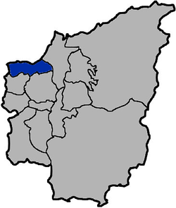
Caotun
Appearance
Caotun Township 草屯鎮 | |
|---|---|
 | |
 Caotun Township in Nantou County | |
| Location | Nantou County, Taiwan |
| Government | |
| • Type | Urban township |
| Area | |
| • Total | 104 km2 (40 sq mi) |
| Population (June 2018) | |
| • Total | 97,477 |
| Caotun Township | |
|---|---|
| Chinese | 草屯鎮 |
| Hanyu Pinyin | Cǎotún Zhèn |
| Wade–Giles | Ts'ao3-t'un2 Chen4 |
| Pha̍k-fa-sṳ | Tshó-thùn-tsṳ́n |
| Hokkien POJ | Chháu-tūn-tìn |
Caotun Township[1] is an urban township in the northwest of Nantou County, Taiwan.[2]
History
The area was historically known as Chháu-ê-tun (草鞋墩) with the present name adopted under Japanese rule in 1920.
Administrative divisions
The township comprises 27 villages: Beishi, Beitou, Bifeng, Bizhou, Duihe, Fuliao, Fuxing, Heping, Jialao, Mingzheng, Nanpu, Pingding, Pinglin, Shanglin, Shanjiao, Shichuan, Shuangdong, Tucheng, Xincuo, Xinfeng, Xinzhuang, Yanfeng, Yufeng, Yushi, Zhongshan, Zhongyuan and Zhongzheng.
Education
Tourist attractions
- Caotun Night Market
- Deng-Ying Academy
- National Taiwan Craft Research Institute
- Taiwan Craft Cultural Park
- Taiwan Times Village
Transportation
The nearest train station to Caotun is the Yuanlin Station of the Taiwan Railway Administration in Changhua County.
Notable natives
- Wu Den-yih, Vice President of the Republic of China (2012-2016)
References
- ^ 臺灣地區鄉鎮市區級以上行政區域名稱中英對照表 Glossary of Names for Administrative Divisions. Ministry of the Interior. 26 March Minguo 104 (2015). Retrieved 30 September 2017. Template:Zh icon
- ^ "Visit Caotun in Beautiful Nantou - Taiwanese Secrets".
External links
Wikimedia Commons has media related to Caotun Township, Nantou.

