
History of the administrative divisions of China before 1912: Difference between revisions
m Updated hatnote per BOTREQ + general fixes using AWB (8008) |
→Government on Taiwan (1949–2005): Adding changes in 1949-2005. Using 10 Dec 1949 (Date Central Government moved to Taipei) as cutoff date. |
||
| Line 675: | Line 675: | ||
After the loss of the [[mainland China|mainland]] to the [[Communist Party of China]] in the [[Chinese Civil War]] and its retreat to [[Taiwan]] in 1949, the [[Kuomintang|Nationalist Party]] continued to regard the Republic of China as the sole legitimate government of [[China]]. The jurisdiction of the Republic was restricted to [[Taiwan]], the [[Pescadores]], and a few islands off [[Fujian]], but the Republic of China has never retracted its claim to mainland China or Mongolia. Accordingly, the official first-order divisions of Republic of China remain the historical divisions of China immediately prior to the loss of mainland China and maps of [[China]] and the world published in Taiwan sometimes show provincial and national boundaries as they were in 1949, ignoring changes made by the [[Communist Party of China|Communist government]] and including [[outer Mongolia|Mongolia]], northern [[Burma]], and [[Tannu Uriankhai]] as part of the Republic. |
After the loss of the [[mainland China|mainland]] to the [[Communist Party of China]] in the [[Chinese Civil War]] and its retreat to [[Taiwan]] in 1949, the [[Kuomintang|Nationalist Party]] continued to regard the Republic of China as the sole legitimate government of [[China]]. The jurisdiction of the Republic was restricted to [[Taiwan]], the [[Pescadores]], and a few islands off [[Fujian]], but the Republic of China has never retracted its claim to mainland China or Mongolia. Accordingly, the official first-order divisions of Republic of China remain the historical divisions of China immediately prior to the loss of mainland China and maps of [[China]] and the world published in Taiwan sometimes show provincial and national boundaries as they were in 1949, ignoring changes made by the [[Communist Party of China|Communist government]] and including [[outer Mongolia|Mongolia]], northern [[Burma]], and [[Tannu Uriankhai]] as part of the Republic. |
||
In 2005, the nominal political divisions of the Republic were 35 [[provinces of China|provinces]], 1 [[special administrative region (Republic of China)|special administrative region]], 2 regions, 14 [[special municipality (Republic of China)|special municipalities]] (adding [[Taipei]] and [[Kaohsiung]] to the original list), 14 leagues, and 4 special banners. For second-order divisions, under provinces and special administrative regions, there are counties, province-controlled cities (56), bureaus (34) and management bureaus (7). Under provincial-level municipalities there are districts, and under leagues there are banners (127). Since 1997, however, most of the Taiwan |
In 2005, the nominal political divisions of the Republic were 35 [[provinces of China|provinces]], 1 [[special administrative region (Republic of China)|special administrative region]], 2 regions, 14 [[special municipality (Republic of China)|special municipalities]] (adding [[Taipei]] and [[Kaohsiung]] to the original list), 14 leagues, and 4 special banners. For second-order divisions, under provinces and special administrative regions, there are counties, province-controlled cities (56), bureaus (34) and management bureaus (7). Under provincial-level municipalities there are districts, and under leagues there are banners (127). Since 1997, however, most of the Taiwan Provincial Government duties and powers have been transferred to the [[government of the Republic of China|national government of the Republic of China]], streamlining provincial administration in favor of counties and provincial cities. |
||
* [[Province]]s (省, ''shěng'') and [[special municipality (Republic of China)|Special Municipalities]] (直轄市, ''zhíxiáshì'') |
* [[Province]]s (省, ''shěng'') and [[special municipality (Republic of China)|Special Municipalities]] (直轄市, ''zhíxiáshì'') |
||
| Line 683: | Line 683: | ||
! colspan="12" style="background: #ffff99;" | '''Changes made to Province-level divisions of the Republic of China between 1949 and 2005''' |
! colspan="12" style="background: #ffff99;" | '''Changes made to Province-level divisions of the Republic of China between 1949 and 2005''' |
||
|- |
|- |
||
!Name!![[Traditional Chinese|Traditional<br>Chinese]]!![[Pinyin]]!!Abbreviation!!Capital!!Capital in Chinese!!rowspan= |
!Name!![[Traditional Chinese|Traditional<br>Chinese]]!![[Pinyin]]!!Abbreviation!!Capital!!Capital in Chinese!!rowspan=16| !!width=450|Notes |
||
|- |
|- |
||
| colspan="6" align="center" style="background: #ffff99;" |'''Provinces''' |
| colspan="6" align="center" style="background: #ffff99;" |'''Provinces''' |
||
| Line 692: | Line 692: | ||
|[[Taiwan Province|Taiwan]]||臺灣||Táiwān||臺 tái||[[Zhongxing New Village]]||中興新村 |
|[[Taiwan Province|Taiwan]]||臺灣||Táiwān||臺 tái||[[Zhongxing New Village]]||中興新村 |
||
|The capital of Taiwan Province was moved to [[Zhongxing Village]] in [[Nantou County]] from [[Taipei]] in the 1960s. |
|The capital of Taiwan Province was moved to [[Zhongxing Village]] in [[Nantou County]] from [[Taipei]] in the 1960s. |
||
|- |
|||
|[[Jiangsu|Kiangsu]]||江蘇||Jiāngsū||蘇 sū||[[Shengsi County]]||嵊泗縣 |
|||
|The government of Kiangsu Province was moved to Shengsi County in 1949. In 1950 the county was conquered by the PLA and the Kiangsu Provincial Government was abolished soon after. |
|||
|- |
|||
|[[Chekiang_Province,_Republic_of_China|Chekiang]]||浙江||Zhèjiāng||浙 zhè||[[Taiwan Province]]||臺灣省 |
|||
|The government of Chekiang Province in Ganlan Township of [[Dinghai County]] was abolished in 1950. In 1951, the provincial government was re-established on the [[Tachen Islands]] of [[Wenling|Wenling County]], later to be moved to [[Taiwan Province]] in 1953. After the loss of the [[Yijiangshan Islands]] during the [[Battle of Yijiangshan Islands]] in 1955, the provincial government was abolished. |
|||
|- |
|||
|[[Sichuan|Szechwan]]||四川||Sìchuān||蜀 shǔ||[[Xichang|Xichang County]]||西昌縣 |
|||
|After the loss of its capital of Chengdu in the December of 1949, the Provincial Government was moved to [[Xichang|Xichang County]] of [[Xikang|Xikang Province]] and remained there until its abolishment in 1950. |
|||
|- |
|||
|[[Xikang|Sikang]]||西康||Xīkāng||康 kāng||[[Xichang|Xichang County]]||西昌縣 |
|||
|The government of Xikang Province was re-established in [[Xichang County]] in Dec. 1949. In 1950, Xichang was taken over by the PLA. |
|||
|- |
|||
|[[Guangdong|Kwangtung]]||廣東||Guǎngdōng||粵 yuè||[[Haikou|Haikou City]]||海口市 |
|||
|The government of Kwangtung Province was moved to [[Haikou|Haikou City]] of [[Hainan]] in 1949 after the loss of its capital [[Guangdong]]. After the loss of Hainan in 1950, the government was subsequently abolished. |
|||
|- |
|||
|[[Yunnan]]||雲南||Yúnnán||滇 diān||[[Bangkok]]||曼谷 |
|||
|The government of Yunnan was moved to [[Bangkok]] in 1950 and abolished in 1951. |
|||
|- |
|||
|[[Xinjiang|Sinkiang]]||新疆||Xīnjiāng||新 xīn||[[Ürümqi|Dihua City]]||迪化市 |
|||
|Provincial Government of Sinkiang was abolished in 1992. |
|||
|- |
|||
| colspan="6" align="center" style="background: #ffff99;" |'''Special Administrative Regions''' |
|||
|- |
|||
|[[Hainan]]||海南||Hǎinán||瓊 qióng||[[Haikou|Haikow]]||海口市 |
|||
|Government abolished in 1950. |
|||
|- |
|- |
||
| colspan="6" align="center" style="background: #ffff99;" |'''Special Municipalities''' |
| colspan="6" align="center" style="background: #ffff99;" |'''Special Municipalities''' |
||
Revision as of 23:18, 20 March 2012
The history of the administrative divisions of China is quite complex. Across history, what is called 'China' has taken many shapes, and many political organizations. For various reasons, both the borders and names of political divisions have changed—sometimes to follow topography, sometimes to weaken former states by dividing them, and sometimes to realize a philosophical or historical ideal. For recent times, the number of recorded tiny changes is quite large; by contrast, the lack of clear, trustworthy data for ancient times forces historians and geographers to draw approximate borders for respective divisions. But thanks to imperial records and geographic descriptions, political divisions may often be redrawn with some precision. Natural changes, such as changes in a river's course (known for the Huang He, but also occurring for others), or loss of data, still make this issue difficult for ancient times. Template:Chinesetext
Summary
| Historical Administrative Divisions in China | ||||
|---|---|---|---|---|
| Dynasty | Primary | Secondary | Tertiary | Quaternary |
| Qin | Commandery (郡, jùn) | County (縣, 县, xiàn) | ||
| Han | Province (州, zhōu) | Commandery | County | |
| Jin | Province (州) | Commandery | County | |
| Sui | "Prefecture" (many smaller 州) | County | ||
| Tang | Circuit (道, dào) | Prefecture (smaller: 州; larger: 府, fǔ) |
County | |
| Song | Circuit (路, lù) | Prefecture (smaller: 州; larger: 府; military: 軍, jūn) |
County | |
| Yuan | Province (省, shěng) | Circuit (道) | Prefecture (smaller: 州; larger: 府) |
|
| Ming | Province (省) | Circuit (道) | Prefecture (smaller: 州; larger: 府) |
County |
| Qing | Province (省) | Circuit (道) | Prefecture (州) | County |
| Republic (pre-1949) |
Province (省) Special Municipality (院轄市, 院辖市, yuànxiáshì) |
Circuit (道) | County Provincial City (省轄市, 省辖市, shěngxiáshì) |
District (區, 区, qū) Urban Township (鎮, 镇, zhèn) Rural Township (鄉, 乡, xiāng) |
Ancient times

Before the establishment of the Qin Dynasty, China was ruled by a network of kings, nobles, and tribes. There was no unified system of administrative divisions. According to ancient texts, China in the Xia and Zhou dynasties consisted of nine zhou, but various texts differ as to the names and even functions of these zhous.
During the Zhou dynasty, the nation was nominally ruled overall by the "Son of Heaven". In reality, however, the country was divided into competing states, each with a hereditary head, variously styled "prince", "duke", or "king". The rivalry of these groups culminated in the Warring States Period, and the state of Qin eventually emerged dominant.
Provinces under the Qin Dynasty
After the state of Qin managed to subdue the rest of China under a unified Qin Dynasty in 221 BC, it designed an administrative hierarchy of two levels:
All of China was divided into commanderies and counties, which were centrally ruled and tightly controlled.
Provinces under the Han and Jin Dynasties

The Han Dynasty initially added a top level of "kingdoms" (王国, wángguó), each headed by a hereditary prince. However, with increasing concerns about the powers of these princes, this quasi-federal structure was gradually abolished and replaced with thirteen provinces (州, zhōu). After the Rebellion of the Seven States, the system was standardized:
Throughout the Han Dynasty, the Three Kingdoms Period, and the Western Jin Dynasty, this system remained intact. This changed, however, with the invasion of tribes from the north, who disrupted the unity of China and set up a variety of governments.
| Provinces of the Han and Western Jin Dynasties | ||||||
|---|---|---|---|---|---|---|
| Name | Traditional Hanzi |
Simplified Hanzi |
Pinyin | Capital | Approximant extent in terms of modern locations | |
| Ancient name | Modern location | |||||
| Bingzhou* | 幷州 | 幷州 | Bīngzhōu | Jinyang | southwest of Taiyuan | Shanxi |
| Jiaozhou* | 交州 | 交州 | Jiāozhōu | Longbian | East of Hanoi | northern Vietnam |
| Jingzhou* | 荆州 | 荆州 | Jīngzhōu | Jiangling | Hubei, Hunan | |
| Jizhou* | 冀州 | 冀州 | Jìzhōu | Xindu | Jizhou, Hebei | southern Hebei |
| Liangzhou* | 涼州 | 凉州 | Liángzhōu | Guzang | Wuwei | western Gansu |
| Qingzhou* | 青州 | 青州 | Qīngzhōu | Linzi | east of Zibo | eastern Shandong |
| Xuzhou* | 徐州 | 徐州 | Xúzhōu | Pengcheng | Xuzhou | northern Jiangsu |
| Yangzhou* | 揚州 | 扬州 | Yángzhōu | Jianye | Nanjing | southern Jiangsu, southern Anhui, Jiangxi, Zhejiang, Fujian, Shanghai |
| Yanzhou* | 兗州 | 兖州 | Yǎnzhōu | Linqiu | northwest of Yuncheng County | western Shandong |
| Yizhou* | 益州 | 益州 | Yìzhōu | Chengdu | central Sichuan, Guizhou | |
| Yongzhou* | 雍州 | 雍州 | Yōngzhōu | Chang'an | northwest of Xi'an | central Shaanxi |
| Youzhou* | 幽州 | 幽州 | Yōuzhōu | Zhuoxian | northern Hebei, Beijing, Tianjin | |
| Yuzhou* | 豫州 | 豫州 | Yùzhōu | Chenxian | Huaiyang | southern Henan, northern Anhui |
| Pingzhou | 平州 | 平州 | Píngzhōu | Xiangping | Liaoyang | Liaoning, northern Korea |
| Qinzhou | 秦州 | 秦州 | Qínzhōu | Jixian | east of Gangu | southern Gansu |
| Liangzhou | 梁州 | 梁州 | Liángzhōu | Nanzheng | Hanzhong | southern Shaanxi, eastern Sichuan, Chongqing |
| Ningzhou | 寧州 | 宁州 | Níngzhōu | Dianchi | southeast of Kunming | Yunnan |
| Guangzhou | 廣州 | 广州 | Guǎngzhōu | Panyu | Guangzhou | Guangdong, eastern Guangxi |
| Sizhou | 司州 | 司州 | Sīzhōu | Luoyang | central Henan, southern Shanxi | |
* One of the original provinces established during the Eastern Han Dynasty.
Ping was formed out of You; Qin out of Liang (凉); Liang (梁) and Ning out of Yi; and Guang out of Jiao. Jiao had been established from a territory called Jiaozhi (交趾); Si too was a new creation, its territory formerly administered by a metropolitan commandant (司隷校尉, Sīlì xiàowèi) with capacities similar to the provincial governors'. Shuofang (朔方, Shuòfāng), a similar territory in northern Shaanxi, was merged into Bing rather than becoming a full province in its own right.
Provinces under Sui Dynasty

By the time unity was finally reestablished by the Sui Dynasty, the provinces had been divided and redivided so many times by different governments that they were almost the same size as commanderies, rendering the two-tier system superfluous. As such, the Sui merged the two together. In English, this merged level is translated as "prefectures". In Chinese, the name changed between zhou and jun several times before being finally settled on zhou. Based on the apocryphal Nine Province system, the Sui restored nine zhou.[1]
The Sui had 9 provinces, 190 prefectures, 1,225 counties, and about nine million registered households or approximately fifty million people.[2]
| Provinces of the Sui Dynasty | ||||||
|---|---|---|---|---|---|---|
| Name | Traditional Hanzi |
Simplified Hanzi |
Pinyin | Capital | Approximate extent in terms of modern locations | |
| Ancient name | Modern location | |||||
| Yongzhou | 雍州 | 雍州 | Yōngzhōu | ? | ? | ? |
| Jizhou | 冀州 | 冀州 | Jìzhōu | ? | ? | ? |
| Yanzhou | 兗州 | 兖州 | Yǎnzhōu | ? | ? | ? |
| Qingzhou | 青州 | 青州 | Qīngzhōu | ? | ? | ? |
| Yuzhou | 豫州 | 豫州 | Yùzhōu | ? | ? | ? |
| Xuzhou | 徐州 | 徐州 | Xúzhōu | ? | ? | ? |
| Liangzhou | 梁州 | 梁州 | Liángzhōu | ? | ? | ? |
| Jingzhou | 荆州 | 荆州 | Jīngzhōu | ? | ? | ? |
| Yangzhou | 揚州 | 扬州 | Yángzhōu | ? | ? | ? |
Provinces under the Tang Dynasty

Emperor Taizong (r. 626−649) set up 10 "circuits" (道, dào) in 627 as a new primary level of administration. The enormity of these circuits, however, originally left them more descriptive than practical, the prefecture remaining the true, human-manageable administrative division.[citation needed] In 639, there were 10 circuits, 43 commanderies (都督府, dūdū fǔ), and 358 prefectures (州 and later 府, fǔ).[3] Emperor Xuanzong added five more circuits before 733.
The Tang Dynasty also created military districts (藩鎮, fānzhèn) controlled by military commissioners (節都使, jiédōushǐ) charged with protecting frontier areas susceptible to foreign attack (similar to the Western marches and marcher lords). This system was eventually generalized to other parts of the country as well and essentially merged into the circuits. Just as in the West, the greater autonomy and strength of the commissioners permitted insubordination and rebellion, which in China led to the Five Dynasties and Ten Kingdoms Period.
- Circuits and Military Districts
- Commanderies and Prefectures
- Counties
| Circuits of the Tang Dynasty | |||||||
|---|---|---|---|---|---|---|---|
| Name | Traditional Hanzi |
Simplified Hanzi |
Pinyin | Capital | Approximate extent in terms of modern locations | ||
| Ancient name | Modern location | ||||||
| Duji* | 都畿 | 都畿 | Dūjī | Henan Fu | Luoyang | Luoyang and environs | |
| Guannei | 關內 | 关内 | Guānnèi | Jingzhao Fu | Xi'an | northern Shaanxi, central Inner Mongolia, Ningxia | |
| Hebei | 河北 | 河北 | Héběi | Weizhou | Wei County, Hebei | Hebei | |
| Hedong | 河東 | 河东 | Hédōng | Puzhou | Puzhou, Yongji, Shanxi | Shanxi | |
| Henan | 河南 | 河南 | Hénán | Bianzhou | Kaifeng | Henan, Shandong, northern Jiangsu, northern Anhui | |
| Huainan | 淮南 | 淮南 | Huáinán | Yangzhou | central Jiangsu, central Anhui | ||
| Jiannan | 劍南 | 剑南 | Jiànnán | Yizhou | Chengdu | central Sichuan, central Yunnan | |
| Jiangnan | 江南 | 江南 | Jiāngnán | Jiangnanxi + Jiangnandong (see map) | |||
| Jiangnanxi** | 江南西 | 江南西 | Jiāngnánxī | Hongzhou | Nanchang | Jiangxi, Hunan, southern Anhui, southern Hubei | |
| Jiangnandong** | 江南東 | 江南东 | Jiāngnándōng | Suzhou | southern Jiangsu, Zhejiang, Fujian, Shanghai | ||
| Jingji* | 京畿 | 京畿 | Jīngjī | Jingzhao Fu | Xi'an | Xi'an and environs | |
| Lingnan | 嶺南 | 岭南 | Lǐngnán | Guangzhou | Guangdong, eastern Guangxi, northern Vietnam | ||
| Longyou | 隴右 | 陇右 | Lǒngyou | Shanzhou | Ledu County, Qinghai | Gansu | |
| Qianzhong* | 黔中 | 黔中 | Qiánzhōng | Qianzhou | Pengshui | Guizhou, western Hunan | |
| Shannan | 山南 | 山南 | Shānnán | Shannanxi + Shannandong (see map) | |||
| Shannanxi** | 山南西 | 山南西 | Shānnánxī | Liangzhou | Hanzhong | southern Shanxi, eastern Sichuan, Chongqing | |
| Shannandong** | 山南東 | 山南东 | Shānnándōng | Xiangzhou | Xiangfan | southern Henan, Hubei | |
* Circuits established under Xuanzong, as opposed to Taizong's original ten circuits.
** Circuits established under Xuanzong by dividing Taizong's Jiangnan and Shannan circuits into an eastern and a western circuit.
Other Tang-era circuits include the West Lingnan, Wu'an, and Qinhua circuits.
Provinces under the Song Dynasty
The Song Dynasty abolished the commissioners and renamed their circuits 路 (lù, which however is still usually translated into English as "circuits"). They also added a number of "army" prefectures (軍, jūn).
- Circuits (路, lù)
- Prefectures (larger: 府, fǔ; smaller: 州, zhōu; military: 軍, jūn)
- Counties
| Circuits of the Northern Song Dynasty | ||||||
|---|---|---|---|---|---|---|
| Name | Traditional Hanzi |
Simplified Hanzi |
Pinyin | Capital | Approximant extent in terms of modern locations | |
| Ancient name | Modern location | |||||
| Chengdufu | 成都府 | 成都府 | Chéngdūfǔ | Chengdu | central Sichuan | |
| Fujian | 福建 | 福建 | Fújiàn | Fuzhou | Fujian | |
| Guangnandong | 廣南東 | 广南东 | Guǎngnándōng | Guangzhou | eastern Guangdong | |
| Guangnanxi | 廣南西 | 广南西 | Guǎngnánxī | Guizhou | Guilin | western Guangdong, Guangxi, Hainan |
| Hebeidong | 河北東 | 河北东 | Héběidōng | Beijing | Daming County, Hebei | eastern Hebei |
| Hebeixi | 河北西 | 河北西 | Héběixī | Zhending | Zhengding County, Hebei | western Hebei |
| Hedong | 河東 | 河东 | Hédōng | Taiyuan | Shanxi | |
| Huainandong | 淮南東 | 淮南东 | Huáinándōng | Yangzhou | central Jiangsu | |
| Huainanxi | 淮南西 | 淮南西 | Huáinánxī | Shouzhou | Fengtai County, Anhui | central Anhui |
| Jiangnandong | 江南東 | 江南东 | Jiāngnándōng | Jiangning Fu | Nanjing | southern Anhui |
| Jiangnanxi | 江南西 | 江南西 | Jiāngnánxī | Hongzhou | Nanchang | Jiangxi |
| Jingdongdong | 京東東 | 江东东 | Jīngdōngdōng | Qingzhou | Qingzhou, Shandong | eastern Shandong |
| Jingdongxi | 京東西 | 江东西 | Jīngdōngxī | Nanjing | south of Shangqiu, Henan | western Shandong |
| Jinghubei | 荊湖北 | 荆湖北 | Jīnghúběi | Jiangling | Hubei, western Hunan | |
| Jinghunan | 荊湖南 | 荊湖南 | Jīnghúnán | Tanzhou | Changsha | Hunan |
| Jingji | 京畿 | 京畿 | Jīngjī | Chenliu | Chenliu, Kaifeng, Henan | Kaifeng and environs |
| Jingxibei | 京西北 | 京西北 | Jīngxīběi | Xijing | Luoyang | central Henan |
| Jingxinan | 京西南 | 京西南 | Jīngxīnán | Xiangzhou | Xiangfan | southern Henan, northern Hubei |
| Kuizhou | 夔州 | 夔州 | Kuízhōu | Kuizhou | Fengjie County, Chongqing | Chongqing, eastern Sichuan, Guizhou |
| Liangzhe | 兩浙 | 两浙 | Liǎngzhè | Hangzhou | Zhejiang, southern Jiangsu, Shanghai | |
| Lizhou | 利州 | 利州 | Lìzhōu | Xingyuan | Hanzhong | northern Sichuan, southern Shaanxi |
| Qinfeng | 秦鳳 | 秦凤 | Qínfèng | Qinzhou | Tianshui | southern Gansu |
| Yongxingjun | 永興軍 | 永兴军 | Yǒngxīngjūn | Jingzhao | Xi'an | Shaanxi |
| Zizhou | 梓州 | 梓州 | Zǐzhōu | Zizhou | Santai County, Sichuan | central southern Sichuan |
Provinces under the Jin and Southern Song Dynasties
The Jurchens invaded China proper in the 12th century. In 1142, peace was formalized between the Jurchen Jin Dynasty and the Southern Song Dynasty, which was forced to cede all of North China to the Jurchens.
By the beginning of the 13th century, the Jurchens had moved their capital to Zhongdu (modern Beijing) and had adopted Chinese administrative structures. The Song Dynasty also maintained the same structure over the southern half of China that they continued to govern.
| Circuits of China under the Jurchen Jin Dynasty and the Southern Song Dynasty | ||||||
|---|---|---|---|---|---|---|
| Name | Traditional Hanzi |
Simplified Hanzi |
Pinyin | Capital | Approximant extent in terms of modern locations | |
| Ancient name | Modern location | |||||
| Jin Dynasty | ||||||
| Beijing | 北京 | 北京 | Běijīng | Beijing | Ningcheng County, Inner Mongolia | eastern Manchuria |
| Damingfu | 大名府 | 大名府 | Dàmíngfǔ | Daming Fu | Daming County, Hebei | border of Henan, Hebei, Shandong |
| Dongjing | 東京 | 东京 | Dōngjīng | Dongjing | Liaoyang | Liaoning |
| Fengxiang | 鳳翔 | 凤翔 | Fèngxiáng | Fengxiang Fu | Fengxiang County, Shaanxi | western Shaanxi, eastern Gansu |
| Fuyan | 鄜延 | 鄜延 | Fūyán | Yan'an | northern Shaanxi | |
| Hebeidong | 河北東 | 河北东 | Héběidōng | Hejian | Hejian, Hebei | eastern Hebei |
| Hebeixi | 河北西 | 河北西 | Héběixī | Zhending | Zhengding County, Hebei | western Hebei |
| Hedongbei | 河東北 | 河东北 | Hédōngběi | Taiyuan | northern Shanxi | |
| Hedongnan | 河東南 | 河东南 | Hédōngnán | Pingyang | Linfen | southern Shanxi |
| Jingzhaofu | 京兆府 | 京兆府 | Jīngzhàofǔ | Jingzhao Fu | Xi'an | central Shaanxi |
| Lintao | 臨洮 | 临洮 | Líntáo | Lintao | Lintao County, Gansu | southern Gansu |
| Nanjing | 南京 | 南京 | Nánjīng | Nanjing | Kaifeng | Henan, northern Anhui |
| Qingyuan | 慶原 | 庆原 | Qìngyuán | Qingyang | eastern Gansu | |
| Shandongdong | 山東東 | 山东东 | Shāndōngdōng | Yidu Fu | Qingzhou, Shandong | eastern Shandong |
| Shandongxi | 山東西 | 山东西 | Shāndōngxī | Dongping Fu | Dongping County, Shandong | western Shandong |
| Shangjing | 上京 | 上京 | Shàngjīng | Shangjing | Acheng, Heilongjiang | northern Manchuria |
| Xianping | 咸平 | 咸平 | Xiánpíng | Xianping Fu | Kaiyuan, Liaoning | northern Liaoning |
| Xijing | 西京 | 西京 | Xījīng | Xijing | Datong | northern Shanxi, central Inner Mongolia |
| Zhongdu | 中都 | 中都 | Zhōngdū | Zhongdu | Beijing | northern Hebei, Beijing, Tianjin |
| Southern Song Dynasty | ||||||
| Chengdufu | 成都府 | 成都府 | Chéngdūfǔ | Chengdu | central Sichuan | |
| Fujian | 福建 | 福建 | Fújiàn | Fuzhou | Fujian | |
| Guangnandong | 廣南東 | 广南东 | Guǎngnándōng | Guangzhou | eastern Guangdong | |
| Guangnanxi | 廣南西 | 广南西 | Guǎngnánxī | Jingjiang Fu | Guilin | western Guangdong, Guangxi, Hainan |
| Huainandong | 淮南東 | 淮南东 | Huáinándōng | Yangzhou | central Jiangsu | |
| Huainanxi | 淮南西 | 淮南西 | Huáinánxī | Luzhou | Hefei | central Anhui |
| Jiangnandong | 江南東 | 江南东 | Jiāngnándōng | Jiangning Fu | Nanjing | southern Anhui |
| Jiangnanxi | 江南西 | 江南 | Jiāngnánxī | Longxing Fu | Nanchang | Jiangxi |
| Jinghubei | 荊湖北 | 荊湖北 | Jīnghúběi | Jiangling | Hubei, western Hunan | |
| Jinghunan | 荊湖南 | 荊湖南 | Jīnghúnán | Tanzhou | Changsha | Hunan |
| Jingxinan | 京西南 | 京西南 | Jīngxīnán | Xiangyang Fu | Xiangfan | southern Henan, northern Hubei |
| Kuizhou | 夔州 | 夔州 | Kuízhōu | Kuizhou | Fengjie County, Chongqing | Chongqing, eastern Sichuan, Guizhou |
| Liangzhedong | 兩浙東 | 兩浙东 | Liǎngzhèdōng | Shaoxing | central and southern Zhejiang | |
| Liangzhexi | 兩浙西 | 兩浙西 | Liǎngzhèxī | Hangzhou | northern Zhejiang, southern Jiangsu, Shanghai | |
| Lizhoudong | 利州東 | 利州东 | Lìzhōudōng | Xingyuan | Hanzhong | northern Sichuan, southern Shaanxi |
| Lizhouxi | 利州西 | 利州西 | Lìzhōuxī | Mianzhou | Lueyang, Shaanxi | northern Sichuan, southern Gansu |
| Tongchuanfu | 潼川府 | 潼川府 | Tóngchuānfǔ | Luzhou | central southern Sichuan | |
Provinces under the Yuan Dynasty
The Mongols, who succeeded in subjugating all of China under the Yuan Dynasty in 1279, introduced the precursors to the modern provinces as a new primary administrative level:
- Provinces (行中書省, xíngzhōngshūshěng)
- Circuits (道, dào)
- Prefectures (larger: 府, fǔ; smaller: 州, zhōu)
- Counties
| Provinces of the Mongol Yuan Dynasty | ||||||
|---|---|---|---|---|---|---|
| Name | Traditional Hanzi |
Simplified Hanzi |
Pinyin | Capital | Approximant extent in terms of modern locations | |
| Ancient name | Modern location | |||||
| Gansu | 甘肅 | 甘肃 | Gānsù | Ganzhou | Zhangye | Gansu, Ningxia |
| Huguang | 湖廣 | 湖广 | Huguǎng | Wuchang | Hunan, western Guangdong, Guangxi, Guizhou, Hainan | |
| Henanjiangbei | 河南江北 | 河南江北 | Hénánjiāngběi | Bianliang | Kaifeng | Henan, northern Hubei, northern Jiangsu, northern Anhui |
| Jiangxi | 江西 | 江西 | Jiāngxī | Longxing | Nanchang | Jiangxi, eastern Guangdong |
| Jiangzhe | 江浙 | 江浙 | Jiāngzhè | Hangzhou | Zhejiang, southern Jiangsu, southern Anhui, Fujian | |
| Liaoyang | 遼陽 | 辽阳 | Liáoyáng | Liaoyang | Manchuria | |
| Lingbei | 嶺北 | 岭北 | Lǐngběi | Helin | Kharkhorin (Karakorum) | Mongolia, northern Inner Mongolia |
| Shaanxi | 陝西 | 陝西 | Shǎnxi | Fengyuan | Xi'an | Shaanxi |
| Sichuan | 四川 | 四川 | Sìchuān | Chengdu | eastern and central Sichuan | |
| Yunnan | 雲南 | 云南 | Yúnnán | Zhongqing | Kunming | Yunnan |
The area around the capital, corresponding to modern Hebei, Shandong, Shanxi, central Inner Mongolia, Beijing, and Tianjin, was called the Central Region (腹裏) and not put into any province, but was directly controlled by the Secretariat (中書省).
Provinces under the Ming Dynasties
The Ming Dynasty continued with this system and had provinces that were almost exactly the same as those in modern China proper. The differences were Huguang had not yet been split into Hubei and Hunan; Gansu and Ningxia were still part of Shaanxi; Anhui and Jiangsu were together as South Zhili; portions of what are today the provinces of Hebei, Beijing, and Tianjin were part of the province of North Zhili; and Hainan, Shanghai, and Chongqing were still parts of their original provinces at this time.) This makes for a total of 15 provinces.
| Provinces of the Ming Dynasty | |||||||
|---|---|---|---|---|---|---|---|
| Name | Traditional Hanzi |
Simplified Hanzi |
Pinyin | Capital | Traditional Hanzi |
Simplified Hanzi |
Modern divisions |
| North Zhili | 北直隸 | 北直隶 | Běizhílì | Shuntian (Beijing) | 順天府(北京) | 顺天府(北京) | Beijing, Hebei, Tianjin |
| South Zhili | 南直隸 | 南直隶 | Nánzhílì | Yingtian (Nanjing) | 應天府(南京) | 应天府(南京) | Anhui, Jiangsu, Shanghai |
| Fujian | 福建 | 福建 | Fújiàn | Fuzhou (Fuzhou) | 福州府 | 福州府 | |
| Guangdong | 廣東 | 广东 | Guǎngdōng | Guangzhou (Guangzhou) | 廣州府 | 广州府 | Guangdong, Hainan |
| Guangxi | 廣西 | 广西 | Guǎngxī | Guilin (Guilin) | 桂林府 | 桂林府 | |
| Guizhou | 貴州 | 贵州 | Guìzhōu | Guiyang (Guiyang) | 貴陽府 | 贵阳府 | |
| Henan | 河南 | 河南 | Hénán | Kaifeng (Kaifeng) | 開封府 | 开封府 | |
| Huguang | 湖廣 | 湖广 | Húguǎng | Wuchang (Wuhan) | 武昌府(武漢) | 武昌府(武汉) | Hubei, Hunan |
| Jiangxi | 江西 | 江西 | Jiāngxī | Nanchang (Nanchang) | 南昌府 | 南昌府 | |
| Shaanxi | 陝西 | 陝西 | Shǎnxī | Xi'an (Xi'an) | 西安府 | 西安府 | Gansu, Ningxia, Shaanxi |
| Shandong | 山東 | 山东 | Shāndōng | Jinan (Jinan) | 濟南府 | 济南府 | |
| Shanxi | 山西 | 山西 | Shānxī | Taiyuan (Taiyuan) | 太原府 | 太原府 | |
| Sichuan | 四川 | 四川 | Sìchuān | Chengdu (Chengdu) | 成都府 | 成都府 | Chongqing, Sichuan |
| Yunnan | 雲南 | 云南 | Yúnnán | Yunnan (Kunming) | 雲南府(昆明) | 云南府(昆明) | |
| Zhejiang | 浙江 | 浙江 | Zhèjiāng | Hangzhou (Hangzhou) | 杭州府 | 杭州府 | |
Provinces and Protectorates under the Qing Dynasties

In 1644, China fell to the Manchus, who established the Qing Dynasty, the last dynasty of China. The Qing government applied the following system over China proper:
- Provinces (省, shěng)
- Circuits (道, dào)
- Prefectures (府, fǔ), Independent Departments (直隸州, zhílìzhōu), and Independent Subprefectures (直隸廳, zhílìtīng)
- Counties (縣, 县, xiàn), Departments (散州, sànzhōu), Subprefectures (散廳, sàntīng)
The Qing split Shaanxi into Shaanxi and Gansu, Huguang into Hubei and Hunan, and South Zhili into Jiangsu and Anhui. Hebei was now called Zhili rather than North Zhili. These provinces are now nearly identical to modern ones. Collectively they are called the "Eighteen Provinces", a concept that endured for several centuries as synonymous to China proper.
This system applied only to China proper, with the rest of the empire under differently systems. Manchuria, Xinjiang, and Outer Mongolia were ruled by military generals assigned by the Lifan Yuan, while Inner Mongolia was organized into leagues. The Qing court put Amdo under their direct control and organized it as Qinghai and also sent imperial commissioners to Tibet (Ü-Tsang and western Kham, approximately the area of the present-day Tibet Autonomous Region) to oversee its affairs.
In the late 19th century, Xinjiang and Taiwan were both set up as provinces. However, Taiwan was ceded to Imperial Japan after the First Sino-Japanese War in 1895. Near the end of the dynasty, Manchuria was also reorganized into three more provinces (Fengtian, Jilin, Heilongjiang), bringing the total number to twenty-two. In 1906, the first romanization system of Mandarin Chinese, Chinese Postal Map Romanization, was officially sanctioned by the Imperial Postal Joint-Session Conference, which showed in the following table.
| Provinces of the Qing Dynasty (1911) | |||||||
|---|---|---|---|---|---|---|---|
| Period Name (Current Name) | Traditional Chinese |
Simplified Chinese |
Pinyin | Abbreviation | Capital | Traditional Chinese |
Simplified Chinese |
| China proper | |||||||
| Anhwei (Anhui) | 安徽 | 安徽 | Ānhuī | 皖 wǎn | Anching (Anqing) | 安慶 | 安庆 |
| Chekiang (Zhejiang) | 浙江 | 浙江 | Zhèjiāng | 浙 zhè | Hangchow (Hangzhou) | 杭州 | 杭州 |
| Chihli (Zhili) | 直隸 | 直隶 | Zhílì | 直 zhí | Paoting (Baoding) | 保定 | 保定 |
| Fukien (Fujian) | 福建 | 福建 | Fújiàn | 閩 mǐn | Foochow (Fuzhou) | 福州 | 福州 |
| Honan (Henan) | 河南 | 河南 | Hénán | 豫 yù | Kaifeng (Kaifeng) | 開封 | 开封 |
| Hupeh (Hubei) | 湖北 | 湖北 | Húběi | 鄂 è | Wuchang (Wuchang) | 武昌 | 武昌 |
| Hunan (Hunan) | 湖南 | 湖南 | Húnán | 湘 xiāng | Changsha (Changsha) | 長沙 | 长沙 |
| Kansu (Gansu) | 甘肅 | 甘肃 | Gānsù | 甘 gān or 隴 lǒng | Lanchow (Lanzhou) | 蘭州 | 兰州 |
| Kiangsu (Jiangsu) | 江蘇 | 江苏 | Jiāngsū | 蘇 sū | Kiangning (Nanjing) Soochow (Suzhou) |
江寧(南京) 蘇州 |
江宁(南京) 苏州 |
| Kiangsi (Jiangxi) | 江西 | 江西 | Jiāngxī | 贛 gàn | Nanchang (Nanchang) | 南昌 | 南昌 |
| Kwangtung (Guangdong) | 廣東 | 广东 | Guǎngdōng | 粵 yuè | Canton (Guangzhou) | 廣州 | 广州 |
| Kwangsi (Guangxi) | 廣西 | 广西 | Guǎngxī | 桂 guì | Kweilin (Guilin) | 桂林 | 桂林 |
| Kweichow (Guizhou) | 貴州 | 贵州 | Guìzhōu | 黔 qián or 貴 guì | Kweiyang (Guiyang) | 貴陽 | 贵阳 |
| Shansi (Shanxi) | 山西 | 山西 | Shānxī | 晉 jìn | Taiyuan (Taiyuan) | 太原 | 太原 |
| Shantung (Shandong) | 山東 | 山东 | Shāndōng | 魯 lǔ | Tsinan (Jinan) | 濟南 | 济南 |
| Shensi (Shaanxi) | 陝西 | 陝西 | Shǎnxī | 陝 shǎn or 秦 qín | Sian (Xi'an) | 西安 | 西安 |
| Szechwan (Sichuan) | 四川 | 四川 | Sìchuān | 川 chuān or 蜀 shǔ | Chengtu (Chengdu) | 成都 | 成都 |
| Yunnan (Yunnan) | 雲南 | 云南 | Yúnnán | 滇 diān or 雲 yún | Yunnan (Kunming) | 雲南(昆明) | 云南(昆明) |
| Manchuria (1907 incorporated into China proper) | |||||||
| Fengtien (Fengtian) | 奉天 | 奉天 | Fèngtiān | 奉 fèng | Mukden (Shenyang) | 盛京(瀋陽) | 盛京(沈阳) |
| Heilungkiang (Heilongjiang) | 黑龍江 | 黑龙江 | Hēilóngjiāng | 黑 hēi | Tsitsihar (Qiqihar) | 齊齊哈爾 | 齐齐哈尔 |
| Kirin (Jilin) | 吉林 | 吉林 | Jílín | 吉 jí | Kirin (Jilin) | 吉林 | 吉林 |
| Sinkiang (1884 incorporated into China proper) | |||||||
| Sinkiang (Xinjiang) | 新疆 | 新疆 | Xīnjiāng | 新 xīn or 疆 jiāng | Tihwa (Urumqi) | 迪化(烏魯木齊) | 迪化(乌鲁木齐) |
| Protectorates of the Qing Dynasty | ||||||||
|---|---|---|---|---|---|---|---|---|
| Period Name (Current Name) | Traditional Chinese |
Simplified Chinese |
Pinyin | Abbreviation | Capital | Traditional Chinese |
Simplified Chinese | |
| Tibet (Tibet) | 西藏 | 西藏 | Xīzàng | 藏 zàng | Lhasa (Lhasa) | 喇薩(拉薩) | 喇萨(拉萨) | |
| Tsinghai (Qinghai) | 青海 | 青海 | Qīnghǎi | 青 qīng | Sining (Xining) | 西寧 | 西宁 | |
| Uliastai (Mongolia) | 烏里雅蘇臺(蒙古) | 乌里雅苏台(蒙古) | Wūlǐyǎsūtái (Ménggǔ) | — | Uliastai (Uliastai) | 烏里雅蘇臺 | 乌里雅苏台 | |
| Altay (Altay) | 阿爾泰 | 阿尔泰 | Āĕrtài | — | Chenghua Temple (Altay) | 承化寺(阿勒泰) | 承化寺(阿勒泰) | |
| Inner Mongolia | 内蒙古 | 内蒙古 | Nèi Měnggǔ | None (The divisions below are direct administered by Lifan Yuan) | ||||
| Jirim (Tongliao) | 哲里木盟(通遼) | 哲里木盟(通辽) | Zhélǐmù | ? | ? | ? | ? | |
| Josutu (part of Chifeng) | 卓索圖盟 | 卓索图盟 | Zhuósuǒtú | ? | ? | ? | ? | |
| Yekejuu (Ordos) | 伊克昭盟(鄂尔多斯) | 伊克昭盟(鄂尔多斯) | Yīkèzhāo | ? | ? | ? | ? | |
| Juuuda (Chifeng) | 昭烏達盟(赤峰) | 昭乌达盟(赤峰) | Zhāowūdá | ? | ? | ? | ? | |
| Xilingol | 錫林郭勒盟 | 锡林郭勒盟 | Xīlínguōlè | ? | Xilinhot | 錫林浩特 | 锡林浩特 | |
| Ulanqab | 烏蘭察布盟 | 乌兰察布盟 | Wūlánchábù | ? | ? | ? | ? | |
| Chahar (part of Xilingol) | 察哈爾 | 察哈尔 | Cháhā'ěr | ? | Kalgan (Zhangjiakou) | 喀拉幹(張家口) | 喀拉干(张家口) | |
| Alxa | 阿拉善厄魯特旗 | 阿拉善厄鲁特旗 | Ālāshàn'èlŭtè | ? | Bayanhot | 定遠營 | 定远营 | |
| Ejin (Ejin Banner) | 額濟納土爾扈特旗 | 额济纳土尔扈特旗 | Éjìnàtŭĕrhùtè | ? | ? | ? | ? | |
Republic of China
Mainland Era (1912–1949)


The Republic of China streamlined the system down to three levels:
Circuits were then abolished in 1928 as being superfluous. However, this reform was soon found to be unfeasible since the average province now had 50+ counties and some more than a hundred. As a result, some provinces were later subdivided into several prefectures.
The Republic of China set up four more provinces out of Inner Mongolia and the surrounding areas (Ningxia, Suiyuan, Chahar, Jehol) and two others out of parts of historical Tibet (Xikang out of Kham and Qinghai out of Amdo; Ü-Tsang was the Dalai Lama's realm at this time and not part of any province), bringing the total number of provinces up to 28. The Republic of China also began setting up municipalities, cities directly administered by the central government. More levels began to be added below the county, townships for instance.
The creation of the puppet state Manchukuo by Japan in the 1930s deprived China of 4 provinces in the northeast (Fengtian, Jilin, Heilongjiang, Jehol). After the defeat of Japan in 1945, Manchuria was reincorporated into China as nine provinces. Taiwan and the Pescadores were also returned to China and organized into Taiwan Province. By this time there was a total of thirty-five provinces, twelve municipalities (院轄市, yuànxiáshì), one special administrative region (特別行政區, tèbié xíngzhèngqǖ), and two regions (地方, difāng) as first-level divisions under the Republic of China.
| Provinces and Equivalents of the Republic of China (1949)[4] | |||||
|---|---|---|---|---|---|
| Period Name (Current Name) | Traditional Chinese |
Pinyin | Abbreviation | Capital | Chinese |
| Provinces | |||||
| Antung (Andong) | 安東 | Āndōng | 安 ān | Tunghwa (Tonghua) | 通化 |
| Anhwei (Anhui) | 安徽 | Ānhuī | 皖 wǎn | Hofei (Hefei) | 合肥 |
| Chahar (Chahar) | 察哈爾 | Cháhār | 察 chá | Changyuan (Zhangjiakou) | 張垣(張家口) |
| Chekiang (Zhejiang) | 浙江 | Zhèjiāng | 浙 zhè | Hangchow (Hangzhou) | 杭州 |
| Fukien (Fujian) | 福建 | Fújiàn | 閩 mǐn | Foochow (Fuzhou) | 福州 |
| Hopeh (Hebei) | 河北 | Héběi | 冀 jì | Tsingyuan (Baoding) | 清苑(保定) |
| Heilungkiang (Heilongjiang) | 黑龍江 | Hēilóngjiāng | 黑 hēi | Peian (Bei'an) | 北安 |
| Hokiang (Hejiang) | 合江 | Héjiāng | 合 hé | Chiamussu (Jiamusi) | 佳木斯 |
| Honan (Henan) | 河南 | Hénán | 豫 yù | Kaifeng (Kaifeng) | 開封 |
| Hupeh (Hubei) | 湖北 | Húběi | 鄂 è | Wuchang (Wuchang) | 武昌 |
| Hunan (Hunan) | 湖南 | Húnán | 湘 xiāng | Changsha (Changsha) | 長沙 |
| Hsingan (Xing'an) | 興安 | Xīng'ān | 興 xīng | Hailar (Hulunbuir) | 海拉爾(呼倫貝爾) |
| Jehol (Rehe) | 熱河 | Rèhé | 熱 rè | Chengteh (Chengde) | 承德 |
| Kansu (Gansu) | 甘肅 | Gānsù | 隴 lǒng | Lanchow (Lanzhou) | 蘭州 |
| Kiangsu (Jiangsu) | 江蘇 | Jiāngsū | 蘇 sū | Chingkiang (Zhenjiang) | 鎮江 |
| Kiangsi (Jiangxi) | 江西 | Jiāngxī | 贛 gàn | Nanchang (Nanchang) | 南昌 |
| Kirin (Jilin) | 吉林 | Jílín | 吉 jí | Kirin (Jilin) | 吉林 |
| Kwangtung (Guangdong) | 廣東 | Guǎngdōng | 粵 yuè | Canton (Guangzhou) | 廣州 |
| Kwangsi (Guangxi) | 廣西 | Guǎngxī | 桂 guì | Kweilin (Guilin) | 桂林 |
| Kweichow (Guizhou) | 貴州 | Guìzhōu | 黔 qián | Kweiyang (Guiyang) | 貴陽 |
| Liaopeh (Liaobei) | 遼北 | Liáoběi | 洮 táo | Liaoyuan (Liaoyuan) | 遼源 |
| Liaoning (Liaoning) | 遼寧 | Liáoníng | 遼 liáo | Shenyang (Shenyang) | 瀋陽 |
| Ningsia (Ningxia) | 寧夏 | Níngxià | 寧 níng | Yinchuan (Yinchuan) | 銀川 |
| Nunkiang (Nenjiang) | 嫩江 | Nènjiāng | 嫩 nèn | Tsitsihar (Qiqihar) | 齊齊哈爾 |
| Shansi (Shanxi) | 山西 | Shānxī | 晉 jìn | Taiyuan (Taiyuan) | 太原 |
| Shantung (Shandong) | 山東 | Shāndōng | 魯 lǔ | Tsinan (Jinan) | 濟南 |
| Shensi (Shaanxi) | 陝西 | Shǎnxī | 陝 shǎn | Sian (Xi'an) | 西安 |
| Sikang (Xikang) | 西康 | Xīkāng | 康 kāng | Kangting (Kangding) | 康定 |
| Sinkiang (Xinjiang) | 新疆 | Xīnjiāng | 新 xīn | Tihwa (Urumqi) | 迪化(烏魯木齊) |
| Suiyuan (Suiyuan) | 綏遠 | Suīyuǎn | 綏 suī | Kweisui (Hohhot) | 歸綏(呼和浩特) |
| Sungkiang (Songjiang) | 松江 | Sōngjiāng | 松 sōng | Mutankiang (Mudanjiang) | 牡丹江 |
| Szechwan (Sichuan) | 四川 | Sìchuān | 蜀 shǔ | Chengtu (Chengdu) | 成都 |
| Taiwan (Taiwan) | 臺灣 | Táiwān | 臺 tái | Taipei | 臺北 |
| Tsinghai (Qinghai) | 青海 | Qīnghǎi | 青 qīng | Sining (Xining) | 西寧 |
| Yunnan (Yunnan) | 雲南 | Yúnnán | 滇 diān | Kunming (Kunming) | 昆明 |
| Special Administrative Region | |||||
| Hainan (Hainan) | 海南 | Hǎinán | 瓊 qióng | Haikow (Haikou) | 海口 |
| Regions | |||||
| Mongolia Area (Outer Mongolia) | 蒙古 | Ménggǔ | 蒙 méng | Kulun (Ulaanbaatar) | 庫倫(烏蘭巴托) |
| Tibet Area (Tibet) | 西藏 | Xīzàng | 藏 zàng | Lhasa | 拉薩 |
| Special Municipalities | |||||
| Chungking (Chongqing) | 重慶 | Chóngqìng | 渝 yú | (Yuzhong District) | 渝中區 |
| Dairen (Dalian) | 大連 | Dàlián | 連 lián | (Xigang District) | 西崗區 |
| Hankow (Hankou, Wuhan) | 漢口 | Hànkǒu | 漢 hàn | (Jiang'an District) | 江岸區 |
| Harbin (Harbin) | 哈爾濱 | Hā'ěrbīn | 哈 hā | (Nangang District) | 南崗區 |
| Kwangchow or Canton (Guangzhou) | 廣州 | Guǎngzhōu | 穗 suì | (Yuexiu District) | 越秀區 |
| Nanking (Nanjing) | 南京 | Nánjīng | 京 jīng | (Xuanwu District) | 玄武區 |
| Peiping or Peking (Beijing) | 北平 | Běipíng | 平 píng | (Xicheng District) | 西城區 |
| Shanghai (Shanghai) | 上海 | Shànghǎi | 滬 hù | (Huangpu District) | 黄浦區 |
| Shenyang or Mukden (Shenyang) | 瀋陽 | Shěnyáng | 瀋 shěn | (Shenhe District) | 瀋河區 |
| Sian (Xi'an) | 西安 | Xī'ān | 安 ān | (Weiyang District) | 未央區 |
| Tientsin (Tianjin) | 天津 | Tiānjīn | 津 jīn | (Heping District) | 和平區 |
| Tsingtao (Qingdao) | 青島 | Qīngdǎo | 青 qīng | (Shinan District) | 市南區 |
Government on Taiwan (1949–2005)

After the loss of the mainland to the Communist Party of China in the Chinese Civil War and its retreat to Taiwan in 1949, the Nationalist Party continued to regard the Republic of China as the sole legitimate government of China. The jurisdiction of the Republic was restricted to Taiwan, the Pescadores, and a few islands off Fujian, but the Republic of China has never retracted its claim to mainland China or Mongolia. Accordingly, the official first-order divisions of Republic of China remain the historical divisions of China immediately prior to the loss of mainland China and maps of China and the world published in Taiwan sometimes show provincial and national boundaries as they were in 1949, ignoring changes made by the Communist government and including Mongolia, northern Burma, and Tannu Uriankhai as part of the Republic.
In 2005, the nominal political divisions of the Republic were 35 provinces, 1 special administrative region, 2 regions, 14 special municipalities (adding Taipei and Kaohsiung to the original list), 14 leagues, and 4 special banners. For second-order divisions, under provinces and special administrative regions, there are counties, province-controlled cities (56), bureaus (34) and management bureaus (7). Under provincial-level municipalities there are districts, and under leagues there are banners (127). Since 1997, however, most of the Taiwan Provincial Government duties and powers have been transferred to the national government of the Republic of China, streamlining provincial administration in favor of counties and provincial cities.
- Provinces (省, shěng) and Special Municipalities (直轄市, zhíxiáshì)
- Counties (縣, xiàn) and Provincial Cities (市, shì)
| Changes made to Province-level divisions of the Republic of China between 1949 and 2005 | |||||||||||
|---|---|---|---|---|---|---|---|---|---|---|---|
| Name | Traditional Chinese |
Pinyin | Abbreviation | Capital | Capital in Chinese | Notes | |||||
| Provinces | |||||||||||
| Fujian | 福建 | Fújiàn | 閩 mǐn | Jincheng Township | 金城鎮 | The capital of Fukien Province was moved to Xindian in 1956, and moved to Jincheng Township, Kinmen since 1996. | |||||
| Taiwan | 臺灣 | Táiwān | 臺 tái | Zhongxing New Village | 中興新村 | The capital of Taiwan Province was moved to Zhongxing Village in Nantou County from Taipei in the 1960s. | |||||
| Kiangsu | 江蘇 | Jiāngsū | 蘇 sū | Shengsi County | 嵊泗縣 | The government of Kiangsu Province was moved to Shengsi County in 1949. In 1950 the county was conquered by the PLA and the Kiangsu Provincial Government was abolished soon after. | |||||
| Chekiang | 浙江 | Zhèjiāng | 浙 zhè | Taiwan Province | 臺灣省 | The government of Chekiang Province in Ganlan Township of Dinghai County was abolished in 1950. In 1951, the provincial government was re-established on the Tachen Islands of Wenling County, later to be moved to Taiwan Province in 1953. After the loss of the Yijiangshan Islands during the Battle of Yijiangshan Islands in 1955, the provincial government was abolished. | |||||
| Szechwan | 四川 | Sìchuān | 蜀 shǔ | Xichang County | 西昌縣 | After the loss of its capital of Chengdu in the December of 1949, the Provincial Government was moved to Xichang County of Xikang Province and remained there until its abolishment in 1950. | |||||
| Sikang | 西康 | Xīkāng | 康 kāng | Xichang County | 西昌縣 | The government of Xikang Province was re-established in Xichang County in Dec. 1949. In 1950, Xichang was taken over by the PLA. | |||||
| Kwangtung | 廣東 | Guǎngdōng | 粵 yuè | Haikou City | 海口市 | The government of Kwangtung Province was moved to Haikou City of Hainan in 1949 after the loss of its capital Guangdong. After the loss of Hainan in 1950, the government was subsequently abolished. | |||||
| Yunnan | 雲南 | Yúnnán | 滇 diān | Bangkok | 曼谷 | The government of Yunnan was moved to Bangkok in 1950 and abolished in 1951. | |||||
| Sinkiang | 新疆 | Xīnjiāng | 新 xīn | Dihua City | 迪化市 | Provincial Government of Sinkiang was abolished in 1992. | |||||
| Special Administrative Regions | |||||||||||
| Hainan | 海南 | Hǎinán | 瓊 qióng | Haikow | 海口市 | Government abolished in 1950. | |||||
| Special Municipalities | The Chinese name 院轄市 Yuànxiáshì was changed to 直轄市 Zhíxiáshì in 1994. | ||||||||||
| Kaohsiung | 高雄 | Gāoxióng | 高 gāo | Lingya District | 苓雅區 | Kaohsiung was elevated in 1979. | |||||
| Taipei | 臺北 | Táiběi | 北 běi | Xinyi District | 信義區 | Taipei was elevated in 1967. | |||||
Recent changes
Recently, the government stopped claiming the divisions in mainland China[5] and stated the top-level divisions of ROC should be the two streamlined provinces (Taiwan and Fukien), five special municipalities (the two previous held on Taiwan plus New Taipei, Taichung, and Tainan, which were upgraded in 2010), fourteen counties, and three provincial cities.[6]
People's Republic of China
Founding
The communist forces initially held scattered fragments of China at the start of the Chinese civil war. By late 1949, they controlled the majority of mainland China, forcing the Republic of China government to relocate to Taiwan.
The People's Republic made the following changes:
- China was divided into 6 greater administrative areas (大行政区 dà xíngzhèngqū) that came above provinces.
- Manchuria was reorganized completely.
- Inner Mongolia was formed out of parts of Manchuria as the first autonomous region.
- The short-lived province Pingyuan was set up.
- Jiangsu was temporarily divided into two administrative regions: Subei and Sunan.
- Anhui was temporarily divided into two administrative regions: Wanbei and Wannan.
- Sichuan was temporarily divided into four administrative regions: Chuandong, Chuannan, Chuanxi and Chuanbei.
1950s
In 1952 the provinces of Jiangsu, Anhui and Sichuan were restored. Pingyuan and Chahar were split into their surrounding provinces. Nanjing, old capital of the Republic of China, was deprived of municipality status and annexed by Jiangsu province. In 1953 Changchun and Harbin were elevated to municipality status.
In 1954 a massive campaign to cut the number of provincial-level divisions was initiated. Of the 14 municipalities existing in 1953, 11 were annexed by nearby provinces, with only Beijing, Shanghai, and Tianjin remaining. The province of Liaoning was formed out of the merger of Liaodong and Liaoxi, while Suiyuan and Ningxia disappeared into Inner Mongolia and Gansu.
The greater administrative area level was abolished in 1954.
The process continued in 1955 with Rehe being split among Hebei, Liaoning and Inner Mongolia, and Xikang disappearing into Sichuan. In that same year Xinjiang became the second autonomous region of China, and plans for a third, Tibet Autonomous Region, were initiated. Qamdo territory was put under the planned Tibet Autonomous Region.
In 1957 two more autonomous regions were added, Ningxia (split back out of Gansu) and Guangxi (which was previously a province). In 1958 Tianjin was annexed by Hebei, leaving only two municipalities, Beijing and Shanghai.
1960s and 1970s
In 1965 Tibet Autonomous Region was established out of the formerly self-governing Tibet region, plus Qamdo territory. In 1967 Tianjin was split back out as a municipality.
1980s, 1990s and 2000s
Starting in the 1980s, prefecture-level cities and county-level cities began to appear in very large numbers, usually by replacing entire prefectures and counties. Hainan and some other islands were split out of Guangdong and set up as a Hainan Province in 1988.
In 1997 Chongqing became the fourth municipality of China. In that same year Hong Kong reverted to Chinese rule and became the first special administrative region. Macau became the second in 1999.
In the 1990s, there has been a campaign to abolish district public offices as a level. By 2004 very few remain.
In the meantime, most prefectures have become prefecture-level cities.
List of all provincial-level divisions since the proclamation of the People's Republic
abolished claimed
| Greater Administrative Areas | |||||||||
|---|---|---|---|---|---|---|---|---|---|
| Name | Simplified Hanzi |
Traditional Hanzi |
Pinyin | Translation | Capital | Simplified Hanzi |
Traditional Hanzi |
Notes | |
| Huabei | 华北 | 華北 | Huáběi | "North China" | Beijing | 北京 | 北京 | 1949–1954 | |
| Dongbei | 东北 | 東北 | Dōngběi | "Northeast" | Shenyang | 沈阳 | 瀋陽 | 1949–1954 | |
| Huadong | 华东 | 華東 | Huádōng | "East China" | Shanghai | 上海 | 上海 | 1949–1954 | |
| Zhongnan | 中南 | 中南 | Zhōngnán | "South Central" | Wuhan | 武汉 | 武漢 | 1949–1954 | |
| Xibei | 西北 | 西北 | Xīběi | "Northwest" | Xi'an | 西安 | 西安 | 1949–1954 | |
| Xinan | 西南 | 西南 | Xīnán | "Southwest" | Chongqing | 重庆 | 重慶 | 1949–1954 | |
| Name | Simplified Hanzi |
Traditional Hanzi |
Pinyin | Abbreviation | Capital | Simplified Hanzi |
Traditional Hanzi |
GAA | Note |
| Provinces | |||||||||
| Andong | 安东 | 安東 | Āndōng | 安 ān | Tonghua | 通化 | 通化 | Dongbei | 1949 abolished → Liaodong, Jilin |
| Chahar | 察哈尔 | 察哈爾 | Cháhā'ěr | 察 chá | Zhangjiakou | 张家口 | 張家口 | Huabei | 1952 abolished → Inner Mongolia, Hebei |
| Fujian | 福建 | 福建 | Fújiàn | 闽 mǐn | Fuzhou | 福州 | 福州 | Huadong | |
| Gansu | 甘肃 | 甘肅 | Gānsù | 甘 gān | Lanzhou | 兰州 | 蘭州 | Xibei | |
| Guangdong | 广东 | 廣東 | Guǎngdōng | 粤 yuè | Guangzhou | 广州 | 廣州 | Zhongnan | 1952 & 1965 Fangchenggang, Qinzhou, Beihai → Guangxi; 1955 reverted 1988 Hainan split into its own province |
| Guangxi | 广西 | 廣西 | Guǎngxī | 桂 guì | Nanning | 南宁 | 南寧 | Zhongnan | 1958 province → autonomous region |
| Guizhou | 贵州 | 貴州 | Guìzhōu | 黔 qián | Guiyang | 贵阳 | 貴陽 | Xinan | |
| Hainan | 海南 | 海南 | Hǎinán | 琼 qióng | Haikou | 海口 | 海口 | Zhongnan | |
| Hebei | 河北 | 河北 | Héběi | 冀 jì | Baoding (49-54; 67-68) Tianjin (54-67) Shijiazhuang (present) |
保定 天津 石家庄 |
保定 天津 石家莊 |
Huabei | |
| Hejiang | 合江 | 合江 | Héjiāng | 合 hé | Jiamusi | 佳木斯 | 佳木斯 | Dongbei | 1949 abolished → Heilongjiang |
| Heilongjiang | 黑龙江 | 黑龍江 | Hēilóngjiāng | 黑 hēi | Qiqihar (49-54) Harbin (present) |
齐齐哈尔 哈尔滨 |
齊齊哈爾 哈爾濱 |
Dongbei | 1952 part of Xing'an split into Inner Mongolia |
| Henan | 河南 | 河南 | Hénán | 豫 yù | Kaifeng (49-54) Zhengzhou (present) |
开封 郑州 |
開封 鄭州 |
Zhongnan | |
| Hubei | 湖北 | 湖北 | Húběi | 鄂 è | Wuhan | 武汉 | 武漢 | Zhongnan | 1967 Tianjin split into its own municipality |
| Hunan | 湖南 | 湖南 | Húnán | 湘 xiāng | Changsha | 长沙 | 長沙 | Zhongnan | |
| Jiangsu | 江苏 | 江蘇 | Jiāngsū | 苏 sū | Nanjing | 南京 | 南京 | Huadong | 1949 abolished → Subei, Subnan; 1952 reverted |
| Jiangxi | 江西 | 江西 | Jiāngxī | 赣 gàn | Nanchang | 南昌 | 南昌 | Huadong | |
| Jilin | 吉林 | 吉林 | Jílín | 吉 jí | Jilin (49-54) Changchun (present) |
吉林 长春 |
吉林 長春 |
Dongbei | 1952 north part split into Inner Mongolia |
| Liaobei | 辽北 | 遼北 | Liáoběi | 洮 táo | Liaoyuan | 辽源 | 遼源 | Dongbei | 1949 abolished → Jilin, Liaoning |
| Liaodong | 辽东 | 遼東 | Liáodōng | 关 guān | Dandong | 丹东 | 丹東 | Dongbei | 1954 abolished → Liaoning |
| Liaoning | 辽宁 | 遼寧 | Liáoníng | 辽 liáo | Shenyang | 沈阳 | 瀋陽 | Dongbei | 1949 abolished → Liaodong, Liaoxi; 1954 reverted 1952 north part split into Inner Mongolia |
| Liaoxi | 辽西 | 遼西 | Liáoxī | 辽 liáo | Jinzhou | 锦州 | 錦州 | Dongbei | 1954 abolished → Liaoning |
| Nenjiang | 嫩江 | 嫩江 | Nènjiāng | 嫩 nèn | Qiqihar | 齐齐哈尔 | 齊齊哈爾 | Dongbei | 1949 abolished → Heilongjiang |
| Ningxia | 宁夏 | 寧夏 | Níngxià | 宁 níng | Yinchuan | 银川 | 銀川 | Xibei | 1958 province → autonomous region |
| Mudanjiang | 牡丹江 | 牡丹江 | Mǔdānjiāng | 丹 dān | Mudanjiang | 牡丹江 | 牡丹江 | Dongbei | 1949 abolished → Heilongjiang |
| Pingyuan | 平原 | 平原 | Píngyuán | 平 píng | Xinxiang | 新乡 | 新鄉 | Zhongnan | 1952 abolished → Henan, Shandong |
| Qinghai | 青海 | 青海 | Qīnghǎi | 青 qīng | Xining | 西宁 | 西寧 | Xibei | |
| Rehe | 热河 | Rèhé | 热 rè | Chengde | 承德 | 承德 | Dongbei | 1955 abolished → Inner Mongolia, & Liaoning | |
| Sichuan | 四川 | 四川 | Sìchuān | 川 chuān | Chengdu | 成都 | 成都 | Xinan | 1949 abolished → Chuanbei, Chuandong, Chuannan, Chuanxi; 1952 reverted 1997 Chongqing split into its own municipality |
| Shaanxi | 陕西 | 陕西 | Shǎnxī | 陕 shǎn | Xi'an | 西安 | 西安 | Xibei | |
| Shandong | 山东 | 山東 | Shāndōng | 鲁 lǔ | Jinan | 济南 | 濟南 | Huadong | |
| Shanxi | 山西 | 山西 | Shānxī | 晋 jìn | Taiyuan | 太原 | 太原 | Huabei | |
| Songjiang | 松江 | 松江 | Sōngjiāng | 松 sōng | Harbin | 哈尔滨 | 哈爾濱 | Dongbei | 1954 abolished → Heilongjiang |
| Suiyuan | 绥远 | 綏遠 | Suíyuǎn | 绥 suí | Hohhot | 呼和浩特 | 呼和浩特 | Huabei | 1954 abolished → Inner Mongolia |
| Taiwan | 台湾 | 臺灣 | Táiwān | 台 tái | Taibei | 台北 | 臺北 | Huadong | claimed since 1949 the founding of the PRC |
| Xikang | 西康 | 西康 | Xīkāng | 康 kāng | Kangding (49-50) Ya'an (50-55) |
康定 雅安 |
康定 雅安 |
Xinan | 1955 abolished → Sichuan & Qamdo |
| Xing'an | 兴安 | 興安 | Xīkāng | 兴 xīng | Hulunbuir | 呼伦贝尔 | 呼倫貝爾 | Dongbei | 1949 abolished → Heilongjiang |
| Xinjiang | 新疆 | 新疆 | Xīnjiāng | 疆 jiāng | Urumqi | 乌鲁木齐 | 烏魯木齊 | Xibei | 1955 province → autonomous region |
| Yunnan | 云南 | 雲南 | Yúnnán | 滇 diān | Kunming | 昆明 | 昆明 | Xinan | |
| Zhejiang | 浙江 | 浙江 | Zhèjiāng | 浙 zhè | Hangzhou | 杭州 | 杭州 | Huadong | |
| Autonomous Regions | |||||||||
| Guangxi | 广西 | 廣西 | Guǎngxī | 桂 guì | Nanning | 南宁 | 南寧 | Zhongnan | 1958 province → autonomous region |
| Inner Mongolia | 內蒙古 | 內蒙古 | Nèi Měnggǔ | 蒙 měng | Hohhot | 呼和浩特 | 呼和浩特 | Huabei | 1952 created; 1969 abolished → Liaoning, Heilongjiang, Jilin, Gansu, Ningxia; 1979 reverted |
| Ningxia | 宁夏 | 寧夏 | Níngxià | 宁 níng | Yinchuan | 银川 | 銀川 | Xibei | 1958 province → autonomous region |
| Tibet | 西藏 | 西藏 | Xīzàng | 藏 zàng | Lhasa | 拉萨 | 拉薩 | Xinan | 1965 region → autonomous region |
| Xinjiang | 新疆 | 新疆 | Xīnjiāng | 疆 jiāng | Urumqi | 乌鲁木齐 | 烏魯木齊 | Xibei | 1955 province → autonomous region |
| Municipalities | |||||||||
| Anshan | 鞍山 | 鞍山 | Ānshān | 鞍 ān | Tiedong District | 铁东区 | 鐵東區 | Dongbei | 1954 abolished → Liaoning |
| Beijing | 北京 | 北京 | Běijīng | 京 jīng | Dongcheng District | 东城区 | 東城區 | Huabei | |
| Benxi | 本溪 | 本溪 | Běnxī | 本 běn | Pingshan District | 平山区 | 平山區 | Dongbei | 1954 abolished → Liaoning |
| Changchun | 长春 | 長春 | Chángchūn | 春 chūn | Nanguan District | 南关区 | 南關區 | Dongbei | 1953 created; 1954 abolished → Jilin |
| Chongqing | 重庆 | 重慶 | Chóngqìng | 渝 yú | Yuzhong District | 渝中区 | 渝中區 | Xinan | 1954 abolished → Sichuan; 1997 reverted |
| Dalian | 大连 | 大連 | Dàlián | 连 lián | Xigang District | 西岗区 | 西崗區 | Dongbei | 1949 abolished → Luda, 1950 reverted, 1954 abolished → Liaoning |
| Fushun | 抚顺 | 撫順 | Fǔshùn | 抚 fǔ | Shuncheng District | 顺城区 | 順城區 | Dongbei | 1954 abolished → Liaoning |
| Harbin | 哈尔滨 | 哈爾濱 | Hāěrbīn | 哈 hā | Nangang District | 南岗区 | 南崗區 | Dongbei | 1953 created, 1954 abolished → Heilongjiang |
| Guangzhou | 广州 | 廣州 | Guǎngzhōu | 穗 suì | Yuexiu District | 越秀区 | 越秀區 | Zhongnan | 1954 abolished → Guangdong |
| Nanjing | 南京 | 南京 | Nánjīng | 宁 níng | Xuanwu District | 宣武区 | 宣武區 | Huadong | 1952 abolished → Jiangsu |
| Shanghai | 上海 | 上海 | Shànghǎi | 沪 hù | Huangpu District | 黄浦区 | 黃浦區 | Huadong | |
| Shenyang | 沈阳 | 瀋陽 | Shěnyáng | 沈 shěn | Shenhe District | 沈河区 | 瀋河區 | Dongbei | 1954 abolished → Liaoning |
| Tianjin | 天津 | 天津 | Tiānjīn | 津 jīn | Heping District | 和平区 | 和平區 | Huabei | 1954 abolished → Hebei, 1967 reverted |
| Wuhan | 武汉 | 武漢 | Wǔhàn | 汉 hàn | Jiang'an District | 江岸区 | 江岸區 | Zhongnan | 1949 abolished → Hubei |
| Xi'an | 西安 | 西安 | Xī'ān | 镐 hào | Weiyang District | 未央区 | 未央區 | Xibei | 1954 abolished → Shaanxi |
| Special Administrative Regions | |||||||||
| Hainan | 海南 | 海南 | Hǎinán | 琼 qióng | Haikou | 海口 | 海口 | Zhongnan | 1949 abolished → Guangdong |
| Hong Kong | 香港 | 香港 | Xiānggǎng | 港 gǎng | Hong Kong | 香港 | 香港 | Zhongnan | 1997 created (Transfer of sovereignty over Hong Kong) |
| Macau | 澳门 | 澳門 | Àomén | 澳 ào | Macau | 澳门 | 澳門 | Zhongnan | 1999 created (Transfer of sovereignty over Macau) |
| Administrative Territories | |||||||||
| Chuanbei | 川北 | 川北 | Chuānběi | 充 chōng | Nanchong | 南充 | 南充 | Xinan | 1950 created; 1952 abolished → Sichuan |
| Chuandong | 川东 | 川東 | Chuāndōng | 渝 yú | Chongqing | 重庆 | 重慶 | Xinan | 1950 created; 1952 abolished → Sichuan |
| Chuannan | 川南 | 川南 | Chuānnán | 泸 lú | Luzhou | 泸州 | 瀘州 | Xinan | 1950 created; 1952 abolished → Sichuan |
| Chuanxi | 川西 | 川西 | Chuānxī | 蓉 róng | Chengdu | 成都 | 成都 | Xinan | 1950 created; 1952 abolished → Sichuan |
| Subei | 苏北 | 蘇北 | Sūběi | 扬 yáng | Yangzhou | 扬州 | 揚州 | Huadong | 1949 created; 1952 abolished → Jiangsu |
| Sunan | 苏南 | 蘇南 | Sūnán | 锡 xī | Wuxi | 无锡 | 無錫 | Huadong | 1949 created; 1952 abolished → Jiangsu |
| Wanbei | 皖北 | 皖北 | Wǎnběi | 合 hé | Hefei | 合肥 | 合肥 | Huadong | 1949 created; 1952 abolished → Anhui |
| Wannan | 皖南 | 皖南 | Wǎnnán | 芜 wú | Wuhu | 芜湖 | 蕪湖 | Huadong | 1949 created; 1952 abolished → Anhui |
| Luda | 旅大 | 旅大 | Wǎnnán | 旅 Lǚ | Dalian | 大连 | 大連 | Dongbei | 1949 created; 1950 abolished → Dalian |
| Regions | |||||||||
| Tibet | 西藏 | 西藏 | Xīzàng | 藏 zàng | Lhasa | 拉萨 | 拉薩 | Xinan | 1965 region → autonomous region |
| Territories | |||||||||
| Qamdo | 昌都 | 昌都 | Chāngdū | 昌 chāng | Qamdo | 昌都 | 昌都 | Xinan | 1965 merge into Tibet |
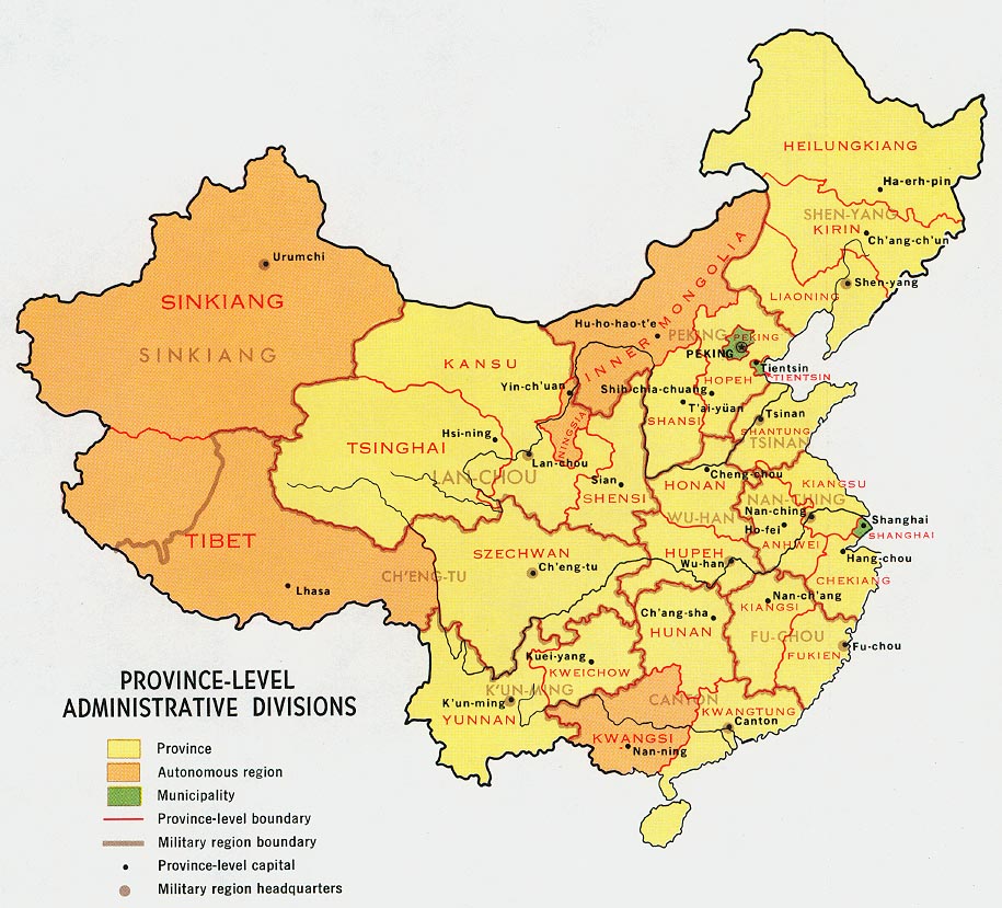
Compare with the current provinces at Administrative divisions of the People's Republic of China.
See also
References
- ^ "What were the ancient 9 provinces?" on www.chinahistoryforum.com
- ^ Twitchett 1979, vol.3, p.128
- ^ Twitchett 1979, vol. 3, p. 203-5.
- ^ National Institute for Compilation and Translation of the Republic of China (Taiwan): Geography Textbook for Junior High School Volume 1 (1993 version): Lesson 10: pages 47 to 49
- ^ Yearbook of ROC (2006)
- ^ 中華民國國情簡介 政府組織
Sources
- Twitchett, D. (1979), Cambridge History of China, Sui and T'ang China 589-906, Part I, vol. vol.3, Cambridge University Press, ISBN 0-521-21446-7
{{citation}}:|volume=has extra text (help)
External links
- Summary of terms
- Historical map scans - maps of various sheng, dao, fu, ting, and xian of the late Qing era.
- Map showing the provincial boundaries of the PRC in 1971