Therubali Airstrip
Appearance
This article relies largely or entirely on a single source. (May 2018) |
Therubali Airport | |||||||||||
|---|---|---|---|---|---|---|---|---|---|---|---|
| Summary | |||||||||||
| Airport type | Public | ||||||||||
| Operator | Government of Odisha | ||||||||||
| Serves | Rayagada | ||||||||||
| Location | Therubali, Odisha (India) | ||||||||||
| Elevation AMSL | 859 ft / 262 m | ||||||||||
| Coordinates | 19°20′44″N 83°26′04″E / 19.34556°N 83.43444°E | ||||||||||
| Map | |||||||||||
 | |||||||||||
| Runways | |||||||||||
| |||||||||||
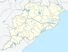
Therubali Airport is located 3.3 km from Therubali city center in Rayagada district, Odisha.[1]
Rairangpur Airport is spread over 30 acres and is under the control of the Works Department of Government of Odisha. The runway is 1,135 meters (around 3,724 ft) long and is periodically maintained by the state government.[2]
Airlines and destinations
Currently, there are no scheduled operations to and from this airport. The nearest airport is Visakhapatnam Airport in Visakhapatnam, Andhra Pradesh i.e. 216 km from Therubali Airport. The state capital Bhubaneswar's Biju Patnaik International Airport is nearly 401 km from Therubali Airport.
See also
References
- ^ "Therubali Airport - Wikimapia". Wikimapia. Retrieved 30 April 2018.
- ^ "Therubali Airport - Rayagada, Odisha" (PDF). Airport Authority of India. Retrieved 30 April 2018.


