Birasal Airstrip
Appearance
Birasal Airstrip | |||||||||||
|---|---|---|---|---|---|---|---|---|---|---|---|
| Summary | |||||||||||
| Airport type | Public | ||||||||||
| Owner | Government of Odisha | ||||||||||
| Serves | Dhenkanal | ||||||||||
| Location | Dhenkanal, Odisha, India | ||||||||||
| Elevation AMSL | 403 ft / 123 m | ||||||||||
| Coordinates | 20°59′0.65″N 85°40′44.48″E / 20.9835139°N 85.6790222°E | ||||||||||
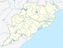
| Map | |||||||||||
 | |||||||||||
| Runways | |||||||||||
| |||||||||||
Birasal Airstrip also known as Dhenkanal Airstrip, is located 53 km from the Dhenkanal city center in central Odisha, India. Nearest airport to this airstrip is Biju Patnaik International Airport in the capital city Bhubaneswar i.e. 134 km.[1]
Accidents and Incidents
- On 8 June 2020, Government Aviation Training Institute (GATI)'s Cessna FA-152 VT-ENF trainer aircraft developed snags resulting in a crash immediately after taking off; both the pilots inside the aircraft were killed.[2]
References
- ^ "Birasal Airstrip - Odisha, India" (PDF).
- ^ "Dhenkanal: Trainer aircraft crashes at Birasal airstrip, two pilots killed". 8 June 2020. Retrieved 8 June 2020.


