
Chapel Rural Historic District: Difference between revisions
Content deleted Content added
→top: add "use mdy dates" template |
trying to fix dead link despite repeat microsoft AI |
||
| Line 18: | Line 18: | ||
| refnum = 14000010<ref name="nris">{{NRISref|version=2010a}}</ref> |
| refnum = 14000010<ref name="nris">{{NRISref|version=2010a}}</ref> |
||
}} |
}} |
||
The '''Chapel Rural Historic District''' is an expansive rural [[historic district (United States)|historic district]] in [[Clarke County, Virginia]]. The district encompasses an area of nearly {{convert|11500|acre|ha}}, a rural landscape that extends from [[Millwood, Virginia|Millwood]] in the south, nearly to [[Berryville, Virginia|Berryville]] in the north. The district takes its name from the [[Old Chapel (Millwood, Virginia)|Old Chapel]], an 18th-century building that stands prominently at the junction of several roads near the center of the district. |
The '''Chapel Rural Historic District''' is an expansive rural [[historic district (United States)|historic district]] in [[Clarke County, Virginia]]. The district encompasses an area of nearly {{convert|11500|acre|ha}}, a rural landscape that extends from [[Millwood, Virginia|Millwood]] in the south, nearly to [[Berryville, Virginia|Berryville]] in the north. The district takes its name from the [[Old Chapel (Millwood, Virginia)|Old Chapel]], an 18th-century building that stands prominently at the junction of several roads near the center of the district. The district includes nearly 700 contributing properties.<ref name=NRHP>{{cite web|url=https://www.dhr.virginia.gov/historic-registers/021-5025 |title=NRHP nomination for Chapel Rural Historic District|publisher=Virginia DHR|accessdate=2024-04-28}}</ref> |
||
The district was listed on the [[National Register of Historic Places]] in 2014.<ref name=nris/> |
The district was listed on the [[National Register of Historic Places]] in 2014.<ref name=nris/> |
||
Latest revision as of 22:14, 28 April 2024
Chapel Rural Historic District | |
 Old Chapel Historic Marker Intersection of Hwy. 340 and Bishop Meade Rd. | |
   | |
| Location | Generally centered along Lord Fairfax Hwy, Millwood, Virginia |
|---|---|
| Coordinates | 39°6′28″N 78°0′52″W / 39.10778°N 78.01444°W |
| Area | 11,496 acres (4,652 ha) |
| NRHP reference No. | 14000010[1] |
| Added to NRHP | February 14, 2014 |
The Chapel Rural Historic District is an expansive rural historic district in Clarke County, Virginia. The district encompasses an area of nearly 11,500 acres (4,700 ha), a rural landscape that extends from Millwood in the south, nearly to Berryville in the north. The district takes its name from the Old Chapel, an 18th-century building that stands prominently at the junction of several roads near the center of the district. The district includes nearly 700 contributing properties.[2]
The district was listed on the National Register of Historic Places in 2014.[1]
Gallery[edit]
- A few of the historic sites within this district:
-
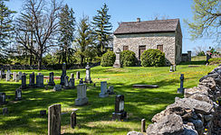 Old Chapel and Cemetery
 -
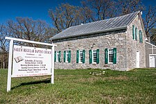 Salem Regular Baptist Church
 -
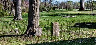 Salem Regular Baptist Church Cemetery
 -
 Millwood Shiloh Baptist Church
 -
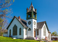
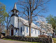 Millwood United Methodist Church
 -
 Christ Church, Millwood
 -
 Old Schoolhouse, now Red Schoolhouse Antiques
 -
 Old Barn, now Black Penny Antiques


References[edit]
- ^ a b "National Register Information System". National Register of Historic Places. National Park Service. July 9, 2010.
- ^ "NRHP nomination for Chapel Rural Historic District". Virginia DHR. Retrieved April 28, 2024.
Wikimedia Commons has media related to Chapel Rural Historic District.

Categories:
- Colonial Revival architecture in Virginia
- Queen Anne architecture in Virginia
- Historic districts in Clarke County, Virginia
- National Register of Historic Places in Clarke County, Virginia
- Historic districts on the National Register of Historic Places in Virginia
- Shenandoah Valley, Virginia Registered Historic Place stubs
- Clarke County, Virginia geography stubs