From Wikipedia, the free encyclopedia
Airport in Bargarh district, Odisha
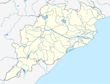
Gunupur Airstrip is a public airstrip owned by Government of Odisha located at Gunupur in the Rayagada district of Odisha. Nearest airport to this airstrip is Jeypore Airport in Jeypore, Odisha.[1]
References
|
|---|
|
Domestic/private |
|---|
| Central India | | Chhattisgarh | |
|---|
| Madhya Pradesh | |
|---|
|
|---|
| Eastern India | | Bihar | |
|---|
| Jharkhand | |
|---|
| Odisha | |
|---|
| West Bengal | |
|---|
|
|---|
| Northeastern India | | Arunachal Pradesh | |
|---|
| Assam | |
|---|
| Meghalaya | |
|---|
| Mizoram | |
|---|
| Nagaland | |
|---|
| Sikkim | |
|---|
| Tripura | |
|---|
|
|---|
| Northern India | | Haryana | |
|---|
| Himachal Pradesh | |
|---|
| Jammu and Kashmir | |
|---|
| Ladakh | |
|---|
| Punjab | |
|---|
| Rajasthan | |
|---|
| Uttarakhand | |
|---|
| Uttar Pradesh | |
|---|
|
|---|
| Southern India | | Andhra Pradesh | |
|---|
| Karnataka | |
|---|
| Lakshadweep | |
|---|
| Puducherry | |
|---|
| Tamil Nadu | |
|---|
|
|---|
| Western India | | Daman and Diu | |
|---|
| Gujarat | |
|---|
| Maharashtra | |
|---|
|
|---|
|
|
Proposed |
|---|
| International | |
|---|
| Domestic | | South | |
|---|
| East | |
|---|
| West | |
|---|
| North | |
|---|
| Central | |
|---|
|
|---|
|
|
Military |
|---|
| Indian Air Force | | Western Air Command | |
|---|
| Eastern Air Command | |
|---|
| Central Air Command | |
|---|
| Southern Air Command | |
|---|
| South Western Air Command | |
|---|
| Training Command | |
|---|
| Maintenance Command | |
|---|
|
|---|
| Indian Navy | | Eastern Naval Command | |
|---|
| Western Naval Command | |
|---|
| Southern Naval Command | |
|---|
|
|---|
| Indian Army | |
|---|
| Indian Coast Guard | |
|---|
| Joint | | Andaman and Nicobar Command | |
|---|
|
|---|
|
|
State-wise list of airports |
|---|
|
|


