Azamgarh Airport
Appearance
This article needs additional citations for verification. (April 2019) |
Azamgarh Airport आजमगढ़ हवाई अड्डा اعظم گڑھ ہوائی اڈا | |||||||||||
|---|---|---|---|---|---|---|---|---|---|---|---|
| Summary | |||||||||||
| Airport type | Public | ||||||||||
| Operator | Airports Authority of India | ||||||||||
| Serves | Azamgarh, Uttar Pradesh, India | ||||||||||
| Location | BALDEV MANDURI KAPTANGANJ | ||||||||||
| Elevation AMSL | 250 ft / 76 m | ||||||||||
| Coordinates | 26°09′12″N 83°07′06″E / 26.15333°N 83.11833°E | ||||||||||
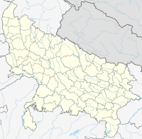
| Map | |||||||||||
 | |||||||||||
| Runways | |||||||||||
| |||||||||||
Village Manduri | |||||||||||
Azamgarh Airport is an upcoming airport, situated at Manduri Village which is outside Azamgarh city, on Sikandarpur road, in the Indian state of Uttar Pradesh.[1] It is developing by upgrading the existing government airstrip.[1][2] Existing airstrip can support aircraft weighing up to 5700 kg with a runway of 1400m by 23m. The airport offers car parking and a VIP Lounge.[3]
See also
Connectivity
The airport is connected to Lucknow and azamgarh city by UPSRTC.
See also
References
- ^ a b "Archived copy". Archived from the original on 22 October 2018. Retrieved 10 March 2019.
{{cite web}}: CS1 maint: archived copy as title (link) - ^ "Archived copy". Archived from the original on 8 March 2019. Retrieved 10 March 2019.
{{cite web}}: CS1 maint: archived copy as title (link) - ^ "DETAILS OF AZAMGARH AIRPORT". Directorate of Civil Aviation. 19 January 2018. Retrieved 14 August 2018.

