
Quanah, Texas
Quanah, Texas | |
|---|---|
.jpg) Hardeman County Courthouse at Christmastime | |
| Nickname: Q TOWN | |
| Motto: Hometown Of Randy Lamb | |
 Location of Quanah, Texas | |
 | |
| Country | United States |
| State | Texas |
| County | Hardeman |
| Area | |
| • Total | 3.5 sq mi (9.0 km2) |
| • Land | 3.5 sq mi (9.0 km2) |
| • Water | 0.0 sq mi (0.0 km2) |
| Elevation | 1,572 ft (479 m) |
| Population (2000) | |
| • Total | 3,022 |
| • Density | 866.8/sq mi (334.7/km2) |
| Time zone | UTC-6 (Central (CST)) |
| • Summer (DST) | UTC-5 (CDT) |
| ZIP code | 79252 |
| Area code | 940 |
| FIPS code | 48-60044Template:GR |
| GNIS feature ID | 1365885Template:GR |
| Also Known for being the hometown of Glen "PEEPIE" Golden truck driver magazine-truck driver of the year 1999 | |
Quanah is a city in and the county seat of Hardeman County, Texas, United States,Template:GR 192 miles (309 km) northwest of Fort Worth. In 1900, 1,651 people lived in Quanah (pronounced KWAN UH); and in 1910, 3,127 resided there. The population was 3,022 at the 2000 census. It is named for Quanah Parker, the last Comanche chief.
Southeast of Quanah and south of Chillicothe is the ghost town of Medicine Mound, which consists of two buildings. One is a restoration of a former general store which highlights the history of rural America. The curator is Myna Potts.
Geography
Quanah is located at 34°17′44″N 99°44′31″W / 34.29556°N 99.74194°WInvalid arguments have been passed to the {{#coordinates:}} function (34.295458, -99.741828)Template:GR.
According to the United States Census Bureau, the city has a total area of 3.5 square miles (9.0 km²), all of it land.
Demographics
As of the censusTemplate:GR of 2000, there were 3,022 people, 1,255 households, and 823 families residing in the city. The population density was 866.8 people per square mile (334.3/km²). There were 1,485 housing units at an average density of 425.9/sq mi (164.3/km²). The racial makeup of the city was 84.05% White, 4.96% African American, 0.40% Native American, 0.43% Asian, 8.24% from other races, and 1.92% from two or more races. Hispanic or Latino of any race were 16.48% of the population.
There were 1,255 households out of which 29.2% had children under the age of 18 living with them, 51.8% were married couples living together, 10.4% had a female householder with no husband present, and 34.4% were non-families. 31.9% of all households were made up of individuals and 20.2% had someone living alone who was 65 years of age or older. The average household size was 2.35 and the average family size was 2.96.
In the city the population was spread out with 25.1% under the age of 18, 7.9% from 18 to 24, 22.0% from 25 to 44, 22.9% from 45 to 64, and 22.0% who were 65 years of age or older. The median age was 42 years. For every 100 females there were 87.6 males. For every 100 females age 18 and over, there were 83.2 males.
The median income for a household in the city was $26,354, and the median income for a family was $29,506. Males had a median income of $26,472 versus $18,403 for females. The per capita income for the city was $16,841. About 16.6% of families and 20.7% of the population were below the poverty line, including 29.8% of those under age 18 and 16.4% of those age 65 or over.
References
External links

Municipalities and communities of Hardeman County, Texas, United States | ||
|---|---|---|
| Cities | 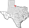 | |
| Ghost town | ||