
Ulhas River
| Ulhas River | |
|---|---|
 | |
 | |
| Location | |
| Country | India |
| State | Maharashtra |
| Cities | Lonavala, Mumbai, Thane |
| Physical characteristics | |
| Source | Western Ghats |
| • location | India |
| Mouth | |
• location | Arabian Sea, India |
| Length | 122 km (76 mi) |
The Ulhas River is a river in Maharashtra, India. It is in the Thane, Raigad, and Pune districts of that state. It flows north and west from it source to where it splits into Vasai Creek and Thane Creek, near Thane. The Ulhas divides Salsette Island from the mainland, and is important for the water supply of Mumbai.[1][2][3]
Gallery
-
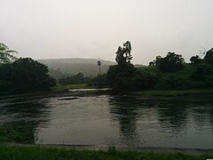 Ulhas River at Kondhana village in Raigad district
 -
 The Ulhas River, as seen from Ghodbunder


See also
References
- ^ Lewis, Clara (18 March 2013). "Greens: Monitor discharge in Ulhas river". Mumbai: Times of India. Retrieved 14 July 2014.
- ^ https://censusindia.gov.in/2011census/dchb/2721_PART_B_DCHB_THANE.pdf [bare URL PDF]
- ^ https://censusindia.gov.in/2011census/dchb/2724_PART_B_DCHB_RAIGARH.pdf [bare URL PDF]
Wikivoyage has a travel guide for Mumbai.