Pathankot Airport
Pathankot Airport | |||||||||||
|---|---|---|---|---|---|---|---|---|---|---|---|
| Summary | |||||||||||
| Airport type | Civil | ||||||||||
| Owner | Government of India | ||||||||||
| Operator | Airports Authority of India | ||||||||||
| Serves | Pathankot | ||||||||||
| Location | Pathankot, Punjab, India | ||||||||||
| Opened | 21 November 2006 | ||||||||||
| Elevation AMSL | 310 m / 1,017 ft | ||||||||||
| Coordinates | 32°14′01″N 075°38′04″E / 32.23361°N 75.63444°E | ||||||||||
| Website | https://www.aai.aero/en/airports/pathankot | ||||||||||
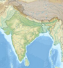
| Map | |||||||||||
| Runways | |||||||||||
| |||||||||||
Pathankot Airport (IATA: IXP, ICAO: VIPK) is a civil (domestic) airport, 3 km from the nearest city Pathankot and 7 km from Pathankot Railway Station, located on the Pathankot – Majra Road. Pathankot airport serves national flights only. The airport, spread over an area of approximately 75 acres, is not well connected by public transport; only cabs are available.
Pathankot Airport was inaugurated by Mr. Praful Patel, the then Aviation Minister of India, on 21 November 2006.[1] The facility was made possible by the efforts of Gurdaspur Member of Parliament and Bollywood actor Vinod Khanna,[2] who had planned to make Pathankot a tourist destination and industrial hub.[3]
Commercial flights were resumed on April 05, 2018,[4] after a hiatus of nearly seven years.[5][6] by Alliance Air, the regional subsidiary of Air India under the Regional Connectivity Scheme.[7]
Airlines and destinations
| Airlines | Destinations |
|---|---|
| Alliance Air | Delhi |
Air Force Station
Pathankot Air Force Station (IATA: IXP, ICAO: VIPK) is a military airport located 3 km from Pathankot, India, on the Pathankot – Majra Road. It is part of the Western Air Command of the Indian Air Force and covers an area of approximately 2000 acres (809.3 hectares). It shares the runways with the civilial enclave.
Incidents
On 2 January 2016, six heavily armed terrorists suspected to belong to Islamist militant group Jaish-e-Mohammed attacked the Air Force Station. The terrorists were wearing Indian Army fatigues and driving a car stolen from a superintendent of the Punjab Police. All six terrorists and seven security forces personnel were killed in the gun battle on 4 January 2016.[8]
References
- ^ "The Tribune, Chandigarh, India - Punjab". www.tribuneindia.com.
- ^ "Vinod Khanna - National Portal of India". india.gov.in.
- ^ "Pathankot airport plain empty". 14 October 2013.
- ^ "List of RCS Airports and routes Started under UDAN-1 & 2 24 October 2018" (PDF). RCS Cell Airports Authority of India Rajiv Gandhi Bhavan New Delhi 110003.
- ^ "After 7 years, domestic flights resume from Pathankot airport". Hindustan Times. 5 April 2018.
- ^ "Asia's Premier News Agency - India News, Business & Political, National & International, Bollywood, Sports | ANI News". www.aninews.in.
- ^ "Regional Connectivity Scheme - RCS Udan". Airports Authority of India. Retrieved 27 April 2020.
- ^ "Terrorists storm air force base, first challenge to Modi's Pak outreach". The Hindu. Retrieved 28 June 2016.


