
Sawtooth Mountain (Boulder County, Colorado)
| Sawtooth Mountain | |
|---|---|
 East aspect | |
| Highest point | |
| Elevation | 12,304 ft (3,750 m)[1][2] |
| Prominence | 382 ft (116 m)[3] |
| Parent peak | Algonquin (12,581 ft)[3] |
| Isolation | 0.85 mi (1.37 km)[3] |
| Coordinates | 40°07′37″N 105°37′28″W / 40.1268793°N 105.6245173°W[4] |
| Geography | |
 Sawtooth Mountain Location in Colorado  Sawtooth Mountain Sawtooth Mountain (the United States) | |
| Country | United States |
| State | Colorado |
| County | Boulder / Grand |
| Protected area | Indian Peaks Wilderness |
| Parent range | Rocky Mountains Front Range[5] |
| Topo map | USGS Allens Park |
| Geology | |
| Rock age | Paleoproterozoic[6] |
| Rock type | Gneiss[6] |
| Climbing | |
| Easiest route | class 2[3] via Buchanan Pass[2] |
Sawtooth Mountain is a 12,304-foot (3,750 m) summit on the boundary shared by Boulder County and Grand County, in Colorado, United States.[4]
Description
[edit]
Sawtooth Mountain is set on the Continental Divide in the Front Range which is a subrange of the Rocky Mountains.[5] It is the easternmost projection of the Continental Divide encompassing the entirety of North America.[1] The mountain is located 20 miles (32 km) west-northwest of Boulder in the Indian Peaks Wilderness, on land managed by Arapaho National Forest and Roosevelt National Forest. It is the 19th-highest summit in the wilderness and 28th-highest in Boulder County.[3] Precipitation runoff from the mountain's east slope drains into tributaries of St. Vrain Creek, whereas the west slope drains to Monarch Lake via Buchanan Creek, thence Lake Granby. Topographic relief is significant as the summit rises 2,300 feet (701 m) above Buchanan Creek in 1.3 mile. The mountain's toponym has been officially adopted by the United States Board on Geographic Names.[4]
Climate
[edit]According to the Köppen climate classification system, Sawtooth Mountain is located in an alpine subarctic climate zone with cold, snowy winters, and cool to warm summers.[7] Due to its altitude, it receives precipitation all year, as snow in winter and as thunderstorms in summer, with a dry period in late spring. Climbers can expect afternoon rain, hail, and lightning from the seasonal monsoon in late July and August.
Gallery
[edit]-
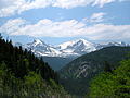
 Buchanan Pass centered with Sawtooth to left
 -
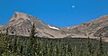
 Sawtooth Mountain (left), Red Deer Mountain (right) from Peak to Peak Highway (Hwy 72)
 -
 Sawtooth Mountain to left, Red Deer Mountain (12,391-ft) to the right


See also
[edit]References
[edit]- ^ a b Robert M. Ormes (1992), Guide to the Colorado Mountains, Johnson Books, ISBN 9781555661946, p. 59.
- ^ a b Gerry Roach (1998), Colorado's Indian Peaks, Fulcrum Publishing, ISBN 9781555914042, p. 151.
- ^ a b c d e "Sawtooth Mountain - 12,328' CO". listsofjohn.com. Retrieved July 3, 2023.
- ^ a b c "Sawtooth Mountain". Geographic Names Information System. United States Geological Survey, United States Department of the Interior. Retrieved July 3, 2023.
- ^ a b "Sawtooth Mountain, Colorado". Peakbagger.com. Retrieved July 3, 2023.
- ^ a b Geologic map of the Estes Park 30' x 60' quadrangle, north-central Colorado, W.A. Braddock, U.S. Geological Survey, 1984.
- ^ Peel, M. C.; Finlayson, B. L.; McMahon, T. A. (2007). "Updated world map of the Köppen−Geiger climate classification". Hydrol. Earth Syst. Sci. 11. ISSN 1027-5606.
External links
[edit]- Sawtooth Mountain: weather forecast
- Sawtooth Mountain climbing: Mountainproject.com
Places adjacent to Sawtooth Mountain (Boulder County, Colorado) | ||||||||||||||||
|---|---|---|---|---|---|---|---|---|---|---|---|---|---|---|---|---|
| ||||||||||||||||