Vijayawada Airport
Vijayawada Airport విజయవాడ విమానాశ్రయము Vijayavāḍa Vimānāśrayamu | |||||||||||
|---|---|---|---|---|---|---|---|---|---|---|---|
| Summary | |||||||||||
| Airport type | Public | ||||||||||
| Owner | AAI | ||||||||||
| Operator | Airports Authority of India | ||||||||||
| Serves | Vijayawada | ||||||||||
| Location | Gannavaram | ||||||||||
| Hub for | |||||||||||
| Elevation AMSL | 82 ft / 25 m | ||||||||||
| Coordinates | 16°31′59.88″N 80°40′0″E / 16.5333000°N 80.66667°E | ||||||||||
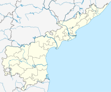
| Map | |||||||||||
 | |||||||||||
| Runways | |||||||||||
| |||||||||||
| Statistics (Apr 2015 - Mar 2016) | |||||||||||
| |||||||||||
Vijayawada Airport (IATA: VGA, ICAO: VOBZ) is a public airport serving Vijayawada, Andhra Pradesh, India. The airport is located 13.5 km (8.4 mi) from the city, on National Highway 16 connecting Chennai to Kolkata. Its runway was extended in 2011, allowing for the operation of bigger aircraft.[4] The airport will also serve Amaravati, the proposed capital of Andhra Pradesh. Hence, in anticipation of an increase in air traffic from the Andhra Pradesh Capital Region, the Airports Authority of India (AAI) is developing and making infrastructural changes to the airport.[5]
History
The airfield served as an army base during the World War II, after which it was converted into a civilian airport. Air Deccan introduced a daily service between Hyderabad and Vijayawada in September 2003.[6] Until 2011, the airport had only four flights a day operated by Kingfisher Airlines.[7] In 2011, flag carrier Air India and private airlines Spicejet and Jet Airways introduced direct flights from to the airport. Air Costa, a regional airline started operations in October 2013, with Vijayawada as its operational hub.
The airport covers an area of 537 acres (217 ha) and the runway is 2,286 metres (7,500 ft) long. The airport has parking bays for four ATR 72/Bombardier Q400, and one Boeing 737/Airbus A320[8]

Airlines and destinations
| Airlines | Destinations |
|---|---|
| Air Costa | Bangalore, Visakhapatnam |
| Air India | Delhi, Hyderabad |
| Air India Regional | Hyderabad, Visakhapatnam |
| SpiceJet | Bangalore, Chennai, Hyderabad, Tirupati, Visakhapatnam |
Accidents and incidents
- On 28 August 1980, Vickers Viscount VT-DJC of Huns Air was damaged beyond economic repair when the nosewheel collapsed after the aircraft bounced three times on landing.[9]
References
- ^ "Traffic Statistics-2016" (PDF). AAI. Retrieved 2 May 2016.
- ^ "Aircraft Movements-2016" (PDF). AAI. Retrieved 2 May 2016.
- ^ "Cargo Statistics-2016" (PDF). AAI. Retrieved 2 May 2016.
- ^ "Extended airport runway trial begins in Vijayawada". The Hindu. Retrieved 30 August 2011.
- ^ "AAI to make modifications at Gannavaram airport". The Hindu. 18 September 2014. Retrieved 18 September 2014.
- ^ "One more flight for Vijayawada". The Hindu. 23 November 2005. Retrieved 18 September 2014.
- ^ "Another pvt airliner to operate from Gannavaram". Times of India. Retrieved 14 March 2011.
- ^ "Air India's new link between Delhi and Vijayawada". Air India. Retrieved 28 October 2011.
- ^ "Accident description". Aviation Safety Network. Retrieved 8 October 2009.


