Lok Nayak Jayaprakash Narayan International Airport
Patna Airport Lok Nayak Jayaprakash Narayan International Airport जयप्रकाश नारायण हवाई अड्डा | |||||||||||
|---|---|---|---|---|---|---|---|---|---|---|---|
| File:Patnaairport.jpg | |||||||||||
| Summary | |||||||||||
| Airport type | Public | ||||||||||
| Operator | Airports Authority of India | ||||||||||
| Serves | Patna, India | ||||||||||
| Elevation AMSL | 170 ft / 52 m | ||||||||||
| Coordinates | 25°35′37″N 085°05′31″E / 25.59361°N 85.09194°E | ||||||||||
 | |||||||||||
| Runways | |||||||||||
| |||||||||||
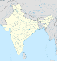
Patna Airport[1] (IATA: PAT, ICAO: VEPT), also known as Jaiprakash Narayan International Airport, Patna[4][5] (Template:Lang-hi), is an airport located 5 kilometres (2.7 NM)[1] southwest of Patna, the capital of state of Bihar in India. The airport is categorised as a restricted international airport by the Airports Authority of India.[citation needed] It is named after "Lok Nayak" Jayaprakash Narayan (1902–1979), an Indian independence activist and political leader.Patna airport is the one of the major airport of Eastern Central India.
Facilities
The airport covers an area of 254 acres (103 ha) and resides at an elevation of 170 feet (52 m) above mean sea level. It has one runway designated 07/25 with an asphalt surface measuring 1,954 by 45 metres (6,411 ft × 148 ft).[1][2]. Recently, the Patna airport was declared as the fastest growing airport among the Tier-II cities. Due to this, a lot of new low budget carriers have started flights from Patna.
Future
Recently due to short runway and no way to increse it the govt. has planned a new airport at Bihita which will be connected with a expessway.It may also shift to Punpun or Bikramganj If Bihita fails.At Bihita there is an Airfoce bace which can be expanded and can fullfill the demands of the new airport.
Airlines and destinations
The following airlines provide scheduled passenger service to destinations in India:
| Airlines | Destinations |
|---|---|
| Air India | Delhi ,[6][7] |
| Buddha Air | Kathmandu (Begins 15 oct Subject to approval by DGCA) |
| IndiGo | Bangalore ,Chennai , Mumbai, Delhi , Hyderabad , Kolkata , Lucknow , Mumbai , Ahmedabad [8] |
| Go Air | Delhi,Mumbai,chennai,Bangalore,Pune [9] |
| Jet Airways | Delhi,Kolkata [10] |
| JetLite | Delhi, Kolkata[11] |
| Jet Airways Konnect | Delhi,Kolkata |
| Kingfisher Airlines | Delhi, Kolkata, Mumbai, Ranchi [12] |
| Saudi Arabian Airlines | Jeddah (Begins 10 oct Only for Hajj season) |
Incidents
On July 17, 2000, Alliance Air Flight 7412 crashed near the airport prior to landing, killing 60 people.[13]
05 September 2007 - Air Arabia Sharjah-Katmandu flight G9537 emergency landing at JayaPrakash Narayn International Airport
References
- ^ a b c d "Patna Airport: Technical Information". Airports Authority of India. Retrieved 31 March 2010.
- ^ a b Airport information for VEPT from DAFIF (effective October 2006)
- ^ Airport information for PAT at Great Circle Mapper. Source: DAFIF (effective October 2006).
- ^ "Photograph of airport terminal showing the name as "Jaiprakash Narayan International Airport, Patna". SkyscraperCity.com. Retrieved 31 March 2010.
- ^ "Photograph of airport entrance showing the name as "Jai Prakash Narayan Intl. Airport, Patna". PatnaPassion.com. Retrieved 31 March 2010.
- ^ "Where we fly". Air India (merged with Indian Airlines). Retrieved 31 March 2010.
- ^ "Flight Schedules". Air India (merged with Indian Airlines). Retrieved 31 March 2010.
- ^ "Route Map". IndiGo. Retrieved 31 March 2010.
- ^ http://www.goair.in/ "Our Network". Go Air.
{{cite web}}: Check|url=value (help); Cite has empty unknown parameter:|1=(help) - ^ "Route Map". Jet Airways. Retrieved 31 March 2010.
- ^ "Our Network". JetLite. Retrieved 31 March 2010.
- ^ "Flight Schedule". Kingfisher Airlines. Retrieved 31 March 2010.
- ^ Accident description at the Aviation Safety Network

