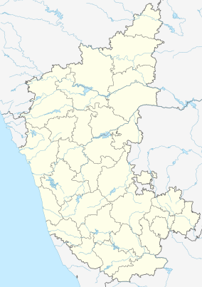
Pushpagiri Wildlife Sanctuary
This article needs additional citations for verification. (December 2015) |
| Pushpagiri Wildlife Sanctuary | |
|---|---|
 Landscape of Shola Forests,Pushpagiri WLS | |
| Location | Somwarpet, Kodagu district, Karnataka, India |
| Nearest city | Somwarpet |
| Coordinates | 12°35′0″N 75°40′0″E / 12.58333°N 75.66667°E |
| Established | 1987[citation needed] |
| Governing body | Karnataka Forest Department |
Pushpagiri Wildlife Sanctuary is one of 21 Wildlife Sanctuaries of India's Karnataka state.
This sanctuary is located in Somwarpet taluk of the Kodagu district. It is home to rare and endangered birdlife.[1] The Kadamakkal reserve forest is a part of the sanctuary. Pushpagiri (Kumara Parvatha) is the highest peak in it.The sanctuary adjoins Bisle reserve forest to the north and Kukke Subramanya forest range to the west.
Mandalpatti peak, Kote betta and Makkalagudi betta are mountains fall in the sanctuary. Mallalli falls and Kote abbe waterfalls (also called as Mukkodlu falls) are located inside the sanctuary. The Pushpagiri Wildlife Sancutuary has been proposed as one of the World Heritage Site.[2]
References
- ^ "BirdLife IBA Factsheet - Pushpagiri Wildlife Sanctuary". Retrieved 2007-02-01.
- ^ "Western Ghats—Talacauvery Sub-Cluster (with Six Site Elements)". Retrieved 2007-02-01.
External links
Wikimedia Commons has media related to Pushpagiri Wildlife Sanctuary.
Wikivoyage has a travel guide for Pushpagiri Wildlife Sanctuary.

