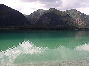
Muncho Lake Provincial Park
Tools
Actions
General
Print/export
In other projects
Appearance
From Wikipedia, the free encyclopedia
This is an old revision of this page, as edited by CambridgeBayWeather (talk | contribs) at 09:04, 20 September 2019 (Tidy). The present address (URL) is a permanent link to this revision, which may differ significantly from the current revision.
| Muncho Lake Provincial Park | |
|---|---|
 Muncho Lake | |
| Location | British Columbia, Canada |
| Nearest city | Fort Nelson |
| Coordinates | 59°10′N 126°01′W / 59.167°N 126.017°W / 59.167; -126.017 |
| Governing body | BC Parks |
Muncho Lake Provincial Park is a provincial park in British Columbia, Canada, located on the Alaska Highway as it transits the northernmost Canadian Rockies west of Fort Nelson. The park is part of the larger Muskwa-Kechika Management Area.[1] It is named after Muncho Lake, which is in the park and is both the name of the lake and of the community located there.
See also
References
- ^ Muskwa-Kechika Protected Areas Archived 2008-10-11 at the Wayback Machine, Muskwa-Kechika Management Area
External links
Wikivoyage has a travel guide for Muncho Lake Provincial Park.
| |||||||||||||||||||||||||||||||||||||||||||||||||||||||||||||||||||||||||
| |||||||||||||||||||||||||||||||||||||||||||||||||||||||||||||||||||||||||
| |||||||||||||||||||||||||||||||||||||||||||||||||||||||||||||||||||||||||
| |||||||||||||||||||||||||||||||||||||||||||||||||||||||||||||||||||||||||
| |||||||||||||||||||||||||||||||||||||||||||||||||||||||||||||||||||||||||
| |||||||||||||||||||||||||||||||||||||||||||||||||||||||||||||||||||||||||
| |||||||||||||||||||||||||||||||||||||||||||||||||||||||||||||||||||||||||
| |||||||||||||||||||||||||||||||||||||||||||||||||||||||||||||||||||||||||
This British Columbia protected areas related article is a stub. You can help Wikipedia by expanding it. |
