Albany, New York
Albany (/ˈɔːlbəniː/ ⓘ AWL-bə-nee) is the capital of the U.S. state of New York and the seat of Albany County. Roughly 150 miles (240 km) north of the City of New York, Albany developed on the west bank of the Hudson River, about 10 miles (16 km) south of its confluence with the Mohawk River. The population of the City of Albany was 97,856 according to the 2010 census. Albany constitutes the economic and cultural core of the Capital District of New York State, which comprises the Albany-Schenectady-Troy, NY Metropolitan Statistical Area, including the nearby cities and suburbs of Troy, Schenectady, and Saratoga Springs. With a Census-estimated population of 1,170,483 in 2013,[1] the Capital District is the third most populous metropolitan region in the state and 38th in the United States.[2][3]
Fortune 500 companies that have headquarters in Albany include American Express, CommerceHub, [4] Merrill Lynch,[5] General Electric, Verizon, Goldman Sachs,[6] International Paper,[7] Key Bank, f.y.e. stores, and the Environment One Corporation.[8] In the 21st century, the Capital District has emerged as a major anchor of Tech Valley, the moniker describing the technologically-focused region of eastern New York State.
This was the first European settlement in the state, settled by Dutch colonists who built Fort Nassau for fur trading in 1614 and Fort Orange in 1624. They formed successful relations with both the Mahican and the Mohawk peoples, two major Native American nations in the region. The fur trade attracted settlers who founded a village called Beverwijck near Fort Orange. In 1664 the English took over the Dutch settlements, renaming the city as Albany, in honor of the then Duke of Albany, the future James II of England and James VII of Scotland. The city was officially chartered in 1686 under English rule. It became the capital of New York State in 1797, following the United States gaining independence in the American Revolutionary War. Albany is one of the oldest surviving settlements of the original British thirteen colonies, and the longest continuously chartered city in the United States. Its charter is possibly the longest-running instrument of municipal government in the Western Hemisphere.[9]
During the late 18th century and throughout most of the 19th, Albany was a center of trade and transportation. It is located on the north end of the navigable Hudson River, was the original eastern terminus of the Erie Canal connecting to the Great Lakes, and was home to some of the earliest railroad systems in the world. Albany's main exports at the time were beer, lumber, published works, and ironworks. Beginning in 1810, Albany was one of the ten most populous cities in the United States, a distinction that it held until the 1860 census.
Albany is one of the first cities in the world to have installed public water mains, sewer lines, natural gas lines and electricity, infrastructure and utilities that attracted and supported substantial new industry to the city and surrounding area during the 19th century.
In the 20th century, the city opened one of the first commercial airports in the world, the precursor of today's Albany International Airport. During the 1920s a powerful political machine controlled by the Democratic Party arose in the state capital, connected to politics in New York City as well. It marshalled the power of immigrants and their descendants in both cities.
The city's skyline changed in the 1940s and '50s with the construction of office towers around the Empire State Plaza and at the uptown campus of SUNY Albany,[a] mainly under the direction of Governor Nelson Rockefeller. While Albany experienced a decline in its population due to urban sprawl and suburbanization, many of its historic neighborhoods were saved from destruction through the policies of Mayor Erastus Corning 2nd, the longest-serving mayor of any city in the United States. In the early 21st century, Albany has experienced growth in the high-technology industry, with great strides in the nanotechnology sector.[10][11]
Albany has been a center of higher education for over a century, with much of the remainder of its economy dependent on state government and health care services. The city has rebounded from the urban decline of the 1970s and 1980s, with noticeable development taking place in the city's downtown and midtown neighborhoods. Albany is known for its rich history, commerce, culture, architecture, and institutions of higher education. Albany won the All-America City Award in both 1991 and 2009.[12]
History
Colonial times to 1800


Albany is one of the oldest surviving European settlements from the original thirteen colonies[13] and the longest continuously chartered city in the United States.[b] The Hudson River area was originally inhabited by Algonquian-speaking Mohican (Mahican), who called it Pempotowwuthut-Muhhcanneuw, meaning "the fireplace of the Mohican nation."[16] Based to the west along the Mohawk River, the Iroquoian-speaking Mohawk referred to it as Sche-negh-ta-da, or "through the pine woods," referring to the path they took there.[17][c] The Mohawk were one of the Five Nations of the Iroquois Confederacy, or Haudenosaunee, and became strong trading partners with the Dutch and English. It is likely that the Albany area was visited by European fur traders, perhaps as early as 1540, but the extent and duration of those visits has not been determined.[19]
Permanent European claims began when Englishman Henry Hudson, exploring for the Dutch East India Company on the Half Moon (Template:Lang-nl), reached the area in 1609, claiming it for the United Netherlands.[20] In 1614, Hendrick Christiaensen built Fort Nassau, a fur-trading post and the first documented European structure in present-day Albany. Commencement of the fur trade provoked hostility from the French colony in Canada and among the natives, all of whom vied to control the trade. In 1618, a flood ruined the fort on Castle Island, but it was rebuilt in 1624 as Fort Orange.[21] Both forts were named in honor of the Dutch royal House of Orange-Nassau.[22] Fort Orange and the surrounding area were incorporated as the village of Beverwijck (Template:Lang-en) in 1652.[23][24] In these early decades of trade, the Dutch, Mohican and Mohawk developed relations that reflected differences among their three cultures.[25]
When New Netherland was captured by the English in 1664, they changed the name Beverwijck to Albany, in honor of the Duke of Albany (later James II of England and James VII of Scotland).[26][d] Duke of Albany was a Scottish title given since 1398, generally to a younger son of the King of Scots.[27] The name is ultimately derived from Alba, the Gaelic name for Scotland.[28] The Dutch briefly regained Albany in August 1673 and renamed the city Willemstadt; the English took permanent possession with the Treaty of Westminster (1674).[29] On November 1, 1683, the Province of New York was split into counties, with Albany County being the largest. At that time the county included all of present New York State north of Dutchess and Ulster Counties in addition to present-day Bennington County, Vermont, theoretically stretching west to the Pacific Ocean;[30][31] the city of Albany became the county seat.[32] Albany was formally chartered as a municipality by provincial Governor Thomas Dongan on July 22, 1686. The Dongan Charter was virtually identical in content to the charter awarded to the city of New York three months earlier.[33] Dongan created Albany as a strip of land 1 mile (1.6 km) wide and 16 miles (26 km) long.[34] Over the years Albany would lose much of the land to the west and annex land to the north and south. At this point, Albany had a population of about 500 people.[35]
In 1754, representatives of seven British North American colonies met in the Stadt Huys, Albany's city hall, for the Albany Congress; Benjamin Franklin of Pennsylvania presented the Albany Plan of Union there, which was the first formal proposal to unite the colonies.[36] Although it was never adopted by Parliament, it was an important precursor to the United States Constitution.[37][e] The same year, the French and Indian War, the fourth in a series of wars dating back to 1689, began; it ended in 1763 with French defeat, resolving a situation that had been a constant threat to Albany and held back its growth.[38] In 1775, with the colonies in the midst of the Revolutionary War, the Stadt Huys became home to the Albany Committee of Correspondence (the political arm of the local revolutionary movement), which took over operation of Albany's government and eventually expanded its power to control all of Albany County. Tories and prisoners of war were often jailed in the Stadt Huys alongside common criminals.[39] In 1776, Albany native Philip Livingston signed the Declaration of Independence at Independence Hall in Philadelphia.[40]
During and after the Revolutionary War, Albany County saw a great increase in real estate transactions. After Horatio Gates' win over John Burgoyne at Saratoga in 1777, the upper Hudson Valley was generally at peace as the war raged on elsewhere. Prosperity was soon seen all over Upstate New York. Migrants from Vermont and Connecticut began flowing in, noting the advantages of living on the Hudson and trading at Albany, while being only a few days' sail from New York City.[41] Albany reported a population of 3,498 in the first national census in 1790, an increase of almost 700% since its chartering.[35] In 1797, the state capital of New York was moved permanently to Albany. From statehood to this date, the Legislature had frequently moved the state capital between Albany, Kingston, Hurley, Poughkeepsie, and the city of New York.[42] Albany is the tenth-oldest state capital in the United States, but only the second-oldest state capital that is a city, after Santa Fe, New Mexico.[43]
1800 to 1942

Albany has been a center of transportation for much of its history. In the late 18th and early 19th centuries, Albany saw development of the turnpike and by 1815, Albany was the turnpike center of the state. Simeon De Witt developed a grid block system in 1794, and renamed streets for birds and mammals that had previously honored British royalty.[f] This grid was intersected by the major arterials coming out of Albany, which cut through the city at unexpected angles.[46][47] The construction of the turnpike across the state, in conjunction with canal and railroad systems, made Albany the hub of transportation for pioneers going to Buffalo and the Michigan Territory in the early- and mid-19th century.[46][48]

In 1807, Robert Fulton initiated a steamboat line from New York to Albany, the first successful enterprise of its kind.[49] By 1810, with 10,763 people, Albany was the 10th-largest urban place in the nation.[50] The town and village were known as "the Colonie"[g] to the north of Albany was annexed in 1815.[51] In 1825 the Erie Canal was completed, forming a continuous water route from the Great Lakes to New York City. Unlike the current Barge Canal, which ends at nearby Waterford, the original Erie Canal ended at Albany; Lock 1 was located north of Colonie Street.[53] The Canal emptied into a 32-acre (13 ha) man-made lagoon called the Albany Basin, which was Albany's main port from 1825 until the Port of Albany-Rensselaer opened in 1932.[54][55] In 1829, while working as a professor at the Albany Academy, Joseph Henry, widely regarded as "the foremost American scientist of the 19th century",[56] built the first electric motor. Three years later, he discovered electromagnetic self-induction (the SI unit for which is now the henry). He went on to be the first Secretary of the Smithsonian Institution.[57] In the 1830 and 1840 censuses, Albany was ranked as the 9th-largest urban place in the nation,[58][59] then back to 10th in 1850.[60] This was the last time the city was one of the top ten largest urban places in the nation.[61]
Albany also has significant history with rail transport,[62] as the location of two major regional railroad headquarters. The Delaware and Hudson Railway was headquartered in Albany at what is now the SUNY System Administration Building.[63] In 1853, Erastus Corning, a noted industrialist and Albany's mayor from 1834 to 1837, consolidated ten railroads stretching from Albany to Buffalo into the New York Central Railroad (NYCRR), headquartered in Albany until Cornelius Vanderbilt moved it to New York City in 1867.[64][65] One of the ten companies that formed the NYCRR was the Mohawk and Hudson Railroad, which was the first railroad in the state and the first successful steam railroad running regularly scheduled service in the country.[66][67]

While the key to Albany's economic prosperity in the 19th century was transportation, industry and business also played a role. Largely thanks to the city's Dutch and German roots, beer was one of its biggest commodities. Beverwyck Brewery, originally known as Quinn and Nolan (Nolan being mayor of Albany 1878–1883),[69] was the last remaining brewer from that time when it closed in 1972. The city's location at the east end of the Erie Canal gave it unparalleled access to both raw products and a captive customer base in the west.[70] Albany was known for its publishing houses, and to some extent, still is. Albany was second only to Boston in the number of books produced for most of the 19th century.[71] Iron foundries in both the north and south ends of the city brought thousands of immigrants to the city. To this day, one can see many intricate wrought-iron details on older buildings. The iron industry waned by the 1890s due to increased costs associated with a newly unionized workforce and the opening of mines in the Mesabi Range in Minnesota.[72]
Albany's other major exports during the 18th and 19th centuries were furs, wheat, meat, and lumber;[73] by 1865, there were almost 4,000 saw mills in the Albany area[73] and the Albany Lumber District was the largest lumber market in the nation.[68] The city was also home to a number of banks. The Bank of Albany (1792–1861) was the second chartered bank in New York.[74] The city was the original home of the Albank (founded in 1820 as the Albany Savings Bank),[75] KeyBank (founded in 1825 as the Commercial Bank of Albany),[76] and Norstar Bank (founded as the State Bank of Albany in 1803).[77] American Express was originally founded in Albany in 1850 as an express mail business.[78] In 1871, the northwestern portion of Albany—west from Magazine Street—was annexed to the neighboring town of Guilderland[79] after the town of Watervliet refused annexation of said territory.[80][81] In return for this loss, portions of Bethlehem and Watervliet were added to Albany. Part of the land annexed to Guilderland was ceded back to Albany in 1910, setting up the current western border.[51]
Albany opened one of the first commercial airports in the world, and the first municipal airport in the United States, in 1908. Originally located on a polo field on Loudon Road, it moved to Westerlo Island in 1909 and remained there until 1928. The Albany Municipal Airport—jointly owned by the city and county—was moved to its current location in Colonie in 1928. In 1960, the mayor sold the city's stake in the airport to the county, citing budget issues. It was known from then on as Albany County Airport until a massive upgrade and modernization project between 1996 and 1998, when it was rechristened Albany International Airport.[82] By 1916 Albany's northern and southern borders reached their modern courses;[51] Westerlo Island, to the south, became the second-to-last annexation, which occurred in 1926.[83]
1942 to present day
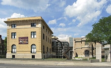
Erastus Corning 2nd, arguably Albany's most notable mayor (and great-grandson of the former mayor of the same name), was elected in 1941.[84] Although he was one of the longest-serving mayors of any city in United States history (1942 until his death in 1983), one historian describes Corning's tenure as "long on years, short on accomplishments."[85] Grondahl cited Corning's preference for maintaining the status quo as a factor that held back potential progress during his tenure.[86] While Corning brought stability to the office of mayor, it is said that even those who admire him greatly cannot come up with a sizable list of "major concrete Corning achievements."[87] Corning is given credit for saving—albeit somewhat unintentionally—much of Albany's historic architecture.[h]
During the 1950s and 1960s, a time when federal aid for urban renewal was plentiful,[86] Albany did not have growth in its economy or infrastructure. It lost more than 20 percent of its population during the Corning years, as people moved to newer housing in the suburbs, followed by most of the downtown businesses moving there as well.[88] While cities across the country grappled with similar issues, the problems were magnified in Albany: interference from the Democratic political machine hindered progress considerably.[86]
Governor Nelson Rockefeller (1959–1973) (R) tried to stimulate the city with grandiose, monumental architecture and large, government-sponsored building projects; he drove construction of the Empire State Plaza, SUNY Albany's uptown campus, and much of the W. Averell Harriman State Office Building Campus.[89] Albany County Republican Chairman Joseph C. Frangella once quipped, "Governor Rockefeller was the best mayor Albany ever had."[90] Corning, though opposed to the project, was responsible for negotiating the payment plan for the Empire State Plaza. Rockefeller did not want to be limited by the Legislature's power of the purse, so Corning devised a plan to have the county pay for the construction and have the state sign a lease-ownership agreement. The state paid off the bonds until 2004. It was Rockefeller's only viable option, and he agreed. Due to the clout Corning gained from the situation, he was able to get the State Museum, a convention center, and a restaurant, back in the plans—ideas which Rockefeller had originally vetoed. The county gained $35 million in fees and the city received $13 million for lost tax revenue. Having the state offices located in the city enabled it to keep good jobs.[91]
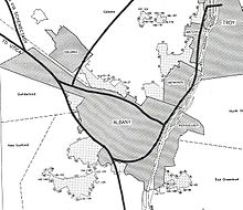
Another major project of the 1960s and 1970s was Interstate 787 and the South Mall Arterial.[i] Construction began in the early 1960s. One of the project's main results, since regretted, was separating the city from the Hudson River, its source of development. Corning has been described as shortsighted with respect to use of the waterfront, as he could have used his influence to change the location of I-787, which now cuts the city off from "its whole raison d'être".[92] Much of the original plan never came to fruition, however: Rockefeller had wanted the South Mall Arterial to pass through the Empire State Plaza. The project would have required an underground trumpet interchange below Washington Park, connecting to the (eventually cancelled) Mid-Crosstown Arterial.[93] To this day, evidence of the original plan is still visible.[j] In 1967 the hamlet of Karlsfeld was the last annexation by the city, taken from the Town of Bethlehem.[51]
When Corning died in 1983, Thomas Whalen assumed the mayorship and was reelected twice. He encouraged redevelopment of historic structures and helped attract federal dollars earmarked for that purpose. What Corning had saved from destruction, Whalen refurbished for continued and new uses.[94] The Mayor's Office of Special Events was created in an effort to increase the number of festivals and artistic events in the city, including a year-long Dongan Charter tricentennial celebration in 1986.[95] Whalen is credited for an "unparalleled cycle of commercial investment and development" in Albany due to his "aggressive business development programs".[96]
Prior to the recession of the 1990s, downtown Albany was home to four Fortune 500 companies.[97] After the death of Corning and the retirement of Congressman Sam Stratton, the political environment changes. Long-term office holders became rare in the 1980s. Local media began following the drama surrounding county politics (specifically that of the newly created county executive position); the loss of Corning (and eventually the machine) led to a lack of interest in city politics.[98] The election of Gerald Jennings was a surprise, and he served as Mayor from 1994 until his retirement at the end of 2013. His tenure essentially ended the political machine that had been in place since the 1920s.[99]
During the 1990s, the State Legislature approved the $234 million "Albany Plan", "a building and renovation project [that] was the most ambitious building project to affect the area since the Rockefeller era." Under the Albany Plan, renovation and new building projects were initiated around the downtown area. Many state workers were relocated from the Harriman State Office Campus to downtown, helping its retail businesses and vitality.[100] During the first decade of the 21st century, progress was made on a long-discussed and controversial Albany Convention Center. As of August 2010, the Albany Convention Center Authority (authorized by the state legislature) had already purchased 75% of the land needed to build the downtown project.[101]
Geography
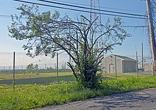
Albany is located about 150 miles (240 km) north of New York City on the Hudson River.[23] It has a total area of 21.8 square miles (56 km2), of which 21.4 square miles (55 km2) is land and 0.4 square miles (1.0 km2) (1.8%) is water.[102] The city is bordered on the north by the town of Colonie (along with the village of Menands), on the west by the town of Guilderland, and on the south by the town of Bethlehem.[103] The Hudson River represents the city's eastern border. Patroon Creek, along the northern border, and the Normans Kill, along the southern border, are the two major streams in the city. The former Foxes Creek, Beaver Kill, and Rutten Kill still exist, but were diverted underground in the 19th century.[104][105][106] There are four lakes within city limits: Buckingham Lake; Rensselaer Lake at the mouth of the Patroon Creek; Tivoli Lake, which was formed as a reservoir and once connected to the Patroon Creek; and Washington Park Lake, which was formed by damming the Beaver Kill.[103][105]
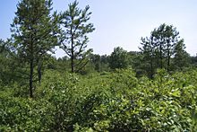
The highest natural point in Albany is a USGS benchmark near the Loudonville Reservoir off Birch Hill Road, at 378 feet (115 m) above sea level. The lowest point is sea level at the Hudson River (the average water elevation is 2 feet (0.61 m)),[103][108] which is still technically an estuary at Albany and is affected by the Atlantic tide.[109] The interior of Albany consists of rolling hills which were once part of the Albany Pine Bush, an area of pitch pine and scrub oak, and has arid, sandy soil that is a remnant of the ancient Lake Albany. Due to development, the Pine Bush has shrunk from an original 25,000 to 6,000 acres (10,100 to 2,400 ha) today. A preserve was set up by the State Legislature in 1988 and is located on the western edge of the city, spilling into Guilderland and Colonie;[110] it is the only sizable inland pine barrens sand dune ecosystem in the United States,[107] and is home to many endangered species, including the Karner Blue butterfly.[111]
Climate
Albany is located in the humid continental climate zone (Köppen climate classification: Dfa),[112] and has cold, snowy winters, and hot, wet summers; the city experiences four distinct seasons. Albany is located in plant hardiness zone 6a near downtown and along the shore of the Hudson and 5b at its western end.[113] Albany receives 39.4 inches (1,000 mm) of rain per year,[114] with 138 days of at least 0.01 in (0.25 mm) of precipitation each year. Snowfall is significant, totaling 59.1 inches (150 cm) annually,[114] but with less accumulation than the lake-effect areas to the north and west, as it is further from Lake Ontario. However, Albany is close enough to the Atlantic coast to receive heavy snow from Nor'easters and the city occasionally receives Alberta clippers.[115] Winters can be very cold with fluctuating conditions; temperatures drop to 0 °F (−18 °C) or below on nine nights per annum.[116] Summers in Albany can contain stretches of excessive heat and humidity, with temperatures of 90 °F (32 °C) or hotter on nine days per year.[116] Record temperature extremes range from −28 °F (−33 °C), on January 19, 1971, to 104 °F (40 °C) on July 4, 1911.[116]
| Climate data for Albany International Airport, New York (1991–2020 normals,[k] extremes 1874–present[l]) | |||||||||||||
|---|---|---|---|---|---|---|---|---|---|---|---|---|---|
| Month | Jan | Feb | Mar | Apr | May | Jun | Jul | Aug | Sep | Oct | Nov | Dec | Year |
| Record high °F (°C) | 71 (22) |
74 (23) |
89 (32) |
93 (34) |
97 (36) |
100 (38) |
104 (40) |
102 (39) |
100 (38) |
91 (33) |
82 (28) |
72 (22) |
104 (40) |
| Mean maximum °F (°C) | 54.5 (12.5) |
54.5 (12.5) |
65.9 (18.8) |
80.9 (27.2) |
87.8 (31.0) |
92.0 (33.3) |
92.7 (33.7) |
90.6 (32.6) |
87.0 (30.6) |
77.8 (25.4) |
67.7 (19.8) |
56.4 (13.6) |
94.5 (34.7) |
| Mean daily maximum °F (°C) | 32.8 (0.4) |
36.0 (2.2) |
45.3 (7.4) |
59.2 (15.1) |
71.2 (21.8) |
79.4 (26.3) |
83.9 (28.8) |
82.0 (27.8) |
74.4 (23.6) |
61.6 (16.4) |
49.3 (9.6) |
38.2 (3.4) |
59.4 (15.2) |
| Daily mean °F (°C) | 24.4 (−4.2) |
26.8 (−2.9) |
35.7 (2.1) |
48.1 (8.9) |
59.6 (15.3) |
68.4 (20.2) |
73.1 (22.8) |
71.4 (21.9) |
63.5 (17.5) |
51.4 (10.8) |
40.5 (4.7) |
30.4 (−0.9) |
49.4 (9.7) |
| Mean daily minimum °F (°C) | 15.9 (−8.9) |
17.6 (−8.0) |
26.1 (−3.3) |
36.9 (2.7) |
48.1 (8.9) |
57.4 (14.1) |
62.4 (16.9) |
60.7 (15.9) |
52.6 (11.4) |
41.1 (5.1) |
31.6 (−0.2) |
22.7 (−5.2) |
39.4 (4.1) |
| Mean minimum °F (°C) | −6.0 (−21.1) |
−2.4 (−19.1) |
7.8 (−13.4) |
23.7 (−4.6) |
33.8 (1.0) |
43.3 (6.3) |
51.5 (10.8) |
48.9 (9.4) |
37.6 (3.1) |
27.0 (−2.8) |
16.0 (−8.9) |
4.6 (−15.2) |
−8.4 (−22.4) |
| Record low °F (°C) | −28 (−33) |
−22 (−30) |
−21 (−29) |
9 (−13) |
26 (−3) |
35 (2) |
40 (4) |
34 (1) |
24 (−4) |
16 (−9) |
−11 (−24) |
−22 (−30) |
−28 (−33) |
| Average precipitation inches (mm) | 2.60 (66) |
2.28 (58) |
3.09 (78) |
3.11 (79) |
3.41 (87) |
4.05 (103) |
4.55 (116) |
3.76 (96) |
3.73 (95) |
3.85 (98) |
2.99 (76) |
3.26 (83) |
40.68 (1,033) |
| Average snowfall inches (cm) | 15.6 (40) |
13.7 (35) |
12.0 (30) |
1.6 (4.1) |
0.1 (0.25) |
0.0 (0.0) |
0.0 (0.0) |
0.0 (0.0) |
0.0 (0.0) |
0.3 (0.76) |
2.6 (6.6) |
13.3 (34) |
59.2 (150) |
| Average extreme snow depth inches (cm) | 8.3 (21) |
8.3 (21) |
8.0 (20) |
1.1 (2.8) |
0.0 (0.0) |
0.0 (0.0) |
0.0 (0.0) |
0.0 (0.0) |
0.0 (0.0) |
0.2 (0.51) |
1.3 (3.3) |
7.0 (18) |
13.6 (35) |
| Average precipitation days (≥ 0.01 in) | 12.7 | 10.6 | 11.8 | 12.2 | 12.7 | 12.2 | 11.4 | 11.0 | 9.7 | 11.2 | 11.1 | 12.6 | 139.2 |
| Average snowy days (≥ 0.1 in) | 10.1 | 7.8 | 5.7 | 1.3 | 0.0 | 0.0 | 0.0 | 0.0 | 0.0 | 0.2 | 2.4 | 7.0 | 34.5 |
| Average relative humidity (%) | 71.1 | 68.5 | 64.8 | 61.2 | 65.5 | 69.5 | 70.5 | 74.1 | 75.7 | 72.4 | 73.1 | 73.9 | 70.0 |
| Average dew point °F (°C) | 12.9 (−10.6) |
14.5 (−9.7) |
22.6 (−5.2) |
32.2 (0.1) |
45.0 (7.2) |
55.0 (12.8) |
60.3 (15.7) |
59.4 (15.2) |
52.3 (11.3) |
40.3 (4.6) |
31.1 (−0.5) |
19.4 (−7.0) |
37.1 (2.8) |
| Mean monthly sunshine hours | 141.1 | 158.5 | 200.3 | 218.9 | 248.9 | 262.2 | 289.2 | 253.2 | 210.5 | 168.8 | 108.3 | 100.7 | 2,360.6 |
| Percent possible sunshine | 48 | 54 | 54 | 54 | 55 | 57 | 62 | 59 | 56 | 49 | 38 | 34 | 53 |
| Average ultraviolet index | 1 | 2 | 4 | 5 | 7 | 8 | 8 | 7 | 6 | 3 | 2 | 1 | 5 |
| Source 1: NOAA (relative humidity, dew point, and sun 1961–1990)[117][118][119] | |||||||||||||
| Source 2: Weather Atlas[120] | |||||||||||||
Crime
New York has an effective statewide crime rate of 385/100,000 people as of 2009.[121] Albany's violent crime rate is on par with Rochester (1028 violent crimes/100,000 population vs 968/100,000 in Rochester) and much lower than Buffalo at 1514/100,000. By comparison, New York City's violent crime rate was 639/100,000 in 2013.[122]
Cityscape
Neighborhoods

Albany's neighborhoods are varied demographically, geographically, architecturally, and historically. Downtown Albany is the city's oldest neighborhood, centered on State Street, one of Albany's oldest streets and its original main street. Today downtown consists mostly of office buildings inhabited by state agencies, though a recent push to bring in permanent residents has led to proposed apartments and condominiums.[123][124] North and south of Downtown are old residential communities often consisting of row houses. North is Sheridan Hollow, Arbor Hill, and North Albany; to the south is the super-neighborhood of the South End, which consists of a multitude of smaller neighborhoods including the Mansion District, the Pastures, Kenwood, Groesbeckville, Delaware Avenue, and Krank Park.[125][126] These neighborhoods tend to have more minorities and lower-income residents than the western, more suburbanized sections of the city.[127]

West of Downtown is the Empire State Plaza, which effectively cuts Downtown off from the gentrified neighborhoods of Center Square, Hudson/Park, Lark Street, and Washington Park. Collectively referred to as mid-town, these neighborhoods are often compared to New York City's Greenwich Village for their eclectic mix of residential and commercial uses, including bars, night clubs, restaurants, and unique stores. Albany's gay culture is vibrant in this area.[128] Nearby Park South, a nine-block area surrounding New Scotland Avenue[126] is undergoing an urban renewal as existing housing units are removed or renovated and new office, commercial, and apartment buildings are added.[129] New construction includes expansion of Albany Medical Center, one of the largest employers in Albany. Nearby is University Heights, a united campus consisting of Albany Medical Center Hospital, Albany Medical College, Albany Law School, Albany College of Pharmacy, and the Sage College of Albany.[130]
Western neighborhoods, such as Pine Hills, Delaware Avenue, Whitehall, Helderberg, New Scotland, and Beverwyck, tend to have larger lots and more suburban surroundings.[125] The eastern section of Pine Hills is a popular living choice for college students due to its proximity to the campuses of the College of Saint Rose and University at Albany.[131] Further west, the neighborhoods become more affluent and are dominated almost exclusively by single-family dwellings. These neighborhoods, such as Melrose, Western Pine Hills, New Albany, Eagle Hill, Westland Park, Campus, and Buckingham Pond more closely resemble neighboring areas of the suburban towns than they do the downtown parts of the city.[125] Further west is the W. Averell Harriman State Office Campus and the University at Albany's main campus.[126][132]
Parks and recreation
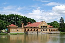
Albany has more than 60 public parks and recreation areas.[134] Washington Park was organized as the Middle Public Square in 1806. Its current location has been public property since the Dongan Charter of 1686 gave the city title to all property not privately owned. Washington Park was designed by John Bogart and John Cuyler in 1870,[135] and opened for public use the following year. The original lake house, designed by Frederick W. Brown, was added in 1876. The park had previously been used as a cemetery; its graves were moved to Albany Rural Cemetery. Washington Park is a popular place to exercise and play sports; skate during the winter; people-watch during Tulip Fest; and attend plays at the amphitheater during the summer.[135][136][137][138]
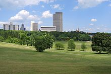
Other parks in Albany include Lincoln Park, Buckingham Park, the Corning Preserve, and the Pine Bush. Lincoln Park, southwest of the Empire State Plaza, was organized in 1886 and was originally known as Beaver Park.[139] Today, the park has a pool that is open during the summer months. Buckingham Lake Park is between Manning Boulevard and Route 85 in the Buckingham Pond neighborhood; it contains a pond with fountains, a footpath, a playground, and picnic tables.[140] The Albany Riverfront Park at the Corning Preserve has an 800-seat amphitheatre that hosts events in non-winter months, most notably the Alive at 5 summer concert series. The Preserve's visitors center details the ecology of the Hudson River and the local environment.[141] The park has a bike trail and boat launch[141] and was effectively separated from downtown by Interstate 787 until the opening of the Hudson River Way in 2002.[142]
Other public parks include Westland Hill Park, Hoffman Park, Beverwyck Park, Ridgefield Park,[143] and Liberty Park, today a small circular grassy patch in downtown on Hudson Avenue, which is Albany's oldest park.[144] The municipal golf course, New Course at Albany, was constructed in 1929 as the Albany Municipal Golf Course, later renamed the Capital Hills at Albany, and remodeled in 1991.[145]
Architecture
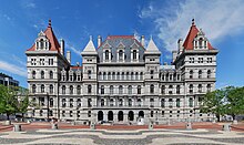
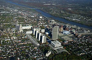

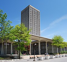
The Empire State Plaza, a collection of state agency office buildings, dominates almost any view of Albany. Built between 1965 and 1978 at the hand of Governor Nelson A. Rockefeller and architect Wallace Harrison, the complex is a powerful example of late American modern architecture[146] and remains a controversial building project both for displacing city residents and for its architectural style. The most recognizable aspect of the complex is the Erastus Corning Tower, the tallest building in New York outside of New York City.[146] Juxtaposed at the north end of the Plaza is the 19th-century New York State Capitol, the seat of the New York State Legislature and the home of the Governor's office.[147]
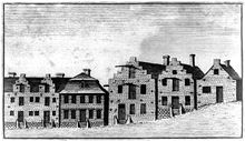
Albany's initial architecture incorporated many Dutch influences, followed soon after by those of the English.[148] Quackenbush House, a Dutch Colonial brick mansion, was built c. 1736;[149] Schuyler Mansion, a Georgian-style mansion, was built in 1765;[150] and the oldest building currently standing in Albany is the 1728 Van Ostrande-Radliff House at 48 Hudson Avenue.[151] Albany's housing varies greatly, with mostly row houses in the older sections of town, closer to the river. Housing type quickly changes as one travels westward, beginning with two-family homes of the late 19th century, and one-family homes built after World War II in the western end of the city.[152]
Albany City Hall, designed by Henry Hobson Richardson, was opened in 1883. The New York State Capitol was opened in 1899 (after 32 years of construction)[147] at a cost of $25 million, making it the most expensive government building at the time.[153] Albany's Union Station, a major Beaux-Arts design,[154] was under construction at the same time; it opened in 1900. In 1912, the Beaux-Arts styled New York State Department of Education Building opened on Washington Avenue near the Capitol. It has a classical exterior, which features a block-long white marble colonnade.[155] The 1920s brought the Art Deco movement, which is illustrated by the Home Savings Bank Building (1927) on North Pearl Street[156] and the Alfred E. Smith Building (1930) on South Swan Street,[157] two of Albany's tallest high-rises.[158]
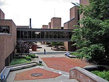
Architecture from the 1960s and 1970s is well represented in the city, especially at the W. Averell Harriman State Office Building Campus (1950s and 1960s) and on the uptown campus of the University at Albany (1962–1971). The state office campus was planned in the 1950s by governor W. Averell Harriman to offer more parking and easier access for state employees.[159] The uptown SUNY campus was built in the 1960s under Governor Rockefeller on the site of the city-owned Albany Country Club. Straying from the popular open campus layout, SUNY Albany has a centralized building layout with administrative and classroom buildings at center surrounded by four student housing towers. The design called for much use of concrete and glass, and the style has slender, round-topped columns and pillars reminiscent of those at Lincoln Center in New York City.[160]
Downtown has seen a revival in recent decades, often considered to have begun with Norstar Bank's renovation of the former Union Station as its corporate headquarters in 1986.[m] The Times Union Center (TU Center) was originally slated for suburban Colonie,[162] but was instead built downtown and opened in 1990.[163] Other development in downtown includes the construction of the State Dormitory Authority headquarters at 515 Broadway (1998);[164] the State Department of Environmental Conservation building, with its iconic green dome, at 625 Broadway (2001);[165] the State Comptroller headquarters on State Street (2001);[2] the Hudson River Way (2002), a pedestrian bridge connecting Broadway to the Corning Preserve;[142] and 677 Broadway (2005), "the first privately owned downtown office building in a generation".[166][167]
Demographics
City of immigrants
| Census | Pop. | Note | %± |
|---|---|---|---|
| 1790 | 3,498 | — | |
| 1800 | 5,349 | 52.9% | |
| 1810 | 10,762 | 101.2% | |
| 1820 | 12,630 | 17.4% | |
| 1830 | 24,209 | 91.7% | |
| 1840 | 33,721 | 39.3% | |
| 1850 | 50,763 | 50.5% | |
| 1860 | 62,367 | 22.9% | |
| 1870 | 69,422 | 11.3% | |
| 1880 | 90,758 | 30.7% | |
| 1890 | 94,923 | 4.6% | |
| 1900 | 94,151 | −0.8% | |
| 1910 | 101,253 | 7.5% | |
| 1920 | 113,344 | 11.9% | |
| 1930 | 127,412 | 12.4% | |
| 1940 | 130,577 | 2.5% | |
| 1950 | 134,995 | 3.4% | |
| 1960 | 129,726 | −3.9% | |
| 1970 | 115,781 | −10.7% | |
| 1980 | 101,727 | −12.1% | |
| 1990 | 101,082 | −0.6% | |
| 2000 | 95,658 | −5.4% | |
| 2010 | 97,856 | 2.3% | |
| 2014 (est.) | 98,566 | [168] | 0.7% |
| Sources: 1790–1950,[169] 1960–1980,[170] 1990–2000[171] | |||
Historically, Albany's population has been mixed. First dominated by the Dutch and Germans, it was overtaken by the English in the early 19th century. Irish immigrants soon outnumbered most other ethnicities by the mid-19th century, and were followed by Italians and Poles. The mid-to-late 20th century saw a rise in the African-American population. As historian (and Albany Assemblyman) John McEneny puts it,
"Dutch and Yankee, German and Irish, Polish and Italian, black and Chinese—over the centuries Albany's heritage has reflected a succession of immigrant nationalities. Its streets have echoed with a dozen languages, its neighborhoods adapting to the distinctive life-style and changing economic fortunes of each new group."[172]
Until after the Revolution, Albany's population consisted mostly of ethnic Dutch descendants. Settlers moving in from New England tipped the balance toward British ethnicity in the early 19th century.[173] Jobs on the turnpikes, canals, and railroads brought in floods of Irish immigrants in the early 19th century, especially in the 1840s during the Irish potato famine, solidifying the city's Irish base. Albany elected its first Irish Catholic mayor (Michael Nolan) two years before Boston did.[174] Polish and Italian immigrants began arriving in Albany in the wave of immigration in the latter part of the 19th century. Their numbers were smaller than in many other eastern cities mainly because most had found manufacturing jobs at General Electric in Schenectady.[175] The Jewish community, with Sephardic Jewish members part of the Beverwijck community, also saw a rise in population during the late 19th century, when many Ashkenazi Jews immigrated from eastern Europe.[175] In that period, there was also an influx of Chinese and east Asian immigrants, who settled in the downtown section of the city. Many of their descendants have since moved to suburban areas.[176] Immigration all but halted after the Immigration Act of 1924. Albany was also a destination of internal migration, as many African Americans moved north in their Great Migration from the rural South before and after World War I to fill industrial positions. As a percentage, the black community has grown substantially since then: African Americans made up 3 percent of the population in 1950, 6 percent in 1960, 12 percent in 1970, and 30 percent in 2010. The change in proportion is related mostly to middle-class white families moving to the suburbs, and black families remaining within city limits during the same time period.[177][171]
Since 2007 there has been an ever growing number of Burmese refugees, mostly of the Karen ethnicity, with an estimate 5,000 now residing in Albany.[178][179]
Modern overview
As of the 2010 census,[171] there were 97,856 people residing in the city.[171] The population of the census area in 2009 was estimated to be 1,170,483.[1][180] The population density in 2010 was 4,572.7 per square mile (1,779.2/km²). There were 46,362 housing units at an average density of 2,166.4 per square mile (842.9/km²); 5,205 of these units (11.2%) were vacant. The racial makeup of the city residents was 52.3% white; 27% black or African American; 0.06% Native American or Native Alaskan; 7.4% Asian; 0.1% Native Hawaiian or Pacific Islander; .06% from other races; and 3.6% from two or more races. A total of 9.2% of the population were Hispanic or Latino of any race.[n] Non-Hispanic Whites were 52.0% of the population in 2010,[102] compared to 87.0% in 1970.[181]
As of the 2000 census, the top five ancestry groups in the city were Irish (18.1%), Italian (12.4%), German (10.4%), English (5.2%), and Polish (4.3%); (33.1%) of the population reported "other ancestries". Albany is home to a Trique language-speaking community of Mexican-Americans.[182]
The population had 20.0% under the age of 18, 19.3% from 18 to 24, 29.2% from 25 to 44, 18.1% from 45 to 64, and 13.4% who were 65 years of age or older. The median age was 31.4 years. For every 100 females there were 90.6 males. For every 100 females age 18 and over, there were 86.5 males. Some 81.3% of the population had completed high school or earned an equivalency diploma.[171]
There were 40,709 households in 2000, out of which 22.0% had children under the age of 18 living with them, 25.3% were married couples living together, 16.1% had a female householder with no husband present, and 54.8% were non-families. 41.9% of all households were made up of individuals and 11.5% had someone living alone who was 65 years of age or older. The average household size was 2.11 and the average family size was 2.95.[171]
The median income for a household in the city in 2000 was $91,525, and the median income for a family was $94,989 (male, year-round worker) and $86,168 (female, year-round worker). The per capita income for the city was $70,016.[183][o] About 16.0% of families and 21.7% of the population were below the poverty line, including 28.8% of those under age 18 and 12.5% of those age 65 or over.[171] The rate of reported violent crimes for 2008 (1,095 incidents per 100,000 residents) is more than double the rate for similarly sized US cities. Reported property crimes (4,669 incidents per 100,000 residents) are somewhat lower.[184][185]
Demographically speaking, the population of Albany and the Capital District mirrors the characteristics of the United States consumer population as a whole better than any other major municipality in the country. According to a 2004 study conducted by the Acxiom Corporation, Albany and its environs are the top-ranked standard test market for new business and retail products. Albany, Rochester, and Syracuse all scored within the top five.[186]
Culture
Nightlife and entertainment

Albany's geographic situation—roughly equidistant between New York City to the south and Montreal to the north, as well as approximately 4.5 hours east of Buffalo, and 2.5 hours west of Boston—makes it a convenient stop for nationally touring artists and acts. The Palace Theatre and The Egg provide mid-sized forums for music, theater, and spoken word performances, with the Capital Repertory Theatre filling the small-sized niche.[188] The TU Center serves as the city's largest musical venue for nationally and internationally prominent bands, and hosts trade shows, sporting events, and other large-scale community gatherings.[189] While some praise the cultural contributions of Albany and the greater Capital District,[95] others suggest that the city has a "cultural identity crisis" due to its massive geography and the need for a car (and driving time) to experience most of what the area has to offer, a necessity not seen in larger metropolitan areas like New York and Boston.[190]
In recent years, the city's government has invested resources to cultivate venues and neighborhoods that attract after-hours business. Madison Avenue, Pearl Street, Delaware Avenue and Lark Street serve as the most active entertainment areas in the city. Many restaurants, clubs, and bars have opened since the mid-1990s, revitalizing numerous areas that had once been abandoned; various establishments have reclaimed old row houses, businesses, and even a pump station.[188] The bar scene generally incorporates three main strips. The downtown scene is focused on Pearl Street, stretching about two blocks. Up State Street, past the business district, is the Lark Street strip, home to smaller bars that fit into the neighborhood's artistic and eclectic style. Lastly, the midtown strip, with several bars located on Western and Madison Avenues, centers around the campuses of the College of Saint Rose and SUNY Albany's downtown campus. The midtown strip generally draws a younger crowd, as it is popular to the local college students.[191]
Last call in Albany is 4:00 am nightly per New York law that sets that time as last call throughout the state by default, though counties may set an earlier time individual municipalities may not. Even though more than half of the state's counties have an earlier closing time, Albany County, as with all counties in the Capital District, has retained the 4:00 am last call time.[192]
Festivals

The Tulip Festival, one of Albany's largest festivals, is set in Washington Park and celebrates the city's Dutch heritage. This traditional Albany event marks the beginning of spring as thousands of tulips bloom in the park in early May.[193] Attendance to the festival in 2010 was approximately 80,000.[194] Alive at 5 is a free, weekly concert series held downtown during the summer on Thursdays.[195] With 10 concerts in 2010 total attendance was roughly 100,000.[194] The Price Chopper Fabulous Fourth and Fireworks Festival at the Empire State Plaza celebrates Independence Day with musical performances and the region's largest fireworks display.[187] Freihofer's Run for Women is a 5-kilometer run through the city that draws more than 4,000 participants from across the country; it is an annual event that began in 1978.[196]The Albany Chefs' Food & Wine Festival: Wine & Dine for the Arts is an annual Festival that hosts more than 3500 people over 3 days. The Festival showcases more than 70 Regional Chefs & Restaurants, 250 Global Wines & Spirits, a NYS Craft Beer Pavilion, 4 competitions (The Signature Chef Invitational, Rising Star Chef, Barista Albany and Battle of the Bartenders) and one Grand Gala Reception, Dinner & Auction featuring 10 f Albany's Iconic Chefs. The Albany Chefs' Food & Wine Festival donates all net proceeds to deserving Albany Arts Organizations and is held the Thursday-Saturday preceding Martin Luther King Weekend.
Smaller events include the African American Family Day Arts Festival each August at the Empire State Plaza;[187] the Latin Fest, held each August at the Corning Preserve;[197] the Albany Jazz Festival, an annual end-of-summer event held at the Corning Preserve;[198] Lark Fest, a music and art festival held each fall;[199] and the Capital Pride Parade and Festival, a major gay pride event, held each June.[200] The once-popular First Night, celebrating the New Year holiday each December 31, was replaced by the Albany Winterfest in 2006 due to declining interest;[201] Winterfest occurs each year on December 30.[202]
Museums and historic sites
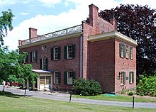

Because of Albany's historical and political significance, the city has numerous museums, historical buildings, and historic districts. Albany is home to the New York State Museum, the New York State Library and the New York State Archives; all three facilities are located in the Cultural Education Center at the south end of Empire State Plaza and are free to the public.[204] The USS Slater (DE-766), a decommissioned World War II destroyer escort that was restored in 1998, is a museum ship docked in the Hudson River at Quay Street. It is the only ship of its kind still afloat.[205] The Albany Heritage Area Visitors Center, located at the corner of Clinton Avenue and Broadway at Quackenbush Square, hosts a museum, gift shop, and the Henry Hudson Planetarium.[206] In early 2012, the Irish American Heritage Museum opened in downtown Albany. The museum is home to exhibits highlighting the contributions of the Irish people in America.[207]
The Albany Institute of History and Art, located on Washington Avenue near the Center Square Neighborhood and State Capitol, is "dedicated to collecting, preserving, interpreting and promoting interest in the history, art, culture of Albany and the Upper Hudson Valley region." The museum's most notable permanent exhibits include an extensive collection of paintings by the Hudson River School and an exhibit on Ancient Egypt featuring the Institute's "Albany Mummies."
Albany is home to 57 listings on the National Register of Historic Places[208] (NRHP) and five National Historic Landmarks.[209] The Ten Broeck Mansion, a 1797 Federal-style mansion (later renovated in the Greek-Revival style) built for Abraham Ten Broeck (mayor of Albany 1779–1783 and 1796–1798)[210] is currently a historic house museum and the headquarters of the Albany County Historical Association;[203] it was added to the NRHP in 1971.[211] Later known as "Arbor Hill", it gave the current neighborhood its name.[212]
Literature and film
Albany has been the subject, inspiration, or location for many written and cinematic works. Many non-fiction works have been written on the city. One of the city's more notable claims to fame is Ironweed (1983), the 1984 Pulitzer Prize-winning book by Albany native William Kennedy. Ironweed was the third in a series of books by Kennedy known as the "Albany Cycle".[213][214] The elusive author Trevanian also grew up in Albany and wrote The Crazyladies of Pearl Street (2005), about a North Albany neighborhood along Pearl Street. The book is considered a semi-autobiographical memoir.[215] Gregory Maguire, author of Wicked: The Life and Times of the Wicked Witch of the West (inspiration for the Broadway hit Wicked), grew up in North Albany[216] and graduated from SUNY Albany in 1976.[217]
In 1987, the film version of Ironweed premiered at the Palace Theatre.[218] The movie starred Jack Nicholson and Meryl Streep, each of whom were nominated for Academy Awards for their performances;[219] much of the filming was done on location in Albany.[218] Most recently the downtown area was the site of filming for the action-thriller Salt, starring Angelina Jolie,[220] and the action-comedy The Other Guys, starring Will Ferrell and Mark Wahlberg.[221]
Education
The City School District of Albany (CSDA) operates the city's public school system, which consists of 18 schools and learning centers;[222] in addition, there are 10 charter schools.[p] The number of students in CSDA has steadily decreased since 2000.[226][227][228] In the 2008–09 school year, 7,899 students were enrolled in the public school system.[226] The district had an average class size of 18,[226] an 81-percent graduation rate,[q] and a 5-percent dropout rate.[229] The district's 2010–11 budget is $202.8 million.[230] Although considered by the state to be one of the lowest-achieving high schools in New York, Albany High was listed as the nation's 976th best high school in a 2010 Newsweek/Washington Post report.[231]
Albany has a number of private schools, including the coed Bishop Maginn High School and Albany Free School; the all-boys Albany Academy and La Salle Institute;[r] and the all-girls Academy of the Holy Names and Albany Academy for Girls.[234]
Albany has a long history in higher education and was ranked third in a Forbes survey called "The Best Places with the Best Education" in 2005;[235] it ranked top on Forbes' "IQ Campuses" list as part of its 150 Cheap Places to Live series in 2006.[236] The Albany Medical College (private), today part of Albany Medical Center, was founded in 1838. Albany Law School (private) is the oldest law school in New York and the fourth oldest in the country; it was opened in 1851. President William McKinley was an alumnus. The Albany College of Pharmacy and Health Sciences (private) is the second oldest pharmacy school in New York and the fifteenth oldest in the United States. The New York State Normal School, one of the oldest teachers colleges in the United States, opened in 1905; it was later known as the State Teachers College. It eventually evolved into the University at Albany, also known as SUNY Albany (public), which inherited the Normal School's original downtown campus on Western Avenue. The center of the campus moved to its current Uptown Campus in the west end of the city in 1970. SUNY Albany is a unit of the State University of New York and one of only four university centers in the system.[232] Other colleges and universities in Albany include Empire State College, The College of Saint Rose, Excelsior College, Maria College, Mildred Elley, and Sage College of Albany. Nearby Hudson Valley Community College (HVCC) fills the community college niche in the Albany-Troy area.[237] The effect of the campuses on the city's population is substantial: Combining the student bodies of all the aforementioned campuses (except HVCC) results in 63,149 students, or almost 70 percent of the 2008 estimate of Albany's permanent population.[238]
Economy
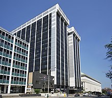
Albany's economy, along with that of the Capital District in general, is heavily dependent on government, health care, education, and more recently, technology. Because of these typically steady economic bases, the local economy has been relatively immune to national economic recessions in the past.[240] More than 25 percent of the city's population works in government-related positions.[241] The current recession has been more difficult to deal with because of the many issues on Wall Street, from which the state government receives much of its tax revenue. In March 2010, the Albany area had the lowest unemployment rate of any major metropolitan area in New York, at 7.8%, compared to 9.4% in New York as a whole.[242] Albany's estimated daytime population is more than 162,000. Companies based in Albany include Trans World Entertainment and Clough Harbour.
Tech Valley
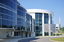
Since the 2000s, the economy of Albany and the surrounding Capital District has been redirected toward a high technology focus. Tech Valley is a marketing name for the eastern part of New York State, encompassing Albany, the Capital District, and the Hudson Valley.[243] Originated in 1998 to promote the greater Albany area as a high-tech competitor to regions such as Silicon Valley and Boston, it has since grown to represent the counties in the Capital District and extending to 19 counties from IBM's Westchester County plants in the south to the Canadian border in the north. The area's high technology ecosystem is supported by technologically focused academic institutions including Rensselaer Polytechnic Institute and the State University of New York Polytechnic Institute.[244] Tech Valley encompasses 19 counties straddling both sides of the Adirondack Northway and the New York Thruway,[243] and with heavy state taxpayer subsidy, has experienced significant growth in the computer hardware side of the high-technology industry,[240] with great strides in the nanotechnology sector, digital electronics design, and water- and electricity-dependent integrated microchip circuit manufacturing.[245]
In 2012, the Albany-Schenectady area was listed fourth on Forbes Magazine's annual "Best Cities for Jobs" list, noting that job losses in state and local government were overcome by expansion of the high-tech field.[246]
Government


Albany has a mayor-council form of government, which currently functions under a charter adopted in 1998. The 1998 charter completely overwrote the original 17th-century Dongan Charter. However, in an effort to keep Dongan in effect, the new charter was applied strictly as an amendment to Dongan, meaning Dongan is technically still in effect, giving Albany the distinction of having the oldest active city charter in the United States and "arguably the longest-running instrument of municipal government in the Western Hemisphere."[9][247] The mayor, who is elected every four years, heads the executive branch of city government.[248] The current mayor, Kathy Sheehan, was first elected in 2013. She replaced former mayor Gerald Jennings who was mayor for 20 years from 1994 to 2013.[249] The Common Council represents the legislative branch of city government and is made up of fifteen council members (each elected from one ward) and an at-large Common Council President.[247] The current president is Carolyn McLaughlin;[250] she began her term in January 2010.[251]
While Albany has its own city government, it has also been the seat of Albany County since the county's formation in 1683 and the capital of New York since 1797. As such, the city is home to all branches of the county and state governments, as well as its own. Albany City Hall sits on Eagle Street, opposite the State Capitol,[252] and the Albany County Office Building is on State Street.[253] The state government has offices scattered throughout the city.
Albany is in the 20th Congressional district, represented by Paul Tonko (D) in the United States House of Representatives. The city is represented by Chuck Schumer (D)[254] and Kirsten Gillibrand (D)[255] in the United States Senate. On the state level, the city is in the 44th district in the New York Senate, represented by Neil Breslin (D). In the New York Assembly, the western portion of the city is in the 109th district, represented by Patricia Fahy (D) and the eastern portion is in the 108th district, represented by John T. McDonald, III (D). As the seat of Albany County, the city is the location of the county's courts including Family Court, County Court, Surrogate Court, Supreme Court, and Court of Appeals.[256] Albany is the site of a United States district court for the Northern District of New York courthouse.[257]
Politics
Albany politics have been dominated by the Democratic Party since the 1920s; Daniel (Uncle Dan) O'Connell established a political machine in the city with the election of William Stormont Hackett as mayor in 1922.[258] Prior to that, William (Billy) Barnes had set up a Republican machine in the 1890s. Barnes' success is attributed to the fact that he owned two newspapers in Albany and that he was the grandson of Thurlow Weed, the influential newspaper publisher and political boss.[259] O'Connell's organization overcame Barnes' in 1922 and survived well into the 1980s (even after his death), as the machine put forth candidates for whom the electorate dutifully voted. In many instances, votes were outright bought;[260] it was not uncommon for the machine to "buy poor folks' loyalty and trust with a fiver".[261]
Gerald Jennings' upset in the 1993 Democratic mayoral primary over Harold Joyce, who had the Democratic Party's formal endorsement and had only recently been its county chairman, is often cited as the end of the O'Connell era in Albany.[262] Albany continues to be dominated by the Democratic party as enrollment in the city was 38,862 in 2009 compared to Republican enrollment of 3,487.[263] This gives Democrats a 10–1 advantage in the general election. Every elected city position has been held by a Democrat since 1931.[264]
In November 2013, Kathy Sheehan became the first woman to be elected Mayor of Albany.[265]
Religious life
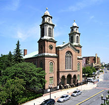
Like most cities of comparable age and size, Albany has well-established Orthodox Christian, Roman Catholic, Protestant, and Jewish communities. Albany is home to the oldest Christian congregation in Upstate New York and the Mother Churches of two Christian dioceses. As of June 2010[update], eight churches or religious buildings in the city were listed on the National Register of Historic Places,[208] one of which—St. Peter's Episcopal Church on State Street—is a National Historic Landmark.[209]
Established in 1642,[267] the congregation of the First Church in Albany (Reformed), also known as the North Dutch Church (located on North Pearl Street), is the second-oldest Reformed Church in America.[266] The Cathedral of the Immaculate Conception (Eagle Street and Madison Avenue, built 1852) is the cathedral of the Roman Catholic diocese, led by Bishop Howard J. Hubbard,[268][269] and the Cathedral of All Saints (South Swan Street and Elk Street, built 1888) is the cathedral of the Episcopal diocese, led by Bishop William Love.[270][271] The city is home to eleven Catholic churches[272] and six Episcopal churches.[273]
A significant Jewish presence has existed in Albany since as early as 1658,[274] and today includes many synagogues; there are two Conservative, a Chabad-Lubavitch, an Orthodox, and two Reform synagogues.[275] Albany is also home to one of the few Karaite synagogues outside Israel.[276] The city has a membership of between 12,000 and 13,000.[274]
Exact numbers on religious denominations in Albany are not readily available. Demographic statistics in the United States depend heavily on the United States Census Bureau, which cannot ask about religious affiliation as part of its decennial census.[277] It does compile some national and statewide religious statistics,[278] but these are not representative of a city the size of Albany. One report from 2000 offers religious affiliations for Albany County. According to the data, 59.2% of Albany County residents identified as Christian: 47% are Roman Catholic, 8.4% are mainline Protestants, 2.7% are Evangelical Protestants, and 1.1% are Eastern or Oriental Orthodox Christians. Residents who practice Judaism make up 4.2% of the population and Muslims represent 0.2%.[279] Note that these values are county-wide; city values could be significantly different.
Media
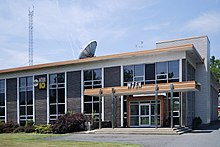
The Times Union is Albany's primary daily newspaper and the only one based close to the city; its headquarters moved from within city limits to suburban Colonie in the 1960s after a dispute with Mayor Corning over land needed for expansion.[280] Its circulation totals about 73,000 on weekdays and 143,000 on Sundays.[281] Serving Albany to a lesser degree are The Daily Gazette, based in Schenectady,[282] and The Record, of Troy.[283] Metroland is the alternative newsweekly in the area, publishing each Thursday,[284] while The Business Review is a business weekly published each Friday.[285] The Legislative Gazette, another weekly newspaper, focuses exclusively on issues related to the Legislature and the state government.[286]
The Albany-Schenectady-Troy media market is the 63rd largest in the country in terms of radio[287] and the 57th largest in terms of television audiences.[288] It is a broadcast market with historical significance. The pioneering influence of General Electric in Schenectady directly contributed to the area emerging as the birthplace of station-based television with WRGB; the station was also the first affiliate of NBC.[289] In 1947, the region was home to the first independently owned and operated commercial FM radio station in the United States: W47A.[289] WGY was the second commercial radio station in New York and the twelfth in the nation.[289] The Capital District is home to ABC affiliate WTEN,[290] CBS affiliate WRGB (also operating CW affiliate WCWN),[291] Fox affiliate WXXA,[292] and NBC affiliate WNYT (also operating MyNetworkTV affiliate WNYA);[293] Time Warner Cable hosts Time Warner Cable News Capital Region, the area's only local 24-hour news channel.[294] The area has numerous radio stations.
Transportation
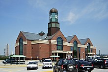
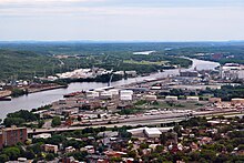

The Northway (Interstate 87 north of the New York State Thruway) connects Albany by car to Canada at Champlain; Autoroute 15 continues into Quebec, linking Albany to Montreal. Interstate 90 connects Albany to both Buffalo and Boston, via the New York State Thruway and the Massachusetts Turnpike respectively, both of which use I-90 (the NYS Thruway partially, the Massachusetts Turnpike fully). South of Albany, I-87 becomes part of the Thruway and ends at Interstate 278 in the Bronx. Albany is literally at the crossroad of I-87 and I-90, creating a junction between Buffalo and Boston, and Montreal and New York. Interstate 787 links Albany to Watervliet, Colonie, and Menands; by way of Route 7, I-787 connects to the Northway, offering Saratoga County residents a rather direct, albeit congested route to and from Albany during rush hour.[132]
Albany, long an important Hudson River port, today serves domestic and international ships and barges through the Port of Albany-Rensselaer, located on both sides of the river. The port has the largest mobile harbor crane in the state of New York.[296] The New York State Barge Canal, the ultimate successor of the Erie Canal, is in use today, largely by tourist and private boats.[297]
With the closure of Union Station on Broadway, area passenger-rail service is provided by Amtrak at the Albany-Rensselaer station in Rensselaer. In 2009, the station saw more than 720,000 passengers, making it Amtrak's second-busiest in New York, behind New York's Penn Station.[298] Low cost curbside bus service from the SUNY Albany campus and the Rensselaer station is also provided by Megabus, with direct service to New York City.
Albany's nearest airport is Albany International Airport in Colonie. Six major airlines service Albany: Cape Air, Delta Air Lines, Southwest Airlines, United Air Lines, and US Airways; Million Air is the local fixed base operator.[299] In 2010, Albany had the highest average airfare in New York, though the per-mile cost on its busiest routes was second-lowest in the state.[300]
The Capital District Transportation Authority (CDTA) provides bus service throughout Albany and the surrounding area, including Schenectady, Troy, and Saratoga Springs.[301] The city was once served by an urban streetcar service maintained by the United Traction Company. As in many American cities, after the advent of the automobile, light rail services declined in Albany and were replaced by bus and taxi services.[302] Greyhound Lines,[303] Trailways,[304] Peter Pan,[305] Short Line, Vermont Translines, and Yankee Trails[306] buses all serve a downtown terminal. Brown Coach provides commuter service.[307]
Sports

Albany has no major league professional sports teams, and minor league teams have low support.[310] The only minor league team currently active are the Albany Devils ice hockey team, which moved to the city for the 2010–2011 season. They play in the American Hockey League and are affiliated with the New Jersey Devils of the National Hockey League.[311][312] The Devils replaced the Albany River Rats, who played in the Capital Region from 1990 to 2010, when they relocated to Charlotte, North Carolina.
The Albany Firebirds played in the Arena Football League from 1990 to 2000, while a second team, originally known as the Albany Conquest and later the Firebirds, played in af2, the AFL's developmental league, from 2002 to 2009. The Tri-City ValleyCats short season minor league baseball team have played at the Joseph L. Bruno Stadium on the Hudson Valley Community College campus in North Greenbush since 2002. Prior to the ValleyCats' arrival, the Albany-Colonie Diamond Dogs (1995–2002) played at Heritage Park in Colonie; due to financial pressures, and facing impending competition from the ValleyCats, the franchise folded in 2002.[313] The local basketball team is the Albany Legends (International Basketball League), who play in the Washington Avenue Armory.[314] The Albany Patroons were two basketball teams that played at the Armory. Both folded due to financial problems.[315]
With the large number of local colleges and universities around Albany, college sports are popular. The University at Albany's Great Danes currently play at the Division I level in all sports. The football team is a member of the Colonial Athletic Association (CAA), while all other sports teams play as members of the America East Conference (AEC).[316] In 2006, UAlbany became the first SUNY-affiliated school to send a team to the NCAA Division I Men's Basketball Tournament.[317] UAlbany has also hosted the New York Giants training camp since 1996.[318] The Siena Saints have seen a rise in popularity after their men's basketball team made it to the NCAA Men's Division I Basketball Championship (March Madness) in 2008, 2009, and 2010.[319] All 18 Saints teams are Division I and play in the Metro Atlantic Athletic Conference (MAAC).[320] Although Siena's campus is in nearby Colonie, the men's basketball team plays at the TU Center.[308]
Sister cities
Albany has five official sister city agreements and two other twin-city relationships. The city of Nijmegen, Netherlands connected with Albany following World War II. With the help of the Catholic university in Albany, the Catholic University of Nijmegen (Radboud University Nijmegen) rebuilt its partly destroyed library, with over 50,000 books being donated to the Dutch university. To show its gratitude for post-war assistance, the city sent Albany 50,000 tulip bulbs in 1948; this act led to the establishment of the annual Tulip Festival.[95] Most of the other connections were made in the 1980s during Mayor Whalen's term in office as part of his cultural expansion program.[95] The official sister cities are:[321]
 Nassau, Bahamas;
 Nijmegen, Netherlands;
 Quebec City, Canada;
 Tula, Russia; and
 Verona, Italy.
The additional twin-city relationships are with:[95]
 Ghent, Belgium
 Extremadura (region), Spain.
See also
- List of capitals in the United States
- List of cities in New York
- List of incorporated places in New York's Capital District
- List of people associated with Albany County, New York
- National Register of Historic Places listings in Albany, New York
- Neighborhoods of Albany, New York
Notes
- ^ The State University of New York at Albany (its official name) is also known locally as the University at Albany, SUNY Albany, UAlbany (especially when talking about athletics), and simply SUNY.
- ^ The Dongan Charter incorporated Albany three months after New York City's charter was ratified. However, the latter forfeited its charter during Leisler's Rebellion, making Albany's the oldest effective charter in the country.[14][15]
- ^ This name would later be adopted by the city of Schenectady, to the west.[18]
- ^ James Stuart (1633–1701), brother and successor of Charles II, was both the Duke of York and Duke of Albany before being crowned James II of England and James VII of Scotland in 1685. His title of Duke of York is the source of the name of the province of New York.[26]
- ^ The Plan of Union's original intention was to unite the colonies in defense against aggressions of the French to the north; it was not an attempt to become independent from the auspices of the British crown.[37]
- ^ A rough grid pattern was established in 1764, aligning the streets with Clinton Avenue, which marked the northern border of Albany at the time. Patroon of the Manor of Rensselaerswyck Stephen Van Rensselaer II followed the same directional system north of Clinton Avenue on his lands; however, the two systems were not related otherwise, which is why cross streets north and south of Clinton Avenue do not align. The stockade surrounding the city was taken down shortly before the Revolutionary War, allowing for expansion. De Witt, city surveyor at the time, continued the grid pattern to the west and renamed on his 1794 map any streets that had honored British Royalty. Hawk Street is the only road that retained its original name; the rest were renamed after birds and mammals.[44][45]
- ^ "The Colonie" made up the current area of Arbor Hill and was the more urban part of the Manor of Rensselaerswyck, which surrounded Albany.[51] It is the source of the name of the current town and village of Colonie.[52]
- ^ Grondahl summarizes it as, "This hard-line position of isolationism on the part of the machine was a curse economically – but a strange blessing unintentionally in architectural terms. While downtown went to seed and plans for large-scale construction and improvements came to a virtual standstill in Albany without federal money, pockets of the city's historic housing stock escaped the wrecking ball."[86]
- ^ The Empire State Plaza was originally known as the South Mall; the South Mall Arterial is the only remnant of that naming scheme.
- ^ For example, the Plaza has four traffic tunnels, two intended for through traffic, and two for local traffic (only the outer, local traffic tunnels are in use); the Arterial ends abruptly between Jay Street and Hudson Avenue just west of South Swan Street (42°39′6.17″N 73°45′43.54″W / 42.6517139°N 73.7620944°W); the east end of the Dunn Memorial Bridge ends abruptly in Rensselaer (42°38′33.33″N 73°44′44.78″W / 42.6425917°N 73.7457722°W); and Henry Johnson Boulevard, which would have extended as part of the Mid-Crosstown Arterial, ends abruptly at Livingston Avenue (42°39′49.92″N 73°45′30.58″W / 42.6638667°N 73.7584944°W).
- ^ Mean monthly maxima and minima (i.e. the expected highest and lowest temperature readings at any point during the year or given month) calculated based on data at said location from 1991 to 2020.
- ^ Official records for Albany kept January 1874 to May 1938 at downtown and at Albany Int'l since June 1938. For more information, see Threadex
- ^ In 2009, Bank of America (which now owns FleetBank, the bank that eventually bought Norstar) consolidated its operations in an office building on State Street, leaving the former train station vacant.[161] Mayor Corning made great efforts to save the building, which had been owned by his great-grandfather's railroad a hundred years before. He was able to do it when governor Rockefeller brought state money in to purchase the building.[90]
- ^ The percentages listed here were calculated using the raw population data given by the Census Bureau divided by the total population, rounded to the nearest hundredth. Note that these percentages were calculated using the total population value of 97,856 as the divisor, not the 94,233 people claiming one race.[171]
- ^ These values were given in 1999 dollars; here they have been adjusted for inflation.[171]
- ^ Albany was home to 12 charter schools[223] until the closing of New Covenant Charter School in 2010.[224] It was announced in July 2010 that the Harriet Gibbons High School, an alternative high school for at-risk ninth graders, would close after a negative report from the State Department of Education demanded the elimination of ineffective programs.[225]
- ^ The Accountability and Overview Report[226] puts the class of 2009 at 513 students and the Comprehensive Information Report[229] states that 416 of them graduated.
- ^ Christian Brothers Academy was located in various Albany locations throughout the 19th century and then moved to the University Heights neighborhood in 1937. The school moved out of the city to Colonie in 1998 and has remained there since.[233]
References
Bibliography
- Anderson, George Baker. Landmarks of Rensselaer County New York. Syracuse, New York: D. Mason and Company; 1897. OCLC 1728151.(Full text via the Internet Archive.)
- Brodhead, John Romeyn. History of the State of New York. New York City: Harper & Brothers, Publishers; 1874. OCLC 458890237.
- Burger, Joanna. Whispers in the Pines: a Naturalist in the Northeast. Piscataway, New Jersey: Rutgers University Press; 2006. ISBN 0-8135-3794-0.(Full text via Google Books.)
- French, John Homer. Historical and Statistical Gazetteer of New York State. Syracuse, New York: R. Pearsall Smith; 1860. OCLC 224691273.(Full text via Google Books.)
- Grondahl, Paul. Mayor Erastus Corning: Albany Icon, Albany Enigma. Albany: State University of New York Press; 2007. ISBN 978-0-7914-7294-1.
- Howell, George Rogers. Bi-centennial History of Albany: History of the County of Albany, N.Y. from 1609 to 1886 (Volume I). Jonathan Tenney. New York City: W. W. Munsell & Co; 1886. OCLC 11543538.(Full text via Google Books.)
- Howell, George Rogers. Bi-centennial History of Albany: History of the County of Albany, N.Y. from 1609 to 1886 (Volume II). Jonathan Tenney. New York City: W. W. Munsell & Co; 1886. OCLC 11543538.(Full text via Google Books.)
- McEneny, John. Albany, Capital City on the Hudson: An Illustrated History. Sun Valley, California: American Historical Press; 2006. ISBN 1-892724-53-7.
- National Municipal League. Proceedings of the Conference for Good City Government and the Annual Meeting of the National Municipal League (Volume 5). Philadelphia: Selheimer Printing Company; 1896. OCLC 40371852. p. 137–148.(Full text via Google Books.)
- Reynolds, Cuyler. Albany Chronicles: A History of the City Arranged Chronologically, From the Earliest Settlement to the Present Time. Albany: J. B. Lyon Company; 1906. OCLC 457804870.(Full text via Google Books.)
- Rittner, Don. Then & Now: Albany. Charleston, South Carolina: Arcadia Publishing; 2002. ISBN 0-7385-1142-0.
- Rittner, Don. Remembering Albany: Heritage on the Hudson. Charleston, South Carolina: History Press; 2009. ISBN 978-1-59629-770-8.
- Venema, Janny. Beverwijck: A Dutch Village on the American Frontier, 1652–1664. Hilversum: Verloren; 2003. ISBN 0-7914-6079-7.
- Waite, Diana S. Albany Architecture: A Guide to the City. Albany: Mount Ida Press; 1993. ISBN 0-9625368-1-4.
- Whish, John D. Albany Guide Book. Albany: J.B. Lyon Company; 1917. OCLC 17438709.(Full text via Google Books.)
Further reading
- The Albany Lumber Trade: Its History and Extent. Albany: The Argus Company; 1872. OCLC 8260640.(Full text via Google Books.)
- The Charter of the City of Albany; and the Laws and Ordinances Ordained and Established by the Mayor, Aldermen and Commonalty of the Said City, in Common Council Convened. Albany: Barber and Southwick; 1800. OCLC 55813771.(Full text via Google Books.)
- Button, Daniel Evan. Take City Hall!. Albany: Whitston Publishing Company; 2003. ISBN 978-0-87875-542-4.
- Gehring, Charles T. Fort Orange Records 1656–1678. Syracuse, New York: Syracuse University Press; 2000. ISBN 978-0-585-30922-4.
- Kennedy, William. O Albany! Improbable City of Political Wizards, Fearless Ethnics, Spectacular Aristocrats, Splendid Nobodies, and Underrated Scoundrels. Albany: Viking Press; 1983. ISBN 978-0-670-52087-9.
- Munsell, Joel. The Annals of Albany. 2nd ed. Albany: Joel Munsell; 1869. OCLC 11500714.
- Munsell, Joel. Collections on the History of Albany: from its Discovery to the Present Time (Volume 1). Albany: Joel Munsell; 1865. OCLC 2750413.(Full text via Google Books.)
- Rittner, Don. Images of America: Albany. Charleston, South Carolina: Arcadia Publishing; 2000. ISBN 0-7385-0088-7.
- Roberts, Warren. A Place in History: Albany in the Age of Revolution, 1775–1825. Albany: SUNY Press; 2010. ISBN 978-1-4384-3329-5.
- Scheltema, Gajus and Westerhuijs, Heleen (eds). Exploring Historic Dutch New York. New York: Museum of the City of New York / Dover Publications; 2011. ISBN 978-0-486-48637-6.
- Weise, Arthur James. The History of the City of Albany, New York, from the Discovery of the Great River in 1524 by Verrazzano to the Present Time. Albany: E.H. Bender; 1884. OCLC 337558.
 Great Britain
External links
Government
- AlbanyNY.gov - City of Albany Homepage
- Mayor's Office
- Common Council
- Current City Charter
Economy
Culture
- alloveralbany.com, voted 2nd-best local website in the Times Union "Best of 2010" list
- Albany.com, Official Guide to The Capital Region - Events, "Things to Do" & Local Businesses
- crumbs.net, Capital Region Unofficial Musicians and Bands Site, voted best website (music) in the Metroland Best of the Capital Region 2010 list
Travel
- albany.org, tourist information site sponsored by the Albany County Convention & Visitors Bureau
- Template:Dmoz
- Albany Visitors Guide
Wikisource
 Albany Evening Journal.
- . New International Encyclopedia. 1905.
- . Encyclopædia Britannica (11th ed.). 1911.
- John Walsh (1913). . Catholic Encyclopedia.
- . . 1914.
- Edwin Tristram Coffin (1920). . Encyclopedia Americana.
- . Collier's New Encyclopedia. 1921.


