
Pan-Philippine Highway
_sign.svg) _sign.svg) _sign.svg) _sign.svg) _sign.svg) _sign.svg) | |
|---|---|
| Maharlika Highway Asian Highway 26 | |
 | |
| Route information | |
| Maintained by Department of Public Works and Highways - Local District Engineering Offices (DPWH) / Private Sectors (Expressway segments only) | |
| Length | 3,517 km (2,185 mi) |
| Component highways | Carlos P. Garcia Highway over Davao City Spurs: Alternate route: C-4 Road from Caloocan to Navotas Road 10 from Navotas to Del Pan Bridge Bonifacio Drive from Del Pan Bridge to P. Burgos Roxas Boulevard from P. Burgos to EDSA |
| Laoag-Caloocan | |
| North end | |
| Major intersections |
|
| South end | |
| Muntinlupa-Matnog | |
| North end | |
| Major intersections |
|
| South end | |
| Location | |
| Country | Philippines |
| Highway system | |
| |
The Pan–Philippine Highway, also known as the Maharlika Highway (![]() ) is a 3,517 km (2,185 mi) network of roads, bridges, and ferry services that connect the islands of Luzon, Samar, Leyte, and Mindanao in the Philippines, serving as the country's principal transport backbone. It is the longest highway in the Philippines that forms the country's north–south backbone component of the National Route 1 (N1) of the Philippine highway network. The entire highway is designated as Asian Highway 26 (AH26), as part of the Asian Highway Network.
) is a 3,517 km (2,185 mi) network of roads, bridges, and ferry services that connect the islands of Luzon, Samar, Leyte, and Mindanao in the Philippines, serving as the country's principal transport backbone. It is the longest highway in the Philippines that forms the country's north–south backbone component of the National Route 1 (N1) of the Philippine highway network. The entire highway is designated as Asian Highway 26 (AH26), as part of the Asian Highway Network.
The northern terminus of the highway is in Laoag City, Ilocos Norte and the southern terminus is in Zamboanga City.
Development
The highway was proposed in 1965, and built under the Martial Law dictatorship of President Ferdinand Marcos. Government planners believed that the motorway and other connected roads would stimulate agricultural production by reducing transport costs, encourage social and economic development outside existing major urban centres such as Manila, and expand industrial production for domestic and overseas markets. Construction was supported by loans and grants from foreign aid institutions, including the World Bank.
The highway was rehabilitated and improved in 1997, during the Ramos Administration, with assistance from the Japanese government, and dubbed the Philippine-Japan Friendship Highway. In 1998, the Department of Tourism designated 35 sections of the highway as "Scenic Highways", with developed amenities for travellers and tourists.
In March 2018, Secretary Mark Villar of the Department of Public Works and Highways (DPWH) inaugurated the 24.61 -kilometer arterial road that will link the North Luzon Expressway (NLEX) with the Maharlika Highway that traverses the central part of Luzon.[1]
Route

Main Route:
- Gen. Segundo Avenue: Laoag
- Manila North Road/Maharlika Highway: Bacarra - Lal-lo
- Cagayan Valley Road: Lal-lo - Tuguegarao - Ilagan - Santiago - Bayombong - San Jose City - Cabanatuan - Gapan - San Miguel - Baliuag
- Doña Remedios Trinidad Road: Baliuag - Pulilan - Guiguinto - Santa Rita (Guiguinto)
- NLEX: Santa Rita (Guiguinto) - Balintawak (Quezon City) (still unsigned as part of AH26)
- EDSA (Eastern Route): Balintawak (Quezon City) - Magallanes (Makati)
- SLEX: Magallanes (Makati) - Turbina (Calamba)(partially signed as AH26).
- Daang Maharlika/Manila South Road: Turbina (Calamba) - Santo Tomas - Alaminos - San Pablo - Tiaong - Lucena - Daet - Naga City - Sorsogon City - Matnog
- Ferry from Matnog to Allen
- Allen - Catbalogan - Tacloban - Liloan
- Ferry from Liloan to Surigao City
- Surigao City - Butuan - Bayugan - Tagum - Davao City - Digos - General Santos - Koronadal - Tacurong - Midsayap - Sultan Kudarat - Parang - Malabang - Sultan Naga Dimaporo - Pagadian - Ipil - Zamboanga City
Alternative Route
- C-4 Road, Radial Road 10, Roxas Boulevard, EDSA (Western Route): Balintawak (Quezon City) - Monumento (Caloocan) - Navotas - Ermita (Manila) - Pasay - Magallanes (Makati)
Asian Highway Network
The Pan-Philippine Highway is designated as ![]() AH26 in the Asian Highway Network, a cooperative project which seeks to improve highway systems and standards across the continent. It is currently the only highway in the system that is isolated from every other highway; island-based sections of the Asian Highway Network in Japan (
AH26 in the Asian Highway Network, a cooperative project which seeks to improve highway systems and standards across the continent. It is currently the only highway in the system that is isolated from every other highway; island-based sections of the Asian Highway Network in Japan (![]() AH1), Sri Lanka (
AH1), Sri Lanka (![]() AH43) and Indonesia (
AH43) and Indonesia (![]() AH2) are all linked to the mainland sections by ferries to South Korea (
AH2) are all linked to the mainland sections by ferries to South Korea (![]() AH1), India (Dhanushkodi), and Singapore, respectively.
AH1), India (Dhanushkodi), and Singapore, respectively.
Intersections
Ilocos Norte
Cagayan

 N101 / N119 in Lal-lo
 N51 in Tuguegarao
Isabela
Nueva Vizcaya
Nueva Ecija
Bulacan
Metro Manila
 N160 in Balintawak, Quezon City
Eastern route
 N129 in Muñoz, Quezon City
 N171 / N173 in North Triangle, Quezon City
 N170 in Diliman, Quezon City
 N172 / N174 in East Triangle, Quezon City
 N59 / N180 in Cubao, Quezon City
 N185 near Camp Crame, Quezon City
 N60 / N59 in Ugong Norte, Quezon City
 N141 in Mandaluyong
 N190 in Makati
Western route

 N1 / N150 in Caloocan
 N130 in Navotas
 N140 in Tondo, Manila
 N145 in San Nicolas, Manila
- N150 near Intramuros, Manila
 N155 in Ermita, Manila
- N140 in Malate, Manila
- N190 in Pasay
 N61 in Pasay
- N170 in Pasay
- N171 in Pasay
SLEX section
- N145 in Magallanes, Makati
 N11 near Fort Bonifacio, Taguig
 N142 in San Martin de Porres, Paranaque
 N63 / N143 near Sucat, Muntinlupa
 N1 / N411 in Alabang, Muntinlupa
 E2 near Poblacion, Muntinlupa
Cavite
Laguna (1st segment)
 N420 in Santa Rosa
- E2 / N1 in Calamba
Batangas
- N145 in Santo Tomas
 N4 in Santo Tomas
Laguna (2nd segment)
Quezon
 N435 in Tiaong
 N606 in Isabang, Lucena
 N422 in Isabang, Lucena
 N605 in Gulang-Gulang, Lucena
- N606 in Talipan, Pagbilao
 N610 in Padre Burgos
 N613 in Gumaca
 N612 in Lopez
 N657 in Lopez
Camarines Norte
 N68 in Santa Elena
 N620 in Labo
 N621 in Daet (northern terminus)
 N622 in Daet
- N621 in Daet (southern terminus)
Camarines Sur
- N68 in Sipocot
 N623 in Pamplona
 N672 in Pili
 N673 in Pili
 N630 in Pili
 N634 in Baao
- N634 in Nabua
 N635 in Bato
Albay
 N638 in Polangui (western terminus)
- N638 in Polangui (eastern terminus)
 N639 in Ligao
 N636 in Ligao
- N630 in Daraga
Sorsogon
 N642 in Pilar
 N641 in Castilla
 N643 in Sorsogon City (western terminus)
 N644 in Sorsogon City
- N643 in Sorsogon City (eastern terminus)
 N645 in Bulan
Luzon–Visayas boundary
 Matnog–Allen ferry line: Continuation of N1/AH26 via San Bernardino Strait
Northern Samar
Samar
- N672 in Calbayog City
- N673 in Calbayog City
 N677 in Gandara (northern terminus)
- N677 in Gandara (southern terminus)
 N675 in Catbalogan City
 N674 in Paranas
 N670 in Santa Rita
Samar–Leyte boundary
Zamboanga del Sur
Zamboanga Sibugay
Compostela Valley
 N906 in Montevista
 N907 in Nabunturan
Davao del Norte
Davao Del Sur
Sultan Kudarat
South Cotabato
 N930 in General Santos
 N931 in General Santos
Surigao del Norte
Agusan del Norte
Agusan del Sur
 N73 in Trento
 N903 in Prosperidad
 N904 in Prosperidad and Trento
 N905 in San Francisco
Maguindanao
Gallery
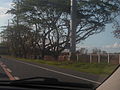
- Selected segments of the Pan-Philippine Highway
-
-
 AH26 reassurance sign along EDSA in Quezon City
 -
 Reassurance sign for Pan-Philippine Highway/AH26 at South Luzon Expressway-Sta. Rosa City, Laguna segment.
 -
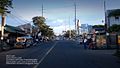
 The segment in Santo Tomas, Batangas.
 -
 Narra Avenue, segment of AH26 in Bayugan City, Agusan del Sur

_(EDSA-North_Triangle,_Quezon_City;_2017-02-22).jpg)
.JPG)


See also
- Transportation in the Philippines
- Department of Public Works and Highways (Philippines)
- Asian Highway Network
- Philippine Nautical Highway System
References
- http://www.bookrags.com/history/worldhistory/pan-philippine-highway-ema-04/
- http://manilarat.blogspot.com/2005/11/philippine-tourism-highway.html
- https://web.archive.org/web/20060619230039/http://www.philippineembassy-usa.org/about/economy.htm
- http://www.rappler.com/newsbreak/iq/74846-ah26-road-sign
- http://www.dpwh.gov.ph/pdf/issuances/DO/09/DO_015_S2009.pdf
- ^ "North Luzon expressway, Maharlika highway linked". Manila Bulletin. Retrieved October 9, 2018.
{{cite web}}: Italic or bold markup not allowed in:|publisher=(help)
External links
| Across the whole continent |  | |
|---|---|---|
| Southeast Asia | ||
| East Asia, Northeast Asia and Southeast Asia | ||
| South Asia | ||
| North Asia, Central Asia and Southwest Asia | ||
| ||||||||||||||||||||||
| ||||||||||||||||||||||