
Sierra Blanca, Texas
Sierra Blanca, Texas | |
|---|---|
 Location of Sierra Blanca, Texas | |
 | |
| Country | United States |
| State | Texas |
| County | Hudspeth |
| Area | |
| • Total | 4.1 sq mi (10.6 km2) |
| • Land | 4.1 sq mi (10.5 km2) |
| • Water | 0.0 sq mi (0.1 km2) |
| Elevation | 4,528 ft (1,380 m) |
| Population (2007) | |
| • Total | 510 |
| • Density | 131.0/sq mi (50.6/km2) |
| Time zone | UTC-7 (Mountain (MST)) |
| • Summer (DST) | UTC-6 (MDT) |
| ZIP code | 79851 |
| Area code | 915 |
| FIPS code | 48-67772Template:GR |
| GNIS feature ID | 1368253Template:GR |
Sierra Blanca is a census-designated place (CDP) in and the county seat of Hudspeth County, Texas, United States.Template:GR The population was 533 at the 2000 census, and had decreased to 510 according to a July 2007 estimate.
The town, founded in 1881 at the completion point of a long-sought southern transcontinental railway,[1] was named for nearby Sierra Blanca Mountain, which was named for the white poppies which grew on it[2][3] (sierra blanca is Spanish for white mountain).
Geography
Sierra Blanca is located at 31°10′55″N 105°20′27″W / 31.18194°N 105.34083°W (31.182009, -105.340843)Template:GR.
According to the United States Census Bureau, the CDP has a total area of 4.1 square miles (11 km2), of which 4.1 square miles (11 km2) is land and 0.04 square miles (0.10 km2) (0.73%) is water.
Demographics
As of the censusTemplate:GR of 2000, there were 533 people, 184 households, and 126 families residing in the CDP. The population density was 131.0 people per square mile (50.6/km²). There were 227 housing units at an average density of 55.8 per square mile (21.5/km²). The racial makeup of the CDP was 87.99% White, 3.19% Native American, 0.19% Asian, 5.07% from other races, and 3.56% from two or more races. Hispanic or Latino of any race were 72.61% of the population.
There were 184 households out of which 40.2% had children under the age of 18 living with them, 52.2% were married couples living together, 13.0% had a female householder with no husband present, and 31.0% were non-families. 28.3% of all households were made up of individuals and 11.4% had someone living alone who was 65 years of age or older. The average household size was 2.72 and the average family size was 3.31.
In the CDP the population was spread out with 29.8% under the age of 18, 11.8% from 18 to 24, 30.8% from 25 to 44, 18.4% from 45 to 64, and 9.2% who were 65 years of age or older. The median age was 30 years. For every 100 females there were 96.0 males. For every 100 females age 18 and over, there were 101.1 males.
The median income for a household in the CDP was $26,438, and the median income for a family was $30,000. Males had a median income of $26,071 versus $17,500 for females. The per capita income for the CDP was $10,768. About 19.6% of families and 22.5% of the population were below the poverty line, including 28.3% of those under age 18 and 32.6% of those age 65 or over.
Education
Sierra Blanca is served by the Sierra Blanca Independent School District.
Environment
The outskirts of Sierra Blanca was the location of a sludge dump that received 250 tons of treated sewage each week from New York City. The dumping was discontinued in 2001.[4]
Reference
- ^ http://www.tshaonline.org/handbook/online/articles/SS/hls47.html
- ^ http://www.texasescapes.com/WestTexasTowns/SierraBlancaTexas/SierraBlancaTx.htm
- ^ http://www.texaslegacy.org/bb/transcripts/addingtonbilltxt.html
- ^ Yardley, Jim (2007-07-27). "New York's Sewage Was a Texas Town's Gold". The New York Times. Retrieved 2009-03-18.
External links
Municipalities and communities of Hudspeth County, Texas, United States | ||
|---|---|---|
| City | 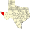 | |
| CDPs | ||
| Other communities | ||
| Ghost towns | ||