Muirpur Airport
Appearance
Myorpur Airport म्योरपुर हवाई अड्डे | |||||||||||
|---|---|---|---|---|---|---|---|---|---|---|---|
| Summary | |||||||||||
| Airport type | Private | ||||||||||
| Owner | Aditya Birla Group | ||||||||||
| Operator | Private, CIVIL GOVERNMENT (LANDING FEES AND DIPLOMATIC CLEARANCE MAY BE REQUIRED), Hindalco | ||||||||||
| Serves | Robertsganj, Singrauli | ||||||||||
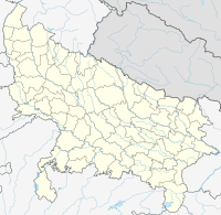
| Location | Mauirpur, Sonbhadra, Uttar Pradesh, India | ||||||||||
| Elevation AMSL | 1,122 ft / 342 m | ||||||||||
| Coordinates | 24°07′33″N 083°02′36″E / 24.12583°N 83.04333°E | ||||||||||
 | |||||||||||
| Runways | |||||||||||
| |||||||||||
Myorpur Airport is situated at Myorpur approx. 12 km from the Renukut in the Sonbhadra district in the Indian state of Uttar Pradesh. It also serves nearby towns, Northern Coalfields Limited (NCL) (coal fields), and Robertsganj, the district headquarters of the Sonbhadra district. The airport serves the region which has many electrical power stations, known as "Energy Capital of India".
Communities served
- Rihandnagar NTPC
- Shaktinagar NTPC
- Vindhyanagar NTPC
- Anpara UPRVUNL
- Obra UPRVUNL
- Renusagar UPRVUNL
- Pipri UPRVUNL
- Singrauli
- Renusagar Hindalco etc.
See also
- Lucknow International Airport
- Varanasi International Airport
- Taj International Airport
- Bareilly Airport
- Kanpur Airport
- Faizabad Airport
- Gorakhpur Airport
References
External links

