
Balkans: Difference between revisions
Undid revision 541598600 by 212.10.70.235 (talk)Not quite what the source says, I'm afraid. |
|||
| Line 52: | Line 52: | ||
*{{BIH}} |
*{{BIH}} |
||
*{{BUL}} |
*{{BUL}} |
||
*{{GRE}} |
*{{GRE}} |
||
*{{flag|Kosovo}} ([[International recognition of Kosovo|partially recognised]] state) {{efn|name=status}} |
|||
*{{MKD}} |
*{{MKD}} |
||
*{{MNE}} |
*{{MNE}} |
||
Revision as of 03:28, 2 March 2013
This article's lead section may be too short to adequately summarize the key points. (September 2012) |

The Balkans, often referred to as the Balkan Peninsula, and recently also as "Southeast Europe", although none of the three are exactly coterminous, is a geopolitical and cultural region of southeastern Europe. Many linguistic families meet in the region, including the Slavic, Romance, Hellenic, Albanian, and Turkic language families. The main religion is Orthodox Christianity, followed by Catholic Christianity and Sunni Islam.[1]
This part of Europe is strongly subdivided culturally and linguistically. At their core, the "Balkans" are states that have been shaped by their membership in the Byzantine and Ottoman Empires.[2]
The Balkans are highly mountainous. Mount Musala (2,925 metres (9,596 ft)) in the Rila mountain in Bulgaria is the highest point in the Balkans.
Name
Etymology
The region takes its name from the Balkan Mountains in Bulgaria and Serbia. The term "Balkan" is generally believed to come from Turkish balkan, meaning "a chain of wooded mountains."[3][4] Alternately, the name may have derived from the Persian bālkāneh or bālākhāna, meaning "high, above, or proud house," and brought to the region in the 12th and 13th centuries by Turkic tribes who applied it to the area.[5] The name is still preserved in Central Asia with the Balkan Mountains[6] and the Balkan Province of Turkmenistan.
In classical antiquity (and until the Ottoman conquest), the region was referred to in Greek and Roman sources as the "Peninsula of Haemus". The mountain range itself was known as the "Haemus Mountains", the name itself being of possibly Thracian etymology.[7]
On a larger scale, the mountains are only one part of a long continuous chain of mountains crossing the region in the form of a reversed letter S, from the Carpathians south to the Balkan range proper, before marching away east into Anatolian Turkey. The Balkan Mountains include the Stara Planina (Old Mountain) mountain range in Bulgaria and part of Serbia. On the west coast, an offshoot of the Dinaric Alps follows the coast south through Dalmatia and Albania, crosses Greece, and continues into the sea in the form of various islands.
In the languages of the region, the peninsula is known as:
- Albanian: Gadishulli Ballkanik and Siujdhesa e Ballkanit
- Bosnian: Balkansko poluostrvo and Balkanski poluotok
- Bulgarian and Macedonian: Балкански полуостров, transliterated: Balkanski poluostrov
- Croatian: Balkanski poluotok
- Greek: Βαλκανική χερσόνησος, transliterated: Valkaniki chersonisos
- Italian: Penisola balcanica
- Romanian: Peninsula Balcanică
- Slovene: Balkanski polotok
- Serbian: Балканско полуострво / Balkansko poluostrvo
- Turkish: Balkan Yarımadası
- Venetian: Penìxoła balcànega
The Balkans are also referred to as Southeast Europe.
Evolution of meaning
The first attested time the name "Balkan" was used in the West for the mountain range in Bulgaria was in a letter sent in 1490 to Pope Innocent VIII by Buonaccorsi Callimaco, an Italian humanist, writer and diplomat.[8] English traveler John Morritt introduced this term into the English literature at the end of the 18th century, and other authors started applying the name to the wider area between the Adriatic and the Black Sea. The concept of the "Balkans" was created by the German geographer August Zeune in 1808,[9] yet the peninsula of the region had had the name "Peninsula of Haemus" since Antiquity.
As time passed, the term gradually acquired political connotations far from its initial geographic meaning, arising from political changes from the late 19th century to the creation of post–World War I Yugoslavia (initially the Kingdom of Serbs, Croats and Slovenes). Zeune's goal was to have a geographical parallel term to the Italic and Iberian Peninsula, and seemingly nothing more. The gradually acquired political connotations are newer, and, to a large extent, due to oscillating political circumstances.
After the dissolution of Yugoslavia beginning in June 1991, the term "Balkans" again received a negative meaning, even in casual usage (see Balkanization). Over the last decade, in the wake of the former Yugoslav split, many Slovenians, Croatians, as well as Serbs of Vojvodina (also Belgraders, western Serbs "Prečani" and Serbs from other regions) have attempted to reject their label as Balkan nations.[10]
This is in part due to the pejorative connotation of the term "Balkans" in the 1990s, and continuation of this meaning until now. Today, the term "Southeast Europe" is often used or, in the case of Slovenia and Croatia, "Central Europe"[citation needed] and Greece has almost exclusively been regarded and referred to as a Southern European country.[citation needed]
Southeastern Europe
Because of the negative connotations of the term "Balkan", the use of the term "Southeastern Europe" has become increasingly popular even though it refers to a much larger area and thus isn't as precise.[11] A European Union initiative of 1999 is called the Stability Pact for South Eastern Europe, and the online newspaper Balkan Times renamed itself Southeast European Times in 2003.
Definitions and boundaries
The Balkan Peninsula

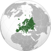
The Balkan Peninsula is an area of southeastern Europe surrounded by water on three sides: the Adriatic Sea to the west, the Mediterranean Sea (including the Ionian and Aegean seas) and the Marmara Sea to the south and the Black Sea to the east. Its northern boundary is often given as the Danube, Sava and Kupa Rivers.[12][13] The Balkan Peninsula has a combined area of about 490,000 km2 (189,000 sq mi).
Territories whose borders lie entirely within the Balkan peninsula (excluding islands):
Territories that are mostly located inside the Balkan peninsula:
Territories that are mostly located outside the Balkan peninsula:
 Italy (Part in the peninsula: Province of Trieste and partially Province of Gorizia),
 Romania (Part in the peninsula: Northern Dobrogea)
 Slovenia (Part in the peninsula: Primorska region, Notranjska, part of Dolenjska)
 Turkey (Part in the peninsula: East Thrace)
Until World War II Italy included Istria and some Dalmatian areas (like Zara, known as Zadar) that are located within the general definition of the Balkan peninsula. The current territory of Italy includes only the small area around Trieste and Gorizia inside the Balkan Peninsula. However, the regions of Trieste and Istria are not usually considered part of the Balkans by Italian geographers, due to a definition of the Balkans that limits its western border to the Kupa River.[14]
The Balkans

The term "The Balkans" covers not only those countries which lie within the boundaries of the Balkan Peninsula, but may also include Slovenia and Romania.[12] Prior to 1991 the whole of Yugoslavia was considered to be part of the Balkans.[15] The term "The Balkans" is sometimes used to describe only the areas in the Balkan peninsula: Moesia, Macedonia, Thrace, Kosovo, Šumadija, Bosnia, Herzegovina, Dalmatia, Thessaly, Epirus, Peloponnese and others, but more often it includes the rest of former Yugoslavia (Serbia, Croatia and Slovenia) and Romania,[12] namely the provinces of: Vojvodina, Slavonia, Banat, Wallachia, Moldavia, Transylvania, and others. Italy as a totality, is generally accepted as part of Western Europe and the Apennines. The term "the Balkans" was coined by August Zeune in 1808.
The Balkans comprise the following territories:[16]
 Albania (28,748 km2)
 Bosnia and Herzegovina (51,197 km2)
 Bulgaria (110,993 km2)
 Croatia (56,594 km2)
 Greece (131,990 km2)
 North Macedonia (25,713 km2)
 Montenegro (13,812 km2)
- Romania (238,391 km2)
 Serbia (88,361 km2)
- Turkey (23,764 km2 Eastern Thrace)
- All territories (745,799 km2 excluding Slovenia; 766,072 km2 including Slovenia)
Western Balkans

European Union institutions and member states define the "Western Balkans" as Albania and the former Yugoslavia, minus Slovenia.[19] The European Bank for Reconstruction and Development uses "Western Balkans" to refer to the above states, minus Croatia.[20] Today Western Balkans is more of a political than geographic definition for the region of Southeast Europe that is not in the European Union.
Nature and natural resources


Most of the area is covered by mountain ranges running from north-west to south-east. The main ranges are the Dinaric Alps in Slovenia, Croatia, Bosnia and Herzegovina and Montenegro, the Šar massif which spreads from Albania to Macedonia, the Pindus range, spanning from southern Albania into central Greece and the Albanian Alps, the Balkan mountains, running from the Black Sea Coast in Bulgaria to its border with Serbia, and the Rhodope mountains in southern Bulgaria and northern Greece. The highest mountain of the region is Rila in Bulgaria, with Musala at 2925 m, Mount Olympus in Greece, the throne of Zeus, being second at 2917 m and Vihren in Bulgaria being the third at 2914 m. The karst field or polje is a common feature of the landscape.
On the Adriatic and Aegean coasts the climate is Mediterranean, on the Black Sea coast the climate is humid subtropical and oceanic, and inland it is humid continental. In the northern part of the peninsula and on the mountains, winters are frosty and snowy, while summers are hot and dry. In the southern part winters are milder. The humid continental climate is predominant in Bosnia and Herzegovina, Bulgaria, northern Croatia, Kosovo,[a] Macedonia, northern Montenegro, the interior of Albania, Romania, Serbia and most of Slovenia, while the other, less common climates, the humid subtropical and oceanic climates, are seen on the Black Sea coast of Bulgaria and Turkey; and the Mediterranean climate is seen on the coast of Albania, southern Croatia, Greece, southern Montenegro, the coast of Slovenia and the Aegean coast of Turkey.
During the centuries many woods have been cut down and replaced with bush. In the southern part and on the coast there is evergreen vegetation. Inland there are woods typical of Central Europe (oak and beech, and in the mountains, spruce, fir and pine). The tree line in the mountains lies at the height of 1800–2300 m. The landscape provides habitats for numerous endemic species, including extraordinarily abundant insects and reptiles that serve as food for a variety of birds of prey and rare vultures.
The soils are generally poor, except on the plains where areas with natural grass, fertile soils and warm summers provide an opportunity for tillage. Elsewhere, land cultivation is mostly unsuccessful because of the mountains, hot summers and poor soils, although certain cultures such as olives and grapes flourish.
Resources of energy are scarce, except in the territory of Kosovo, where considerable coal, lead, zinc, chromium, silver deposits are located.[21] Other deposits of coal, especially in Romania, Bulgaria, Serbia and Bosnia also exist. Lignite deposits are widespread in Greece. Petroleum is most notably present in Romania, although scarce reserves exist in Greece, Serbia, Albania and Croatia. Natural gas deposits are scarce. Hydropower is in wide use, with over 1,000 dams. The often relentless bora wind is also being harnessed for power generation.
Metal ores are more usual than other raw materials. Iron ore is rare but in some countries there is a considerable amount of copper, zinc, tin, chromite, manganese, magnesite and bauxite. Some metals are exported.
The time zones are situated as follows:
- Territories in the time zone of UTC+01:00: Albania, Bosnia and Herzegovina, Croatia, Kosovo,[a] Macedonia, Montenegro, Serbia and Slovenia
- Territories in the time zone of UTC+02:00: Bulgaria, Greece, Romania and Turkey
History and geopolitical significance


Antiquity
The Balkan region was the first area of Europe to experience the arrival of farming cultures in the Neolithic era. The practices of growing grain and raising livestock arrived in the Balkans from the Fertile Crescent by way of Anatolia, and spread west and north into Pannonia and Central Europe.
The identity of the Balkans is dominated by its geographical position; historically the area was known as a crossroads of various cultures. It has been a juncture between the Latin and Greek bodies of the Roman Empire, the destination of a massive influx of pagan Slavs, an area where Orthodox and Catholic Christianity met, as well as the meeting point between Islam and Christianity.
In pre-classical and classical antiquity, this region was home to Greeks, Illyrians, Paeonians, Thracians, Dacians and other ancient groups. Later the Roman Empire conquered most of the region and spread Roman culture and the Latin language but significant parts still remained under classical Greek influence. The Romans considered the Rhodope Mountains to be the northern limit of the Peninsula of Haemus and the same limit applied approximately to the border between Greek and Latin use in the region (later called the Jireček Line).[22] The Slavs arrived in the 6th century and began assimilating and displacing already assimilated through Romanization and Hellenization older inhabitants of the northern and central Balkans.[23] During the Middle Ages, the Balkans became the stage for a series of wars between the Byzantine Roman, Bulgarian and Serbian Empires.
Early modern period
By the end of the 16th century, the Ottoman Empire had become the controlling force in the region after expanding from Anatolia through Thrace to the Balkans. Many people in the Balkans place their greatest folk heroes in the era of either the onslaught or the retreat of the Ottoman Empire. As examples, for Croats, Nikola Šubić Zrinski and Petar Kružić; for Greeks Constantine XI Palaiologos and Kolokotronis for Serbs, Miloš Obilić and Tzar Lazar; for Montenegrins, Đurađ I Balšić and Ivan Crnojević; for Albanians, George Kastrioti Skanderbeg; for ethnic Macedonians, Nikola Karev[24] and Goce Delčev;[24] for Bosniaks, Husein Gradaščević and for Bulgarians, Vasil Levski, Georgi Sava Rakovski and Hristo Botev.


In the past several centuries, because of the frequent Ottoman wars in Europe fought in and around the Balkans, and the comparative Ottoman isolation from the mainstream of economic advance (reflecting the shift of Europe's commercial and political centre of gravity towards the Atlantic), the Balkans has been the least developed part of Europe. According to Suraiya Faroqhi and Donald Quataert, "The population of the Balkans, according to one estimate, fell from a high of 8 million in the late 16th century to only 3 million by the mid-eighteenth. This estimate is in harmony with the first findings based on Ottoman documentary evidence."[25]
Most of the Balkan nation-states emerged during the 19th and early 20th centuries as they gained independence either from the Ottoman Empire or the Austro-Hungarian empire. Greece in 1821, Serbia, Bulgaria and Montenegro in 1878, Romania in 1878, Albania in 1912, Croatia and Slovenia in 1991.
20th century


World wars
In 1912–1913 the First Balkan War broke out when the nation-states of Bulgaria, Serbia, Greece and Montenegro united in an alliance against the Ottoman Empire. As a result of the war, almost all remaining European territories of the Ottoman Empire were captured and partitioned among the allies. Ensuing events also led to the creation of an independent Albanian state. Despite its success, Bulgaria was dissatisfied over the division of the spoils in Macedonia, and provoked the Second Balkan War when it attacked its former allies, Serbia and Greece. The Serbs and the Greeks repelled them and after the Greek army invaded Bulgaria followed by a Romanian intervention, Bulgaria collapsed. The Ottoman Empire used the opportunity to recapture Eastern Thrace, establishing its new western borders that still stand today.
The First World War was sparked in the Balkans in 1914 when Mlada Bosna, a revolutionary organization with predominately Serbian and pro Yugoslav oriented members, assassinated the Austro-Hungarian heir Archduke Franz Ferdinand of Austria in Bosnia and Herzegovina's capital, Sarajevo. That caused a war between the two countries which—through the existing chains of alliances—led to the First World War. The Ottoman empire soon joined the Central powers becoming one of the three empires participating in that alliance. The next year Bulgaria joined the Central Powers attacking Serbia which was successfully fighting Austro-Hungary to the north for a year. That led to Serbia's defeat and the intervention of the Entente in the Balkans which sent an expeditionary force to establish a new front, the third one of that war, which soon also became static. The participation of Greece in the war three years later, in 1918, on the part of the Entente finally altered the balance between the opponents leading to the collapse of the common German-Bulgarian front there which caused the exit of Bulgaria from the war, and in turn the collapse of the Austro-Hungarian Empire ending the First World War.[26]
With the start of the Second World War all Balkan countries with the exception of Greece were allies of Germany having bilateral military agreements or being part of the Axis Pact. Fascist Italy expanded the war in Balkans by using its protectorate Albania to invade Greece. After repelling the attack the Greeks counterattacked, invading Italy-held Albania and causing Nazi Germany's intervention in the Balkans to help its ally.[27] Days before the German invasion a successful coup d'état in Belgrade by neutral military personnel seized power.[28]
Although the new government reaffirmed Serbia's intentions to fulfil its obligations as member of the Axis,[29] Germany using its other two allied countries in the region, Bulgaria and Romania, invaded both Greece and Yugoslavia. Yugoslavia immediately disintegrated when those loyal to the Serbian King and the Croatian units mutinied.[30] Greece resisted, but, after two months of fighting, collapsed and was occupied. The two countries were partitioned between the three Axis allies, Bulgaria, Germany and Italy, and two independent states, Croatia and Montenegro were created.
During the occupation the population suffered considerable hardship due to ethnic cleansing policies, repression and starvation, to which the population reacted by creating a mass resistance movement.[31] Together with the early and extremely heavy winter of that year (which caused hundreds of thousands deaths among the poorly fed population), the German invasion had disastrous effects in the timetable of the planned invasion in Russia causing a significant delay[32] which had key consequences to the route of the war.[33]
Finally at the end of 1944, the Soviets invaded Romania and Bulgaria while the Germans evacuated the Balkans. They left behind a region largely ruined as a result of war-time exploitation, but by making use of the post-war separation of Germany into two independent entities, the German states successfully and legally avoided paying any reparations or repaying the forced taken loans to the occupied countries. The official Yugoslav post-war estimate of victims in Yugoslavia during World War II is 1,704,000. Subsequent data gathering in the 1980s by historians Vladimir Žerjavić and Bogoljub Kočović showed that the actual number of dead was about 1 million. Greece suffered more than 300,000 casualties during the occupation.
Cold War

During the Cold War, most of the countries on the Balkans were governed by communist governments. Greece became the first battleground of the emerging Cold War. The Truman Doctrine was the US response to the civil war, which raged from 1944 to 1949. The Civil War, unleashed by the Communist Party of Greece, backed by communist volunteers from neighboring countries (Albania, Bulgaria and Yugoslavia), led to massive American assistance for the non-communist Greek government. With this backing, Greece managed to defeat the partisans and, ultimately, remained the only non-Communist country in the region.
However, despite being under communist governments, Yugoslavia (1948) and Albania (1961) fell out with the Soviet Union. Yugoslavia, led by marshal Josip Broz Tito (1892–1980), first propped up then rejected the idea of merging with Bulgaria, and instead sought closer relations with the West, later even spearheaded, together with India and Egypt the Non-Aligned Movement. Albania on the other hand gravitated toward Communist China, later adopting an isolationist position.

As the only non-communist countries, Greece and Turkey were (and still are) part of NATO composing the South-eastern wing of the alliance.
Post–Cold War
In the 1990s, the region was gravely affected by the wars between the former Yugoslav republics that broke out after Slovenia and Croatia held free elections and their people voted for independence on their respective countries' referendums. Serbia in turn declared the dissolution of the union as unconstitutional and the Yugoslavian army unsuccessfully tried to maintain status quo. Slovenia and Croatia declared independence on 26 June 1991, followed by the Ten-Day War in Slovenia. Till October 1991, the Army withdrew from Slovenia, and in Croatia, the war between the Croatian government and local Serbs would continue until 1995. In the ensuing 10 years armed confrontation, gradually all the other Republics declared independence, with Bosnia being the most affected by the fighting. The long lasting wars resulted in a United Nations intervention and NATO ground and air forces took action against Serb forces in Bosnia and Herzegovina and Serbia.
From the dissolution of Yugoslavia six republics achieved international recognition as sovereign republics: Slovenia, Croatia, Bosnia and Herzegovina, Macedonia, Montenegro and Serbia. The Albanian institutions in Kosovo, currently under UN administration, declared independence in 2008 (according to the official Serbian policy, Kosovo is still an internal autonomous region). In July 2010, the International Court of Justice, after a UN General Assembly's request, opined that, since there is not an active rule in international law limiting the declarations of independence, the unilateral Kosovar proclamation does not violate it (leaving unanswered the questions about the consequences of said act, including whether with said declaration Kosovo achieved the status of a State). The international community is still divided on the matter and while the majority of the UN members do not recognize it as independent, most NATO and EU countries do. After the end of the wars a revolution broke in Serbia and Slobodan Milošević, the Serbian communist leader (elected president between 1989 and 2000), was overthrown and handed for trial to the International Criminal Tribunal for crimes against the International Humanitarian Law during the Yugoslav wars. Milošević died of a heart attack in 2006 before a verdict could have been released. Ιn 2001 an Albanian uprising in Macedonia forced the country to give local autonomy to the ethnic Albanians in the areas where they predominate.
With the dissolution of Yugoslavia an issue emerged over the name under which the former (federated) republic of Macedonia would internationally be recognized, between the new country and Greece. Being the Macedonian part of Yugoslavia (see Vardar Macedonia), the federated Republic under the Yugoslav identity had the name Republic of Macedonia on which it declared its sovereignty in 1991. Greece, having a large region (see Macedonia (Greece)) also under the same name opposed to the usage of this name as an indication of a nationality. The issue is currently under negotiations after a UN initiation.
Balkan countries control the direct land routes between Western Europe and South West Asia (Asia Minor and the Middle East). Since 2000, all Balkan countries are friendly towards the EU and the USA.[citation needed]
Greece has been a member of the European Union since 1981; Slovenia since 2004. Bulgaria and Romania joined in 2007. In 2005, the European Union decided to start accession negotiations with candidate countries; Croatia, Turkey, and Macedonia were accepted as candidates for European Union membership. As of April 2009,[34] Albania, Bulgaria, Croatia, Romania and Slovenia are also members of NATO. Bosnia and Herzegovina and what was then Serbia and Montenegro started negotiations with the EU over the Stabilization and Accession Agreements, although shortly after they started, negotiations with Serbia and Montenegro were suspended for lack of co-operation with the International Criminal Tribunal for the Former Yugoslavia. In 2008 Greece vetoed Macedonia's NATO membership bid over the Macedonia naming dispute between the two countries[citation needed].
All other countries have expressed a desire to join the EU but at some date in the future.
Politics and economy


Currently all of the states are republics, but until World War II all except Turkey were monarchies. Most of the republics are parliamentary, excluding Romania and Bosnia which are semi-presidential. All the states have open market economies, most of which are in the upper-middle income range ($4,000 – $12,000 p.c.), the remaining – Greece, Slovenia and Croatia have high income economies (over $12,000 p.c.), which are also classified with very high HDI in contrast to the remaining states which are classified with high HDI. The states from the former Eastern Bloc that formerly had planned economy system and Turkey mark gradual economic growth each year, only the economy of Greece drops for 2012 and meanwhile it is expected to growth in 2013. The Gross domestic product (Purchasing power parity) per capita is highest in Slovenia and Greece (over $25), followed by Croatia (up to $20), Turkey, Bulgaria, Romania, Montenegro, Serbia, Macedonia ($10 – $15), Bosnia, Albania and Kosovo[a] (below $10).[35] The Gini coefficient, which indicates the level of difference by monetary welfare of the layers, is on the second level at the highest monetary equality in Albania, Bulgaria, Croatia, Serbia and Slovenia, on the third level in Greece, Montenegro and Romania, on the fourth level in Macedonia, on the fifth level in Turkey, and the most unequal by Gini coefficient is Bosnia at the eighth level which is the penultimate level and one of the highest in the world. The unemployment is lowest in Romania and Slovenia (below 10%), followed by Bulgaria, Turkey, Albania (10 – 15%), Croatia, Greece (15 – 20%), Montenegro, Serbia, Bosnia (20 – 30%), Macedonia (over 30%) and Kosovo[a] (over 40%).
- On political, social and economic criteria the divisions are as follows:
- Territories members of the European Union: Bulgaria, Greece, Romania and Slovenia
- Territories candidates for EU membership authorized to join on specified date: Croatia (2013)
- Territories candidates for EU membership disapproved with deposited date for joining: Macedonia, Montenegro, Serbia and Turkey
- Territories which submitted application for candidate status for EU membership: Albania
- Territories considered as potential candidates for EU membership: Bosnia and Herzegovina and Kosovo[a]
- On border control and trade criteria the divisions are as follows:
- Territories members of the Schengen Area: Greece and Slovenia
- Territories candidates for the Schengen Area: Bulgaria and Romania
- Territories in a customs union with the EU: Turkey
- Territories members of the Central European Free Trade Agreement: Albania, Bosnia and Herzegovina, Croatia (leaving in 2013), Kosovo[a], Macedonia, Montenegro and Serbia
- On currency criteria the divisions are as follows:
- Territories members of the Eurozone: Greece and Slovenia
- Territories using the Euro without authorization by the EU: Kosovo[a] and Montenegro
- Territories using the national currencies and candidates for the Eurozone: Bulgaria(lev) and Romania(leu)
- Territories using the national currencies: Albania,(lek) Bosnia and Herzegovina,(convertible mark) Croatia,(kuna) Macedonia(denar) and Serbia(dinar)
- On military criteria the divisions are as follows:
- Territories members of NATO: Albania, Bulgaria, Croatia, Greece, Romania, Slovenia and Turkey
- Territories members of the Partnership for Peace with Individual Partnership Action Plan and Membership Action Plan for joining NATO: Bosnia and Herzegovina, Macedonia and Montenegro
- Territories members of the Partnership for Peace: Serbia
- Territories under NATO protection: Kosovo[a]
- On the recent political, social and economic criteria there are two groups of countries:
- Territories with communist past: Albania, Bosnia and Herzegovina, Bulgaria, Croatia, Kosovo,[a] Macedonia, Montenegro, Romania, Serbia and Slovenia
- Territories with capitalist past: Greece and Turkey
Regional organizations
 |
 members observers supporting partners |
 members observers |
 members observers |
See also the Black Sea Regional organizations
Demographics


The Balkans have a population of 60–71 million and a population density of 80-91/km2, depending on whether the Turkish and Italian parts are counted within the peninsula. Without those, the peninsula has a population of about 48 million and a density of 99/km2.
Population by territories:
| Territory | Total population | In the peninsula * | Density | Life expectancy |
|---|---|---|---|---|
| 2,831,741[36] | 2,831,741 [36] | 98.5/km2 | 77.4 years | |
| 3,839,737 [37] | 3,839,737 [37] | 75.0/km2 | 74.9 years | |
| 7,364,570 [38] | 7,364,570 [38] | 66.4/km2 | 73.0 years | |
| 4,290,612 [39] | 2,700,000 [39]~ | 75.8/km2 | 75.3 years | |
| 10,815,197 [40] | 10,815,197 [40] | 81.7/km2 | 79.5 years | |
| Not a part of the region(see [1]) | ~330,000 [41] | – | – | |
| 1,733,872 [42] | 1,733,872 [42] | 178.7/km2 | – | |
| 2,057,284 [43] | 2,057,284 [43] | 80.0/km2 | 74.2 years | |
| 625,266 [44] | 625,266 [44] | 45.3/km2 | – | |
| 19,042,936 [45] | 832,141 [45] | 90.2/km2 | 72.5 years | |
| 7,120,666 [46] | ~3,500,000 [46] | 91.9/km2 | 73.9 years | |
| Not a part of the region(see [1]) | ~360,000 [47] | – | – | |
| Not a part of the region(see [1]) | 10,436,983 [48] | – | – | |
| Balkans ** | 59,764,374 (excl. Turkey, Slovenia and Italy's parts) 70,610,355 (incl. Turkey, Slovenia and Italy's parts) |
44,888,282 (excl. northern Croatia and Serbia) | – | – |
[*] The islands are not taken into account.
[**] Both census figures of Serbia and Kosovo in the table do not include North Kosovo, therefore in the population of the Balkans, made up of sum of the populations in the table, is added separately an additional number of 70,000 to include the missing population of North Kosovo.
Religion
The region's principal religions are Christianity (Eastern Orthodox and Roman Catholic) and Islam (Sunni).[1] Eastern Orthodoxy is the majority religion in both the Balkan peninsula and the Balkan region. A variety of different traditions of each faith are practiced, with each of the Eastern Orthodox countries having its own national church.
- Territories in which the principal religion is Eastern Orthodoxy:
- Bulgaria (Bulgarian Orthodoxy)
- Greece (Greek Orthodoxy)
- Macedonia (Macedonian and Serbian Orthodoxy)
- Montenegro (Serbian Orthodox Church and Montenegrin Orthodoxy)
- Romania (Romanian Orthodoxy)
- Serbia (Serbian Orthodoxy)
- Territories in which the principal religion is Roman Catholicism:
- Croatia (87.83% Catholics (3 897 332); according to 2001 census official data)
- Slovenia (57.80% Catholics (1 135 626); according to 2002 census official data)
- Territories in which the principal religion is Sunni Islam:
- Albania
- Kosovo[a]
- Turkey
- Territories in which religious minorities encompass over 10% of the population:
The Jewish communities of the Balkans were some of the oldest in Europe and date back to ancient times. The Jewish communities of the Balkans were Sephardi Jews, except in Slovenia, Croatia and Romania where the Jewish communities were Ashkenazi Jews. In Slovenia, there were Jewish immigrants dating back to Roman times pre-dating the 6th century settlement of the region by the Slavic peoples.[49] In Bosnia and Herzegovina, the small and close-knit Jewish community is 90% Sephardic and Ladino is still spoken among the elderly. The Sephardi Jewish cemetery in Sarajevo has tombstones of a unique shape, inscribed in ancient Ladino.[50] Sephardi Jews used to have a large presence in the city of Thessaloniki, and by 1900, some 80,000, or more than half of the population, were Jews.[51] However the Jewish communities in the Balkans suffered immensely during World War II and the vast majority were killed during the Holocaust. However an exception were the Bulgarian Jews many of whom were saved by Boris III of Bulgaria, who resisted Adolf Hitler for their deportation to concentration camps. Almost all of the few survivors have emigrated to the (then) newly founded state of Israel and elsewhere. No Balkan country today has a significant Jewish minority.
Language
The Balkans today is a very diverse ethno-linguistic region, being home to multiple Slavic, Romance, and Turkic languages, as well as Greek, Albanian and others. Through its history many other ethnic groups with their own languages lived in the area, among them Thracians, Illyrians, Romans, Celts and various Germanic tribes.
- Territories where the mainly spoken language is from the Albanian linguistic family:
- Albania and Kosovo[a]
- Territories where the mainly spoken language is from the Hellenic linguistic family:
- Greece
- Territories where the mainly spoken language is from the Latin linguistic family:
- Romania
- Territories where the mainly spoken language is from the Slavic linguistic family:
- Bosnia and Herzegovina, Bulgaria, Croatia, Macedonia, Montenegro, Serbia and Slovenia
- Territories where the mainly spoken language is from the Turkic linguistic family:
- Turkey
- Territories in which there are minority linguistic families encompassing over 10% of the population:
- Macedonia: Albanian linguistic family
Urbanization
Most of the states in the Balkans are predominantly urbanized, the countries in which the rural population is the majority are Bosnia and Herzegovina, Kosovo[a] and Slovenia, all of them having situation on scales with about 50% rural and 50% urban.[52]


A list of cities with population of over 200,000 inhabitants: Template:Balkan cities over 200,000 people
Culture
This section is empty. You can help by adding to it. (December 2011) |
See also
Notes and references
Notes:
References:
- ^ a b Okey, Robin (2007). Taming Balkan Nationalism. Oxford University Press.
- ^ Konrad Clewing, Oliver Jens Schmitt: Geschichte Südosteuropas. Verlag Friedrich Pustet, Regensburg 2012, p. 1/2.
- ^ Balkan. Microsoft Corporation. Archived from the original on 2009-10-31. Retrieved 2008-03-31.
{{cite encyclopedia}}:|work=ignored (help) - ^ "balkan". Büyük Türkçe Sözlük (in Turkish). http://www.tdkterim.gov.tr/bts/: Türk Dil Kurumu.
Sarp ve ormanlık sıradağ
{{cite encyclopedia}}: External link in|location= - ^ Todorova, Maria N. (1997). Imagining the Balkans. New York: Oxford University Press, Inc. p. 27.
- ^ "Balkhan Mountains". World Land Features Database. Land.WorldCityDB.com. Archived from the original on 28 February 2008. Retrieved 2008-03-31.
{{cite web}}: Unknown parameter|deadurl=ignored (|url-status=suggested) (help) - ^ "Bulgaria". Hemus – a Thracian name. Indiana University. p. 54.
- ^ Todorova, Maria (2009). Imagining the Balkans. Oxford University Press US. p. 22. ISBN 0-19-538786-4.
- ^ Pavic, Silvia (2000-11-22). "Some Thoughts About The Balkans". About, Inc. Archived from the original on 28 February 2008. Retrieved 2008-03-31.
{{cite web}}: Unknown parameter|deadurl=ignored (|url-status=suggested) (help) - ^ Lindstrom, Nicole (2003). "Between Europe and the Balkans: Mapping Slovenia and Croatia's 'Return to Europe' in the 1990s". Dialectical Anthropology. 27 (3–4): 313–329. doi:10.1023/B:DIAL.0000006189.45297.9e.
- ^ Bideleux, Robert (2007). A history of Eastern Europe. Taylor & Francis. p. 37. ISBN 978-0-415-36627-4.
{{cite book}}: Unknown parameter|coauthors=ignored (|author=suggested) (help) - ^ a b c Jelavich, Barbara (1983). History of the Balkans: Eighteenth and nineteenth centuries. Cambridge University Press. p. 1. ISBN 978-0-521-27458-6.
{{cite book}}: Cite has empty unknown parameter:|coauthors=(help) - ^ britannica.com; encarta.msn.com (Archived 2009-10-31); The Columbia Encyclopedia.
- ^ Istituto Geografico De Agostini, L'Enciclopedia Geografica – Vol.I – Italia, 2004, Ed. De Agostini p.78
- ^ Tintero, Felipa L. World Geography Affected by World Upheavals. Goodwill Trading Co., Inc. p. 51. ISBN 971-574-041-3.
{{cite book}}: Unknown parameter|coauthors=ignored (|author=suggested) (help) - ^ Bideleux, Robert (1996). European integration and disintegration: east and west. p. 249.
{{cite book}}: More than one of|pages=and|page=specified (help); Unknown parameter|coauthors=ignored (|author=suggested) (help) - ^ http://books.google.fr/books?id=8vFeeIodS-AC&pg=PA56&lpg=PA56&dq=slovenia+not+part+of+balkans&hl=en
- ^ http://books.google.si/books?id=5jrHOKsU9pEC&lpg=PA21&dq=slovenia%20balkans%20included&pg=PA21#v=onepage&q=slovenia%20balkans%20included&f=false
- ^ "Western Balkans: Enhancing the European Perspective" (PDF). Communication from the Commission to the European Parliament and the Council. 2008-03-05. Archived from the original (PDF) on 9 April 2008. Retrieved 2008-04-08.
{{cite web}}: Unknown parameter|deadurl=ignored (|url-status=suggested) (help) - ^ Marjola Xhunga (2006-05-21). "Western Balkans Initiative launched". European Bank for Reconstruction and Development. Archived from the original on 2008-06-16. Retrieved 2008-05-17.
- ^ "Regions and territories: Kosovo". BBC News. 2009-11-20. Archived from the original on 15 April 2010. Retrieved 2010-04-17.
{{cite web}}: Unknown parameter|deadurl=ignored (|url-status=suggested) (help) - ^ Boundary between Greek and Latin
- ^ "Twenty Years of Balkan Tangle". Mary Edith Durham (2007). p.125. ISBN 1-4346-3426-4
- ^ a b Considered a Bulgarian in Bulgaria
- ^ "An economic and social history of the Ottoman Empire". Suraiya Faroqhi, Donald Quataert (1997). Cambridge University Press. p.652. ISBN 0-521-57455-2
- ^ Encyclopedia of World War I, Spencer Tucker, Priscilla Mary Roberts, p.242
- ^ Europe in Flames, J. Klam, 2002, p.41
- ^ Russia's life-saver, Albert Loren Weeks, 2004, p.98
- ^ Germany and the 2nd World War Volume III:The Mediterranean, south-east Europe, and north Africa, 1939–1941, Gerhard Schreiber, Bernd Stegemann, Detlef Vogel, 1995, p.484
- ^ Germany and the 2nd World War Volume III:The Mediterranean, south-east Europe, and north Africa, 1939–1941, Gerhard Schreiber, Bernd Stegemann, Detlef Vogel, 1995, p.521
- ^ Inside Hitler's Greece:The Experience of Occupation, Mark Mazower, 1993
- ^ Hermann Goring: Hitler's Second-In-Command, Fred Ramen, 2002, p.61
- ^ The encyclopedia of codenames of World War II#Marita, Christopher Chant, 1986, p.125-6
- ^ Ceremony marks the accession of Albania and Croatia to NATO, NATO – News, 7 April 2009. Retrieved 2009-04-18.
- ^ "Report for Selected Countries and Subjects". International Monetary Fund. 2009–2016.
- ^ a b "Institute of Statistics of Albania. 2011 Census Results".
- ^ a b Agency for Statistics of Bosnia and Herzegovina. Estimate for 2011.
- ^ a b "National Statistical Institute of Bulgaria. 2011 Census Results".
- ^ a b Croatian Bureau of Statistics. 2011 Census Results.
- ^ a b National Statistical Service of Greece. 2011 Census Results.
- ^ National Institute of Statistics of Italy. Estimate for 2009. 236,520 people in Province of Trieste and and about 90,000 in the Balkan part of Province of Gorizia.
- ^ a b "Statistical Office of Kosovo. 2011 Census Results".
- ^ a b "State Statistical Office of Macedonia. Estimate for 2010" (PDF) (in Macedonian). Retrieved 2010-04-17.
- ^ a b "Statistical Office of Montenegro. 2011 Census Results".
- ^ a b "National Institute of Statistics of Romania. 2011 Census Results" (PDF) (in Romanian).
- ^ a b "Statistical Office of Serbia. 2011 Census Results". Since the Statistical Office of the Republic of Serbia cannot provide data of Kosovo's population due to the situation in the terrain, the total population data excludes Kosovo which Serbia claims as part of its own sovereign territory.
- ^ "Statistical Office of Slovenia. Estimate for 2009".
- ^ "Turkish Statistical Institute. Registred population as of 2011".
- ^ Jews of Yugoslavia 1941–1945 Victims of Genocide and Freedom Fighters, Jasa Romano
- ^ European Jewish Congress – Bosnia-Herzegovina, Accessed July 15, 2008.
- ^ "Greece". Jewish Virtual Library.
- ^ "Data: Urban population (% of total)". The World Bank. 2006–2010.
References
- Banac, Ivo (1992). "Historiography of the Countries of Eastern Europe: Yugoslavia". American Historical Review. 97 (4). University of Chicago Press: 1084–1104. doi:10.2307/2165494. JSTOR 2165494.
{{cite journal}}: Unknown parameter|month=ignored (help) - Banac, Ivo (1984). The National Question in Yugoslavia: Origins, History, Politics. Ithaca, N.Y.: Cornell University Press. ISBN 978-0-8014-9493-2.
- Carter, Francis W., ed. An Historical Geography of the Balkans Academic Press, 1977.
- Dvornik, Francis. The Slavs in European History and Civilization Rutgers University Press, 1962.
- Fine, John V. A., Jr. The Early Medieval Balkans: A Critical Survey from the Sixth to the Late Twelfth Century [1983]; The Late Medieval Balkans: A Critical Survey from the Late Twelfth Century to the Ottoman Conquest. Ann Arbor: University of Michigan Press, [1987].
- Jelavich, Barbara (1983-07-29). History of the Balkans. Cambridge University Press.
- Jelavich, Charles and Jelavich, Barbara, eds. (1963). The Balkans In Transition: Essays on the Development of Balkan Life and Politics Since the Eighteenth Century. University of California Press.
{{cite book}}:|first=has generic name (help)CS1 maint: multiple names: authors list (link) - Kitsikis, Dimitri (2008). La montée du national-bolchevisme dans les Balkans. Le retour à la Serbie de 1830. Paris: Avatar.
- Lampe, John R., and Marvin R. Jackson; Balkan Economic History, 1550–1950: From Imperial Borderlands to Developing Nations Indiana University Press, 1982
- Király, Béla K., ed. East Central European Society in the Era of Revolutions, 1775–1856. 1984
- Komlos, John (1990-10-15). Economic Development in the Habsburg Monarchy and in the Successor States. East European Monographs #28. East European Monographs. ISBN 978-0-88033-177-7.
- Mazower, Mark (2000). The Balkans: A Short History. Modern Library Chronicles. New York: Random House. ISBN 0-679-64087-8.
- Stavrianos, L. S. (2000-05-01) [1958]. The Balkans since 1453. with Traian Stoianovich. New York: NYU Press. ISBN 978-0-8147-9766-2.
- Stoianovich, Traian (1994). Balkan Worlds: The First and Last Europe. Sources and Studies in World History. New York: M.E. Sharpe. ISBN 978-1-56324-032-4.
{{cite book}}: Unknown parameter|month=ignored (help)
External links
- Western Balkans Photos and tourism information about: Croatia, Serbia, BiH and Montenegro
- South-East Europe Review
- Introduction to Tourism in the Area
- Balkan History by Steven W. Sowards
- SEEurope.net—news coverage on Southeastern Europe
- Southeast European Times
- The Centre for South East European Studies
- Balkans region: Oil and Gas Fact Sheet—United States Department of Energy Analysis Brief
- Balkans urged to curb trafficking—BBC
- News from Balkans
- Analysis from Balkans
- Balkan Business News
- Balkanalysis.com- Objective Analysis, Research and News on the Balkans
- A thirteen hour trip from Fyr Macedonia to the Dalmatian coast
Countries on the Balkan Peninsula | ||
|---|---|---|
| Geographically fully located | | |
| Significantly located | ||
| Partially located | ||
| Mostly outside the peninsula |
| |
| See also | ||
| Africa | |
|---|---|
| North America |
|
| South America | |
| Asia | |
| Europe | |
| Oceania | |
| Polar | |
| Oceans | |
| Non-continent-based world regions | |