Saidapet railway station
This is an old revision of this page, as edited by 49.207.203.200 (talk) at 04:48, 20 September 2022. The present address (URL) is a permanent link to this revision, which may differ significantly from the current revision.
Saidapet Saidapettai | |||||
|---|---|---|---|---|---|
 | |||||
| General information | |||||
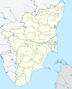
| Location | Karaneeswarar Koil Street, Suriyammapet, Saidapet, Chennai, Tamil Nadu 600 015, India | ||||
| Coordinates | 13°01′27″N 80°13′27″E / 13.02415°N 80.224183°E / 13.02415; 80.224183 | ||||
| Owned by | Ministry of Railways, Indian Railways | ||||
| Line(s) | South and South West lines of Chennai Suburban Railway | ||||
| Tracks | 4 | ||||
| Construction | |||||
| Structure type | Standard on-ground station | ||||
| Parking | Available | ||||
| Other information | |||||
| Station code | SP | ||||
| Fare zone | Southern Railways | ||||
| History | |||||
| Opened | Early 1900s | ||||
| Electrified | 15 November 1931[1] | ||||
| Previous names | South Indian Railway | ||||
| |||||
Saidapet railway station is one of the railway stations of the Chennai Beach–Chengelpet section of the Chennai Suburban Railway Network. It serves the neighbourhoods of Saidapet and Little Mount. It is situated about 12 km (7.5 mi) from Chennai Beach, and has an elevation of 10 m (33 ft) above sea level.
History
Saidapet railway station was constructed when the suburban railway service between Madras Beach and Tambaram was opened on 11 May 1931, and the tracks were electrified on 15 November 1931.[1] The section was converted to 25 kV AC traction on 15 January 1967.[2]
See also
References
- ^ a b "Electric Traction - I". IRFCA.org. Retrieved 17 November 2012.
- ^ "IR Electrification Chronology up to 31.03.2004". History of Electrification. IRFCA.org. Retrieved 17 November 2012.
External links
Saidapet | |||||||
|---|---|---|---|---|---|---|---|
| |||||||
Saidapet | |||||||
|---|---|---|---|---|---|---|---|
| |||||||
- Pages using gadget WikiMiniAtlas
- Use dmy dates from January 2016
- Use Indian English from January 2016
- All Wikipedia articles written in Indian English
- Coordinates on Wikidata
- Articles using Infobox station with markup inside name
- Articles using Infobox station with images inside type
- Pages using infobox station with deprecated parameters


