
Alabama: Difference between revisions
ClueBot NG (talk | contribs) m Reverting possible vandalism by 173.242.228.246 to version by Fnlayson. False positive? Report it. Thanks, ClueBot NG. (175156) (Bot) |
|||
| Line 533: | Line 533: | ||
===Birmingham=== |
===Birmingham=== |
||
In the 1970s and 1980s, Birmingham's economy was transformed by the [[University of Alabama at Birmingham]] (UAB)'s investments in bio-technology and medical research. [[UAB Hospital]] is a [[trauma center|Level I trauma center]], the only one in Alabama, that provides health care and breakthrough medical research. UAB is now the area's largest employer and the largest in Alabama, with a workforce of about 20,000. Other health care-services providers such as [[HealthSouth Corporation]], [[Surgical Care Affiliates]], [[Diagnostic Health Corporation]] and [[Naphcare]] are also headquartered in the city. |
In the 1970s and 1980s, Birmingham's economy was transformed by the [[University of Alabama at Birmingham]] (UAB)'s investments in bio-technology and medical research. [[UAB Hospital]] is a [[trauma center|Level I trauma center]], the only one in Alabama, that provides health care and breakthrough medical research.<ref>{{cite web|url=http://www.facs.org/trauma/verified.html |title=Verified Trauma Centers |date=December 30, 2010 |work=American College of Surgeons, Verified Trauma Centers |accessdate=2011-01-09 }}</ref> UAB is now the area's largest employer and the largest in Alabama, with a workforce of about 20,000. Other health care-services providers such as [[HealthSouth Corporation]], [[Surgical Care Affiliates]], [[Diagnostic Health Corporation]] and [[Naphcare]] are also headquartered in the city. |
||
Birmingham is also a leading U.S. banking center and the headquarters of [[Regions Financial Corporation]], [[BBVA Compass]] and [[Superior Bancorp]]. Birmingham-based Compass Banchshares was acquired by Madrid-based [[BBVA]] in September 2007, although the headquarters of BBVA Compass remains in Birmingham. In November 2006, Regions Financial completed its merger with [[AmSouth Bancorporation]], which was also headquartered in Birmingham. [[SouthTrust Corporation]], another large bank headquartered in Birmingham, was acquired by [[Wachovia]] in 2004 for $14.3 billion. The city still has major operations for Wachovia and its now post-operating bank [[Wells Fargo]], which includes a regional headquarters, a operations center campus and a $400 million dollar data center. Nearly a dozen smaller banks are also headquartered in the Magic City, such as Superior Bancorp, [[ServisFirst]] and New South Federal Savings Bank. Birmingham also serves as the headquarters for several large investment management companies, including [[Harbert Management Corporation]]. |
Birmingham is also a leading U.S. banking center and the headquarters of [[Regions Financial Corporation]], [[BBVA Compass]] and [[Superior Bancorp]]. Birmingham-based Compass Banchshares was acquired by Madrid-based [[BBVA]] in September 2007, although the headquarters of BBVA Compass remains in Birmingham. In November 2006, Regions Financial completed its merger with [[AmSouth Bancorporation]], which was also headquartered in Birmingham. [[SouthTrust Corporation]], another large bank headquartered in Birmingham, was acquired by [[Wachovia]] in 2004 for $14.3 billion. The city still has major operations for Wachovia and its now post-operating bank [[Wells Fargo]], which includes a regional headquarters, a operations center campus and a $400 million dollar data center. Nearly a dozen smaller banks are also headquartered in the Magic City, such as Superior Bancorp, [[ServisFirst]] and New South Federal Savings Bank. Birmingham also serves as the headquarters for several large investment management companies, including [[Harbert Management Corporation]]. |
||
Revision as of 03:02, 10 January 2011
Alabama | |
|---|---|
| Country | United States |
| Before statehood | Alabama Territory |
| Admitted to the Union | December 14, 1819 (22nd) |
| Capital | Montgomery |
| Largest city | Birmingham 229,800 (2007 estimate)[1] |
| Largest county or equivalent | Baldwin County |
| Largest metro and urban areas | Greater Birmingham Area |
| Government | |
| • Governor | Robert R. Riley (R) |
| • Lieutenant Governor | Jim Folsom, Jr. (D) |
| Legislature | Alabama Legislature |
| • Upper house | Senate |
| • Lower house | House of Representatives |
| U.S. senators | Richard Shelby (R) Jeff Sessions (R) |
| U.S. House delegation | 6 Republicans, 1 Democrat (list) |
| Population | |
| • Total | 4,779,736[citation needed] |
| • Density | 84.83/sq mi (33.84/km2) |
| Language | |
| • Official language | English |
| • Spoken language | English (96.17%) Spanish (2.12%) |
| Traditional abbreviation | Ala. |
| Latitude | 30° 11′ N to 35° N |
| Longitude | 84° 53′ W to 88° 28′ W |
Alabama (/[invalid input: 'en-us-Alabama.ogg']ˌæləˈbæmə/) is a state located in the southeastern region of the United States of America. It is bordered by Tennessee to the north, Georgia to the east, Florida and the Gulf of Mexico to the south, and Mississippi to the west. Alabama ranks 30th in total land area and ranks second in the size of its inland waterways. The state ranks 23rd in population with 4.7 million residents in 2009.[4]
From the American Civil War until World War II, Alabama, like many Southern states, suffered economic hardship, in part because of continued dependence on agriculture. Despite the growth of major industries and urban centers, white rural interests dominated the state legislature until the 1960s, while urban interests and African Americans were under-represented.[5] Following World War II, Alabama experienced growth as the economy of the state transitioned from agriculture to diversified interests in heavy manufacturing, mineral extraction, education, and technology. In addition, the establishment or expansion of multiple military installations, primarily those of the U.S. Army and U.S. Air Force, added to state jobs.
Alabama is unofficially nicknamed the Yellowhammer State, after the state bird. Alabama is also known as the "Heart of Dixie". The state tree is the Longleaf Pine, the state flower is the Camellia. The capital of Alabama is Montgomery. The largest city by population is Birmingham. The largest city by total land area is Huntsville. The oldest city is Mobile, founded by French colonists.
Etymology
The Alabama (people), a Muskogean-speaking tribe whose members lived just below the confluence of the Coosa and Tallapoosa Rivers on the upper reaches of the Alabama River,[6] served as the etymological source of the names of the river and state. In the Alabama language, the word for an Alabama person is Albaamo (or variously Albaama or Albàamo in different dialects; the plural form "Alabama persons" is Albaamaha).[7] The word Alabama is believed to have originated from the Choctaw language[8] and was later adopted by the Alabama tribe as their name.[9] The spelling of the word varies significantly between sources.[9] The first usage appears in three accounts of the Hernando de Soto expedition of 1540 with Garcilasso de la Vega using Alibamo, while the Knight of Elvas and Rodrigo Ranjel wrote Alibamu and Limamu, respectively.[9] As early as 1702, the tribe was known to the French as Alibamon with French maps identifying the river as Rivière des Alibamons.[6] Other spellings of the appellation have included Alibamu, Alabamo, Albama, Alebamon, Alibama, Alibamou, Alabamu, and Allibamou.[9][10][11][12]
Although the origin of Alabama could be discerned, sources disagree on its meaning. An 1842 article in the Jacksonville Republican originated the idea that the meaning was "Here We Rest."[9] This notion was popularized in the 1850s through the writings of Alexander Beaufort Meek.[9] Experts in the Muskogean languages have been unable to find any evidence to support such a translation.[6][9] Scholars believe the word comes from the Choctaw alba (meaning "plants" or "weeds") and amo (meaning "to cut", "to trim", or "to gather").[8][9][13] The meaning may have been "clearers of the thicket"[8] or "herb gatherers"[13][14] which may refer to clearing of land for cultivation[10] or to collecting medicinal plants.[14]
History
Indigenous peoples, early history
Indigenous peoples of varying cultures lived in the area for thousands of years before European colonization. Trade with the Northeast via the Ohio River began during the Burial Mound Period (1000 BC–AD 700) and continued until European contact.[15] The agrarian Mississippian culture covered most of the state from 1000 to 1600 AD, with one of its major centers being at the Moundville Archaeological Site in Moundville, Alabama.[16][17] Analysis of artifacts recovered from archaeological excavations at Moundville were the basis of scholars' formulating the characteristics of the Southeastern Ceremonial Complex (SECC).[18] Contrary to popular belief, the SECC appears to have no direct links to Mesoamerican culture, but developed independently. The Ceremonial Complex represents a major component of the religion of the Mississippian peoples; it is one of the primary means by which their religion is understood.[19]
Among the historical tribes of Native American people living in the area of present-day Alabama at the time of European contact were Iroquoian-speaking Cherokee, and the Muskogean-speaking Alabama (Alibamu), Chickasaw, Choctaw, Creek, Koasati, and Mobile.[20]
European settlement
The French founded the first European settlement in the region at Old Mobile, in 1702.[21] The area was French from 1702 to 1763; part of British West Florida from 1763 to 1780; part of Spanish West Florida from 1780 to 1810; part of the independent Republic of West Florida for a short time (90 days); annexed by the U.S. and added to the Territory of Orleans (1810); and, finally, added to the Mississippi Territory in 1812. Throughout these later developments, however, the Spanish had kept a nominal (although largely ignored) governmental presence in the region, based out of Mobile. When Andrew Jackson's forces occupied Mobile in 1814 —while preparing for the Battle of New Orleans —he demonstrated the United States' de facto authority over the region, effectively ending Spanish governance (though not its claim), while gaining an unencumbered passage to the gulf.[22]
The area making up today's northern and central Alabama, known as the Yazoo lands, had been claimed by the Province of Georgia after 1763. Following the Revolutionary War, it remained a part of the state of Georgia —although heavily disputed. Conflicting claims to the area were held, first by several Native American tribes (most notably the Cherokee and Yazoo), by other states (e.g. South Carolina); and by the US federal government; Britain and Spain. In 1802, the region was joined to the Mississippi Territory. Individual statehood was delayed, however, by the territory's lack of a coastline.
Statehood, Civil War and Reconstruction
Alabama became the twenty-second state —admitted to the Union in 1819. Part of the frontier in the 1820s and 1830s, its constitution provided for universal suffrage for white men. Settlers rapidly arrived to take advantage of the fertile soil. Southeastern planters and traders from the Upper South brought slaves with them as the cotton plantations expanded. The economy of the central "Black Belt" (named for its dark, productive soil) was built around large cotton plantations whose owners' wealth grew largely from slave labor.[23] The area also drew many poor, disfranchised people who became subsistence farmers. The 1860 census records show that enslaved Africans comprised 45% of the state's total population of 964,201. There were only 2,690 free persons of color living in Alabama at the time.
On January 11, 1861, Alabama seceded from the Union and joined the Confederate States of America. While few battles were fought in the state, Alabama contributed about 120,000 soldiers to the American Civil War. Alabama's slaves were freed by the 13th Amendment in 1865.[24] During Reconstruction, the new state legislators created a public school system for the first time, as well as establishing some welfare institutions to help its people. Alabama was officially restored to the Union in 1868.
After the Civil War, the state was still chiefly agricultural, with an economy tied to cotton. Planters resisted working with free labor during Reconstruction and sought to re-establish controls over freedmen. In the early years the Ku Klux Klan had numerous independent chapters in Alabama that attacked freedmen and other Republicans. After it was suppressed, insurgent whites organized paramilitary groups, such as the Red Shirts and White League, that acted more openly to suppress black voting. Regaining power by the late 1870s, in the last decade of the nineteenth century, white Democrats passed electoral laws and constitutional amendments to disfranchise most blacks and many poor whites. Having regained power in the state legislature, Democrats passed Jim Crow laws, including racial segregation in public facilities, to restore white supremacy.
1900-1960
In its new constitution of 1901, the legislature effectively disfranchised African Americans through voting restrictions. While the planter class had engaged poor whites in supporting these legislative efforts, the new restrictions resulted in disfranchising poor whites as well, due mostly to imposition of a cumulative poll tax. The law was in effect for decades. By 1941, a total of more whites than blacks had been disfranchised: 600,000 whites to 520,000 blacks.[25]
The damage to the African-American community was pervasive, as nearly all its citizens lost the ability to vote. In 1900, fourteen Black Belt counties (which were primarily African American) had more than 79,000 voters on the rolls. By June 1, 1903, the number of registered voters had dropped to 1,081. In 1900, Alabama had more than 181,000 African Americans eligible to vote. By 1903, only 2,980 had managed to "qualify" to register, although at least 74,000 black voters were literate. The shut out was long-lasting.[25] The disfranchisement was ended only by African Americans' leading the Civil Rights Movement and gaining Federal legislation in the mid-1960s to protect their voting and civil rights. The Voting Rights Act of 1965 also protected the suffrage of poor whites.
The rural-dominated legislature consistently underfunded schools and services for the disfranchised African Americans in the segregated state, but did not relieve them of paying taxes.[23] Continued racial discrimination, agricultural depression, and the failure of the cotton crops due to boll weevil infestation led tens of thousands of African Americans to seek opportunities in northern cities. They left Alabama in the early 20th century as part of the Great Migration to industrial jobs and better futures in northern industrial cities. The population growth rate in Alabama (see "Historical Populations" table below) dropped by nearly half from 1910–1920, reflecting the effect of emigration.
At the same time, many rural whites and blacks migrated to the city of Birmingham for work in new industrial jobs. It experienced such rapid growth that it was nicknamed "The Magic City". By the 1920s, Birmingham was the 19th largest city in the U.S. and held more than 30% of the population of the state. Heavy industry and mining were the basis of the economy.[26]

Industrial development related to the demands of World War II brought prosperity.[23] Cotton faded in importance as the state developed a manufacturing and service base. In the 1960s under Governor George Wallace, many whites in the state opposed integration efforts.
1960-present
Despite massive population changes in the state from 1901 to 1961, the rural-dominated legislature refused to reapportion House and Senate seats based on population. They held on to old representation to maintain political and economic power in agricultural areas. In addition, the state legislature gerrymandered the few Birmingham legislative seats to ensure election by persons living outside Birmingham.
One result was that Jefferson County, containing Birmingham's industrial and economic powerhouse, contributed more than one-third of all tax revenue to the state, but did not receive a proportional amount in services. Urban interests were consistently underrepresented in the legislature. A 1960 study noted that because of rural domination, "A minority of about 25 per cent of the total state population is in majority control of the Alabama legislature."[5]
African Americans were presumed partial to Republicans for historical reasons, but they were disfranchised. White Alabamans felt bitter towards the Republican Party in the aftermath of the Civil War and Reconstruction. These factors created a longstanding tradition that any candidate who wanted to be viable with white voters had to run as a Democrat regardless of political beliefs. The state continued as one-party Democratic for more than a century after Reconstruction ended.[citation needed] It produced a number of national leaders.
During the Civil Rights Movement, African Americans achieved a protection of voting and other civil rights through the passage of the national Civil Rights Act of 1964,[27] and the Voting Rights Act of 1965. De jure segregation ended in the states as Jim Crow laws were invalidated or repealed.[28]
Under the Voting Rights Act of 1965, cases were filed in Federal courts to force Alabama to properly redistrict by population both the state legislature House and Senate. In 1972, for the first time since 1901, the legislature implemented the Alabama constitution's provision for periodic redistricting based on population. This benefited the urban areas that had developed, as well as all in the population who had been underrepresented for more than 60 years.[5]
After 1972, the state's white voters shifted much of their support to Republican candidates in presidential elections (as also occurred in neighboring southern states). Since 1990 the majority of whites in the state have voted increasingly Republican in state elections. In 2010, Republicans won control of both houses of the legislature for the first time in 136 years.[29]
Geography

Alabama is the thirtieth largest state in the United States with 52,423 square miles (135,775 km²) of total area: 3.19% of the area is water, making Alabama twenty-third in the amount of surface water, also giving it the second largest inland waterway system in the United States.[30] About three-fifths of the land area is a gentle plain with a general descent towards the Mississippi River and the Gulf of Mexico. The North Alabama region is mostly mountainous, with the Tennessee River cutting a large valley creating numerous creeks, streams, rivers, mountains, and lakes.[31]
The states bordering Alabama are Tennessee to the north; Georgia to the east; Florida to the south; and Mississippi to the west. Alabama has coastline at the Gulf of Mexico, in the extreme southern edge of the state.[31] Alabama ranges in elevation from sea level[3] at Mobile Bay to over 1,800 feet (550 m) in the Appalachian Mountains in the northeast. The highest point is Mount Cheaha,[31] at a height of 2,407 ft (734 m). Alabama's land consists of 22 million acres (89,000 km2) of forest or 67% of total land area.[32] Suburban Baldwin County, along the Gulf Coast, is the largest county in the state in both land area and water area.[33]
Areas in Alabama administered by the National Park Service include Horseshoe Bend National Military Park near Alexander City; Little River Canyon National Preserve near Fort Payne; Russell Cave National Monument in Bridgeport; Tuskegee Airmen National Historic Site in Tuskegee; and Tuskegee Institute National Historic Site near Tuskegee.[34] Additionally, Alabama has four National Forests including Conecuh, Talladega, Tuskegee, and William B. Bankhead.[35] Alabama also contains the Natchez Trace Parkway, the Selma To Montgomery National Historic Trail, and the Trail Of Tears National Historic Trail. A notable natural wonder in Alabama is "Natural Bridge" rock, the longest natural bridge east of the Rockies, located just south of Haleyville, in Winston County.
A 5-mile (8 km)-wide meteorite impact crater is located in Elmore County, just north of Montgomery. This is the Wetumpka crater, which is the site of "Alabama's greatest natural disaster".[36] A 1,000-foot (300 m)-wide meteorite hit the area about 80 million years ago.[36] The hills just east of downtown Wetumpka showcase the eroded remains of the impact crater that was blasted into the bedrock, with the area labeled the Wetumpka crater or astrobleme ("star-wound") because of the concentric rings of fractures and zones of shattered rock that can be found beneath the surface.[37] In 2002, Christian Koeberl with the Institute of Geochemistry University of Vienna published evidence and established the site as an internationally recognized impact crater.[36]
Urban areas


| Rank | Metropolitan Area | Population (2009 estimates) |
|---|---|---|
| 1 | Birmingham-Hoover | 1,131,070 |
| 2 | Mobile | 411,721 |
| 3 | Huntsville | 406,316 |
| 4 | Montgomery | 366,401 |
| 5 | Tuscaloosa | 210,839 |
| 6 | Decatur | 151,399 |
| 7 | Florence-Muscle Shoals | 144,238 |
| 8 | Dothan | 142,693 |
| 9 | Auburn-Opelika | 135,883 |
| 10 | Anniston-Oxford | 114,081 |
| 11 | Gadsden | 103,645 |
| Total | 3,318,286 |
| Rank | City | Population (2009 estimates) |
|---|---|---|
| 1 | Birmingham | 230,131 |
| 2 | Montgomery | 202,124 |
| 3 | Mobile | 193,205 |
| 4 | Huntsville | 179,652 |
| 5 | Tuscaloosa | 93,138 |
| 6 | Hoover | 72,989 |
| 7 | Dothan | 67,525 |
| 8 | Auburn | 57,828 |
| 9 | Decatur | 56,411 |
| 10 | Madison | 39,875 |
| 11 | Gadsden | 37,291 |
| 12 | Madison | 36,824 |
| 13 | Florence | 36,721 |
| 14 | Phenix City | 30,067 |
| 15 | Prichard | 27,963 |
Climate
The state is classified as humid subtropical (Cfa) under the Koppen Climate Classification.[38] The average annual temperature is 64 °F (18 °C). Temperatures tend to be warmer in the southern part of the state with its proximity to the Gulf of Mexico, while the northern parts of the state, especially in the Appalachian Mountains in the northeast, tend to be slightly cooler.[39] Generally, Alabama has very hot summers and mild winters with copious precipitation throughout the year. Alabama receives an average of 56 inches (1,400 mm) of rainfall annually and enjoys a lengthy growing season of up to 300 days in the southern part of the state.[39]
Summers in Alabama are among the hottest in the United States, with high temperatures averaging over 90 °F (32 °C) throughout the summer in some parts of the state. Alabama is also prone to tropical storms and even hurricanes. Areas of the state far away from the Gulf are not immune to the effects of the storms, which often dump tremendous amounts of rain as they move inland and weaken.

South Alabama reports more thunderstorms than any part of the U.S.[citation needed] The Gulf Coast, around Mobile Bay, averages between 70 and 80 days per year with thunder reported. This activity decreases somewhat further north in the state, but even the far north of the state reports thunder on about 60 days per year. Occasionally, thunderstorms are severe with frequent lightning and large hail – the central and northern parts of the state are most vulnerable to this type of storm. Alabama ranks seventh in the number of deaths from lightning and ninth in the number of deaths from lightning strikes per capita.[40] Sometimes tornadoes occur – these are common throughout the state, although the peak season for tornadoes varies from the northern to southern parts of the state. Alabama, along with Kansas, has the most reported EF5 tornadoes than any other state – according to statistics from the National Climatic Data Center for the period January 1, 1950, to October 31, 2006. An F5 tornado is the most powerful of its kind.[41] Several long – tracked F5 tornadoes have contributed to Alabama reporting more tornado fatalities than any other state except for Texas and Mississippi. The Super Outbreak in March 1974 badly affected Alabama. The northern part of the state – along the Tennessee Valley – is one of the areas in the US most vulnerable to violent tornadoes. The area of Alabama and Mississippi most affected by tornadoes is sometimes referred to as Dixie Alley, as distinct from the Tornado Alley of the Southern Plains. Alabama is one of the few places in the world that has a secondary tornado season (November and December) along with the spring severe weather season.
Winters are generally mild in Alabama, as they are throughout most of the southeastern United States, with average January low temperatures around 40 °F (4 °C) in Mobile and around 32 °F (0 °C) in Birmingham. Although snow is a rare event in much of Alabama, areas of the state north of Montgomery may receive a dusting of snow a few times every winter, with an occasional moderately heavy snowfall every few years. For example, the annual average snowfall for the Birmingham area is 2 inches (51 mm) per year. In the southern Gulf coast, snowfall is less frequent, sometimes going several years without any snowfall.
| Monthly normal high and low temperatures for various Alabama cities[42] | |||||||||||||||||||||||||
| Month | Jan | Feb | Mar | Apr | May | Jun | Jul | Aug | Sep | Oct | Nov | Dec | |||||||||||||
|---|---|---|---|---|---|---|---|---|---|---|---|---|---|---|---|---|---|---|---|---|---|---|---|---|---|
| City | temp | °F | °C | °F | °C | °F | °C | °F | °C | °F | °C | °F | °C | °F | °C | °F | °C | °F | °C | °F | °C | °F | °C | °F | °C |
| Birmingham | high | 53 | 12 | 58 | 14 | 66 | 19 | 74 | 23 | 81 | 27 | 88 | 31 | 91 | 33 | 90 | 32 | 85 | 29 | 75 | 24 | 64 | 18 | 56 | 13 |
| low | 32 | 0 | 35 | 2 | 42 | 6 | 48 | 9 | 58 | 14 | 65 | 18 | 70 | 21 | 69 | 21 | 63 | 17 | 51 | 11 | 42 | 6 | 35 | 2 | |
| Huntsville | high | 49 | 9 | 55 | 13 | 63 | 17 | 72 | 22 | 80 | 27 | 86 | 30 | 89 | 32 | 89 | 32 | 83 | 28 | 73 | 23 | 62 | 17 | 52 | 11 |
| low | 31 | −1 | 34 | 1 | 41 | 5 | 48 | 9 | 58 | 14 | 65 | 18 | 70 | 21 | 68 | 20 | 62 | 17 | 50 | 10 | 41 | 5 | 34 | 1 | |
| Mobile | high | 61 | 16 | 64 | 18 | 71 | 22 | 77 | 25 | 84 | 29 | 89 | 32 | 91 | 33 | 91 | 33 | 87 | 31 | 79 | 26 | 70 | 21 | 63 | 17 |
| low | 40 | 4 | 42 | 6 | 49 | 9 | 55 | 13 | 63 | 17 | 69 | 21 | 72 | 22 | 72 | 22 | 68 | 20 | 56 | 13 | 48 | 9 | 42 | 6 | |
| Montgomery | high | 58 | 14 | 62 | 17 | 70 | 21 | 78 | 26 | 85 | 29 | 91 | 33 | 93 | 34 | 92 | 33 | 88 | 31 | 79 | 26 | 69 | 21 | 60 | 16 |
| low | 36 | 2 | 39 | 4 | 45 | 7 | 51 | 11 | 60 | 16 | 67 | 19 | 71 | 22 | 70 | 21 | 65 | 18 | 52 | 11 | 44 | 7 | 38 | 3 | |
Demographics

| Census | Pop. | Note | %± |
|---|---|---|---|
| 1800 | 1,250 | — | |
| 1810 | 9,046 | 623.7% | |
| 1820 | 127,901 | 1,313.9% | |
| 1830 | 309,527 | 142.0% | |
| 1840 | 590,756 | 90.9% | |
| 1850 | 771,623 | 30.6% | |
| 1860 | 964,201 | 25.0% | |
| 1870 | 996,992 | 3.4% | |
| 1880 | 1,262,505 | 26.6% | |
| 1890 | 1,513,401 | 19.9% | |
| 1900 | 1,828,697 | 20.8% | |
| 1910 | 2,138,093 | 16.9% | |
| 1920 | 2,348,174 | 9.8% | |
| 1930 | 2,646,248 | 12.7% | |
| 1940 | 2,832,961 | 7.1% | |
| 1950 | 3,061,743 | 8.1% | |
| 1960 | 3,266,740 | 6.7% | |
| 1970 | 3,444,165 | 5.4% | |
| 1980 | 3,893,888 | 13.1% | |
| 1990 | 4,040,587 | 3.8% | |
| 2000 | 4,447,100 | 10.1% | |
| 2010 | 4,779,736 | 7.5% | |
| Sources: 1910-2010[43] | |||
The United States Census Bureau, as of July 1, 2008, estimated Alabama's population at 4,661,900,[2] which represents an increase of 214,545, or 4.8%, since the last census in 2000.[44] This includes a natural increase since the last census of 121,054 people (that is 502,457 births minus 381,403 deaths) and an increase due to net migration of 104,991 people into the state.[44] Immigration from outside the United States resulted in a net increase of 31,180 people, and migration within the country produced a net gain of 73,811 people.[44] The state had 108,000 foreign-born (2.4% of the state population), of which an estimated 22.2% were illegal immigrants (24,000).
The center of population of Alabama is located in Chilton County, outside of the town of Jemison, an area known as Jemison Division.[45]
Race and ancestry
According to the 2006-2008 American Community Survey,[46] the racial composition of the state was: 70.4% White (Non-Hispanic Whites: 68.7%), 26.2% Black or African American, 0.5% Native American, 1.0% Asian, less than 0.1% Native Hawaiian and Other Pacific islander, 0.8% from some other race, and 1.2% from two or more races. Hispanics or Latinos (of any race) make up 2.7% of the total population.
The largest reported ancestry groups in Alabama: African American (26.2%), English (23.6%), Irish (7.7%), German (5.7%), and Scots-Irish (2%).[47][48][49] In the 2000 Census 621,080 people claimed to be of "American" ancestry, most them are of overwhelmingly English extraction, however most English Americans identify simply as having American ancestry because their roots have been in North America for so long, in many cases since the early sixteen hundreds. Demographers estimate that roughly 23% of people in Alabama are of predominantly English ancestry.[50][51][52][53] There are also many more people in Alabama of Scots-Irish origins than are self-reported.[49]
In 1984 under the Davis-Strong Act, Alabama established a state Indian Commission and officially recognized seven American Indian tribes, including the Echota Cherokee Tribe of Alabama, which is a 501 (c3) group. It is made up of descendants of the Chickamauga Cherokee and others who managed to evade Indian Removal in the 1830s. Working with Auburn University, the tribe has begun a revival of the Cherokee language.
Religion
Alabama is located in the middle of the Bible Belt. A majority of people in Alabama today identify as Protestant. The Mobile area is notable for its large percentage of Catholics, owing to the area's founding as part of the French colony of La Louisiane and later history under Spanish rule.[citation needed] As of 2000, the three largest denominational groups in Alabama are Evangelical Protestant, Mainline Protestant, and Catholic. The Southern Baptist Convention has the highest number of adherents in Alabama with 1,380,121, followed by the United Methodist Church with 327,734 members, and the Catholic Church with 150,647 adherents.[54]
In a 2007 survey, nearly 70% of respondents could name all four of the Christian Gospels. Of those who indicated a religious preference, 59% said they possessed a "full understanding" of their faith and needed no further learning.[55] In a 2007 poll, 92% of Alabamians reported having at least some confidence in churches in the state.[56][57] In the 2008 American Religious Identification Survey, 80% of Alabama respondents reported their religion as Christian (other than Catholic,) 6% as Catholic, and 11% as having no religion at all.[58]
Economy

The state has heavily invested in aerospace, education, health care, and banking, and various heavy industries, including automobile manufacturing, mineral extraction, steel production and fabrication. According to the United States Bureau of Economic Analysis, the 2008 total gross state product was $170 billion, or $29,411 per capita. Alabama's 2008 GDP increased 0.7% from the previous year. The single largest increase came in the area of information.[59] In 1999, per capita income for the state was $18,189.[60]
As of September 2010, the state's unemployment rate is 8.9%.[61]
Alabama's agricultural outputs include poultry and eggs, cattle, plant nursery items, peanuts, cotton, grains such as corn and sorghum, vegetables, milk, soybeans, and peaches. Although known as "The Cotton State", Alabama ranks between eight and ten in national cotton production, according to various reports,[62][63] with Texas, Georgia and Mississippi comprising the top three.
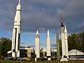
Alabama's industrial outputs include iron and steel products (including cast-iron and steel pipe); paper, lumber, and wood products; mining (mostly coal); plastic products; cars and trucks; and apparel. Also, Alabama produces aerospace and electronic products, mostly in the Huntsville area, location of NASA George C. Marshall Space Flight Center and the US Army Aviation and Missile Command, headquartered at Redstone Arsenal.
Alabama is part of the largest industrial growth corridor in the nation.[citation needed] Most of this growth is due to Alabama's rapidly expanding automotive manufacturing industry. Headquartered in the state are Honda Manufacturing of Alabama, Hyundai Motor Manufacturing Alabama, Mercedes-Benz U.S. International, and Toyota Motor Manufacturing Alabama. Since 1993, the automobile industry has generated more than 67,800 new jobs in the state. Alabama currently ranks 4th in the nation in automobile output.[64]
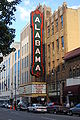
Birmingham
In the 1970s and 1980s, Birmingham's economy was transformed by the University of Alabama at Birmingham (UAB)'s investments in bio-technology and medical research. UAB Hospital is a Level I trauma center, the only one in Alabama, that provides health care and breakthrough medical research.[65] UAB is now the area's largest employer and the largest in Alabama, with a workforce of about 20,000. Other health care-services providers such as HealthSouth Corporation, Surgical Care Affiliates, Diagnostic Health Corporation and Naphcare are also headquartered in the city.
Birmingham is also a leading U.S. banking center and the headquarters of Regions Financial Corporation, BBVA Compass and Superior Bancorp. Birmingham-based Compass Banchshares was acquired by Madrid-based BBVA in September 2007, although the headquarters of BBVA Compass remains in Birmingham. In November 2006, Regions Financial completed its merger with AmSouth Bancorporation, which was also headquartered in Birmingham. SouthTrust Corporation, another large bank headquartered in Birmingham, was acquired by Wachovia in 2004 for $14.3 billion. The city still has major operations for Wachovia and its now post-operating bank Wells Fargo, which includes a regional headquarters, a operations center campus and a $400 million dollar data center. Nearly a dozen smaller banks are also headquartered in the Magic City, such as Superior Bancorp, ServisFirst and New South Federal Savings Bank. Birmingham also serves as the headquarters for several large investment management companies, including Harbert Management Corporation.
Telecommunications provider AT&T, formerly BellSouth, also has a major presence in Birmingham with several large offices in the metropolitan area. The company has over 6,000 employees and more than 1,200 contract employees, that work at a local data center, located in the area. Major insurance providers include Protective Life, Infinity Property & Casualty, Liberty National Life Insurance Company and ProAssurance. Torchmark Corporation was headquartered in the city until 2006, and still maintains its largest operation in the city.[citation needed]
Birmingham is also a powerhouse of construction and engineering companies. This started with Rust Engineering Company, which later became Rust International, and has grown to include Brasfield & Gorrie, BE&K, Hoar Construction and B.L. Harbert International, which all routinely are included in the Engineering News-Record lists of top design, international construction, and engineering firms.
Huntsville
Huntsville's main economic influence is derived from aerospace and military technology. Redstone Arsenal, NASA's Marshall Space Flight Center, Cummings Research Park (CRP), and the University of Alabama in Huntsville help drive the economy. Huntsville has commercial technology companies such as the network access company ADTRAN, computer graphics company Intergraph, and design and manufacturer of IT infrastructure Avocent. Telecommunications provider Deltacom is headquartered in Huntsville. Cinram manufactures and distributes 20th Century Fox DVDs and Blu-ray Discs out of their Huntsville plant. Sanmina-SCI has a large presence in the area.[citation needed] Forty-two Fortune 500 companies have operations in Huntsville.[citation needed] In 2005, Forbes Magazine named the Huntsville-Decatur Combined Statistical Area as 6th best place in the nation for doing business, and number one in terms of the number of engineers per total employment.[citation needed]
Mobile
The city of Mobile, Alabama's only saltwater port, is a busy seaport on the Gulf of Mexico with inland waterway access to the Midwest by way of the Tennessee-Tombigbee Waterway. The Port of Mobile is currently the 9th largest by tonnage in the United States.[66] In May 2007, a site north of Mobile was selected by German steelmaker ThyssenKrupp for a $3.7 billion steel production plant, with the promise of 2,700 permanent jobs.[67]
$9 billion is spent annually on "travel related expenses." This figure is used to indicate the extent of tourism.[68]
Taxes
Alabama levies a 2, 4, or 5 percent personal income tax, depending upon the amount earned and filing status. Taxpayers are not allowed to deduct their federal income tax from their Alabama state tax, but can deduct federal Social Security and Medicare taxes.
The state's general sales tax rate is 4%.[69] The collection rate could be substantially higher, depending upon additional city and county sales taxes. For example, the total sales tax rate in Mobile is 10% and there is an additional restaurant tax of 1%, which means that a diner in Mobile would pay a 11% tax on a meal. Sales and excise taxes in Alabama account for 51% of all state and local revenue, compared with an average of about 36% nationwide. Alabama is also one of the few remaining states that levies a tax on food and medicine. Alabama's income tax on poor working families is among the nation's very highest.[70] Alabama is the only state that levies income tax on a family of four with income as low as $4,600, which is barely one-quarter of the federal poverty line.[70] Alabama's threshold is the lowest among the 41 states and the District of Columbia with income taxes.[70]
The corporate income tax rate is currently 6.5%. The overall federal, state, and local tax burden in Alabama ranks the state as the second least tax-burdened state in the country.[71] Property taxes are the lowest in the United States. The current state constitution requires a voter referendum to raise property taxes.
Since Alabama's tax structure largely depends on consumer spending, it is subject to high variable budget structure. For example, in 2003 Alabama had an annual budget deficit as high as $670 million.
Transportation
Alabama has five major interstate roads that cross it: I-65 runs north–south roughly through the middle of the state; I-59/I-20 travels from the central west border to Birmingham, where I-59 continues to the north-east corner of the state and I-20 continues east towards Atlanta; I-85 originates in Montgomery and runs east-northeast to the Georgia border, providing a main thoroughfare to Atlanta; and I-10 traverses the southernmost portion of the state, running from west to east through Mobile. Another interstate road, I-22, is currently under construction. When completed around 2012 it will connect Birmingham with Memphis, Tennessee. Several US Highways also pass through the state, such as US 11, US 29, US 31, US 43, US 72, US 78, US 80, US 82, US 84, US 98, US 231, US 278, US 280, and US 431.
Major airports in Alabama include Birmingham-Shuttlesworth International Airport (BHM), Huntsville International Airport (HSV), Dothan Regional Airport (DHN), Mobile Regional Airport (MOB), Montgomery Regional Airport (MGM), Muscle Shoals – Northwest Alabama Regional Airport (MSL), Tuscaloosa Regional Airport (TCL), and Pryor Field Regional Airport (DCU). For rail transport, Amtrak schedules the Crescent, a daily passenger train, running from New York to New Orleans with stops at Anniston, Birmingham, and Tuscaloosa.
Water ports

Water Ports of Alabama, listed from north to south
| Port name | Location | Connected to |
|---|---|---|
| Port of Florence | Florence/Muscle Shoals, on Pickwick Lake | Tennessee River |
| Port of Decatur | Decatur, on Wheeler Lake | Tennessee River |
| Port of Guntersville | Guntersville, on Lake Guntersville | Tennessee River |
| Port of Birmingham | Birmingham, on Black Warrior River | Tenn-Tom Waterway |
| Port of Tuscaloosa | Tuscaloosa, on Black Warrior River | Tenn-Tom Waterway |
| Port of Montgomery | Montgomery, on Woodruff Lake | Alabama River |
| Port of Mobile | Mobile, on Mobile Bay | Gulf of Mexico |
Law and government

State government
The foundational document for Alabama's government is the Alabama Constitution, which was ratified in 1901. At almost 800 amendments and 310,000 words, it is the world's longest constitution and is roughly forty times the length of the U.S. Constitution.[72][73] There is a significant movement to rewrite and modernize Alabama's constitution.[74] This movement is based upon the fact that Alabama's constitution highly centralizes power in Montgomery and leaves practically no power in local hands. Any policy changes proposed around the state must be approved by the entire Alabama legislature and, frequently, by state referendum. One criticism of the current constitution claims that its complexity and length were intentional to codify segregation and racism.
Alabama is divided into three equal branches: The legislative branch is the Alabama Legislature, a bicameral assembly composed of the Alabama House of Representatives, with 105 members, and the Alabama Senate, with 35 members. The Legislature is responsible for writing, debating, passing, or defeating state legislation.
The executive branch is responsible for the execution and oversight of laws. It is headed by the Governor of Alabama. Other members of executive branch include the cabinet, the Attorney General of Alabama, the Alabama Secretary of State, the Alabama Commissioner of Agriculture and Industries, the Alabama State Treasurer, and the Alabama State Auditor.
The judicial branch is responsible for interpreting the Constitution and applying the law in state criminal and civil cases. The highest court is the Supreme Court of Alabama.
Local and county government
Alabama has 67 counties. Each county has its own elected legislative branch, usually called the County Commission, which usually also has executive authority in the county. Because of the restraints placed in the Alabama Constitution, all but seven counties (Jefferson, Lee, Mobile, Madison, Montgomery, Shelby, and Tuscaloosa) in the state have little to no home rule. Instead, most counties in the state must lobby the Local Legislation Committee of the state legislature to get simple local policies such as waste disposal to land use zoning.
Alabama is an alcoholic beverage control state; the government holds a monopoly on the sale of alcohol. However, counties can declare themselves "dry"; the state does not sell alcohol in those areas.
State politics

The current governor of the state is Republican Bob Riley. The lieutenant governor is Jim Folsom Jr. The Chief Justice of the Alabama Supreme Court is Democrat Sue Bell Cobb. The Democratic Party currently holds a large majority in both houses of the Legislature. Because of the Legislature's power to override a gubernatorial veto by a mere simple majority (most state Legislatures require a two-thirds majority to override a veto), the relationship between the executive and legislative branches can be easily strained when different parties control the branches.
During Reconstruction following the American Civil War, Alabama was occupied by federal troops of the Third Military District under General John Pope. In 1874, the political coalition known as the Redeemers took control of the state government from the Republicans, in part by suppressing the African American vote.
After 1890, a coalition of whites passed laws to segregate and disenfranchise black residents, a process completed in provisions of the 1901 constitution. Provisions which disfranchised African Americans also disfranchised poor whites, however. By 1941 more whites than blacks had been disfranchised: 600,000 to 520,000, although the impact was greater on the African-American community, as almost all of its citizens were disfranchised.
From 1901 to the 1960s, the state legislature failed to perform redistricting as population grew and shifted within the state. The result was a rural minority that dominated state politics until a series of court cases required redistricting in 1972.
With the disfranchisement of African Americans, the state became part of the "Solid South", a one-party system in which the Democratic Party became essentially the only political party in every Southern state. For nearly 100 years, local and state elections in Alabama were decided in the Democratic Party primary, with generally only token Republican challengers running in the General Election.
In the 1986 Democratic primary election, the then-incumbent Lieutenant Governor, Bill Baxley, lost the Democratic nomination for Governor in a scandal[citation needed] to then Attorney General Charles Graddick. The state Democratic party invalidated the election and placed Baxley's name on the ballot as the Democratic candidate instead of the candidate chosen in the primary. The voters of the state revolted at what they perceived as disenfranchisement of their right to vote and elected the Republican challenger Guy Hunt as Governor. He was the first Republican Governor elected in Alabama since Reconstruction. Since then, Republicans have become increasingly competitive in Alabama politics. They currently control both seats in the U.S. Senate, four out of the state's seven congressional seats. Republicans hold an 8–1 majority on the Alabama Supreme Court[75] and have a 5–2 majority among statewide elected executive branch offices.
However, Democrats currently hold all three seats on the Alabama Public Service Commission[76][77] and they maintain control of both houses of the legislature, holding approximately 59.4% of seats in the Alabama Senate and 58.7% of seats in the Alabama House of Representatives. A majority of local offices in the state are still held by Democrats. Local elections in rural counties are generally decided in the Democratic primary and local elections in metropolitan counties are decided in the Republican Primary, although there are exceptions.[78][79] Only one Republican Lt. Governor has been elected since Reconstruction, Steve Windom. Windom served as Lt. Governor under Democratic Gov. Don Siegelman. The last time that Alabama had a governor and Lt. governor of the same party was the period between 1983 and 1987 when Wallace was serving his fourth term as governor and Bill Baxley was serving as Lt. Governor; both were Democrats.
An overwhelming majority of sheriff's offices in Alabama are in Democratic hands. However, most of the Democratic sheriffs preside over more rural and less populated counties and the majority of Republicans preside over more urban/suburban and more populated counties.[80] Only three Alabama counties (Tuscaloosa, Montgomery and Calhoun) with a population of over 100,000 have Democratic sheriffs and only five Alabama counties with a population of under 75,000 have Republican sheriffs (Autauga, Coffee, Dale, Coosa, and Blount).[81]
Alabama state politics gained nationwide and international attention in the 1950s and 1960s during the American Civil Rights Movement, when majority whites bureaucratically, and at times, violently resisted protests for electoral and social reform. George Wallace, the state's governor, remains a notorious and controversial figure. Only with the passage of the Civil Rights Act of 1964[27] and Voting Rights Act of 1965 did African Americans regain suffrage and other civil rights.
In 2007, the Alabama Legislature passed, and the Governor signed, a resolution expressing "profound regret" over slavery and its lingering impact. In a symbolic ceremony, the bill was signed in the Alabama State Capitol, which housed Congress of the Confederate States of America.[82]
National politics
| Year | Republican | Democratic | State winner |
|---|---|---|---|
| 2008 | 60.32% 1,266,546 | 38.80% 813,479 | John McCain |
| 2004 | 62.46% 1,176,394 | 36.84% 693,933 | George W. Bush |
| 2000 | 56.47% 944,409 | 41.59% 695,602 | George W. Bush |
| 1996 | 50.12% 769,044 | 43.16% 662,165 | Bob Dole |
| 1992 | 47.65% 804,283 | 40.88% 690,080 | George Bush |
| 1988 | 59.17% 815,576 | 39.86% 549,506 | George Bush |
| 1984 | 60.54% 872,849 | 38.28% 551,899 | Ronald Reagan |
| 1980 | 48.75% 654,192 | 47.45% 636,730 | Ronald Reagan |
| 1976 | 42.61% 504,070 | 55.73% 659,170 | Jimmy Carter |
| 1972 | 72.43% 728,701 | 25.54% 256,923 | Richard Nixon |
| 1968* | 13.99% 146,923 | 18.72% 196,579 | George Wallace (I) |
| 1964 | 69.45% 479,085 | 30.55% 210,732 | Barry Goldwater |
| 1960 | 42.16% 237,981 | 56.39% 318,303 | John F. Kennedy |
| *State won by George Wallace of the American Independent Party, at 65.86%, or 691,425 votes | |||
From 1876 through 1956, Alabama supported only Democratic presidential candidates, by large margins. In 1960, the Democrats won with John F. Kennedy on the ballot, but the Democratic electors from Alabama gave 6 of their 11 electoral votes as a protest to Harry Byrd. In 1964, Republican Barry Goldwater carried the state, in part because of his opposition to the 1964 Civil Rights Act, which restored the franchise for African Americans.
In the 1968 presidential election, Alabama supported native son and American Independent Party candidate George Wallace over both Richard Nixon and Hubert Humphrey. Wallace was the official Democratic candidate in Alabama, while Humphrey was listed as the "National Democratic".[83] In 1976, Democratic candidate Jimmy Carter from Georgia carried the state, the region, and the nation, but Democratic control of the region slipped after that.
Since 1980, conservative Alabama voters have increasingly voted for Republican candidates at the Federal level, especially in Presidential elections. By contrast, Democratic candidates have been elected to many state-level offices and comprise a longstanding majority in the Alabama Legislature; see Dixiecrat.
In 2004, George W. Bush won Alabama's nine electoral votes by a margin of 25 percentage points with 62.5% of the vote, mostly white voters. The eleven counties that voted Democratic were Black Belt counties, where African Americans are the majority racial group.
The state's two U.S. senators are Jefferson B. Sessions III and Richard C. Shelby, both Republicans.
In the U.S. House of Representatives, the state is represented by seven members, five of whom are Republicans: (Jo Bonner, Mike D. Rogers, Robert Aderholt, Parker Griffith, and Spencer Bachus) and two are Democrats: (Bobby Bright and Artur Davis).
Education
Primary and secondary education
Public primary and secondary education in Alabama is under the overview of the Alabama State Board of Education as well as local oversight by 67 county school boards and 60 city boards of education. Together, 1,541 individual schools provide education for 743,364 elementary and secondary students.[84]
Public school funding is appropriated through the Alabama Legislature through the Education Trust Fund. In FY 2006–2007, Alabama appropriated $3,775,163,578 for primary and secondary education. That represented an increase of $444,736,387 over the previous fiscal year.[84] In 2007, over 82 percent of schools made adequate yearly progress (AYP) toward student proficiency under the National No Child Left Behind law, using measures determined by the State of Alabama. In 2004, 23 percent of schools met AYP.[85]
While Alabama's public education system has improved, it lags behind in achievement compared to other states. According to U.S. Census data, Alabama's high school graduation rate – 75% – is the second lowest in the United States (after Mississippi).[86] The largest educational gains were among people with some college education but without degrees.[87]
Colleges and universities

Alabama's programs of higher education include 14 four-year public universities, two-year community colleges, and 17 private, undergraduate and graduate universities. In the state are two medical schools (University of Alabama at Birmingham and University of South Alabama), two veterinary colleges (Auburn University and Tuskegee University), a dental school (University of Alabama at Birmingham), an optometry college (University of Alabama at Birmingham), two pharmacy schools (Auburn University and Samford University), and five law schools (University of Alabama School of Law, Birmingham School of Law, Cumberland School of Law, Miles Law School, and the Thomas Goode Jones School of Law). Public, post-secondary education in Alabama is overseen by the Alabama Commission on Higher Education. Colleges and universities in Alabama offer degree programs from two-year associate degrees to 16 doctoral level programs.[88]
Accreditation of academic programs is through the Southern Association of Schools and Colleges as well as a plethora of subject focused national and international accreditation agencies.[89]
Sports
Professional sports teams
Alabama has several minor league professional teams including four minor league baseball teams.
| Club | City | Sport | League | Venue | Notes |
|---|---|---|---|---|---|
| Alabama Hammers | Huntsville | Arena football | Southern Indoor Football League | Von Braun Center | |
| Birmingham Barons | Birmingham | Baseball | Southern League | Regions Park | |
| Huntsville Havoc | Huntsville | Ice Hockey | Southern Professional Hockey League | Von Braun Center | |
| Huntsville Stars | Huntsville | Baseball | Southern League | Joe W. Davis Stadium | |
| Mobile BayBears | Mobile | Baseball | Southern League | Hank Aaron Stadium | |
| Montgomery Biscuits | Montgomery | Baseball | Southern League | Montgomery Riverwalk Stadium | |
| Rocket City United | Huntsville | Soccer | National Premier Soccer League | Madison City Schools Stadium | |
| Tennessee Valley Tigers | Huntsville | Football | Independent Women's Football League | Milton Frank Stadium | replaced the Alabama Renegades |
Notable Alabamians
Cultural sites and events
-
-

-

-
-

-
Veterans Memorial Park in Tuscaloosa
-
 Mardi Gras in Mobile
 -
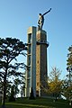 The Vulcan statue in Birmingham
 -
-
-
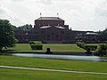
The Mercedes-Benz Visitors Center in Tuscaloosa


See also
References
- ^ "Annual Estimates of the Population for Incorporated Places Over 100,000, Ranked by July 1, 2007 Population: April 1, 2000, to July 1, 2007" (CSV). 2007 Population Estimates. U.S. Census Bureau, Population Division. July 8, 2008. Retrieved 2007-06-28. in Excel format
- ^ a b "Annual Estimates of the Resident Population for the United States, Regions, States, and Puerto Rico: April 1, 2000 to July 1, 2008". United States Census Bureau. Retrieved 2009-02-01.
- ^ a b c "Elevations and Distances in the United States". U.S Geological Survey. April 29, 2005. Retrieved November 3, 2006.
- ^ "Alabama Quick Facts". State and County Quick Facts. U.S. Census Bureau. Retrieved December 30, 2010.
- ^ a b c "George Mason University, United States Election Project: Alabama Redistricting Summary, accessed March 10, 2008". Web.archive.org. Archived from the original on 2007-10-17. Retrieved 2010-10-24.
- ^ a b c Read, William A. (1984). Indian Place Names in Alabama. University of Alabama Press. ISBN 0-8173-0231-X. OCLC 10724679.
- ^ Sylestine, Cora; Hardy; Heather; and Montler, Timothy (1993). Dictionary of the Alabama Language. Austin: University of Texas Press. ISBN 0-292-73077-2. OCLC 26590560.
{{cite book}}: CS1 maint: multiple names: authors list (link) - ^ a b c Rogers, William W. (1994). Alabama: the History of a Deep South State. University of Alabama Press. ISBN 0-8173-0712-5. OCLC 28634588.
{{cite book}}: Unknown parameter|coauthors=ignored (|author=suggested) (help) - ^ a b c d e f g h "Alabama: The State Name". All About Alabama. Alabama Department of Archives and History. Retrieved 2007-08-02.
- ^ a b Wills, Charles A. (1995). A Historical Album of Alabama. The Millbrook Press. ISBN 1-56294-591-2. OCLC 32242468.
- ^ Griffith, Lucille (1972). Alabama: A Documentary History to 1900. University of Alabama Press. ISBN 0-8173-0371-5. OCLC 17530914.
- ^ The use of state names derived from Native American languages is common; an estimated 27 states have names of Native American origin. Weiss, Sonia (1999). The Complete Idiot's Guide to Baby Names. Mcmillan USA. ISBN 0-02-863367-9. OCLC 222611214.
- ^ a b Swanton, John R. (1953). "The Indian Tribes of North America". Bureau of American Ethnology Bulletin 145: 153–174. Retrieved 2007-08-02.
- ^ a b Swanton, John R. (1937). "Review of Read, Indian Place Names of Alabama". American Speech. 12 (12): 212–215. doi:10.2307/452431.
- ^ "Alabama". The New York Times Almanac 2004. The New York Times. 2006-08-11. Retrieved 2006-09-23.
- ^ Welch, Paul D. (1991). Moundville's Economy. University of Alabama Press. ISBN 0817305122. OCLC 21330955.
- ^ Walthall, John A. (1990). Prehistoric Indians of the Southeast-Archaeology of Alabama and the Middle South. University of Alabama Press. ISBN 0817305521. OCLC 26656858.
- ^ Townsend, Richard F. (2004). Hero, Hawk, and Open Hand. Yale University Press. ISBN 0300106017. OCLC 56633574.
- ^ edited by F. Kent Reilly III and James F. Garber ; foreword by Vincas P. Steponaitis. (2004). Ancient Objects and Sacred Realms. University of Texas Press. ISBN 9780292713475. OCLC 70335213.
{{cite book}}:|author=has generic name (help); Unknown parameter|editors=ignored (|editor=suggested) (help)CS1 maint: multiple names: authors list (link) - ^ "Alabama Indian Tribes". Indian Tribal Records. AccessGenealogy.com. Updated 2006. Retrieved 2006-09-23.
{{cite web}}: Check date values in:|date=(help) - ^ "Alabama State History". theUS50.com. Retrieved 2006-09-23.
- ^ "AL-Alabama". Landscapes and History by state. StateMaster.com. Retrieved 2006-09-23.
- ^ a b c "The Black Belt". Southern Spaces Internet Journal. Emory University. 2004-04-19. Retrieved 2006-09-23.
- ^ "13th Amendment to the U.S. Constitution: Abolition of Slavery (1865)". Historical Documents. HistoricalDocuments.com. 2005. Retrieved 2006-09-23.
- ^ a b Glenn Feldman. The Disfranchisement Myth: Poor Whites and Suffrage Restriction in Alabama. Athens: University of Georgia Press, 2004, p. 136.
- ^ "Birmingham". Bhamwiki. Retrieved 2010-10-24.
- ^ a b "Civil Rights Act of 1964". Finduslaw.com. Retrieved 2010-10-24.
- ^ "Voting Rights". Civil Rights: Law and History. US Department of Justice. 2002-01-09. Archived from the original on 2007-02-21. Retrieved 2006-09-23.
- ^ "The New South Rises, Again". Civil Rights: Law and History. Southerner.net. Spring 1999. Retrieved 2006-09-23.
- ^ "GCT-PH1-R. Population, Housing Units, Area, and Density (areas ranked by population): 2000". Geographic Comparison Table. US Census Bureau. Census Year 2000. Retrieved 2006-09-23.
{{cite web}}: Check date values in:|date=(help) - ^ a b c "The Geography of Alabama". Geography of the States. NetState.com. 2006-08-11. Retrieved 2006-09-23.
- ^ Alabama Forest Owner's Guide to Information Resources, Introduction, Alabamaforests.org
- ^ "Alabama County (geographies ranked by total population)". Geographic Comparison Table. U.S. Census Bureau. Census year 2000. Retrieved 2007-05-14.
{{cite web}}: Check date values in:|date=(help); Unknown parameter|ST-2S&-_lang=ignored (help) - ^ "National Park Guide". Geographic Search. Washington, D.C: National Park Service – U.S. Department of the Interior. Retrieved 2006-09-23.
- ^ "National Forests in Alabama". USDA Forest Service. United States Department of Agriculture. Retrieved 2008-10-05.
- ^ a b c "Wetumpka Impact Crater" Wetumpka Public Library. Retrieved August 21, 2007.
- ^ "The Wetumpka Astrobleme" by John C. Hall, Alabama Heritage, Fall 1996, Number 42.
- ^ Christopher M. Godfrey (2008-11-04). "Greenhouse effect and climate" (PDF). Atmospheric Sciences. University of North Carolina, Asheville.
{{cite web}}: Cite has empty unknown parameter:|month=(help) - ^ a b "Alabama Climate". Britannica.com. Retrieved 2010-10-24.
- ^ Lightning Fatalities, Injuries and Damages in the United States, 1990–2003, [1] Retrieved May 8, 2007
- ^ Fujita scale. Tornadoproject.com. Retrieved September 3, 2007.
- ^ Alabama Weather and Climate. US Travel Weather
- ^ http://2010.census.gov/2010census/data/apportionment-pop-text.php
- ^ a b c U. S. Census Bureau (2008-12-15). "Cumulative Estimates of the Components of Population Change for the United States, Regions and States: April 1, 2000 to July 1, 2008 (NST-EST2008-04)" (CSV). Retrieved 2009-01-16.
- ^ "Population and Population Centers by State - 2000". United States Census Bureau. Retrieved 2008-12-03.
- ^ American Community Survey: Alabama. Retrieved 24 July 2010.
- ^ Data on selected ancestry groups.
- ^ 1980 United States Census
- ^ a b American FactFinder, United States Census Bureau. "Alabama - Selected Social Characteristics in the United States: 2006-2008". Factfinder.census.gov. Retrieved 2010-10-24.
- ^ dq=Sharing+the+dream:+white+males+in+multicultural+America++english+ancestry&cd=1#v=onepage&q=&f=false Sharing the Dream: White Males in a Multicultural America By Dominic J. Pulera.
- ^ Reynolds Farley, 'The New Census Question about Ancestry: What Did It Tell Us?', Demography, Vol. 28, No. 3 (August 1991), pp. 414, 421.
- ^ Stanley Lieberson and Lawrence Santi, 'The Use of Nativity Data to Estimate Ethnic Characteristics and Patterns', Social Science Research, Vol. 14, No. 1 (1985), pp. 44-6.
- ^ Stanley Lieberson and Mary C. Waters, 'Ethnic Groups in Flux: The Changing Ethnic Responses of American Whites', Annals of the American Academy of Political and Social Science, Vol. 487, No. 79 (September 1986), pp. 82-86.
- ^ "State Membership Reports". thearda.com. Retrieved 2010-06-15.
- ^ Campbell, Kirsten (2007-03-25). "Alabama rates well in biblical literacy". Mobile Register. Advance Publications, Inc. p. A1.
{{cite news}}:|access-date=requires|url=(help) - ^ "Confidence in State and Local Institutions Survey" (PDF). Capital Survey Research Center. Archived from the original (PDF) on 2007-08-09. Retrieved 2007-06-02.
- ^ White, David (2007-04-01). "Poll says we feel good about state Trust in government, unlike some institutions, hasn't fallen". Birmingham News. Birmingham News. p. 13A.
{{cite news}}:|access-date=requires|url=(help) - ^ Barry A. Kosmin and Ariela Keysar (2009). "AMERICAN RELIGIOUS IDENTIFICATION SURVEY (ARIS) 2008" (PDF). Hartford, Connecticut, USA: Trinity College. p. 20. Retrieved 2009-05-08.
- ^ "GDP by State (2008)". Bureau of Economic Analysis, Regional Economic Accounts. June 2, 2009. Retrieved 2009-10-09. full release with tables
- ^ "United States Census Bureau". State and County Quick Facts. Retrieved 2007-05-30.
- ^ Bls.gov; Local Area Unemployment Statistics
- ^ "Alabama and CBER: 75 Years of Change" (PDF). Alabama Business. Center for Business and Economic Research, Culverhouse College of Commerce, The University of Alabama. Q4 2005. Retrieved 2006-09-23.
{{cite web}}: Check date values in:|date=(help) - ^ "State Highlights for 2004–2005" (PDF). Alabama Cooperative Extension System. USDA, NASS, Alabama Statistical Office. 2005. Retrieved 2006-09-23.
- ^ "Vehicle Technologies Program: Fact #539: October 6, 2008 Light Vehicle Production by State". .eere.energy.gov. 2008-10-06. Retrieved 2010-10-24.
- ^ "Verified Trauma Centers". American College of Surgeons, Verified Trauma Centers. December 30, 2010. Retrieved 2011-01-09.
- ^ "WATERBORNE COMMERCE OF THE UNITED STATES" (PDF). U.S. Army Corps of Engineers: Waterborne Commerce Statistics. p. 90. Retrieved 2010-03-08.
- ^ "ThyssenKrupp's Alabama incentive package tops $811 million". Press register. 2007-05-11. Retrieved 2007-05-11.
- ^ Fahrenthold, David A. (2 May 2010). "Obama to survey environmental damage in gulf". Washington, DC: Washington Pose. pp. A6.
- ^ Comparison of State and Local Retail Sales Taxes, July 2004 Retrieved on May 25, 2007.
- ^ a b c "Reducing Alabama's Income Tax on Working-Poor Families: Two Options - 4/14/99". Cbpp.org. Retrieved 2010-10-24.
- ^ "Alabama State Local Tax Burden Compared to U.S. Average (1970–2007)" (PDF). Tax Foundation. Retrieved 2007-05-30.
- ^ Roig-Franzia, Manuel (2004-11-28). "Alabama Vote Opens Old Racial Wounds". Washington Post. Retrieved 2006-09-22.
- ^ "Constitution of Alabama - 1901". The Alabama Legislative Information System. Retrieved 2006-09-22.
- ^ "Alabama Citizens for Constitutional Reform". Constitutionalreform.org. Retrieved 2010-10-24.
- ^ "Sue Bell Cobb considering running for governor - Breaking News from The Birmingham News - al.com". Blog.al.com. 2009-05-02. Retrieved 2009-08-07.
- ^ "Commissioners". Psc.state.al.us. Retrieved 2009-08-07.
- ^ Special (2008-11-05). "Lucy Baxley wins Alabama Public Service Commission presidency, but recount possible". Birmingham News via al.com. Retrieved 2009-08-07.
- ^ "2006 Gubernatorial Democratic Primary Election Results - Alabama". Uselectionatlas.org. Retrieved 2009-08-07.
- ^ "2006 Gubernatorial Republican Primary Election Results - Alabama". Uselectionatlas.org. 2007-02-15. Retrieved 2009-08-07.
- ^ "Association". Alabama Sheriffs. Retrieved 2009-08-07.
- ^ "2007-2011 Alabama Sheriffs". Alabamasheriffs.com. Retrieved 2009-08-07.
- ^ Rawls, Phillip (2007-06-01). "Alabama offers an apology for slavery". The Virginian Pilot. Landmark Communications.
{{cite news}}:|access-date=requires|url=(help) - ^ "1968 Presidential General Election Results - Alabama". Uselectionatlas.org. 1968-11-05. Retrieved 2009-08-07.
- ^ a b "Alabama Education Quick Facts 2007" (PDF). Retrieved 2007-08-11.
- ^ "Eighty-Two Percent of Alabama Schools Make AYP While Increasing Annual Measurable Objectives" (PDF). Retrieved 2007-08-11.
- ^ http://www.census.gov/prod/2003pubs/c2kbr-24.pdf
- ^ Education Statistics. CensusScope.org
- ^ "Degree titles and abbreviations". Alabama Commission on Higher Education. Retrieved 2007-09-03. [dead link]
- ^ "Accreditation". Alabama Commission on Higher Education. Retrieved 2007-09-03.
Further reading
- For a detailed bibliography, see the History of Alabama.
- Atkins, Leah Rawls, Wayne Flynt, William Warren Rogers, and David Ward. Alabama: The History of a Deep South State (1994)
- Flynt, Wayne. Alabama in the Twentieth Century (2004)
- Owen Thomas M. History of Alabama and Dictionary of Alabama Biography 4 vols. 1921.
- Jackson, Harvey H. Inside Alabama: A Personal History of My State (2004)
- Mohl, Raymond A. "Latinization in the Heart of Dixie: Hispanics in Late-twentieth-century Alabama" Alabama Review 2002 55(4): 243–274. ISSN 0002-4341
- Peirce, Neal R. The Deep South States of America: People, Politics, and Power in the Seven Deep South States (1974). Information on politics and economics 1960–72.
- Williams, Benjamin Buford. A Literary History of Alabama: The Nineteenth Century 1979.
- WPA. Guide to Alabama (1939)
External links
 Definitions from Wiktionary
 Media from Commons
 News from Wikinews
 Quotations from Wikiquote
 Texts from Wikisource
 Textbooks from Wikibooks
 Resources from Wikiversity
![]() Geographic data related to Alabama at OpenStreetMap
Geographic data related to Alabama at OpenStreetMap
- Alabama.gov – Official website.
- Alabama State Guide, from the Library of Congress
- Alabama State Databases – Annotated list of searchable databases produced by Alabama state agencies and compiled by the Government Documents Roundtable of the American Library Association.
- Alabama Association of Regional Councils
- Energy Data & Statistics for Alabama- From the U.S. Department of Energy
- TourAlabama.org – Alabama Department of Tourism and Travel
- All About Alabama, at the Alabama Department of Archives and History
- AlabamaMosaic, a digital repository of materials on Alabama's history, culture, places, and people
- Code of Alabama 1975 – at the Alabama Legislature site
- Alabama at Curlie
- USGS real-time, geographic, and other scientific resources of Alabama
- Alabama QuickFacts from the U.S. Census Bureau
- Alabama State Fact Sheet from the U.S. Department of Agriculture
- Alabama State Parks
- National Parks of Alabama
- Encyclopedia of Alabama covers history, culture, geography, and natural environment.
Places adjacent to Alabama | |
|---|---|