
Gilgit

Gilgit (Urdu: گلگت, Hindi: गिलगित) is the capital city of the Northern Areas, Pakistan and a tehsil (headquarters) of Gilgit District. Its ancient name was Sargin, later to be known as Gilit, and it is still called Gilit or Sargin-Gilit by local people, in the Burushaski language, it is named Geelt. Ghallata is considered its name in ancient Sanskrit literature. Gilgit city is one of the two major hubs on the Northern Areas for all mountaineering expeditions of Karakoram to the peaks of the Himalayas, the other hub being Skardu.
Gilgit has an area of 38,000 square kilometres (14,672 sq mi). The region is significantly mountainous, lying on the foothills of the Karakoram mountains, and has an average altitude of 1,500 metres (4,900 ft). It is drained by the Indus River, which rises in the neighbouring regions of Ladakh and Baltistan.
History
Gilgit was an important city on the Silk Road through which Buddhism was spread from South Asia to the rest of Asia. A large number of Buddhist Sanskrit texts, included the long version of the Heart Sutra have been unearthed in Gilgit. The Dards and Cizinas also appear in many of the old Pauranic lists of peoples, with the former finding mention in Ptolemy's accounts of the region. Two famous travellers, Faxian, and Xuanzang are known to have traversed Gilgit as per their accounts.
'The former rulers had the title of Ra, and there is reason to suppose that they were at one time Hindus, but for the last five centuries and a half they have been Mohommedans. The names of the Hindu Ras have been lost, with the exception of the last of their number, Shri Buddutt. Tradition relates that he was killed by a Mohommedan adventurer, who married his daughter and founded a new dynasty , since called Trakhane , from a celebrated Ra named Trakhan , who reigned about the commencement of the fourteenth century . The previous rulers of whom Shiri Buddut was the last were called Shahreis . [1]
Gilgit was ruled for centuries by the local Trakhàn Dynasty. However, its independence came to an end about 1810 with the death of Raja Abas, the last Trakhàn Raja.[2]

The rulers of Hunza and Nager also claim origin with the Trakhàn dynasty. They claim descent from a heroic Kayani Prince of Persia by the name of Azur Jamshid (also known as Shamsher) who secretly married the daughter of the king Shri Badat who conspired with him to overthrow her Cannibal father[3]. Sri Badat's faith is theorised as Hindu[4][5] by some and Buddhist[6][7] by others. However, considering the region's Buddhist heritage, with the most recent influence being Islam, the most likely preceding influence of the region is Buddhism. Though the titular Sri and the name Badat denotes a Hindu origin of the this ruler.
Prince Azur Jamshid succeeded in overthrowing King Badat who was known as Adam Khor (lit. man-eater)[8][9], often demanding a child a day from his subjects, his demise is still celebrated to this very day by locals in traditional annual celebrations[10]. In the beginning of the new year, where a Juniper procession walks along the river, in memory of chasing the cannibal king Sri Badat away[11].
Azur Jamshid abdicated after 16 years of rule in favour of his wife Nur Bakht Khatùn until their son and heir Garg, grew of age and assumed the title of Raja and ruled, for 55 years. The dynasty flourished under the name of the Kayani dynasty until 1421 when Raja Torra Khan assumed rulership. He ruled as a memorable king until 1475. He distinguished his family line from his step brother Shah Rais Khan (who fled to the king of Badakshan and with who's help he gained Chitral from Raja Torra Khan), as the now known dynastic name of Trakhàn. The descendants of Shah Rais Khan being respectfully known as the Ra'issiya Dynasty.[12]
' The period of greatest prosperity was probably under the Shin Ras , whose rule seems to have been peaceable and settled . The whole population , from the RA to the poorest subject lived by agriculture . According to tradition Shri Buddutt's rule extended over Chitral , Yassin, Tangir, Darel, Chilas, Gor, Astor, Hunza, Nagar and Haramosh all of which were held by tributary princes of the same family. [13]
The area had been a flourishing tract but prosperity was destroyed by warfare over the next fifty years, and by the great flood of 1841 in which the river Indus was blocked by a landslip below the Hatu Pir and the valley was turned into a lake[14]. After the death of Abas, Sulaiman Shah, raja of Yasin, conquered Gilgit. Then, Azad Khan, raja of Punial, killed Sulaiman Shah, taking Gilgit; then Tair Shah, raja of Buroshall (Nagar), took Gilgit and killed Azad Khan. Tair Shah's son Shah Sakandar inherited, only to be killed by Gaur Rahman, raja of Yasin of the Khushwakhte Dynasty, when he took Gilgit. Then in 1842, Shah Sakandar's brother, Karim Khan, expelled Gaur Rahman with the support of a Sikh army from Kashmir. The Sikh general, Nathu Shah, left garrison troops and Karim Khan ruled until Gilgit was ceded to Gulab Singh of Jammu and Kashmir in 1846 by the Treaty of Amritsar,[2] and Dogra troops replaced the Sikh in Gilgit.
Nathu Shah and Karim Khan both transferred their allegiance to Gulab Singh and continued local administration. When Hunza attacked in 1848 both of them were killed. Gilgit fell to the Hunza and their Yasin and Punial allies, but was soon reconquered by Gulab Singh's Dogra troops. With the support of Gaur Rahman, Gilgit's inhabitants drove their new rulers out in an uprising in 1852. Gaur Rahman then ruled Gilgit until his death in 1860, just before new Dogra forces from Ranbir Singh, son of Gulab Singh, captured the fort and town.[2] The rule of Jammu was restored. Gilgit came under British rule in 1889, when it was unified with neighbouring Nagar and Hunza in the Gilgit Agency.
“In 1889, in order to guard against the advance of Russia, the British Government, acting as the suzerain power of Kashmir, established the Gilgit Agency”. The Agency was re-established under control of the British Resident in Jammu & Kashmir. “It comprised the Gilgit Wazarat; the State of Hunza and Nagar; the Punial Jagir; the Governorships of Yasin, Kuh-Ghizr and Ishkoman, and Chilas”. In 1935, the British demanded J&K lease to them for 60 years Gilgit town plus most of the Gilgit Agency and the hill-states Hunza, Nagar, Yasin and Ishkuman. Hari Singh had no choice but to acquiesce. The leased region was then treated as part of British India, administered by a Political Agent at Gilgit responsible to Delhi, first through the Resident in J& K and later a British Agent in Peshawar. J& K State no longer kept troops in Gilgit and a mercenary force, the Gilgit Scouts, was recruited with British officers and paid for by Delhi. In April 1947, Delhi decided to formally retrocede the leased areas to Hari Singh’s J& K State as of 15 August 1947. The transfer was to formally take place on 1 August. On 4 November 1947, Brown raised the new Pakistani flag in the Scouts’ lines, and by the third week of November a Political Agent from Pakistan had established himself at Gilgit. Brown had engineered Gilgit and its adjoining states to first secede from J&K, and, after some talk of being independent, had promptly acceded to Pakistan. His commander in Peshawar, a Col. Bacon, as well as Col. Iskander Mirza, Defence Secretary in the new Pakistan and later to lead the first military coup détat and become President of Pakistan, were pleased enough. In July 1948, Brown was awarded an MBE (Military) and the British Governor of the NWFP got him a civilian job with ICI~ which however sent him to Calcutta, where he came to be attacked and left for dead on the streets by Sikhs avenging the Bunji massacre. Brown survived, returned to England, started a riding school, and died in 1984. In March 1994, Pakistan awarded his widow the Sitara-I-Pakistan in recognition of his coup détat. Gilgit’s ordinary people had not participated in Brown’s coup which carried their fortunes into the new Pakistan, and to this day appear to remain without legislative representation. It was merely assumed that since they were mostly Muslim in number they would wish to be part of Pakistan ~ which also became Liaquat Ali Khan’s assumption about J&K State as a whole in his 1950 statements in North America. What the Gilgit case demonstrates is that J&K State’s descent into a legal condition of ownerless anarchy open to “Military Decision” had begun even before the Pakistani invasion of 22 October 1947 (viz. “Solving Kashmir”, The Statesman, 1-3 December 2005). Also, whatever else the British said or did with respect to J & K, they were closely allied to the new Pakistan on the matter of Gilgit.”
Tourism and transport
Gilgit city is one of the two major hubs for all mountaineering expeditions in the Northern Areas of Pakistan. Almost all tourists headed for treks in Karakoram or Himalaya Ranges arrive at Gilgit first. Many tourists choose to travel to Gilgit by air since the road travel between Islamabad and Gilgit, by the Karakoram Highway, takes nearly 24 hours, whereas the air travel takes a mere 45-50 minutes.
Important Places to Visit
- Naltar
- Hunza
- Ferry Meadows (Raikot)
- Shigar (Skardu)
- Kutoval (Haramosh)
- Bagrote
- Deosai Plains (Astore)
- Rama (Astore)
- Gaasho Pahoot (Juglot Sai)
- Phunder
- Yaseen Valley
Road transport

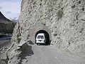
Gilgit lies about 10 km off the Karakoram Highway. The KKH connects it to Chilas, Dasu, Besham, Mansehra, Abbottabad and Islamabad in the south. In the North it is connected to Karimabad (Hunza) and Sust in the Northern Areas and to the Chinese cities of Tashkurgan, Upal and Kashgar in Xinjiang.
There are various transports companies i.e. Silk Route Transport Pvt, Mashabrum Transport Pvt and Northern Areas Transport Corporation (NATCO). But NATCO has vast coverage faciality. It offers passenger road service between Islamabad, Gilgit, Sust and Tashkurgan, and road service between Kashgar and Gilgit (via Tashkurgan and Sust) started in the summer of 2006. However, the border crossing between China and Pakistan at Khunjerab Pass (the highest border of the world) is open only between May 1 and October 15 of every year. During winter, the roads are blocked by snow. Even during the monsoon season in summer, the roads are often blocked due to landslides. The best time to travel on Karakoram Highway is spring or early summer.
Air transport

Pakistan International Airlines flies ATR 42-500 flights twice daily between Gilgit Airport and Islamabad International Airport and the journey offers one of the most scenic aerial views in the world as it passes close to Nanga Parbat and the mountain peaks are higher than the aircraft's cruising altitude. There are two routes that the aircraft takes: One is the direct route from the capital Islamabad that takes the plane over the Margalla Hills then over the town of Haripur directly over the Kaghan Valley from where it heads towards Nanga Parbat and finally abeam the mountain the descent starts into the Indus valley. The other route that it flies is all along the Indus valley which is also scenic but a little longer. These flights, however, are subject to the clearance of weather and in winters, flights are often delayed by several days. After a Fokker aircraft crashed near Multan, the Government of Pakistan banned all Fokker flights in domestic operations.[citation needed]
Hospitals
The health system in northern areas is still in its primary phase with just a District Hospital in whole Gilgit city ,supported by a Military Hospital.Some NGOs do play a minor role in uplift but catering specific communities.Government has yet to fully develop a comprehensive health system in the area. TB , endocrinal disorders with mainly iodine deficiency disorders,iron deficiency ,and diarrheal diseases are more common.Sewerage system has yet to be fully established,electricity and water supply is still faulty ,making a hindrance in developing the strong health care system.
Education
Schools
- KG School,Hospital Road
- Govt High School,Saddar Bazar
- Govt Girls High School,Hospital Road
- Public School,Gilgit
- APS School
- Tamir e Nou School
Colleges
- F.G Degree college Jutial
- F.G Degree college for women
- Army Public School and College
- Public School and Colleges Jutial
- Aga Khan Higher Secondary School Konodass
- Al-Musataf Public School and College
- Gilgit College of Commerce Jutial
- Karakurum College of Commerce
- Al Azhar College of Commerce
- The Prelude public school and college
University
- Karakoram International University Gilgit
Gallery
-
 Danyor Tanel
 -
 Manuscript of the Buddhist Jyotiṣkāvadāna text written in the Brāhmī script, from Gilgit.


Notes
- ^ Tribes of the Hindoo Koosh by John Bidduph published by Sang-e-Meel -Publications Page 20
- ^ a b c Drew, Frederic (1875) The Jummoo and Kashmir Territories: A Geographical Account E. Stanford, London, OCLC 1581591, republished a number of times
- ^ The Gilgit Agency, 1877-1935 by Amar Singh Chohan, Atlantic Publishers & Distributors 1984, p4
- ^ Between the Oxus and the Indus by Reginald Charles Francis Schomberg, 1976, p249
- ^ The Gilgit Agency, 1877-1935 by Amar Singh Chohan, Atlantic Publishers & Distributors 1984, p4
- ^ Recent Research on Ladakh 4 & 5: Proceedings of the Fourth and Fifth by Henry Osmaston, Philip Denwood, 1995 Motilal Banarsidas, p226
- ^ History of Northern Areas of Pakistan by Ahmad Hasan Dani, 1989, p163
- ^ Imperial Gazetteer of India. Provincial Series: Kashmir and Jammu, ISBN 0543917762, Adamant, p107
- ^ Between the Oxus and the Indus by Reginald Charles Francis Schomberg, 1976, p144
- ^ Dissertation page 21
- ^ Recent Research on Ladakh 4 & 5 by Henry Osmaston, Philip Denwood, Motilal Banarsidass Publ. 1995, p229
- ^ History of Civilizations of Central Asia By Ahmad Hasan Dani, Vadim Mikhaĭlovich, Motilal Banarsidass Publ 1999, p216-217
- ^ Tribes of the Hindoo Koosh by John Bidduph published by Sang-e-Meel -Publications Page 20 and 21
- ^ Gilgit - Imperial Gazetteer of India, v. 12, p. 238
References
- The Gilgit Game by John Keay (1985) ISBN 0-19-577466-3
- Drew, Frederic. Date unknown. The Northern Barrier of India: a popular account of the Jammoo and Kashmir Territories with Illustrations. Reprint: Light & Life Publishers, Jammu. 1971.
- Jettmar, Karl, 1980. Bolor & Dardistan. National Institute of Folk Heritage, Islamabad.
- Knight, E. F. 1893. Where Three Empires Meet: A Narrative of Recent Travel in: Kashmir, Western Tibet, Gilgit, and the adjoining countries. Longmans, Green, and Co., London. Reprint: Ch'eng Wen Publishing Company, Taipei. 1971.
- Leitner, G. W. 1893. Dardistan in 1866, 1886 and 1893: Being An Account of the History, Religions, Customs, Legends, Fables and Songs of Gilgit, Chilas, Kandia (Gabrial) Yasin, Chitral, Hunza, Nagyr and other parts of the Hindukush, as also a supplement to the second edition of The Hunza and Nagyr Handbook. And An Epitome of Part III of the author's “The Languages and Races of Dardistan. First Reprint 1978. Manjusri Publishing House, New Delhi.
- Muhammad, Gulam. 1980. Festivals and Folklore of Gilgit. National Institute of Folk Heritage, Islamabad.
- This article incorporates text from a publication now in the public domain: Chisholm, Hugh, ed. (1911). Encyclopædia Britannica (11th ed.). Cambridge University Press.
{{cite encyclopedia}}: Missing or empty|title=(help) - Imperial Gazetteer of India. Provincial Series: Kashmir and Jammu
- Shri Badat The Cannibal King A Buddhist Jataka from Gilgit
See also
- Hunza
- Skardu
- Karakoram
- Northern Areas
- National Highways of Pakistan
- Xinjiang
- Karakoram Highway
- Kashghar
- Kashmir
- Parri Bangla
- Shina language
- Shin of Hindukush
- Nagar
External Links
Template:Buddhism2
Template:PakistanCapitals
Pakistan articles | |||||||||||||||||||
|---|---|---|---|---|---|---|---|---|---|---|---|---|---|---|---|---|---|---|---|
| |||||||||||||||||||
| |||||||||||||||||||
| |||||||||||||||||||
| |||||||||||||||||||
| |||||||||||||||||||
35°55′N 74°18′E / 35.917°N 74.300°E