
Covington, Kentucky
Covington, Kentucky | |
|---|---|
 Downtown Covington skyline | |
 Seal | |
 Location of Covington in Kenton County, Kentucky. | |
| Coordinates: 39°05′01″N 84°30′31″W / 39.08361°N 84.50861°W[1] | |
| Country | United States |
| State | Kentucky |
| County | Kenton |
| Founded | 1815 |
| Government | |
| • Type | Commission-City Manager |
| • Mayor | Joseph U. Meyer (D)[2] |
| Area | |
| • Total | 13.76 sq mi (35.63 km2) |
| • Land | 13.20 sq mi (34.18 km2) |
| • Water | 0.56 sq mi (1.45 km2) |
| Elevation | 509 ft (155 m) |
| Population (2020) | |
| • Total | 40,961 |
| • Density | 3,103.81/sq mi (1,198.42/km2) |
| Time zone | UTC−5 (EST) |
| • Summer (DST) | UTC−4 (EDT) |
| ZIP code | 41011-41012, 41014-41019 |
| Area code | 859 |
| FIPS code | 21-17848 |
| GNIS feature ID | 0490167[1] |
| Website | covingtonky.gov |
Covington is a city in Kenton County, Kentucky, United States, located at the confluence of the Ohio and Licking Rivers. Cincinnati, Ohio, lies to its immediate north across the Ohio and Newport, to its east across the Licking and Ludlow to its west. Covington had a population of 40,640 at the time of the 2010 U.S. census, making it the largest city of Northern Kentucky and the fifth-most populous city in the state.[4] It is one of its county's two seats,[5] along with Independence.
Name
When it was laid out in 1815, it was named in honor of Gen. Leonard Covington,[6] who was killed at the Battle of Crysler's Farm during the War of 1812.[7]
History


In 1814, John Gano, Richard Gano, and Thomas Carneal purchased The Point, 150 acres (0.6 km2) of land on the west side of the Licking River at its confluence with the Ohio, from Thomas Kennedy for $50,000, and laid out the settlement of Covington the next year.[8] The town was formally incorporated by the Kentucky General Assembly a year later[citation needed] and raised to city status in 1834.[7]
The city prospered as an emporium for Kentucky's tobacco and cigar production.[9] In 1862, Stewart Iron Works was established; for a time, it was the largest iron fence maker in the world and still exists today as part of the Huseman Group of Cincinnati. There were also distilleries, glassworks, and stove factories.[9] Like nearby Cincinnati, Covington's factories and businesses were particularly staffed by Catholic and German immigrants.[9] Its Catholic church was eventually raised to the level of a diocese.[7]
By 1900, Covington was the second-largest city and industrial region in Kentucky.[7] At the time, its population of almost 43,000 was about 12% foreign-born and 5% Black.[7] By this time, it was connected to the Chesapeake & Ohio and Louisville & Nashville railways, and companies offered steamboat service to other ports on the Ohio River.[7] Its factories had expanded to include cotton goods, machinery, and cordage.[7]
Covington even boasted a Federal League baseball team, the Covington Blue Sox, during the 1913 season. The present-day circuit courthouse is located at the site of its former grounds, Federal Park, which is thought to have been the smallest stadium ever used by a professional baseball club.
It declined in importance during the Great Depression and the middle 20th century.[8] The city has undergone some redevelopment during the late 20th and early 21st centuries as the most populous city in Kenton County.
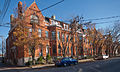
Neighborhoods

Covington claims 19 distinct neighborhoods,[10] ranging in population from several hundred to 10,000 people. Many of the neighborhoods are located in 12 historic districts that are predominantly found in the northern portion of the city, but Covington annexed many areas to the south in the late 20th and early 21st centuries to significantly enlarge its land area. Most of the neighborhoods have active resident associations or block watches that are dedicated to involving residents in strengthening their neighborhoods, improving safety, housing, and beautification.
Geography
The city is on the south bank of the Ohio River with Cincinnati, Ohio across the river to the north. The Licking River forms the eastern boundary with Newport in the adjacent Campbell County.[11]
According to the United States Census Bureau, Covington has a total area of 13.7 square miles (35 km2), of which 13.1 square miles (34 km2) is land and 0.5 square miles (1.3 km2) (3.88%) is covered by water.
Climate
Covington is located within a climatic transition zone; it is nestled within the southern end of the humid continental climate zone and the northern periphery of the humid subtropical climate of the Upland South, with hot, humid summers and cool winters. Evidence of both a humid subtropical and humid continental climate can be found here, particularly noticeable by the presence of plants indicative of each climatic region; for example, the southern magnolia (Magnolia grandiflora) from the subtropics and the blue spruce from cooler regions are successful landscape plants in and around Covington.
| Climate data for Cincinnati (Cincinnati/Northern Kentucky Int'l), 1991–2020 normals,[a] extremes 1871–present[b] | |||||||||||||
|---|---|---|---|---|---|---|---|---|---|---|---|---|---|
| Month | Jan | Feb | Mar | Apr | May | Jun | Jul | Aug | Sep | Oct | Nov | Dec | Year |
| Record high °F (°C) | 77 (25) |
79 (26) |
88 (31) |
90 (32) |
95 (35) |
102 (39) |
108 (42) |
103 (39) |
102 (39) |
95 (35) |
82 (28) |
75 (24) |
108 (42) |
| Mean maximum °F (°C) | 61.8 (16.6) |
66.1 (18.9) |
74.3 (23.5) |
81.1 (27.3) |
86.7 (30.4) |
91.6 (33.1) |
93.6 (34.2) |
93.2 (34.0) |
90.7 (32.6) |
82.9 (28.3) |
72.0 (22.2) |
63.8 (17.7) |
95.3 (35.2) |
| Mean daily maximum °F (°C) | 39.6 (4.2) |
43.7 (6.5) |
53.5 (11.9) |
65.5 (18.6) |
74.5 (23.6) |
82.6 (28.1) |
86.0 (30.0) |
85.2 (29.6) |
78.9 (26.1) |
66.7 (19.3) |
53.8 (12.1) |
43.3 (6.3) |
64.4 (18.0) |
| Daily mean °F (°C) | 31.4 (−0.3) |
34.7 (1.5) |
43.6 (6.4) |
54.6 (12.6) |
64.1 (17.8) |
72.3 (22.4) |
75.9 (24.4) |
74.9 (23.8) |
68.1 (20.1) |
56.2 (13.4) |
44.4 (6.9) |
35.6 (2.0) |
54.7 (12.6) |
| Mean daily minimum °F (°C) | 23.1 (−4.9) |
25.8 (−3.4) |
33.8 (1.0) |
43.7 (6.5) |
53.7 (12.1) |
62.1 (16.7) |
65.9 (18.8) |
64.6 (18.1) |
57.3 (14.1) |
45.7 (7.6) |
35.1 (1.7) |
27.9 (−2.3) |
44.9 (7.2) |
| Mean minimum °F (°C) | 0.1 (−17.7) |
6.5 (−14.2) |
14.8 (−9.6) |
26.7 (−2.9) |
36.6 (2.6) |
49.2 (9.6) |
55.9 (13.3) |
54.6 (12.6) |
42.5 (5.8) |
29.8 (−1.2) |
19.0 (−7.2) |
9.1 (−12.7) |
−2.7 (−19.3) |
| Record low °F (°C) | −25 (−32) |
−17 (−27) |
−11 (−24) |
15 (−9) |
27 (−3) |
39 (4) |
47 (8) |
43 (6) |
31 (−1) |
16 (−9) |
0 (−18) |
−20 (−29) |
−25 (−32) |
| Average precipitation inches (mm) | 3.30 (84) |
3.17 (81) |
4.16 (106) |
4.53 (115) |
4.67 (119) |
4.75 (121) |
3.83 (97) |
3.43 (87) |
3.11 (79) |
3.35 (85) |
3.23 (82) |
3.73 (95) |
45.26 (1,150) |
| Average snowfall inches (cm) | 7.7 (20) |
6.7 (17) |
3.4 (8.6) |
0.4 (1.0) |
0.0 (0.0) |
0.0 (0.0) |
0.0 (0.0) |
0.0 (0.0) |
0.0 (0.0) |
0.2 (0.51) |
0.8 (2.0) |
4.1 (10) |
23.3 (59) |
| Average extreme snow depth inches (cm) | 3.5 (8.9) |
3.4 (8.6) |
2.0 (5.1) |
0.2 (0.51) |
0.0 (0.0) |
0.0 (0.0) |
0.0 (0.0) |
0.0 (0.0) |
0.0 (0.0) |
0.1 (0.25) |
0.4 (1.0) |
2.0 (5.1) |
6.0 (15) |
| Average precipitation days (≥ 0.01 in) | 13.2 | 12.0 | 12.5 | 13.1 | 13.5 | 11.8 | 11.0 | 8.9 | 8.3 | 8.7 | 10.3 | 12.4 | 135.7 |
| Average snowy days (≥ 0.1 in) | 6.7 | 5.9 | 2.7 | 0.6 | 0.0 | 0.0 | 0.0 | 0.0 | 0.0 | 0.1 | 1.1 | 4.6 | 21.7 |
| Average relative humidity (%) | 72.2 | 70.1 | 67.0 | 62.8 | 66.9 | 69.2 | 71.5 | 72.3 | 72.7 | 69.2 | 71.0 | 73.8 | 69.9 |
| Average dew point °F (°C) | 19.9 (−6.7) |
22.5 (−5.3) |
31.3 (−0.4) |
39.6 (4.2) |
50.5 (10.3) |
59.7 (15.4) |
64.2 (17.9) |
63.0 (17.2) |
56.7 (13.7) |
43.7 (6.5) |
34.7 (1.5) |
25.5 (−3.6) |
42.6 (5.9) |
| Mean monthly sunshine hours | 120.8 | 128.4 | 170.1 | 211.0 | 249.9 | 275.5 | 277.0 | 261.5 | 234.4 | 188.8 | 118.7 | 99.3 | 2,335.4 |
| Percent possible sunshine | 40 | 43 | 46 | 53 | 56 | 62 | 61 | 62 | 63 | 55 | 39 | 34 | 52 |
| Average ultraviolet index | 2 | 3 | 5 | 6 | 8 | 9 | 9 | 8 | 7 | 4 | 2 | 2 | 5 |
| Source 1: NOAA (relative humidity and sun 1961–1990)[12][13][14][15] | |||||||||||||
| Source 2: Weather Atlas (UV)[16] | |||||||||||||
Demographics

| Census | Pop. | Note | %± |
|---|---|---|---|
| 1830 | 743 | — | |
| 1840 | 2,026 | 172.7% | |
| 1850 | 9,408 | 364.4% | |
| 1860 | 16,471 | 75.1% | |
| 1870 | 24,505 | 48.8% | |
| 1880 | 29,720 | 21.3% | |
| 1890 | 37,371 | 25.7% | |
| 1900 | 42,938 | 14.9% | |
| 1910 | 53,270 | 24.1% | |
| 1920 | 57,121 | 7.2% | |
| 1930 | 65,252 | 14.2% | |
| 1940 | 62,018 | −5.0% | |
| 1950 | 64,452 | 3.9% | |
| 1960 | 60,376 | −6.3% | |
| 1970 | 52,535 | −13.0% | |
| 1980 | 49,585 | −5.6% | |
| 1990 | 43,264 | −12.7% | |
| 2000 | 43,370 | 0.2% | |
| 2010 | 40,640 | −6.3% | |
| 2020 | 40,961 | 0.8% | |
| U.S. Decennial Census[17] | |||
As of the census[18] of 2000, 43,370 people, 18,257 households, and 10,132 families resided in the city. The population density was 3,301.3 people per square mile (1,274.4/km2). The 20,448 housing units averaged 1,556.5 per square mile (600.8/km2). The racial makeup of the city was 87.05% White, 10.14% African American, 0.24% Native American, 0.34% Asian, 0.03% Pacific Islander, 0.63% from other races, and 1.57% from two or more races. Hispanics or Latinos of any race were 1.38% of the population.
Of the 18,257 households, 28.8% had children under the age of 18 living with them, 34.3% were married couples living together, 16.5% had a female householder with no husband present, and 44.5% were not families; 36.5% of all households were made up of individuals, and 12.0% had someone living alone who was 65 years of age or older. The average household size was 2.31 and the average family size was 3.08.
The age distribution was 25.9% under the age of 18, 10.0% from 18 to 24, 33.3% from 25 to 44, 19.0% from 45 to 64, and 11.9% who were 65 years of age or older. The median age was 33 years. For every 100 females, there were 95.9 males. For every 100 females age 18 and over, there were 92.0 males.
The median income for a household in the city was $30,735, and the median income for a family was $38,307. Males had a median income of $31,238 versus $24,487 for females. The per capita income for the city was $16,841. About 15.5% of families and 18.4% of the population were below the poverty line, including 25.0% of those under age 18 and 13.4% of those age 65 or over.
Covington has some of the least expensive real estate in Kentucky; the median house price in Covington is around $95,430, while the median house price for Kentucky as a whole is $124,100.[19]
Transportation
.jpg)
U.S. Route 25, Interstate 71 in Kentucky and Interstate 75 in Kentucky serve downtown Covington.
Bus transit is served by the Transit Authority of Northern Kentucky (TANK).[20]
Covington Union Station served Chesapeake and Ohio and Louisville and Nashville passenger trains into the 1960s. The final train making stops at the station was the L&N's Pan-American (Cincinnati-New Orleans) in 1971. The L&N's Humming Bird (Cincinnati- Memphis and New Orleans) also served the station. C&O trains included the Fast Flying Virginian, George Washington and Sportsman. The C&O dropped Union Station from its trains' itineraries in 1966.
Air
Covington is served by Cincinnati/Northern Kentucky International Airport (CVG), which is the largest airport in the state, and is hub to passenger airline Delta Air Lines and headquarters of its Delta Private Jets. The airport is one of DHL Aviation's three superhubs, serving destinations throughout the Americas, Europe, Africa, and Asia, making it the seventh-busiest airport in the U.S. based on cargo operations.[21] CVG is also a focus city for Frontier Airlines and is the largest O&D airport and base for Allegiant Air, along with home to a maintenance for American Airlines subsidiary PSA Airlines and Delta Air Lines subsidiary Endeavor Air.
Economy
Principal employers
According to Covington's 2019 Comprehensive Annual Financial Report,[22] the principal employers in the city are:
| # | Employer | # of Employees |
|---|---|---|
| 1 | Internal Revenue Service - Closed 2019 | 3,951 |
| 2 | Fidelity Investments | 2,069 |
| 3 | Club Chef | 1,039 |
| 4 | Covington Board of Education | 914 |
| 5 | Crown Services Inc. | 524 |
| 6 | Rosedale Manor | 488 |
| 7 | State of Kentucky | 477 |
| 8 | St. Elizabeth Hospital | 408 |
| 9 | Diocese of Covington Board of Education | 403 |
| 10 | Atkins & Pearce Mftg | 339 |
Education
Public education within much of Covington is provided by Covington Independent Public Schools, the largest independent school district in Kentucky.[23] Its high school, Holmes Junior/Senior High School, is the oldest public high school in the state.
Southern portions of the city are in the Kenton County School District.[24]
The Roman Catholic Diocese of Covington operates two high schools in the city, Covington Latin School and Holy Cross High School. Two Catholic high schools, the all-boys' Covington Catholic High School and all-girls' Notre Dame Academy, moved to neighboring Park Hills in the 1950s. Calvary Christian School, a Baptist school, is also located in Covington.
Law enforcement
In 1817, the Town of Covington created the position "Captain of Patrol," and assigned two "Patrollers" under his supervision. The patrol area included the Town and eight miles of surrounding territory. In 1833 the first full time Town Marshall was appointed. An act of the Kentucky General Assembly in 1834 incorporated Covington as a city, and in 1842, the City of Covington appointed its first "Police Commissioner." Covington City Ordinance created the “Voluntary Night Watch" in 1843, which consisted of seventy-one reputable persons invested with police authority. In 1856 a regular citizen's police force was established. [25] The department is Led by Colonel Robert Nader, Lieutenant Colonel of Operations Brian Steffen, and Lieutenant Colonel of Services Patrick Swift.[26] The department is currently staffed by 114 sworn officers, each assigned to one of 4 bureaus. Though several substations exist, most personnel operate out of the central headquarters, located at 1 Police Memorial Drive.[27] The department maintains accreditation through the Kentucky Association of Chiefs of Police as well as the Commission on Accreditation for Law Enforcement Agencies.[28]
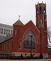
Historic churches


- Cathedral Basilica of the Assumption in Covington
- Holy Cross Roman Catholic Church
- Latonia Christian Church
- Mother of God Parish
- Saint Augustine Catholic Church
- Saint John the Evangelist Catholic Church in the Lewisburg Historic District
- Trinity Episcopal Church
- Eastside Church of the Nazarene
- First Christian Church Covington
- Madison Avenue Christian Church
Notable people
- Mike Battaglia, NBC Sports analyst and long-time Kentucky Derby announcer, was born in Latonia.
- Gary Bauer, former Republican presidential hopeful, was born in Covington.
- Daniel Carter Beard, youth leader, his life-sized bronze statue, created by sculptor Kenneth Bradford, stands in town.
- Adrian Belew, musician, vocalist and guitarist of King Crimson since early 1980s, was born in Covington.
- Harry Berte, a Major League Baseball infielder
- Gail Borden, inventor of condensed milk, lived in Covington during his childhood.
- Chuck Bradley, football player
- Mary Jane Goodson Carlisle (1835-1905), Acting First Lady of the United States
- Steve Cauthen, U.S. Racing Hall of Fame jockey, was born in Covington.
- Jamour Chames, visual artist, was born in Covington.[29]
- Bob Charles, Australian politician, member of the Australian House of Representatives, was born in Covington.
- Martha Jane Knowlton Coray, the first female member of the Brigham Young Academy Board of Trustees, was born in Covington.
- Byrd Spilman Dewey, author and Florida pioneer
- Asa Drury, educator, Baptist minister, and first superintendent of Covington public schools
- Frank Duveneck, realist painter, was born in Covington.
- Mitch English, national television personality, a host of The Daily Buzz also featured in theatrical releases and other television programs, was born in Covington.
- Henry Forrest, U.S. Racing Hall of Fame Thoroughbred racehorse trainer, was born in Covington.
- Frederick William Franz, religious leader and theologian, fourth president of the Jehovah's Witnesses, was born in Covington.
- Loyd Gentry Jr., Thoroughbred racehorse trainer, born in Covington.
- Haven Gillespie, songwriter, remembered primarily for "Santa Claus Is Coming to Town", was born in Covington.
- Rickard D. Gwydir, Superintendent of Public Works and city auditor (19th century)
- Joe Heving, Major League Baseball player
- Daniel Henry Holmes, businessman and founder of D.H. Holmes in 1849 in New Orleans; department store was largest in South at his death; he built Holmesdale, a 32-room mansion, in Covington and lived here part-time.
- David Justice, Major League Baseball player, graduated from Covington Latin School.
- Durward Kirby, television personality, best known as co-host of Candid Camera, was born in Covington.
- Jared Lorenzen, professional football quarterback, backup to Eli Manning for Super Bowl XLII champion New York Giants, was born in Covington.
- Clarence Lushbaugh - pathologist and radiobiologist at Los Alamos National Laboratory and Oak Ridge Associated Universities
- Randy Marsh, Major League Baseball umpire, graduated from Covington Holmes High School.
- Una Merkel, film and Tony Award-winning stage actress, was born in Covington.
- Lee Roy Reams, Broadway actor, was born in Covington.
- George Remus, lawyer and bootlegger during the Prohibition era.
- Jack Roush, champion NASCAR owner of Roush Fenway Racing team, was born in Covington.
- Pat Scott, All-American Girls Professional Baseball League pitcher, was born in Covington.
- Robert F. Schulkers, writer of children´s books, was born in Covington
- William Wright Southgate, northern Kentucky Congressman
- Dorothy Spencer, film editor, four-time Oscar nominee, was born in Covington.
- John W. Stevenson, Governor and Senator
- Tom Thacker, NCAA and NBA champion basketball player, top pick of 1963 NBA draft, was born in Covington.
- Paul Walther, professional basketball player, was born in Covington.
- Bernart T. Wisenall, architect, lived in Covington.
- Ron Ziegler, White House Press Secretary during President Richard Nixon's administration, was born in Covington.
See also
Gallery
-

-
 Historic Trinity Episcopal Church
 -
 Mother of God Catholic Church
 -
 Emery Row
 -
 MainStrasse Village
 -
 Mutter Gottes Historic District


References
Citations
- ^ a b c U.S. Geological Survey Geographic Names Information System: Covington, Kentucky
- ^ "Joseph U Meyer". The City of Covington, Kentucky Official Government Website. City of Covington, Kentucky. Retrieved July 19, 2020.
- ^ "2020 U.S. Gazetteer Files". United States Census Bureau. Retrieved March 18, 2022.
- ^ Covington, Kentucky QuickFacts Archived November 2, 2012, at the Wayback Machine U.S. Census Bureau. Retrieved March 11, 2013.
- ^ "Find a County". National Association of Counties. Archived from the original on May 31, 2011. Retrieved June 7, 2011.
- ^ Gannett, Henry (1905), The Origin of Certain Place Names in the United States, Washington: Government Printing Office, p. 94.
- ^ a b c d e f g EB (1911).
- ^ a b Our History City of Covington. Retrieved March 11, 2013.
- ^ a b c EB (1878).
- ^ "Center for Great Neighborhoods of Covington". Archived from the original on January 26, 2014. Retrieved March 3, 2014.
- ^ Covington, KY, 7.5 Minute Topographic Quadrangle, USGS, 1981
- ^ "NowData—NOAA Online Weather Data". National Oceanic and Atmospheric Administration. Retrieved May 9, 2021.
- ^ "Station: Cincinnati Northern KY AP, KY". U.S. Climate Normals 2020: U.S. Monthly Climate Normals (1991–2020). National Oceanic and Atmospheric Administration. Archived from the original on February 6, 2024. Retrieved May 9, 2021.
- ^ "Records for Cincinnati". National Weather Service. Retrieved April 13, 2012.
- ^ "WMO Climate Normals for CINCINNATI/GREATER CINCINNATI,KY 1961–1990". National Oceanic and Atmospheric Administration. Archived from the original on February 6, 2024. Retrieved July 25, 2020.
- ^ "Cincinnati, Ohio, USA - Monthly weather forecast and Climate data". Weather Atlas. Retrieved July 4, 2019.
- ^ "Census of Population and Housing". Census.gov. Retrieved June 4, 2015.
- ^ "U.S. Census website". United States Census Bureau. Retrieved January 31, 2008.
- ^ "Kentucky Homes For Sale By City". Kentucky Real Estate Trends. RealEstate.com. Archived from the original on November 5, 2012. Retrieved January 21, 2013.
- ^ TANK Destinations Transit Authority of Northern Kentucky. Retrieved March 11, 2013.
- ^ https://www.faa.gov/airports/planning_capacity/passenger_allcargo_stats/passenger/media/cy17-cargo-airports.pdf [bare URL PDF]
- ^ Comprehensive Annual Financial Report for the Fiscal Year Ended June 30, 2019 (PDF). City of Covington, Kentucky. December 20, 2019. p. 135. Retrieved March 29, 2020.
- ^ "Appendix B: Maps Of Independent School Districts In Operation In FY 2014-FY 2015 Using 2005 Tax District Boundaries – Covington ISD" (PDF). Research Report No. 415 – Kentucky's Independent School Districts: A Primer. Frankfort, KY: Office of Education Accountability, Legislative Research Commission. September 15, 2015. p. 100 (PDF p. 114).
- ^ "2020 CENSUS - SCHOOL DISTRICT REFERENCE MAP: Kenton County, KY" (PDF). U.S. Census Bureau. Retrieved July 25, 2022. - Text list
- ^ https://www.covingtonky.gov/government/departments/police-department/about History of Department
- ^ "City of Covington, KY > Contact Us > Staff".
- ^ 'https://www.covingtonky.gov/government/departments/police-department/connect-with-us Location and Contact Information
- ^ https://kypolicechiefs.org/accreditation/law-enforcement-accreditation-program/accredited-agencies/ Archived 2019-03-27 at the Wayback Machine Accredited Law Enforcement Agencies
- ^ "Interview with Artist Jamour Chames". Noragouma.com. Retrieved on October 16, 2016.
Notes
- ^ Mean monthly maxima and minima (i.e. the expected highest and lowest temperature readings at any point during the year or given month) calculated based on data at said location from 1991 to 2020.
- ^ Official records for Cincinnati kept at downtown from January 1871 to March 1915, at the Cincinnati Abbe Observatory just north of downtown from April 1915 to March 1947, and at KCVG near Hebron, Kentucky since April 1947. For more information, see Threadex and History of Weather Observations Cincinnati, Ohio 1789–1947.
Bibliography
- . Encyclopædia Britannica. Vol. 6 (9th ed.). 1878. p. 531.
- . Encyclopædia Britannica. Vol. 7 (11th ed.). 1911. p. 315.
External links
- City of Covington official website
- Covington Journal, Google news archive. —PDFs of 873 issues, dating from 1849 to 1876.
Municipalities and communities of Kenton County, Kentucky, United States | ||
|---|---|---|
| Cities |  | |
| Unincorporated communities | ||
| Footnotes | ‡This populated place also has portions in an adjacent county or counties. | |
Great Lakes megalopolis as defined by the RPA | ||
|---|---|---|
Includes all metropolitan areas that have a population of 150,000 or greater according to the most recent national census. | ||
| Great Lakes region cities |  | |
| Surrounding cities |
| |
| Cities of states south of region | ||
| Other metro-regions | ||
| International | |
|---|---|
| National | |
| Geographic | |
| Other | |